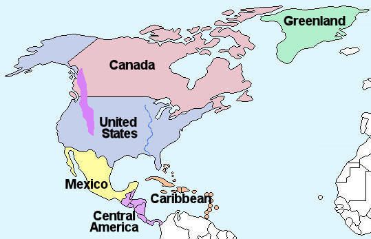
Arizona belongs to the North American continent through a combination of continental-scale geology, tectonic plate interactions, and internationally recognized political boundaries. Situated in the southwestern quadrant of the United States, the state shares land borders with other U.S. states and an international border with Mexico, firmly anchoring its geographic position within the northern and western hemispheres of the North American landmass.
Introduction to North American Geography and Arizona's Position
Geographic classification relies on multiple intersecting frameworks, including continental plates, traditional continent definitions, and political boundaries. When examining why Arizona belongs to the North American continent, geographers and earth scientists look at tectonic foundations, continental shelf continuity, and political jurisdiction.
From a broad geographical perspective, a continent is a large, continuous landmass separated by oceans or major water bodies. North America extends from the Arctic archipelago in the north down through the Canadian Shield, the contiguous United States, and Mexico, narrowing through Central America. Within this vast expanse, Arizona occupies an interior and southwestern position, far removed from any oceanic separation that would place it outside the continental mainland. Understanding this classification requires analyzing how tectonic plates, regional topography, and political history converge to define Arizona's place on the map.
Tectonic Plates and the North American Lithosphere
At a geological level, a continent is fundamentally defined by its underlying tectonic plate. Arizona rests entirely upon the North American Plate, a massive lithospheric plate that encompasses Greenland, the North American continent, parts of the Atlantic Ocean, and pieces of Siberia and Iceland.
The geological stability and active margins of the North American Plate dictate the physical landscape of Arizona. While the eastern portions of the plate are stable cratons, the western margin—where Arizona resides—is characterized by complex tectonic activity, Basin and Range faulting, and ancient subduction zones.
The Transition Zone and the Basin and Range Province
Arizona’s landscape is divided into distinct physiographic provinces that reflect its geological relationship with the broader North American continent:
- The Colorado Plateau: Occupying the northern and northeastern portions of the state, this high-elevation region features relatively flat-lying sedimentary rocks that connect geologically to the greater Colorado Plateau region spanning Utah, Colorado, and New Mexico.
- The Transition Zone (Central Highlands): A rugged mountainous belt separating the Colorado Plateau from the southern deserts, acting as a structural step-down.
- The Basin and Range Province: Covering the southern and western portions of Arizona, this area is defined by abrupt, fault-block mountain ranges separated by flat desert basins, extending westward into California and southward into Mexico.
These geological structures are not isolated anomalies; they are direct expressions of continental-scale tectonic stretching and crustal thinning that have shaped the western margin of North America over tens of millions of years.
Political and Cartographic Boundaries of Arizona
While geology establishes the physical landmass, human geography and political borders formalize territorial jurisdiction. Arizona is the 48th U.S. state, admitted to the Union on February 14, 1912. Its borders were established through a series of historical treaties, acts of the United States Congress, and territorial adjustments, including the Mexican-American War and the Gadsden Purchase.
The state is bounded by:
- Utah to the north (sharing the famous "Four Corners" monument point).
- New Mexico to the east.
- Nevada and California to the west, separated in part by the lower Colorado River.
- The Mexican states of Sonora and Baja California to the south.
Because these surrounding political entities are themselves integral parts of the United States and Mexico—both sovereign nations situated entirely within the North American continent—Arizona is completely landlocked within the continental interior relative to global oceans, bounded only by its domestic and international neighbors.
Geographic Comparison of Arizona Within North America
To understand Arizona's scale and regional context within the continent, it helps to examine its geographic metrics alongside broader North American features.
| Feature | Measurement / Description | Continental Context |
|---|---|---|
| Total Land Area | Approximately 113,990 square miles (295,234 km²) | Ranks 6th in size among U.S. states; roughly 1.2% of the contiguous U.S. |
| Elevation Range | From about 70 feet above sea level along the Colorado River to 12,633 feet at Humphreys Peak | Reflects the high-relief topography typical of the Western Cordillera of North America. |
| Primary Drainage Basin | Colorado River watershed | Drains into the Gulf of California (Pacific Ocean), part of the North American Pacific watershed. |
| Tectonic Setting | North American Plate interior/western margin | Shares a continuous lithospheric foundation with the rest of the continent. |
Climate, Biomes, and Continental Ecosystems
Arizona’s ecosystems and climate zones further reinforce its identity as part of the North American continent, specifically displaying the transition zones typical of the North American Desert systems and western mountain ranges.
The state features four major North American deserts:
- The Sonoran Desert: Dominated by the iconic saguaro cactus, extending from southern Arizona down into the Mexican state of Sonora.
- The Mojave Desert: Touching the northwestern corner of the state, characterized by Joshua trees and basin-and-range topography.
- The Chihuahuan Desert: Reaching into southeastern Arizona with semi-arid grasslands and diverse scrublands.
- The Painted Desert / Colorado Plateau Desert: High-desert environments in the north featuring colorful layered badlands.
These biomes do not exist in isolation; they are contiguous with broader ecological corridors that span international borders, demonstrating that flora, fauna, and climatic patterns operate on a continental scale across the North American landmass.
Frequently Asked Questions
Is Arizona part of the North American mainland?
Yes. Arizona is located entirely within the interior mainland of the North American continent. It has no oceanic borders and is completely surrounded by other U.S. states and Mexico, all of which reside on the North American landmass.
What tectonic plate is Arizona on?
Arizona rests entirely on the North American Plate. This major tectonic plate carries the entire North American continent as well as portions of surrounding oceanic crust, moving slowly southwestward away from the Mid-Atlantic Ridge.
Does Arizona share an international border with another North American country?
Yes. Arizona shares a 373-mile international border with Mexico to the south. Both the United States and Mexico are sovereign nations located within the North American continent.
How do Arizona's geographical features connect to the rest of the United States?
Arizona shares major geographic and ecological features with neighboring states. The Rocky Mountains and Colorado Plateau extend northward into Utah, Colorado, and Wyoming, while the Basin and Range province stretches westward into California and Nevada.
Is any part of Arizona considered outside the North American continent?
No. Every square inch of Arizona—from the low deserts of Yuma to the high peaks of the San Francisco Peaks near Flagstaff—is firmly situated within the geographical, geological, and political boundaries of the North American continent.
Conclusion and Summary of Continental Status
Arizona's status as part of the North American continent is absolute and multifaceted. Geologically, it is anchored to the North American Plate through a complex mix of the Colorado Plateau and the Basin and Range province. Ecologically and climatically, its deserts and mountain ranges form a seamless continuation of North American biomes. Politically, its borders within the United States and its proximity to Mexico firmly place it within the heart of the continent. Recognizing these overlapping layers of geography provides a complete picture of why Arizona belongs indisputably to the North American continent.