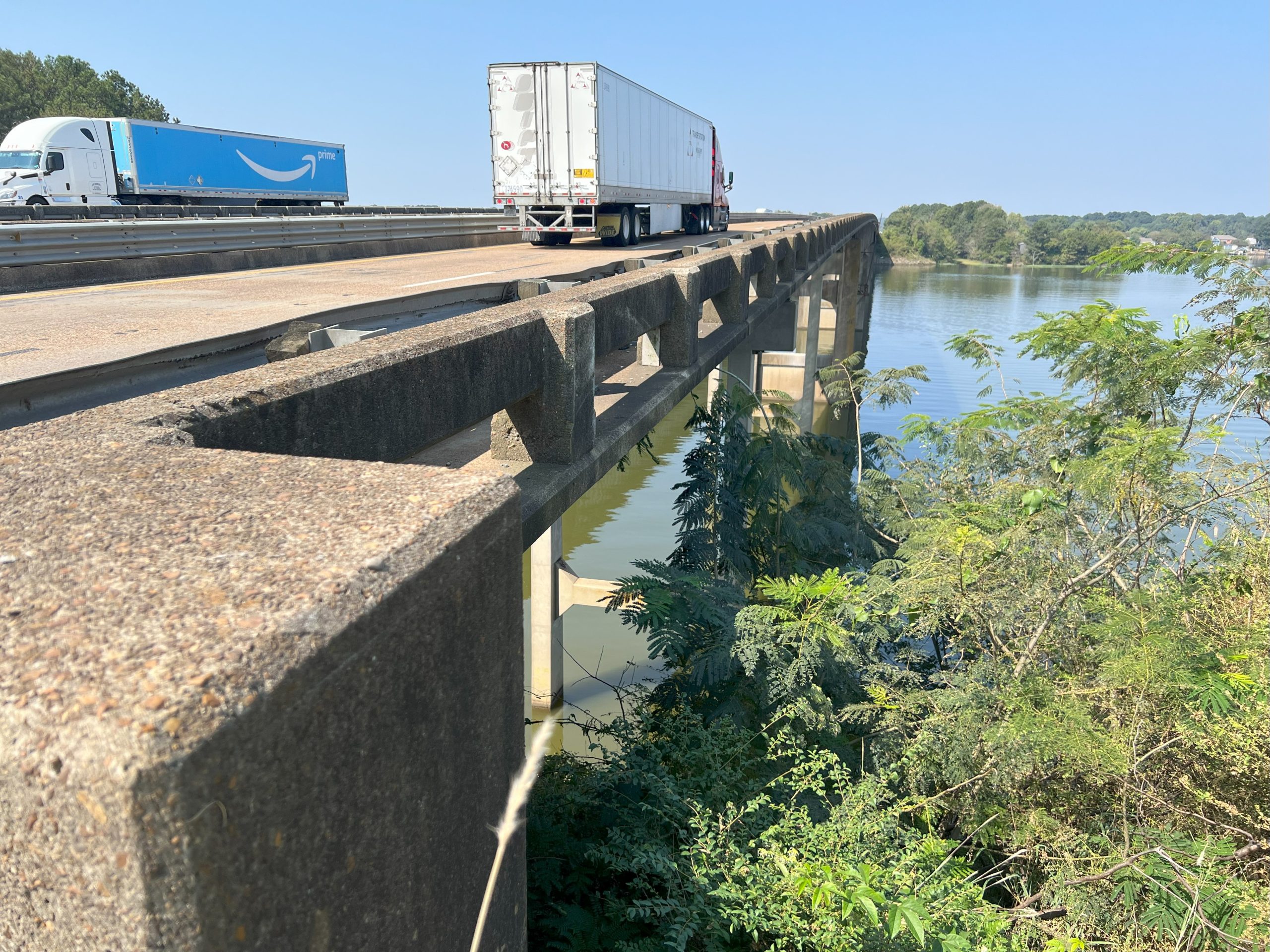
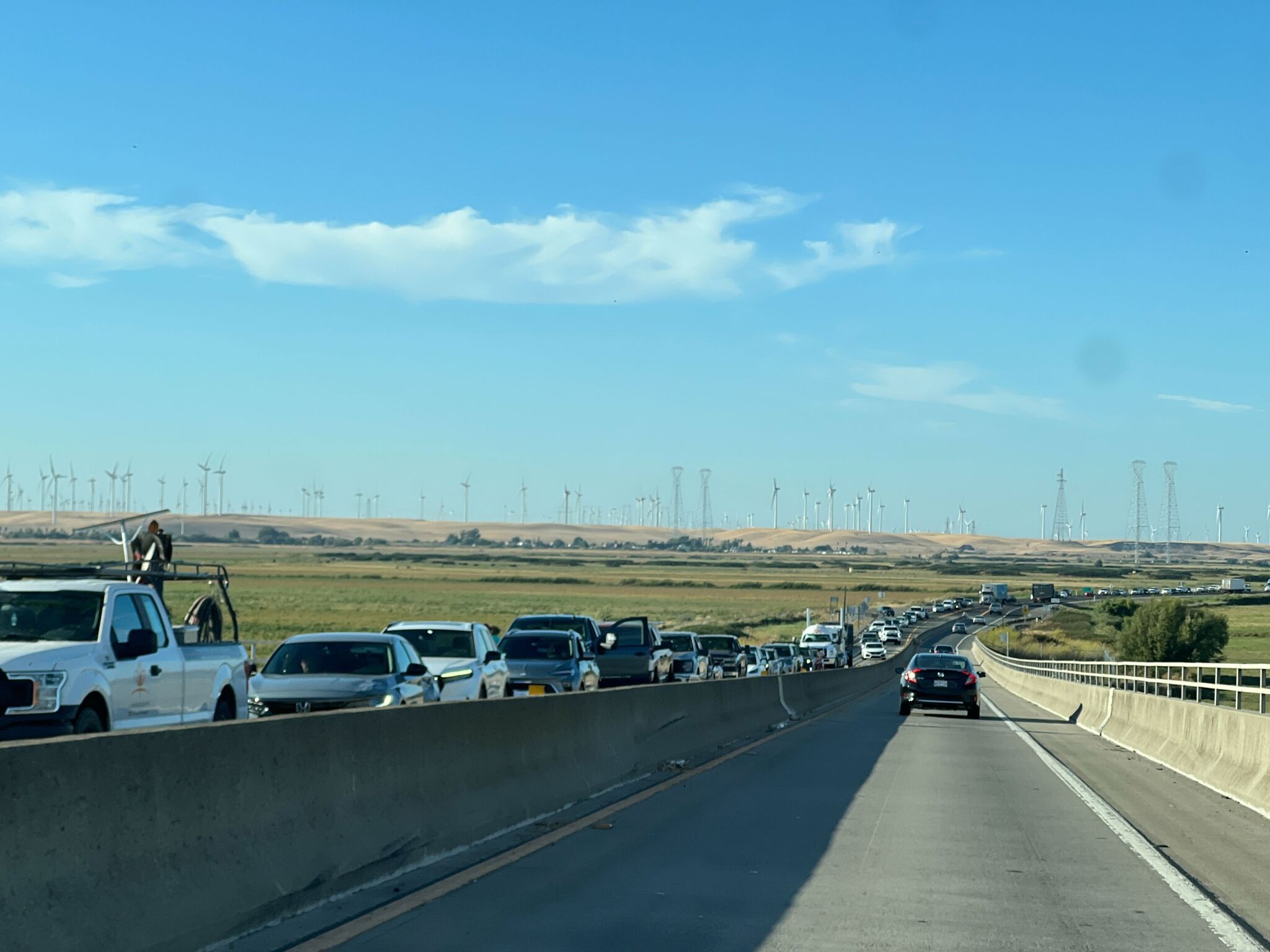
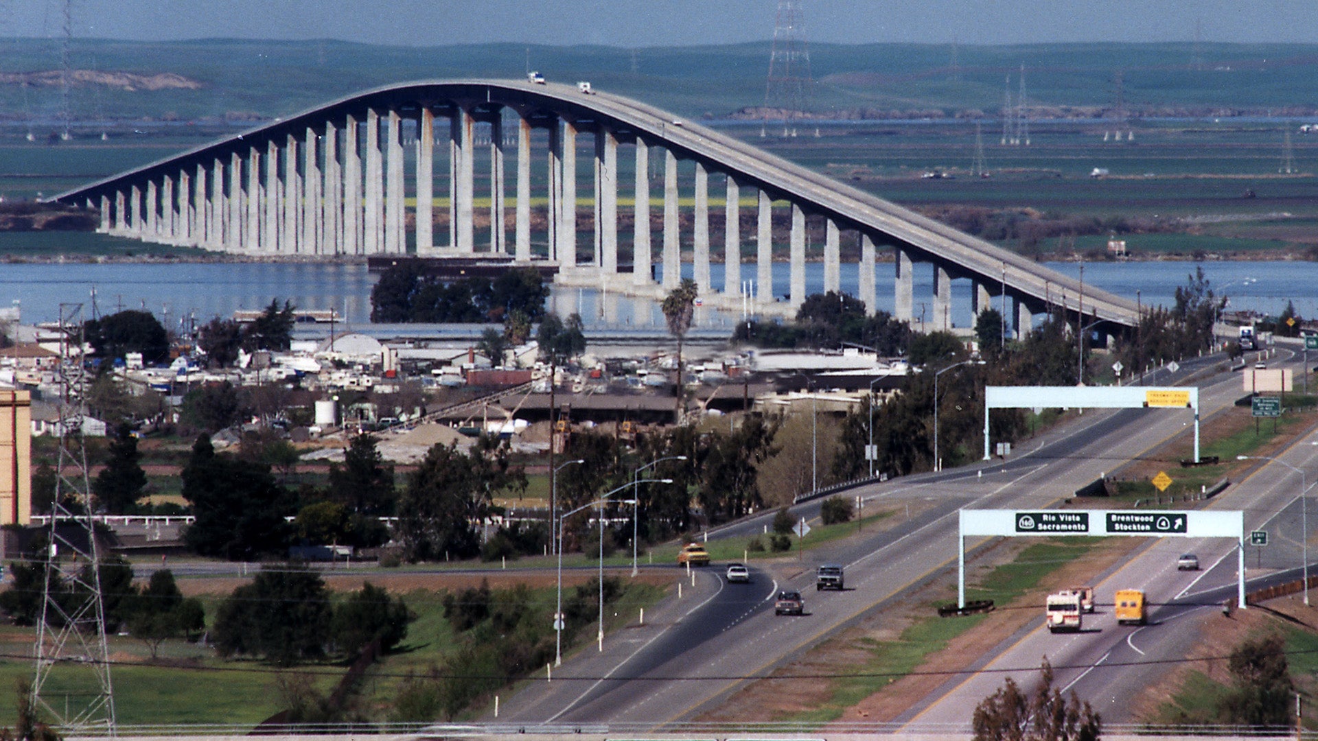
The Antioch Bridge (Senator John J. Nejedly Bridge) on State Route 160 is currently subject to periodic closures and restrictions due to scheduled maintenance and regional weather patterns. In 2026, commuters should expect intermittent overnight shutdowns for deck preservation and strict high-wind prohibitions for high-profile vehicles to ensure structural integrity and traveler safety.
The Antioch Bridge serves as a critical link between Contra Costa and Sacramento counties, spanning the San Joaquin River. Because it is a high-level fixed-span bridge with significant exposure to the elements of the Sacramento-San Joaquin River Delta, closures are a common logistical hurdle for residents of Antioch, Oakley, and the surrounding Delta communities. Understanding the mechanisms behind these closures—ranging from environmental triggers to 2026 infrastructure investments—is essential for efficient travel planning and regional commerce.
Understanding the Vulnerability: Why the Antioch Bridge Closes
The Antioch Bridge is unique among San Francisco Bay Area spans due to its height, narrow profile, and geographical orientation. Rising 135 feet above the water at its highest point, the bridge acts as a massive sail when heavy winds funnel through the Carquinez Strait and into the Delta. In 2026, safety protocols remain rigorous, as the bridge's design makes it susceptible to lateral forces that can jeopardize high-profile vehicles.
High Wind Restrictions and Protocols
Wind-related closures are the most frequent cause of unplanned disruptions on State Route 160. Caltrans (California Department of Transportation) and the California Highway Patrol (CHP) monitor anemometers placed at the mid-span of the bridge.
- Level 1 (Cautionary): When sustained winds reach 25 mph, "High Wind" advisories are posted on Changeable Message Signs (CMS). High-profile vehicles, such as empty tractor-trailers, RVs, and vans, are advised to use caution.
- Level 2 (Restriction): At sustained winds of 35-40 mph, high-profile vehicles are often prohibited from crossing. Enforcement is typically handled by CHP units stationed at the bridge approaches in Antioch and Sherman Island.
- Level 3 (Full Closure): If gusts exceed 50-60 mph or sustained winds create significant sway, the bridge may be closed to all traffic. This is a rare occurrence but happens during intense winter storms or "atmospheric river" events, which have become more frequent in recent years.
Structural Maintenance and 2026 Preservation Projects
As of 2026, the Antioch Bridge is undergoing a multi-phase "Deck Life Extension" project. This initiative involves removing the top layer of worn concrete and replacing it with a high-performance polyester polymer overlay. This material is designed to prevent saltwater and chemicals from reaching the steel reinforcement bars, which would otherwise cause corrosion and structural weakening.
These maintenance closures are typically scheduled during "off-peak" hours—usually Sunday through Thursday between 9:00 PM and 5:00 AM. While one lane often remains open with flaggers or pilot cars, full directional closures are sometimes necessary to allow the polymer to cure without the vibration of passing traffic.
Navigating Detours: Alternative Routes During a Closure
When the Antioch Bridge is closed, the detour options vary significantly in terms of time, distance, and toll costs. Because the bridge is a primary artery for those traveling between the East Bay and the Sacramento Valley, a closure can add anywhere from 30 to 60 minutes to a commute.
The Rio Vista Bridge Option (SR-160 North)
For those heading north toward Sacramento or Rio Vista, the primary alternative is to stay on the surface roads or take Highway 4 to the Rio Vista Bridge (Helen Madere Memorial Bridge). However, travelers must be aware that the Rio Vista Bridge is a vertical-lift bridge. If it is raised for marine traffic, further delays are inevitable.
The Benicia-Martinez Bridge Option (I-680)
For commuters heading toward the North Bay or the western side of the Delta, the Benicia-Martinez Bridge on Interstate 680 is the most reliable detour. While this adds significant mileage for someone starting in Antioch, the multi-lane freeway capacity of I-680 is much higher than the two-lane SR-160.
The Richmond-San Rafael and Carquinez Options
In extreme cases where multiple Delta routes are impacted by regional flooding or high winds, drivers may be forced as far west as the Carquinez Bridge (I-80). This is rarely efficient for local Antioch traffic but may be necessary for long-haul freight moving toward the Port of Oakland.
| Detour Route | Distance from Antioch | Estimated Added Time | Toll Status (2026) |
|---|---|---|---|
| SR-12 via Rio Vista | ~25 miles | 35–50 minutes | No Toll |
| I-680 Benicia-Martinez | ~28 miles | 40–60 minutes | Toll (FasTrak Only) |
| I-80 Carquinez Bridge | ~38 miles | 55–75 minutes | Toll (FasTrak Only) |
| I-580 Richmond-San Rafael | ~52 miles | 75–100 minutes | Toll (FasTrak Only) |
The Impact of Closures on Local Infrastructure and Economy
The closure of the Antioch Bridge does more than just delay commuters; it places immense strain on the local infrastructure of the City of Antioch and the City of Oakley. When SR-160 is blocked, traffic spills onto Wilbur Avenue, East 18th Street, and Main Street.
Local Traffic Congestion
During a bridge closure, the "feeder" streets in Antioch often reach a state of gridlock. This affects emergency response times for the Contra Costa County Fire Protection District and local police. In 2026, local municipalities have improved their coordination with Caltrans to synchronize traffic signals during bridge emergencies to flush traffic toward Highway 4 more efficiently.
Freight and Agriculture
The Delta region is a hub for agricultural transport. Trucks carrying produce from the Sacramento Valley to processing plants in the East Bay rely on the Antioch Bridge to avoid the heavy congestion of I-80. A single closure can disrupt "just-in-time" delivery schedules, leading to increased costs for logistics companies and, eventually, consumers.
Technological Improvements in 2026 Status Reporting
In 2026, the methods for verifying the status of the Antioch Bridge have become more automated and user-friendly. Real-time data is now the standard for avoiding the frustration of arriving at a closed gate.
- Caltrans QuickMap: This remains the primary source for official road status. In 2026, the app includes high-definition camera feeds specifically for the Antioch Bridge approaches, allowing drivers to see wind conditions and traffic queues visually.
- 511.org and Waze Integration: Real-time API feeds from Caltrans are now directly integrated into GPS apps. If the bridge closes, these apps will automatically reroute drivers before they exit Highway 4.
- Bridge Condition Sensors: New fiber-optic sensors installed during the 2025-2026 retrofit provide instant data on bridge vibration and sway. This data allows Caltrans to reopen the bridge more quickly after a wind event, as they no longer have to wait for a manual physical inspection in many cases.
Historical Context: The Legacy of the Senator John J. Nejedly Bridge
To understand the current closure protocols, one must look at the history of the span. The original Antioch Bridge, built in 1926, was a narrow, lift-span structure that was notoriously dangerous and prone to ship strikes. One such strike in 1970 significantly damaged the bridge, highlighting the need for a modern replacement.
The current bridge, completed in 1978 and named after Senator John J. Nejedly, was designed as a high-level fixed span to allow ships to pass underneath without the need for a lift mechanism. While this improved marine traffic, it created the high-profile wind vulnerability we see today. The 2026 maintenance efforts are part of a long-term commitment to ensure this 1970s-era steel and concrete structure can withstand the increased traffic loads and environmental stressors of the 21st century.
Safety Recommendations for Travelers
If you are forced to cross the Antioch Bridge during inclement weather or are caught in a closure, follow these safety guidelines:
- Observe the "High Wind" Signs: Never ignore a restriction. If your vehicle feels "light" or is buffeted by wind on the approach, turn around. The center of the span is much windier than the land-based approaches.
- Maintain Speed Consistency: On the bridge, sudden braking can lead to loss of control in high winds. Maintain a steady, moderate speed and keep a firm grip on the steering wheel.
- Check Status Before Leaving: Before departing from Sacramento or Antioch, check the Caltrans QuickMap. A two-minute check can save an hour of detour time.
- Have Your FasTrak Ready: Since 2026 bridge operations are entirely cashless, ensure your FasTrak account is funded. While the Antioch Bridge is a toll bridge for southbound traffic, detouring through Benicia or the Carquinez Bridge will also require electronic payment.
Frequently Asked Questions (FAQ)
Is the Antioch Bridge closed right now?
Bridge status changes frequently due to wind conditions and maintenance schedules. The most accurate way to check the current status is through the Caltrans QuickMap website or mobile app, or by calling 511 within the Bay Area. In 2026, automated "Bridge Closed" alerts are also broadcast via local radio stations on the AM band near the bridge approaches.
Why is the Antioch Bridge a toll bridge only in one direction?
The Antioch Bridge, like most state-owned bridges in the Bay Area, collects tolls in the Southbound direction (entering Contra Costa County). This is designed to streamline traffic flow and centralize toll collection infrastructure. As of 2026, all tolls are collected electronically via FasTrak or License Plate Billing; there are no cash booths on the span.
What is the maximum wind speed allowed on the Antioch Bridge?
While there is no single "hard" number for all vehicles, restrictions typically begin when sustained winds exceed 35 mph. A full closure to all traffic generally occurs if sustained winds reach 50-60 mph or if gusts are deemed a threat to the structural dampening systems. High-profile vehicles (trucks, trailers, SUVs with roof loads) are the first to be restricted.
How long do the 2026 maintenance closures last?
Most scheduled maintenance closures are overnight only, typically starting at 9:00 PM and concluding by 5:00 AM the following morning. These are usually planned for Sunday through Thursday nights to minimize the impact on weekend travelers and Friday evening commuters. Always check the Caltrans District 4 weekly construction logs for the most current schedule.
Can I walk or bike across the Antioch Bridge?
Yes, the Antioch Bridge features a protected pedestrian and bicycle path on the eastern side of the span. However, this path is also subject to closure during high-wind events for the safety of the users. Bicyclists should exercise extreme caution as the wind gusts at the mid-span can be significantly stronger than at ground level.
Final Recommendation for Commuters
For regular commuters between the Central Valley and the East Bay, the best strategy in 2026 is redundancy. Always have a secondary route mapped out and keep a "go-bag" with essentials in the car in case a 20-minute drive turns into a two-hour detour. By utilizing real-time monitoring tools like QuickMap and respecting the wind advisories issued by Caltrans, drivers can navigate the Antioch Bridge safely and avoid the most significant delays.