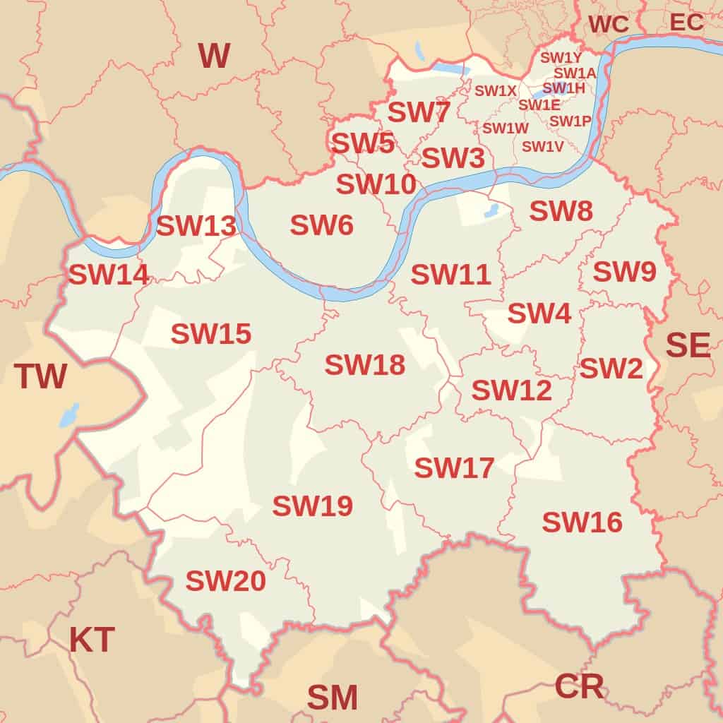
A classic example of a UK postcode is SW1A 1AA, which is the designated code for Buckingham Palace in London. UK postcodes are sophisticated alphanumeric identifiers ranging from five to seven characters (excluding the central space). They are divided into two distinct segments: the Outward Code (e.g., SW1A), which identifies the postal district, and the Inward Code (e.g., 1AA), which assists in the final sorting for local delivery.
The UK postcode system, managed by the Royal Mail, is one of the most precise addressing systems in the world. As of 2026, it remains the backbone of British logistics, navigation, and socioeconomic data analysis. Understanding how a postcode is constructed is essential for anyone from international senders to software developers building address validation tools.
The Anatomy of a UK Postcode
To understand a postcode, one must look at it as a hierarchical sequence. Each character or group of characters narrows down a geographic or functional location. A postcode is always split into two halves by a single space, and this space is critical for both human readability and optical character recognition (OCR) by sorting machines.
The Outward Code (Outcode)
The first half of the postcode is known as the Outward Code. This is the part of the code used by the Royal Mail to direct mail from a central sorting office to the correct local delivery office.
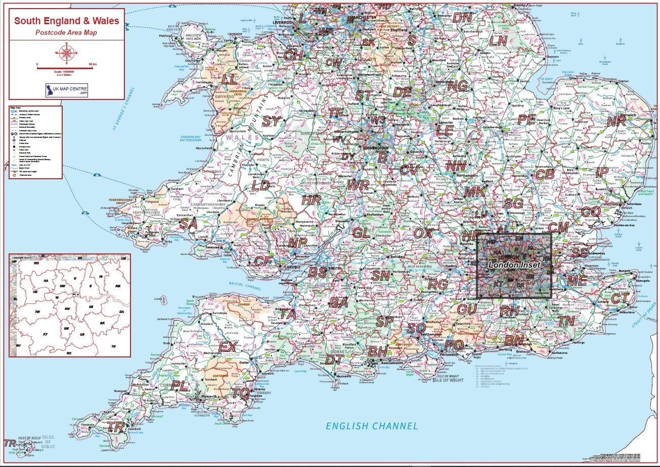
- Postcode Area: The first one or two letters (e.g., SW for South West London, B for Birmingham, EH for Edinburgh). There are currently 124 postcode areas in the UK.
- Postcode District: This follows the area code and consists of one or two digits, and sometimes a letter (e.g., SW1A, B1, EH12). The district identifies the specific town or section of a city where the mail is headed.
The Inward Code (Incode)
The second half of the postcode is the Inward Code. This is used by the local delivery office to sort mail into individual "walks" or delivery routes.
- Postcode Sector: The first character of the Inward Code is a digit (e.g., SW1A 1AA). This helps the local office sort the mail into a specific neighborhood or group of streets.
- Postcode Unit: The final two letters (e.g., SW1A 1AA). This is the most granular level, often representing a single street, a section of a street, or even a single high-volume business address.
Detailed Examples of UK Postcodes
While SW1A 1AA is the most famous example, the structure varies slightly depending on the density of the population and the historical development of the local grid.
1. Central London (Alphanumeric Districts)
In high-density areas of London, the district code often includes a letter to provide more subdivisions.
- Example: EC1A 1BB
- Breakdown: EC (East Central London), 1A (District), 1 (Sector), BB (Unit).
2. Major Cities (Single Letter Area)
Many large cities that were established early in the postal system use a single letter.
- Example: M1 1AG (Manchester City Centre)
- Breakdown: M (Manchester), 1 (District), 1 (Sector), AG (Unit).
- Example: B1 1AY (Birmingham)
- Breakdown: B (Birmingham), 1 (District), 1 (Sector), AY (Unit).
3. Regional/County Codes (Two Letter Area)
Most of the UK uses a two-letter area code based on a major town or city within that region.
- Example: GL50 1TA (Cheltenham, Gloucestershire)
- Breakdown: GL (Gloucester), 50 (District), 1 (Sector), TA (Unit).
- Example: BT1 1AA (Belfast, Northern Ireland)
- Breakdown: BT (Belfast), 1 (District), 1 (Sector), AA (Unit).
4. Special and Non-Geographic Postcodes
Some postcodes do not represent a physical location but are assigned to specific organizations or for administrative purposes.
- GIR 0AA: Historically used for the former National Girobank.
- XM4 5HQ: A whimsical postcode assigned to "Santa" at Reindeerland for children's letters.
- BS98 1TL: Used by large companies (in this case, Lloyds Bank) to handle high volumes of mail that don't go to a specific street address.
Summary Table of Postcode Structures
The UK postcode system allows for several different combinations of letters and numbers. The following table illustrates the six possible formats as defined by British Standard BS 7666.
| Format | Structure Name | Example Postcode | Area | District | Sector | Unit |
|---|---|---|---|---|---|---|
| AN NAA | Area-Number | M1 1AA | M | 1 | 1 | AA |
| ANN NAA | Area-Number-Number | M60 1NW | M | 60 | 1 | NW |
| AAN NAA | Area-Area-Number | CR2 6XH | CR | 2 | 6 | XH |
| AANN NAA | Area-Area-Number-Number | DN55 1PT | DN | 55 | 1 | PT |
| ANA NAA | Area-Number-Alpha | W1A 1HQ | W | 1A | 1 | HQ |
| AANA NAA | Area-Area-Number-Alpha | EC1A 1BB | EC | 1A | 1 | BB |
Technical Syntax and Validation Rules
For developers and database administrators in 2026, validating a UK postcode requires more than just checking for alphanumeric characters. There are specific rules regarding which letters can appear in which positions to avoid confusion with numbers or to prevent invalid area combinations.
Character Restrictions
The Royal Mail enforces strict rules on character placement:
- First Letter: Cannot be Q, V, or X.
- Second Letter: Cannot be I, J, or Z.
- Third Character (if alpha): Only A, B, E, H, L, M, N, P, R, S, V, W, X, and Y are permitted.
- Fourth Character (if alpha): Only A, B, E, H, L, M, N, P, R, S, V, W, X, and Y are permitted.
- Inward Code Letters: The last two letters (the Unit) never use C, I, K, M, O, or V, as these can be easily misread in handwriting or by older scanning equipment.
Regular Expression (Regex) Validation
A standard, comprehensive Regular Expression used for validating the majority of UK postcodes is:
^(([A-Z]{1,2}[0-9][A-Z0-9]?|ASCN|STHL|TDCU|BBND|[DFS]IQQ|PCRN|TKCA) ?[0-9][A-Z]{2}|BFPO ?[0-9]{1,4}|(GIR ?0AA))$
This Regex accounts for standard geographic codes, special codes like the Girobank address, and British Forces Post Office (BFPO) formats.
The Significance of Postcodes in 2026
The postcode is far more than just a mailing tool. In the UK, it acts as a primary key for a vast array of public and private services.
Insurance and Risk Assessment
Insurance companies use postcodes to determine premiums for home and car insurance. By analyzing data tied to a specific postcode unit (which usually contains about 15–20 addresses), insurers can assess risks such as flooding, crime rates, and traffic accident frequency. This is often referred to as "the postcode lottery," where living a few streets away can significantly alter the cost of living.
Logistics and E-commerce
With the continued growth of autonomous delivery drones and EV courier fleets in 2026, the precision of the postcode unit is vital. Geofencing technologies rely on the latitude and longitude coordinates associated with the Postcode Address File (PAF) to ensure that deliveries are dropped at the correct doorstep without human intervention.
Socioeconomic Research
The Office for National Statistics (ONS) uses postcodes to aggregate data for the census and other national surveys. Because postcodes are so granular, they allow the government to identify specific areas that may require additional funding for schools, hospitals, or infrastructure improvements. For more detailed geographical data, researchers often refer to the ONS Postcode Directory.
Common Mistakes to Avoid
When dealing with UK postcodes, several common errors can lead to delivery delays or database errors:
- Omitting the Space: While many modern systems can auto-format postcodes, the official standard requires a space between the Outward and Inward codes.
- Confusing "0" and "O": In a postcode, the first character of the Inward Code is always a number. Therefore, in "1AA," the "1" is a number, and the "AA" are letters. There is never a letter "O" as the first character of the Inward Code.
- Using Lowercase: While the Royal Mail can process lowercase letters, the professional and technical standard is to always use uppercase for clarity.
- Assuming 7 Characters: A postcode can be 5, 6, or 7 characters long (excluding the space). Never build a database field that mandates exactly 7 characters.
How to Verify a Postcode
If you are unsure of a postcode or need to find the correct code for a specific address, the most authoritative source remains the Royal Mail Postcode Finder. This tool uses the live Postcode Address File (PAF), which is updated daily to reflect new developments, demolished buildings, and renamed streets.
For businesses processing high volumes of addresses, integrating a Postcode Lookup API is the standard practice in 2026. These services allow users to enter a postcode and select their specific address from a dropdown menu, ensuring 100% accuracy and reducing the "bounce rate" of physical mail.
Frequently Asked Questions
What is the shortest possible UK postcode?
The shortest postcodes are five characters long (including the space, they occupy six slots). An example would be W1 1AA. These are typically found in central urban areas where the district and sector can be represented by single digits.
Do Overseas Territories use the same system?
British Overseas Territories, such as the Falkland Islands or Gibraltar, have their own systems, though some mimic the UK format. For example, the postcode for the Falkland Islands is FIQQ 1ZZ. These are technically distinct from the domestic UK postcode system but are often included in UK-based postal software for compatibility.
Can a postcode change?
Yes. The Royal Mail occasionally "re-codes" areas if the volume of mail becomes too high for the existing infrastructure or if new housing developments exhaust the available units in a sector. When this happens, there is usually a transition period where both the old and new postcodes are recognized.
Why do some postcodes end in letters like "W" or "B"?
In London, the historical postal districts were subdivided further to manage the sheer density of addresses. Districts like W1 were split into W1A, W1B, W1C, etc. The trailing letter in the Outward Code is only common in central London and occasionally in other major city centers.
Is the postcode the same as a ZIP code?
While they serve the same primary purpose—sorting mail—they are different in structure. A US ZIP code is purely numerical (5 or 9 digits), whereas a UK postcode is alphanumeric. The UK system is generally considered more granular, often identifying a smaller group of houses than a standard US ZIP code.
Final Recommendation for 2026
When using or collecting "an example postcode in the uk," always prioritize the SW1A 1AA format for testing and documentation, as it is the most widely recognized. For developers, ensure your validation logic is flexible enough to handle the six different alphanumeric structures mentioned above. If you are managing a mailing list or a customer database, verify your data against the Royal Mail PAF at least once per quarter to account for the thousands of minor adjustments made to the UK's postal network every year.