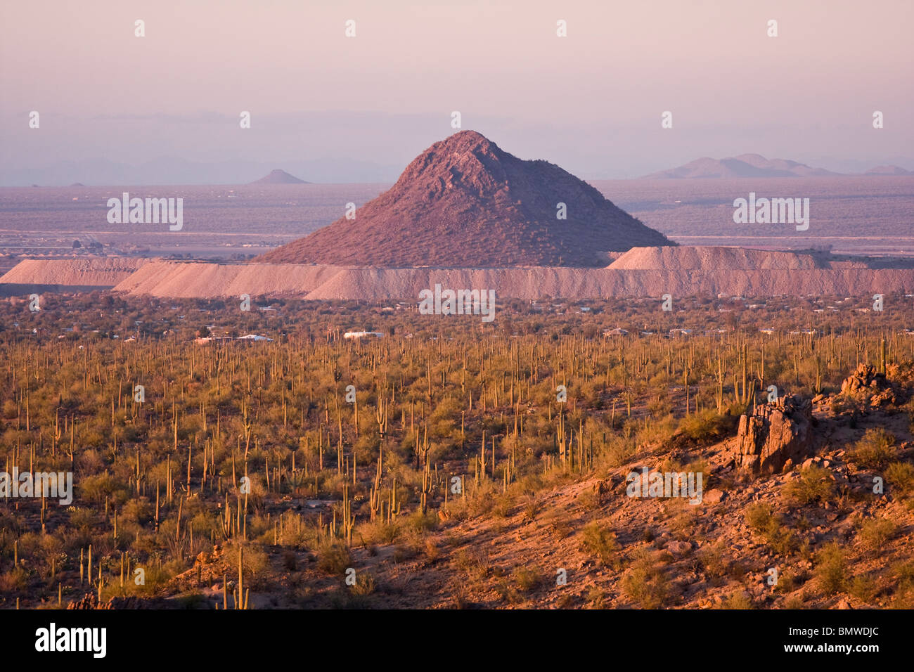
Arizona geography is defined by a dramatic three-tiered structure consisting of the high-altitude Colorado Plateau in the north, the rugged Transition Zone in the center, and the low-elevation Basin and Range province in the south. This structural diversity creates extreme contrasts in climate, vegetation, and topography across the state’s 113,990 square miles.
From the snow-capped volcanic peaks of Flagstaff to the arid, saguaro-studded basins of the Sonoran Desert, Arizona represents one of the most geologically and biologically diverse regions in North America. To understand Arizona geography is to understand the interplay between tectonic forces, erosion, and climate patterns that have shaped the American Southwest over hundreds of millions of years.
The Three Physiographic Provinces of Arizona
The most effective way to categorize Arizona’s geography is through its three distinct physiographic provinces. These regions are not merely arbitrary lines on a map; they represent fundamental differences in rock type, elevation, and geological history.
1. The Colorado Plateau
Encompassing the northern third of the state, the Colorado Plateau is a high-altitude semi-arid region characterized by horizontal rock layers, deep canyons, and vast plateaus. Unlike the rest of the state, the Plateau has remained relatively stable tectonically, allowing for the preservation of ancient sedimentary layers.
Elevations here typically range from 5,000 to 8,000 feet. The defining feature of this province is the Grand Canyon, carved by the Colorado River over the last five to six million years. However, the Plateau also includes the Painted Desert, known for its triassic-aged chinle formation, and the San Francisco Volcanic Field. The plateau’s climate is significantly cooler and wetter than the southern deserts, frequently experiencing heavy winter snowfall.
2. The Transition Zone
Acting as a rugged diagonal "staircase" across the center of the state, the Transition Zone (also known as the Central Highlands) separates the high Colorado Plateau from the low southern deserts. This region is marked by extreme topographic relief and complex geology, including some of the oldest rocks in the state, dating back nearly two billion years.
The most famous feature of the Transition Zone is the Mogollon Rim, a massive escarpment that stretches for roughly 200 miles across Arizona. This rim marks the southern edge of the Colorado Plateau and drops precipitously, sometimes as much as 2,000 feet, into the valleys below. The Transition Zone is home to the world’s largest contiguous ponderosa pine forest, providing a critical watershed for the thirsty metropolitan areas to the south.
3. The Basin and Range Province
The southern and western portions of Arizona belong to the Basin and Range province, a region defined by crustal stretching and thinning. This tectonic activity has created a landscape of alternating mountain ranges (basins) and flat, sediment-filled valleys (ranges).
This province is where the iconic Sonoran Desert resides. The mountain ranges here, often referred to as "Sky Islands," rise abruptly from the desert floor, creating isolated ecosystems that harbor species found nowhere else in the world. Elevations can drop as low as 70 feet above sea level near Yuma, while the surrounding peaks can reach nearly 10,000 feet, illustrating the "landscape of contrasts" that defines the state.
Geological History and Formation
The geography of Arizona is a living record of Earth's history. The state sits atop the North American Craton, but its surface has been repeatedly transformed by volcanic eruptions, inland seas, and tectonic collisions.
The Great Unconformity and Sedimentary Layers
In the Grand Canyon, the "Great Unconformity" represents a gap in the geological record where younger sedimentary rocks sit directly atop much older igneous and metamorphic rocks. This gap accounts for hundreds of millions of years of missing time, erased by erosion before the Paleozoic seas deposited the layers of limestone, sandstone, and shale that make up the canyon’s upper walls.
Cenozoic Volcanism
Arizona remains a volcanically active state in geological terms. The San Francisco Volcanic Field near Flagstaff contains over 600 volcanoes. Humphreys Peak, the highest point in Arizona at 12,633 feet, is the remnant of a massive stratovolcano. To the east, the White Mountains were formed by extensive lava flows, while the Superstition Mountains near Phoenix are the remnants of a massive volcanic caldera collapse that occurred roughly 25 million years ago.
Climate, Life Zones, and Biodiversity
Because of its extreme verticality, Arizona hosts nearly every major "Life Zone" found in North America. This concept, pioneered by C. Hart Merriam in the late 19th century while studying the San Francisco Peaks, illustrates how changes in elevation mimic changes in latitude.
- Lower Sonoran Zone (Under 3,500 ft): Home to the saguaro cactus, creosote bush, and palo verde trees. This is the hottest and driest part of the state, where temperatures in the summer of 2026 continue to reach record highs.
- Upper Sonoran Zone (3,500–6,500 ft): Characterized by chaparral, pinyon-juniper woodlands, and grasslands. This zone covers much of the Transition Zone and the lower edges of the Colorado Plateau.
- Transition Zone (6,500–8,000 ft): Dominated by ponderosa pine. This zone receives significant moisture, often in the form of summer monsoons and winter snow.
- Canadian and Hudsonian Zones (8,000–11,500 ft): Features Douglas fir, aspen, and spruce forests. These areas resemble the forests of Canada and the Pacific Northwest.
- Alpine Tundra (Above 11,500 ft): Found only on the highest peaks of the San Francisco Mountains, this zone consists of mosses, lichens, and hardy wildflowers capable of surviving extreme cold and wind.
Water Systems and Hydrology
In an arid state, geography is inextricably linked to water. Arizona's drainage patterns are dominated by the Colorado River and its major tributaries: the Little Colorado, the Salt, the Verde, and the Gila Rivers.
The Role of the Colorado River
The Colorado River is the lifeblood of the Southwest. Originating in the Rocky Mountains, it flows through the Grand Canyon and along Arizona’s western border. As of 2026, the management of this river remains the most pressing geographic and political issue in the region. The state relies on a complex system of dams (such as Hoover and Glen Canyon) and the Central Arizona Project (CAP) canal to transport water hundreds of miles from the river to the population centers of Phoenix and Tucson.
Groundwater and Riparian Corridors
While the rivers are the visible arteries, Arizona’s geography also includes vast underground aquifers. However, over-pumping in the Basin and Range province has led to land subsidence and earth fissures. Conversely, the state’s remaining perennial streams, such as the San Pedro River, support "riparian corridors"—lush strips of green that provide habitat for over 400 species of birds and serve as vital migratory paths through the desert.
Comparing Arizona's Geographic Regions
The following table summarizes the primary differences between the three main physiographic provinces of Arizona.
| Feature | Colorado Plateau | Transition Zone | Basin and Range |
|---|---|---|---|
| Average Elevation | 5,000 – 8,000 ft | 4,000 – 6,000 ft | 100 – 4,000 ft |
| Primary Rock Types | Sedimentary (Sandstone, Limestone) | Metamorphic & Igneous | Volcanic & Alluvial Sediment |
| Major Landmarks | Grand Canyon, Painted Desert | Mogollon Rim, Salt River Canyon | Saguaro National Park, Chiricahuas |
| Dominant Vegetation | Pinyon-Juniper, Sagebrush | Ponderosa Pine, Chaparral | Saguaro, Creosote, Mesquite |
| Climate Type | Cold Steppe / Alpine | Temperate / Montane | Arid / Semi-Arid Desert |
| Major Cities | Flagstaff, Page, Winslow | Prescott, Payson, Sedona | Phoenix, Tucson, Yuma |
Human Geography and Settlement Patterns
The physical geography of Arizona has dictated where and how humans live. Historically, Indigenous populations like the Ancestral Puebloans settled on the Colorado Plateau, utilizing runoff for dry farming. The Hohokam in the Salt River Valley engineered massive irrigation canals, a geographic footprint that the modern Phoenix metropolitan area still follows today.
In 2026, the "Landscape of Contrasts" is also reflected in the urban-rural divide. Approximately 80% of Arizona’s population is concentrated in the Basin and Range province, specifically within the Maricopa and Pima county corridors. This concentration creates significant geographic pressure on water resources and energy grids, as these low-elevation basins experience the most intense heat.
Meanwhile, the Transition Zone and Colorado Plateau serve primarily as recreational and resource-based regions. The geography of the north supports tourism (Grand Canyon National Park), timber, and ranching, while the south is a hub for high-tech manufacturing, aerospace, and intensive agriculture made possible by irrigation.
The Impact of the North American Monsoon
A discussion of Arizona’s geography is incomplete without mentioning the North American Monsoon. Between June and September, a shift in wind patterns draws moisture from the Gulf of California and the Gulf of Mexico into the state.
The varied topography plays a crucial role in this weather pattern. As moist air is pushed up against the steep slopes of the Mogollon Rim and the "Sky Islands" (a process known as orographic lift), it cools and condenses, triggering violent thunderstorms and flash floods. This seasonal phenomenon is responsible for up to half of the annual rainfall in some parts of the state and is the primary reason the Sonoran Desert is much greener and more biologically diverse than other deserts like the Mojave or the Sahara.
Challenges and Preservation in 2026
Arizona's geography faces significant challenges. Decades of drought, combined with rising temperatures, have increased the risk of catastrophic wildfires, particularly in the ponderosa pine forests of the Transition Zone. These fires change the geography of the landscape by stripping vegetation, which in turn leads to massive erosion and debris flows during monsoon rains.
Efforts by the Arizona State Land Department and various federal agencies like the National Park Service are focused on managing these geographic shifts. From forest thinning projects to the restoration of natural springs, the goal is to maintain the "contrasts" that make the state unique while ensuring that the landscape remains habitable for future generations.
Frequently Asked Questions
What is the highest and lowest point in Arizona?
The highest point is Humphreys Peak at 12,633 feet, located near Flagstaff in the San Francisco Peaks. The lowest point is on the Colorado River south of Yuma, sitting at just 70 feet above sea level. This elevation span of over 12,500 feet is a primary reason for the state's biological diversity.
Why is the Mogollon Rim important to Arizona's geography?
The Mogollon Rim acts as a massive drainage divide and a biological transition zone. It forces moist air upward, creating significant rainfall that feeds the Salt and Verde River systems. These rivers provide a substantial portion of the surface water used by the Phoenix metropolitan area.
Is Arizona's geography mostly desert?
While often perceived as such, only about one-third of Arizona is true desert. The remainder consists of high-altitude plateaus, alpine forests, and rugged mountain ranges. Arizona actually contains the largest contiguous forest of ponderosa pines in the world.
What are "Sky Islands" in Arizona geography?
Sky Islands are isolated mountain ranges in southern Arizona that rise out of the desert floor. Because the elevation changes so rapidly, these mountains contain entirely different ecosystems than the surrounding desert. For example, you can travel from desert scrub at the base to a sub-alpine forest at the summit in just a few miles of driving.
How did the Grand Canyon form?
The Grand Canyon was formed through a combination of tectonic uplift and the erosive power of the Colorado River. As the Colorado Plateau was lifted by internal Earth forces, the river cut downward like a saw through wood, exposing nearly two billion years of geological history in its walls.
Practical Recommendation for Exploration
To truly experience Arizona's "Landscape of Contrasts," travelers should drive the State Route 89A from Sedona to Flagstaff through Oak Creek Canyon. This route begins in the red rock formations of the Transition Zone and ascends through several life zones, ending in the high-altitude forests of the Colorado Plateau. It provides a condensed, visual lesson in the geological and biological diversity discussed throughout this article.