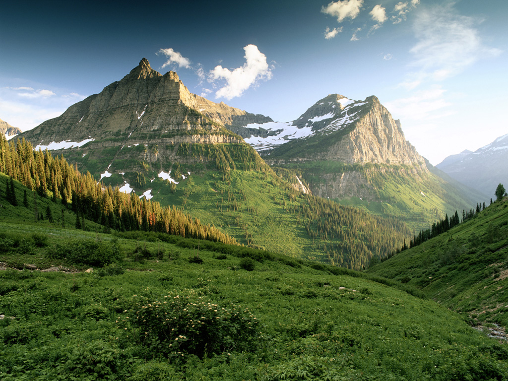
The Appalachian Mountains form a vast, ancient mountain system spanning over 2,000 miles (3,200 kilometers) across eastern North America. Originating through multiple tectonic collisions over 480 million years ago, the range features distinct physiographic provinces, deeply eroded structural landforms, and climate zones ranging from humid subtropical lowlands to subarctic alpine summits.
Geographic Extent and Physiographic Provinces
The Appalachian Mountain system extends continuously from the island of Newfoundland in Canada southwestward through the eastern United States to central Alabama. This expanse forms the geographical barrier between the Atlantic Coastal Plain to the east and the interior North American Lowlands to the west. Far from a uniform chain, the Appalachians comprise distinct sub-regions—known as physiographic provinces—each defined by unique rock types, structural histories, and surface topographies.
Appalachian Physiographic Provinces
- Appalachian Plateau
- Flat/Dissected Strata
- (Coal, Sandstone)
- Valley & Ridge
- Folded/Faulted Layers
- (Limestone, Sandstone)
- Blue Ridge
- Metamorphic Core
- (Basement Rock)
- Piedmont
- Crystalline
- Low Hills
The Piedmont Province
Bordering the Atlantic Coastal Plain along the "Fall Line," the Piedmont forms the eastern foothill region of the Appalachians. Characterized by gently rolling terrain and moderate elevations (typically between 300 and 1,000 feet above sea level), the Piedmont consists primarily of highly weathered metamorphic rocks—such as schist, gneiss, and marble—interspersed with igneous intrusions. Millions of years of chemical weathering have broken down these crystalline basement rocks into deep, clay-rich soils.
The Blue Ridge Province
Rising sharply west of the Piedmont, the Blue Ridge Province contains some of the highest elevations in eastern North America, including Mount Mitchell in North Carolina (6,684 feet / 2,037 meters). The province is underlain by billion-year-old igneous and metamorphic basement rocks, including granite, charnockite, and metabasalt (often referred to as greenstone). The relief is dramatic, featuring steep ridge lines, narrow valleys, and dense forest canopy cover that releases volatile organic compounds, producing the characteristic blue haze for which the region is named.
The Valley and Ridge Province
West of the Blue Ridge lies the Valley and Ridge Province, a zone dominated by long, parallel, northeast-to-southwest trending ridges separated by broad, flat-floored valleys. This striking linear topography is the surface expression of folded and faulted Paleozoic sedimentary rocks. Resistant layers of sandstone and conglomerate form the high ridge crests, while softer, easily eroded limestones, dolostones, and shales form the intervening valleys. The Great Appalachian Valley forms the easternmost trough of this province, stretching from New York down to Alabama.
The Appalachian Plateau
The westernmost province consists of the Allegheny Plateau in the north and the Cumberland Plateau in the south. Unlike the folded strata of the Valley and Ridge, the Appalachian Plateau is underlain by relatively flat-lying sedimentary rock layers. However, millions of years of stream incision have dissected the terrain into an extremely rugged landscape of steep ravines, winding valleys, and narrow ridge crests—a topographic style known as a maturely dissected plateau. This province contains major deposits of bituminous coal, shale, and natural gas.
The New England Province
Northeast of the Hudson River, the standard Appalachian provinces merge into the complex New England Province. This region includes the Green Mountains of Vermont, the White Mountains of New Hampshire, and the coastal ranges of Maine. Glaciation during the Pleistocene Epoch dramatically reshaped this area, scraping away deep soil layers, carving glacial cirques, scouring U-shaped valleys, and exposing granite peaks like Mount Washington (6,288 feet / 1,917 meters).
Geologic Timeline and Tectonic History
The geological history of the Appalachian Mountains spans more than a billion years, capturing a full Supercontinent Cycle (the Wilson Cycle). The modern landforms are the heavily eroded remnants of an immense mountain chain that once rivaled the modern Himalayas in height and extent.
Tectonic Timeline of the Appalachians
- Grenville Orogeny (~1.1 Billion Yrs)
- Assembly of Rodinia
- Taconic Orogeny (~450 Million Yrs)
- Island Arc Collision
- Acadian Orogeny (~375 Million Yrs)
- Avalonia Terrane Collision
- Alleghanian Orogeny (~320-260 Million Yrs)
- Collision with Gondwana (Pangaea)
The Proterozoic Basement (Grenville Orogeny)
The foundational rock of the Appalachians originated approximately 1.1 to 1.0 billion years ago during the Grenville Orogeny. This massive tectonic event occurred when ancient continental masses collided to assemble the supercontinent Rodinia. The intense heat and pressure recrystallized existing rocks into deep-crustal metamorphic basement rocks, such as the billion-year-old gneisses now exposed in the core of the Blue Ridge Mountains.
Rifting of Rodinia and Formation of the Iapetus Ocean
Between 750 and 550 million years ago, Rodinia began to rift apart. As the continental crust pulled open, magma surged to the surface, depositing thick layers of basaltic lava (now metamorphosed into the Catoctin greenstone). As the rifting widened, a new ocean called the Iapetus Ocean formed. Sedimentation along the broad continental margins of ancestral North America (Laurentia) deposited vast layers of quartz sand, mud, and carbonate ooze, which later compressed into sandstone, shale, and limestone.
The Paleozoic Mountain-Building Cycles (Orogenies)
The mountain system was constructed through three major mountain-building events (orogenies) caused by the progressive closure of the Iapetus Ocean:
- The Taconic Orogeny (~450 million years ago): During the Ordovician Period, a volcanic island arc collided with the eastern margin of Laurentia. The weight of the accreting volcanic arc depressed the continental shelf, creating a deep foreland basin that trapped thousands of feet of sediment while pushing up early mountain ridges.
- The Acadian Orogeny (~375 million years ago): During the Devonian Period, a micro-continent named Avalonia collided with eastern Laurentia. This collision produced intense metamorphism, faulting, and widespread igneous intrusions, building high alpine chains across modern-day New England and Atlantic Canada.
- The Alleghanian Orogeny (~320 to 260 million years ago): The final, most violent collision occurred when the supercontinent Gondwana (containing modern Africa and South America) collided with Laurentia to form Pangaea. This continental collision crumpled the eastern edge of North America, pushing massive sheets of crystalline rock miles westward over younger sedimentary rock along low-angle thrust faults. The interior sedimentary layers folded into the tight waves seen today in the Valley and Ridge Province.
Post-Rifting, Mesozoic Erosion, and Cenozoic Rejuvenation
During the Mesozoic Era (around 200 million years ago), Pangaea broke apart, opening the modern Atlantic Ocean. The Appalachians became an interior mountain chain subjected to relentless weathering and river erosion. By the Cretaceous Period, the original high peaks had been worn down to a featureless, low-lying plain (peneplain).
During the Cenozoic Era (the past 66 million years), broad regional uplift (epeirogenic rejuvenation) elevated the entire Appalachian region without folding the rocks further. This vertical uplift reactivated stream systems, allowing rivers to cut deep gorges into the landscape and exposing the alternating hard and soft rock layers that define the modern landscape.
Summary of Appalachian Physiographic Features
The following matrix compares the dominant geologic, lithologic, and topomorphic traits across the primary sub-regions of the Appalachian chain:
| Physiographic Province | Dominant Rock Types | Primary Tectonic / Structural Traits | Characteristic Topography | Key Geographic Features / Examples |
|---|---|---|---|---|
| Piedmont | Metamorphic (schist, gneiss) and Igneous intrusions | Highly deformed crystalline rock, sheared fault zones | Gently rolling hills, deeply weathered saprolite soils | Fall Line boundary, Atlanta Metros, Piedmont Urban Crescent |
| Blue Ridge | Proterozoic basement gneiss, Metavolcanics (greenstone) | Massive thrust-sheet faulting pushed westward | High relief, steep ridges, highest peaks in eastern North America | Mount Mitchell (6,684 ft), Shenandoah & Great Smoky Mountains |
| Valley and Ridge | Folded Sedimentary (sandstone, limestone, shale) | Synclines, anticlines, fold-thrust structures | Parallel linear ridges and wide agricultural valleys | Great Appalachian Valley, Delaware Water Gap, Cumberland Valley |
| Appalachian Plateau | Flat-lying Sedimentary (sandstone, siltstone, coal seams) | Undeformed to gently warped horizontal strata | Deeply dissected river plateaus, steep dendritic ravines | Allegheny Mountains, Cumberland Plateau, New River Gorge |
| New England | Glaciated Igneous (granite) and High-grade Metamorphic | Complex Paleozoic terranes modified by Pleistocene glaciers | Scoured mountain summits, glacial cirques, U-shaped valleys | Mount Washington (6,288 ft), White Mountains, Green Mountains |
Rock Formations and Lithological Characteristics
The diverse rock formations within the Appalachians directly govern the region's surface hydrology, soil chemistry, and land utilization patterns.
Metamorphic and Igneous Cores
The high-relief backbones of the Blue Ridge and New England provinces consist of dense, crystalline rocks that resist weathering:
- Gneiss and Schist: Foliated metamorphic rocks created under intense tectonic pressure during the Grenville and Alleghanian orogenies. Their interlocking mineral structure makes them highly resistant to mechanical erosion.
- Granite Intrusions: Magmatic plutons formed deep within the crust during the Acadian and Alleghanian events, later exposed by erosion. Granite formations dominate regions like the White Mountains and coastal Maine.
- Metabasalt (Greenstone): Ancient basaltic lava flows altered by heat and chemical fluid transfer, producing durable green-hued rock layers found along the crest of the Blue Ridge.
Cross-Section of Valley & Ridge Lithology
- Resistant Sandstone Ridge (High Peak)
- Sandstone Layer
- Heavy Weathering
- Hard Quartzite
- Errodible Limestone/Shale Valley (Low Valley)
- Soluble Limestone - Karst
- Caves, Sinkholes, Aquifers
- Resistant Sandstone Ridge (High Peak)
- Sandstone Layer
- Heavy Weathering
- Hard Quartzite
Sedimentary Successions and Karst Topography
The Valley and Ridge and Appalachian Plateau provinces feature extensive sedimentary rock sequences:
- Sandstones and Quartzites: High-silica rocks formed from ancient beach sands and river deltas. Because silica resists chemical dissolution, sandstone layers remain intact, forming the long, sharp crests of ridges like Massanutten Mountain and Tuscarora Mountain.
- Limestones and Dolostones: Carbonate sediments deposited in warm, shallow ocean environments during the early Paleozoic Era. Because calcium carbonate ($CaCO_3$) dissolves in slightly acidic rainwater, limestone valleys undergo intense karstification. This process creates extensive subterranean networks, including thousands of caves, underground streams, and sinkholes across states like Virginia, West Virginia, and Tennessee.
- Coal-Bearing Formations: During the Carboniferous Period (specifically the Mississippian and Pennsylvanian epochs), broad coastal swamps covered the Appalachian basin. Accumulated plant matter was rapidly buried under clay and sand layers, transforming under geothermal heat and pressure into rich bituminous and anthracite coal seams.
For detailed hydrogeologic classifications of Appalachian sedimentary and crystalline bedrock aquifers, consult the United States Geological Survey Ground Water Atlas.
Climatic Systems and Weather Patterns
The climate of the Appalachian Mountains varies dramatically from south to north and from low valleys to isolated alpine peaks. The range acts as both a continental climate barrier and a engine for generating complex localized weather systems.
Latitudinal & Elevational Climate Zones
- Alpine Tundra / Subarctic: Mount Washington Summit (ET/Dfc)
- Cool Temperate Spruce-Fir: High Peaks >5,000 ft (Dfb)
- Humid Continental Zone: Northern Lowlands / Mid-Appalachians (Dfb/Dfa)
- Humid Subtropical Zone: Southern Valleys & Piedmont (Cfa)
Macroclimate: The Latitudinal Gradient
The Appalachian range spans nearly 20 degrees of latitude, generating a broad spectrum of climate zones under the Köppen climate classification:
- Humid Subtropical (Cfa): Prevails across the southern lowlands, Piedmont, and lower valleys of Georgia, the Carolinas, and Tennessee. Summers are long, hot, and humid, while winters are mild.
- Humid Continental (Dfa / Dfb): Dominates the central and northern Appalachians from Pennsylvania northward through New England. Summers are warm to mild, and winters are cold, bringing heavy snowfall and persistent sub-zero temperatures.
- Subarctic / Alpine Tundra (Dfc / ET): Found on high-elevation summits in the northern range—such as Mount Washington and Mount Katahdin—and isolated high peaks of North Carolina. These regions experience extremely cold winters, short cool summers, and extreme winds.
Elevation, Environmental Lapse Rate, and Orographic Lift
Elevation plays a critical role in controlling temperature and precipitation across short geographical distances. Average air temperatures drop by approximately $3.5^\circ\text{F}$ for every 1,000 feet of elevation gain (an standard environmental lapse rate of roughly $6.5^\circ\text{C}$ per 1,000 meters). Consequently, high-elevation summits in the Great Smoky Mountains maintain temperatures comparable to locations hundreds of miles to the north in Canada.
Orographic Lift Mechanism
- Moist Air Mass (Gulf / Atlantic)
- Windward Slope: Cloud Formation & Heavy Rain
- Leeward Slope: Rain Shadow Effect (Drier Air Descends)
The mountain barrier forces approaching air masses upward—a phenomenon known as orographic lift:
- Warm, moisture-laden air moving north from the Gulf of Mexico or west from the Atlantic Ocean collides with the steep Appalachian ridges.
- As the air rises, it expands and cools, forcing water vapor to condense into clouds and heavy precipitation.
- The windward (southwestern and western) slopes receive significant rainfall, with some areas of the Southern Appalachian spruce-fir forest receiving over 80 inches (2,000 millimeters) of precipitation annually, qualifying them as temperate rain forests.
- Conversely, lower valleys situated on the leeward (eastern) side of major ridges experience a rain shadow effect, receiving substantially less annual moisture.
Thermal Inversions and Cloud Forests
During calm winter nights and humid summer mornings, thermal inversions frequently develop in the Appalachian valleys. Cool, dense air drains down the mountain slopes into the valley bottoms, trapping cold air and fog beneath a layer of warmer air above. In high-elevation zones—such as those above 5,000 feet in North Carolina, Tennessee, and Virginia—summits spend up to one-third of the year immersed in cloud cover. These fog-drenched environments support distinct high-elevation coniferous forests dependent on moisture intercepted directly from fog droplets.
Extreme Wind Dynamics and Extreme Events
The Appalachian chain serves as a track for severe coastal storms, tropical cyclones, and winter nor'easters. The isolated high peaks of New England experience some of the most severe weather recorded on Earth due to the convergence of major storm tracks and narrow topography:
- The summits funnels westerly jet-stream winds, accelerating them over steep mountain crests via the Venturi effect.
- Mount Washington held the world record for the highest recorded surface wind speed unassociated with a tornado or tropical cyclone for decades—measuring 231 miles per hour (372 km/h) on April 12, 1934. Real-time meteorological data and weather records for this severe mountain environment are tracked by the National Oceanic and Atmospheric Administration.
Hydrography and Drainage Networks
The Appalachian Mountains form the hydrologic backbone of eastern North America, establishing major drainage basin divides that direct surface water runoff into the Atlantic Ocean, the Gulf of Mexico, and the St. Lawrence River.
Appalachian Drainage Dynamics
- Appalachian High Crests / Continental Divide
- Westerly Drainage (Dendritic Patterns)
- Appalachian Plateau (Ohio & Mississippi Basins)
- Gulf of Mexico
- Appalachian Plateau (Ohio & Mississippi Basins)
- Easterly Drainage (Trellis Patterns)
- Valley & Ridge Region (Atlantic Coastal Rivers)
- Atlantic Ocean
- Valley & Ridge Region (Atlantic Coastal Rivers)
- Westerly Drainage (Dendritic Patterns)
The Eastern Continental Divide
Running along the high ridges of the Blue Ridge and Allegheny mountains, the Eastern Continental Divide separates waters flowing eastward directly into the Atlantic Ocean from waters flowing westward into the Ohio and Tennessee river systems—which ultimately drain into the Gulf of Mexico via the Mississippi River.
Distinct Drainage Patterns
The underlying rock structures determine how river networks cut across the landscape:
- Trellis Drainage: Dominates the Valley and Ridge Province. Primary streams flow within soft limestone valleys, while smaller tributary streams join at right angles, cutting through softer rock zones between linear sandstone ridges.
- Dendritic Drainage: Prevails on the flat-lying rock layers of the Appalachian Plateau. Rivers branch out irregularly in all directions, resembling the roots of a tree, as they carve deep, uniform gorges into the horizontal strata.
Drainage Patterns Comparison
- Trellis Drainage (Valley & Ridge)
- Main Valley Stream
- Sub-tributaries at right angles between Sandstone Ridges
- Dendritic Drainage (Appalachian Plateau)
- Main Trunk River
- Branches spread evenly across horizontal strata
Antecedent Streams and Water Gaps
Several major rivers—including the Susquehanna, Delaware, Potomac, and New rivers—are older than the modern topographic uplift of the mountain chain. These antecedent streams maintained their courses as the land slowly rose beneath them during Cenozoic rejuvenation. As the land lifted, the rivers eroded down at an equal rate, slicing straight through hard sandstone ridges. Today, these narrow, spectacular gorges are known as water gaps (such as the Delaware Water Gap and the Potomac Water Gap at Harpers Ferry). Where rivers once cut through ridges but were later diverted, dry notches remain in the landscape, known as wind gaps.
Ecological Significance of Appalachian Geomorphology
The physical and climatic characteristics of the Appalachian Mountains make them one of the most biodiverse temperate regions in the Northern Hemisphere.
Ice Age Refugia & Elevational Migration
Pleistocene Glaciation: Ice Sheet (Flora/Fauna driven south to Southern Refuge)
Modern Climate Interglacial: Temperate Basins (Species migrate up to Subarctic Tops)
Glacial Refugia: During the Pleistocene ice ages, massive continental ice sheets advanced southward, stopping in northern Pennsylvania. The unglaciated Southern Appalachians served as a vital sanctuary (refugium) for plants and animals fleeing frozen northern climates. When the ice sheets retreated, many cool-climate species survived by migrating upward into high-altitude mountain microclimates rather than moving northward.
Biogeographic Islands: High summits in the Southern Appalachians function as ecological "sky islands." Dense spruce-fir forests on peaks above 5,000 feet harbor endemic species—such as the Cheat Mountain salamander and the Fraser fir—isolated from similar northern habitats by warm, low-elevation valleys.
Salamander Diversity Hotspot: The combination of abundant precipitation, cool environments, dense forest leaf litter, and deep karst cave systems has made the Southern and Central Appalachians the global center of biodiversity for lungless salamanders (family Plethodontidae).
Frequently Asked Questions
How old are the Appalachian Mountains compared to the Rocky Mountains?
The Appalachian Mountains are significantly older than the Rocky Mountains. The initial tectonic building blocks of the Appalachians began forming over 480 million years ago, with final structural assembly occurring around 260 million years ago. In contrast, the Rocky Mountains were formed much later, primarily during the Laramide Orogeny between 70 and 40 million years ago. Because the Appalachians are hundreds of millions of years older, prolonged weathering and stream erosion have rounded their summits and reduced their overall peak elevations compared to the sharp, high-altitude peaks of the Rockies.
What caused the unique linear parallel ridges of the Valley and Ridge Province?
The parallel ridges and valleys were formed by a combination of intense folding during the Alleghanian Orogeny and millions of years of differential erosion. Continental collision compressed ancient sedimentary layers into giant structural waves—upward folds called anticlines and downward folds called synclines. Over time, surface streams eroded away soft, soluble limestones and shales, carving out flat valleys. The hard, weather-resistant sandstone layers resisted erosion, remaining elevated as long, parallel ridge crests.
Why do the Southern Appalachian Mountains have such high biodiversity?
High biodiversity in the Southern Appalachians stems from complex topography, microclimatic variation, and historical stability. The south-to-north ridge orientation provided an unobstructed migration corridor for species shifting habitats during glacial periods. Additionally, steep elevational gradients create rapid climatic shifts across short physical distances, allowing humid subtropical species to thrive in valleys while cold-adapted boreal species survive on nearby summits. The absence of direct Pleistocene glaciation south of Pennsylvania also prevented widespread extinctions.
How does elevation affect precipitation in the Appalachian chain?
Elevation drives precipitation through orographic lifting. As prevailing moist air masses from the Gulf of Mexico or Atlantic Ocean encounter high Appalachian ridges, the air is forced upward into colder atmospheric layers. The air cools, loses its capacity to hold moisture, and drops water as rain or snow on the windward slopes. As a result, high-elevation peaks (such as Mount Mitchell) receive up to 80 inches of precipitation annually, whereas adjacent low-lying valleys on the leeward side receive considerably less rainfall.
Technical Summary and Key Takeaways
The Appalachian Mountains represent an ancient, highly evolved landscape where deep tectonic history, varied lithology, and dynamic climate patterns intersect:
- Complex Physiography: The system transitions from eastern metamorphic lowlands (Piedmont) through ancient crystalline peaks (Blue Ridge), folded sedimentary troughs (Valley and Ridge), flat-lying dissected plateaus (Appalachian Plateau), and glaciated northern summits (New England).
- Deep Geologic Time: Built through three primary Paleozoic orogenies (Taconic, Acadian, Alleghanian) following the Proterozoic Grenville event, the mountain system reflects the full assembly and eventual breakup of the supercontinent Pangaea.
- Lithologic Control: Resistant sandstones and crystalline metamorphic rocks maintain high ridge crests, while soluble limestones undergo karstification to create low valleys, cave networks, and complex aquifers.
- Climatic Diversity: Ranging from humid subtropical bases in the south to subarctic alpine summits in the north, the terrain leverages elevation and orographic lift to generate distinct microclimates, high wind speeds, and cloud-drenched boreal forests.
- Hydrologic & Ecological Significance: The range serves as eastern North America's primary drainage divide, utilizing trellis and dendritic river systems to channel water across the continent while preserving one of the richest temperate forest ecosystems on Earth.