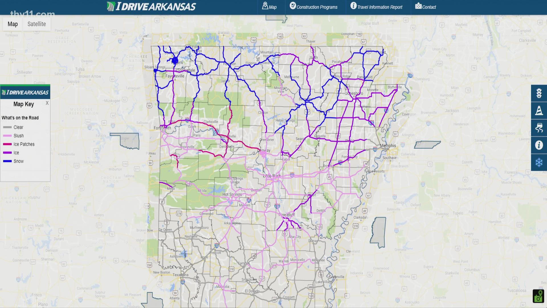
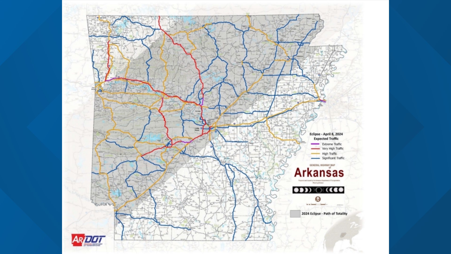
Arkansas road conditions are primarily monitored and reported by the Arkansas Department of Transportation (ARDOT) through the IDriveArkansas platform. This integrated system provides real-time updates on construction, weather-related hazards, traffic congestion, and road closures via a web portal, a dedicated mobile application, and the 511 telephone hotline. In 2026, these tools remain the definitive source for navigating the state’s 16,000-mile highway system safely and efficiently.
The Role of the Arkansas Department of Transportation (ARDOT)
The Arkansas Department of Transportation (ARDOT) is the state-level agency responsible for the planning, construction, and maintenance of the Arkansas State Highway System. Unlike many other states where local counties manage a significant portion of secondary roads, Arkansas maintains a highly centralized highway system, making ARDOT’s reporting essential for almost any inter-city travel.
As we navigate through 2026, ARDOT continues to manage one of the largest state-maintained highway systems in the United States relative to its population. This responsibility involves monitoring diverse topographies—from the flat, flood-prone regions of the Mississippi Delta to the steep, winding corridors of the Ozark and Ouachita Mountains. Each of these regions presents unique challenges for road conditions, requiring a sophisticated network of sensors, cameras, and field reports to keep the public informed.
The IDriveArkansas Ecosystem
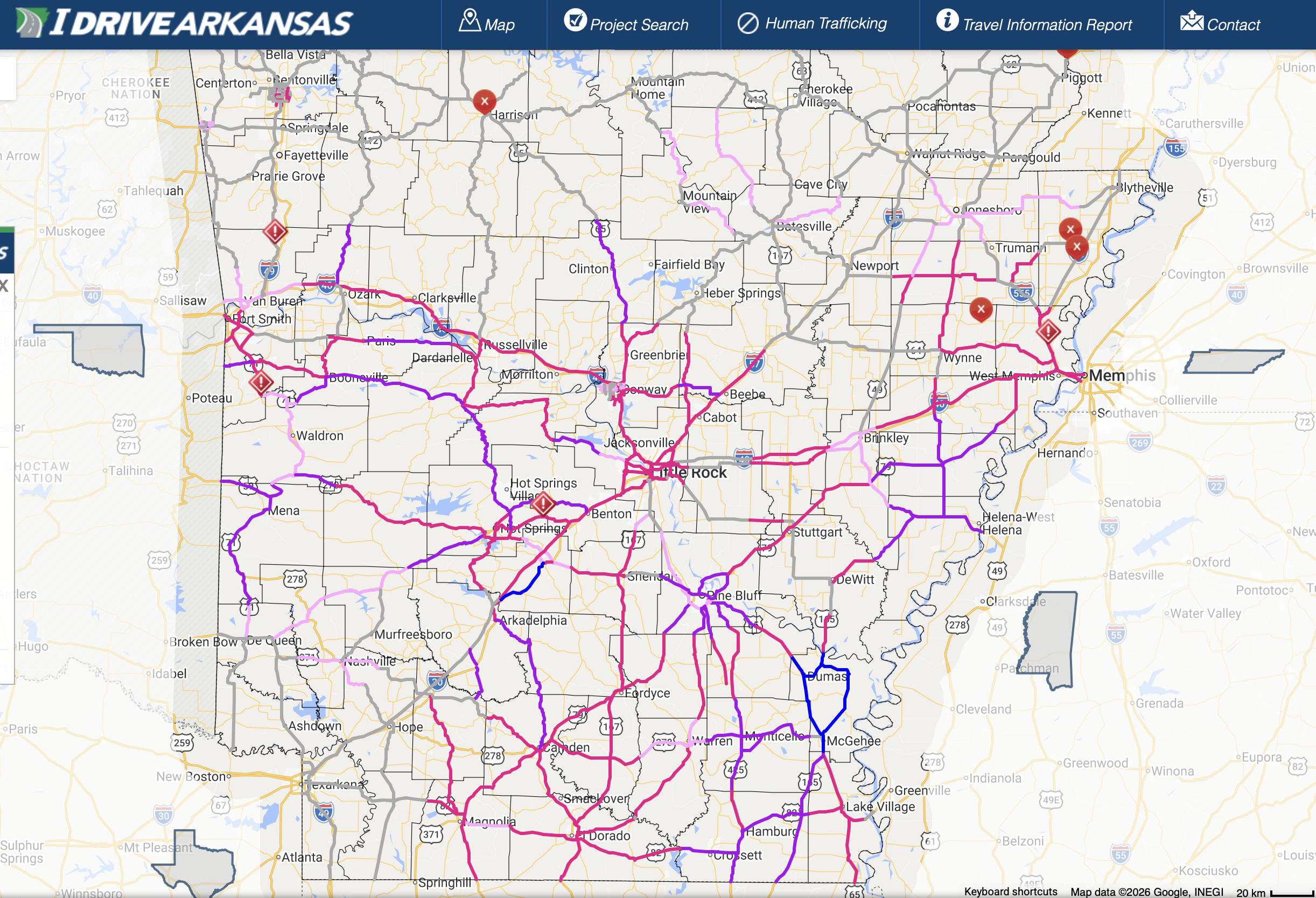
The centerpiece of Arkansas’s road condition reporting is IDriveArkansas. Launched to consolidate various data streams into a single user-friendly interface, it has evolved into a comprehensive travel tool. The platform aggregates data from:
- Pavement Sensors: Embedded technology that detects temperature and moisture.
- CCTV Traffic Cameras: Live feeds located at major interchanges and high-traffic corridors.
- Field Reports: Direct observations from ARDOT maintenance crews and Arkansas State Police.
- Incident Management Systems: Real-time data regarding accidents and stalled vehicles.
By accessing IDriveArkansas.com, travelers can view a live map that highlights current construction zones, winter weather impacts, and congestion levels. In 2026, this system is more critical than ever as the state undergoes several multi-year infrastructure expansions.
Understanding Real-Time Traffic and Construction Reports
Traffic conditions in Arkansas can change rapidly due to the state’s role as a major freight corridor. Interstate 40 (I-40), which bisects the state from east to west, is one of the busiest trucking routes in the nation. Consequently, ARDOT prioritizes real-time monitoring of these high-volume paths.
Construction Zone Classifications
When viewing road conditions, users will typically encounter several types of construction-related status updates:
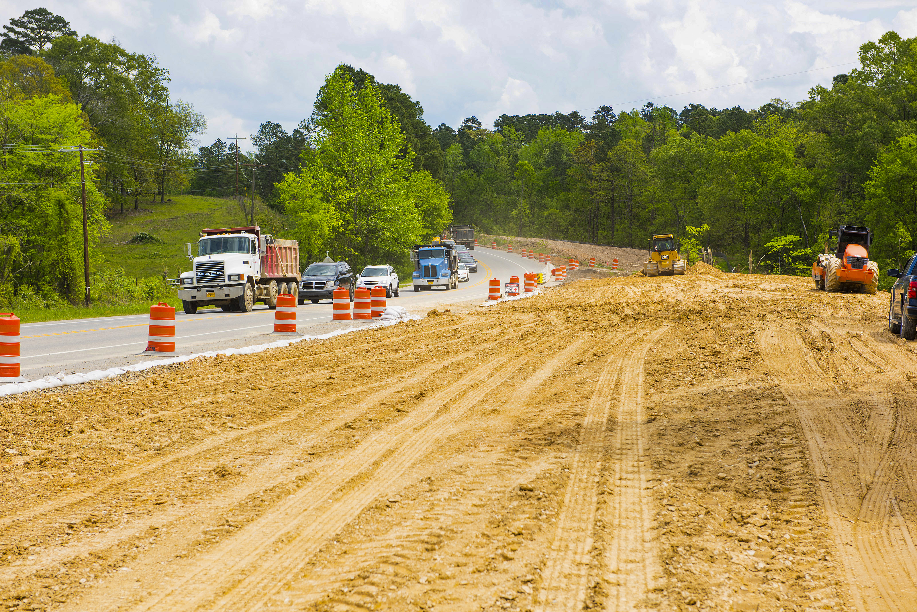
- Work Zones (Active): These areas feature crews on-site. Speed limits are strictly enforced, and fines are doubled under Arkansas law.
- Lane Restrictions: The road remains open, but the capacity is reduced. This is common during bridge inspections or pavement resurfacing.
- Scheduled Closures: Often occurring at night, these are planned events for major structural work, such as setting bridge girders.
- Long-Term Projects: These represent multi-year expansions, such as the ongoing "30 Crossing" project in Little Rock or the I-49 corridor developments in Northwest Arkansas.
Incident and Congestion Alerts
Beyond planned construction, "road conditions" also refer to unexpected incidents. ARDOT utilizes a color-coded system on its digital maps to indicate traffic speed:
- Green: Free-flow traffic at or near the posted speed limit.
- Yellow/Orange: Slowed traffic, typically indicating moderate congestion or the approach to a work zone.
- Red: Heavy congestion or stopped traffic, usually signifying a major accident or a complete road blockage.
Weather-Related Road Conditions and Winter Maintenance
Arkansas experiences a wide range of weather events that impact road safety, including severe thunderstorms, flash flooding, and winter storms. Because the state lies in a transitional climate zone, winter weather often manifests as freezing rain or sleet rather than dry snow, creating particularly hazardous driving conditions.
Winter Weather Reporting Categories
During the winter months, ARDOT maintenance crews work around the clock to scout roads. They report conditions based on specific criteria found on the IDriveArkansas map:
- Clear: Pavement is dry or slightly damp, with no significant accumulation of frozen precipitation.
- Damp/Wet: The road is wet, but temperatures are above freezing. This is a "watch" phase for potential black ice.
- Slushy: Snow or ice is melting, creating a thick, slippery layer. This often leads to hydroplaning risks.
- Snow-Covered: The road surface is not visible. Travel is highly discouraged unless the vehicle is equipped for such conditions.
- Ice-Covered: The most dangerous designation. This typically occurs after freezing rain events common in Central and Southern Arkansas.
Flooding and Hydroplaning Hazards
In the Arkansas Delta and river valley regions, flash flooding is a frequent cause of road closures. ARDOT works closely with the National Weather Service to issue alerts when highways are overtopped by water. Drivers are reminded of the "Turn Around Don't Drown" campaign, as even a few inches of moving water can displace a vehicle.
Utilizing the Arkansas 511 System
For those who cannot access a smartphone app or prefer voice-activated updates, the 511 Travel Information System is the primary alternative. By dialing 5-1-1 within state lines, callers access a voice-response system that provides:
- Route-Specific Reports: Users can state a highway number (e.g., "Interstate 30") to hear specific updates.
- Regional Overviews: Updates for specific districts, such as the Little Rock metro area or the Fort Smith region.
- Transfers to Neighboring States: The system can often route callers to 511 services in Oklahoma, Missouri, or Tennessee for cross-border travel planning.
The 511 system is a critical safety feature for commercial drivers and travelers in rural areas where high-speed cellular data may be inconsistent.
Commercial Trucking and Freight Considerations
Arkansas is a logistics hub, home to several of the nation's largest freight carriers. As such, "road conditions" for a trucker involve more than just traffic speed; they involve weight restrictions and vertical clearances.
ARDOT provides specific resources for the trucking industry, including:
- Permit Maps: Visualizing which routes are cleared for oversize or overweight loads.
- Bridge Weight Limits: Real-time updates on bridges that have been downgraded for weight, necessitating detours for heavy rigs.
- Truck Parking Availability: Some segments of I-40 have integrated sensors to tell drivers how many parking spots remain at upcoming rest areas, reducing the need for drivers to park on highway shoulders.
| Information Source | Primary Use Case | Best For |
|---|---|---|
| IDriveArkansas App | Real-time GPS-linked updates | Commuters and daily travelers |
| IDriveArkansas.com | Pre-trip planning and camera views | Long-distance travelers/dispatchers |
| 511 Phone System | Hands-free updates | Rural driving/Commercial drivers |
| ARDOT Social Media | Emergency alerts and major news | Real-time crisis updates (floods/storms) |
| Dynamic Message Signs | Immediate en-route warnings | Approaching hazards or exits |
Major Infrastructure Projects Impacting Conditions in 2026
In 2026, several large-scale projects continue to influence road conditions across the state. Understanding these projects helps travelers anticipate delays even when weather is clear.
The 30 Crossing (Little Rock)
This is one of the largest construction projects in ARDOT history. Centered on the I-30 bridge over the Arkansas River, it aims to improve safety and bottlenecks in the heart of the capital city. In 2026, motorists should expect frequent lane shifts and narrow shoulders through the downtown corridor.
I-49 Expansion (Northwest Arkansas)
As the Fayetteville-Springdale-Rogers area continues to grow, I-49 faces significant congestion. Projects to widen the interstate to six or eight lanes in certain segments are common. This region often experiences "bottlenecking" during morning and evening rush hours, which is reflected as "Red" or "Orange" on IDriveArkansas.
Future 57 / Highway 67 Extension
The transition of Highway 67 into the Future Interstate 57 corridor involves significant pavement rehabilitation and bridge upgrades between North Little Rock and the Missouri state line. This route is a primary alternative to I-40 for northeast travel, and construction here can significantly impact travel times to Jonesboro and beyond.
Intelligent Transportation Systems (ITS) and Technology
Arkansas has invested heavily in Intelligent Transportation Systems (ITS) to improve how road conditions are communicated. This network includes:
- Dynamic Message Signs (DMS): The large electronic signs over highways that provide estimated travel times or warn of accidents ahead.
- Road Weather Information Systems (RWIS): Specialized weather stations that monitor pavement temperature, wind speed, and visibility specifically for road maintenance crews.
- Waze Integration: ARDOT feeds its official construction and closure data into third-party apps like Waze and Google Maps, ensuring that even if you aren't using an official ARDOT app, you are still receiving verified state data.
Safety Protocols and Driver Responsibility
While ARDOT provides the data, driver behavior remains the most significant factor in navigating road conditions safely. Arkansas law includes several provisions aimed at protecting both drivers and workers.
- The Move Over Law: Drivers are required to move over one lane or slow down significantly when approaching any vehicle on the shoulder with flashing lights. This includes police, emergency vehicles, and ARDOT maintenance trucks.
- Work Zone Safety: Speeding in a work zone is a high-priority enforcement area for the Arkansas State Police. Even if workers are not visible, the reduced speed limit applies if the signs are posted.
- Distracted Driving: Arkansas has strict laws against texting while driving. Using the IDriveArkansas app should be done before the trip begins or by a passenger.
Frequently Asked Questions
How often is the IDriveArkansas map updated?
The map is updated 24/7. Automated data, such as traffic speeds and sensor readings, update every few minutes. Manual reports, such as specific accident details or construction progress, are updated as soon as field reports are verified by the ARDOT Communications Center.
Are county roads included in ARDOT road condition reports?
Generally, no. ARDOT is responsible for State Highways, U.S. Highways, and Interstates. Conditions for county roads are managed by individual County Judges and their respective road departments. If a road does not have a highway shield (e.g., Highway 10) or an Interstate sign, it is likely not covered by IDriveArkansas.
Can I view live camera feeds during a snowstorm?
Yes. The IDriveArkansas "Traffic Cameras" layer allows users to see live or near-live images from across the state. This is particularly useful for verifying the "Snow-Covered" or "Ice-Covered" status of a specific mountain pass or bridge before you head out.
What should I do if I see a hazard not on the map?
If you encounter a dangerous road condition that has not yet been reported, such as a large pothole, debris in the lane, or a malfunctioning signal, you can contact the Arkansas Department of Transportation's main office or, in emergencies, notify the Arkansas State Police (*55 on a mobile phone).
Does Arkansas provide a map of rest area closures?
Yes. Within the IDriveArkansas app and website, there is a specific layer for "Rest Areas" and "Welcome Centers." This layer will indicate if a facility is closed for maintenance or if it has reached capacity for truck parking.
Practical Recommendations for Travelers
To ensure a safe journey through Arkansas, always check the IDriveArkansas platform at least 30 minutes before departure. During the winter, check again every two hours, as temperatures in the Ozarks can drop rapidly, turning wet roads into ice in a matter of minutes. For those traveling through Little Rock or Northwest Arkansas, allow an extra 20 minutes of travel time regardless of the reported conditions to account for the heavy volume associated with 2026 infrastructure projects. Finally, always carry an emergency kit during winter months, as mountain corridors can occasionally be shut down for hours following major semi-truck accidents.