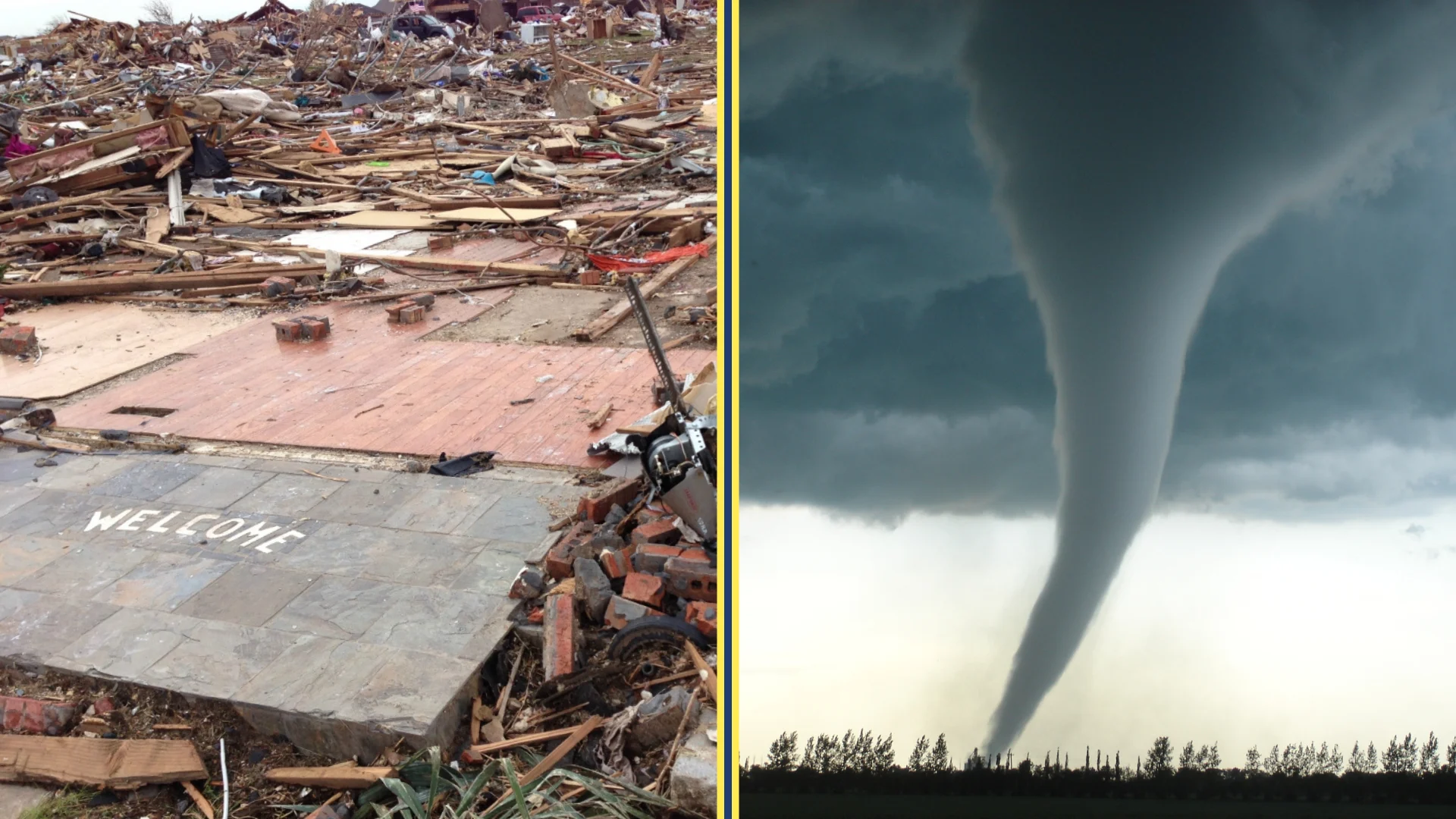
No, hurricanes and tornadoes are distinct meteorological phenomena. While both are powerful, rotating atmospheric vortices, they differ fundamentally in their scale, duration, formation mechanisms, and the environments required to sustain them. Hurricanes are massive oceanic systems lasting weeks, whereas tornadoes are smaller, intense land-based events lasting minutes to hours.
Defining the Atmospheric Vortex: Hurricanes vs. Tornadoes
To understand whether a hurricane is a tornado, one must first look at the classification of an atmospheric vortex. Both systems involve air rotating around a low-pressure center, but the similarities largely end there. In the field of meteorology, a hurricane is a type of tropical cyclone—a closed, low-pressure system that forms over warm tropical waters. It is characterized by organized convection and a well-defined surface wind circulation.
A tornado, conversely, is a violently rotating column of air that is in contact with both the surface of the earth and a cumulonimbus cloud (or, in rare cases, the base of a cumulus cloud). While a hurricane is a self-sustaining weather system that can cover hundreds of miles, a tornado is usually a localized appendage of a much larger parent thunderstorm, such as a supercell.
By 2026, our understanding of these distinctions has become even more refined through high-resolution satellite imagery and advanced Doppler radar. We now recognize that while they are "cousins" in the family of rotating winds, they occupy different ends of the meteorological spectrum in terms of energy source and physical footprint.
The Mechanisms of Formation
The "engine" that powers a hurricane is vastly different from the one that drives a tornado. Understanding these "engines" helps clarify why one cannot be the other.
How Hurricanes Form
Hurricanes require a specific set of environmental "ingredients" to develop, primarily found in tropical latitudes. The primary source of energy is the latent heat released when moist air rises and water vapor condenses.
- Warm Ocean Waters: Sea surface temperatures must generally be at least 80°F (26.5°C) to a depth of about 150 feet.
- Atmospheric Instability: The air must cool off rapidly with height to allow for the continued ascent of moist air.
- Low Vertical Wind Shear: Unlike tornadoes, hurricanes thrive in environments with low wind shear (minimal change in wind speed or direction with height). High shear can "rip" a developing hurricane apart.
- Coriolis Effect: Hurricanes rarely form within 5 degrees of the equator because the Coriolis force—the rotation of the Earth—is too weak to induce the necessary spin.
How Tornadoes Form
Tornadoes are generally born from intense convective instability and high vertical wind shear—the very thing that destroys hurricanes.
- Wind Shear: For a tornado to form, there must be a significant change in wind speed and direction with height. This creates a horizontal "rolling" effect in the lower atmosphere.
- Updrafts: Strong convective updrafts tilt this horizontal rolling air into a vertical position.
- Supercells: Most intense tornadoes are produced by supercell thunderstorms, which possess a deep, persistently rotating updraft called a mesocyclone.
- Temperature Gradients: The collision of warm, moist air (often from the Gulf of Mexico) with cold, dry air (from Canada or the Rockies) provides the volatile energy needed for these storms to trigger.
Physical Scale and Duration: A Study in Contrast
One of the most immediate ways to distinguish these two events is their physical size and how long they last.
Horizontal Scale
A typical hurricane is a massive entity. The "hurricane-force" winds (74 mph or greater) may extend 25 to 150 miles from the center, but the entire cloud shield can span over 500 miles in diameter. In contrast, the average tornado is only about 500 feet wide. Even the most "wedge-like" tornadoes, which are considered massive, rarely exceed 2 miles in width. Comparing the two is like comparing a large city to a single street corner.
Vertical Scale
A hurricane is relatively "thin" compared to its width. It occupies the depth of the troposphere (roughly 8 to 10 miles high). A tornado, while also extending through the depth of the parent cloud, is a much narrower "needle" of rotation piercing through the atmosphere.
Duration and Life Cycle
In 2026, tracking technology allows us to follow a hurricane from its birth as a tropical wave off the coast of Africa to its dissipation over the North Atlantic, a journey that can take three weeks. A tornado, however, has a much more fleeting existence. Most tornadoes last less than 10 minutes and travel only a few miles. While "long-track" tornadoes can stay on the ground for over an hour and travel 100 miles, they are the exception rather than the rule.
The Relationship: When Hurricanes Spawn Tornadoes
While hurricanes are not tornadoes, they are frequently the producers of tornadoes. When a hurricane makes landfall, the change in friction between the water and the land, combined with the inherent instability in the storm’s outer rainbands, creates the perfect conditions for tornado formation.
These are known as Tropical Cyclone Tornadoes (TCTs). They typically occur in the "right-front quadrant" of the hurricane (relative to its direction of motion). As the hurricane's outer bands move over land, the surface winds slow down due to friction with terrain and buildings, while the winds a few thousand feet up remain very fast. This creates the vertical wind shear necessary to spin up small, often short-lived tornadoes.
Tornadoes produced by hurricanes are usually weaker than those produced by Great Plains supercells—often ranging from EF0 to EF2 on the Enhanced Fujita scale—but they are exceptionally dangerous because they are "rain-wrapped" and difficult to see. Furthermore, they occur within a broader environment of life-threatening winds and flooding, complicating the emergency response.
Measuring Intensity: Saffir-Simpson vs. Enhanced Fujita
Because the nature of the damage and the wind patterns differ, scientists use two different scales to categorize these storms.
| Feature | Hurricane | Tornado |
|---|---|---|
| Measurement Scale | Saffir-Simpson Scale (Category 1-5) | Enhanced Fujita Scale (EF0-EF5) |
| Primary Metric | Sustained wind speed (1-minute average) | Damage indicators (to estimate wind gusts) |
| Typical Width | 100 to 500 miles | 150 feet to 2 miles |
| Duration | Days to weeks | Seconds to hours |
| Warning Time | Days (via Hurricane Watches/Warnings) | Minutes (average 13-15 minutes) |
| Water Requirement | Essential (Warm ocean water) | None (Primarily a land-based phenomenon) |
| Core Structure | Clear "Eye" with calm winds | "Core" of highest velocity rotation |
The Saffir-Simpson Scale
This scale is used strictly for tropical cyclones. It categorizes hurricanes based on their sustained wind speeds. A Category 1 hurricane starts at 74 mph, while a Category 5 exceeds 156 mph. The focus here is on the long-term endurance of the wind and the resulting storm surge.
The Enhanced Fujita (EF) Scale
Since it is nearly impossible to place an anemometer (wind gauge) directly in the path of a tornado and have it survive, meteorologists use the EF scale. This scale examines the damage to 28 different "damage indicators" (like houses, trees, or schools) to estimate what the 3-second wind gusts must have been. An EF5 tornado is estimated to have winds over 200 mph—faster than almost any hurricane wind ever recorded at ground level.
Forecasting and Public Warning Systems
The way society prepares for these events reflects their different natures. As of 2026, the National Hurricane Center provides "cones of uncertainty" that predict a hurricane's path up to five days in advance. This allows for massive evacuations of coastal cities and the shuttering of infrastructure.
Tornado forecasting is much more immediate. The Storm Prediction Center issues "Watches" when conditions are favorable for tornadoes over a large area (like several counties). However, a "Warning" is only issued when a tornado is sighted or indicated by radar. In 2026, the average lead time for a tornado warning remains approximately 13 to 15 minutes. This necessitates a "shelter-in-place" strategy rather than the "evacuation" strategy used for hurricanes.
Damage Profiles: Surge vs. Swath
The type of destruction left behind also separates the two. A hurricane's primary killers are water-related: storm surge and inland flooding. While wind damage is significant, the sheer volume of water pushed onto land by a 400-mile-wide storm is the greatest threat to life and property.
A tornado's damage is almost entirely wind-related. It leaves a narrow, concentrated path of destruction where buildings can be completely leveled while the house next door remains untouched. The pressure changes inside a tornado are also more extreme over a shorter distance than in a hurricane, which can lead to the structural failure of buildings in seconds.
Frequently Asked Questions
Can a tornado turn into a hurricane?
No, a tornado cannot turn into a hurricane. A tornado is a localized, small-scale event that requires land-based instability or parent thunderstorms to exist. A hurricane is a massive, heat-driven engine that requires thousands of square miles of warm ocean water to develop. They are fundamentally different scales of atmospheric motion.
Which is more dangerous, a hurricane or a tornado?
Both are extremely lethal, but in different ways. Hurricanes generally cause more property damage and have a higher potential for mass casualties due to storm surges affecting entire coastlines. Tornadoes are more dangerous on an individual level because they provide very little warning time and their peak wind speeds can far exceed those of a hurricane.
Do all hurricanes have tornadoes?
Not all hurricanes produce tornadoes, but many do. Research indicates that nearly all hurricanes that make landfall in the United States produce at least one tornado, provided the atmospheric conditions in the outer rainbands support the necessary vertical wind shear.
Why do hurricanes weaken over land while tornadoes thrive?
Hurricanes weaken over land because they are cut off from their primary fuel source: the evaporation of warm ocean water. Furthermore, the friction of the land disrupts the organized flow of the storm. Tornadoes "thrive" over land because the uneven heating of the ground and the presence of complex wind patterns (shear) provide the energy and rotation they need to form.
Are "water sprouts" the same as hurricanes?
No. A waterspout is essentially a tornado over water. Some are "fair-weather" waterspouts, which are weak and not associated with supercells, while others are "tornadic waterspouts" which are actual tornadoes that moved from land to water or formed over water from a severe thunderstorm. They have no relation to the structure or scale of a hurricane.
Can you have a tornado without a hurricane?
Yes, the vast majority of tornadoes occur independently of hurricanes. Most tornadoes are the result of frontal systems and supercell thunderstorms, particularly in regions like the "Tornado Alley" in the United States.
Final Recommendations for Safety
Understanding the difference between these storms is essential for survival. If you are in a hurricane-prone area, your primary goal is to evacuate if ordered, specifically to escape the storm surge. If you are in a tornado-prone area, your goal is to seek internal shelter—ideally in a basement or a small, windowless interior room on the lowest floor.
In 2026, always ensure your mobile device is set to receive Wireless Emergency Alerts (WEA). Whether it is the slow-moving giant of a hurricane or the sudden strike of a tornado, early notification remains the most effective tool for protecting your life and the lives of your family.