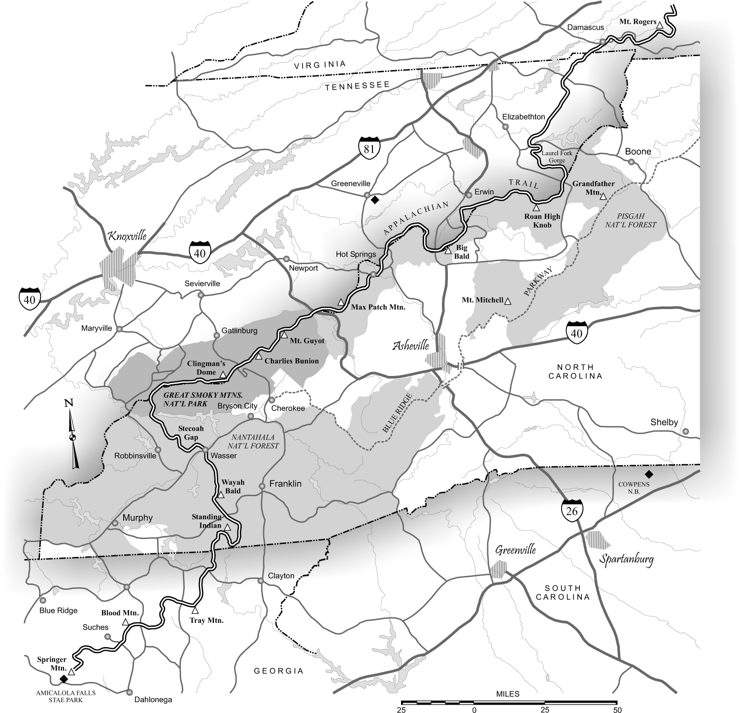
An Appalachian Trail map PDF provides hikers, thru-hikers, and trip planners with a reliable, printable, and digitally accessible format of the 2,190-plus-mile Appalachian National Scenic Trail. These files range from high-level route overview brochures provided by the National Park Service to detailed geospatial topographic sheets suitable for offline GPS navigation and field printing.
Understanding Appalachian Trail Map PDFs: Overview vs. Topographic Files
Navigating the Appalachian Trail (AT) requires an understanding of map types, scales, and digital formats. A digital document labeled as an Appalachian Trail map PDF can serve vastly different purposes depending on its underlying cartography and spatial indexing. Broadly speaking, trail maps fall into two main categories: high-level graphic overviews and high-resolution geospatial topographic files.
- App Trail PDF Map Types
- Overview PDFs
- NPS / ATC
- Route Planning
- Low Detail
- GeoPDFs / Topo
- USGS Quads
- 1:24,000 Scale
- GPS-Enabled
- Overview PDFs
High-Level Route Overview PDFs
Overview maps are created primarily by management organizations such as the National Park Service (NPS) and the Appalachian Trail Conservancy (ATC). These PDFs illustrate the full extent of the trail across its 14-state footprint—from Springer Mountain in Georgia to Mount Katahdin in Maine.
Overview files show major highway crossings, state lines, prominent mountain ranges, and primary access points. While invaluable for macro-level itinerary planning, resupply logistics, and visual orientation, overview maps lack the contour lines, fine terrain features, micro-hydrography, and localized trail shelter locations necessary for active, safe wilderness navigation.
Geospatial Topographic PDFs (GeoPDFs)
Topographic PDF maps—such as standard 7.5-minute quadrangles from the United States Geological Survey (USGS) or custom exports from geospatial mapping software—contain embedded coordinate registration data (geospatial metadata). When loaded into a compatible mobile application, a GeoPDF allows your smartphone’s internal GPS chip to plot your real-time position directly onto the map screen without requiring a cellular network or active internet connection.
Topographic PDFs display elevation contour intervals (typically 20-foot to 40-foot spacing), ridge lines, side trails, water sources, and land ownership boundaries. They provide the micro-level spatial awareness needed when severe weather, trail reroutes, or emergencies require leaving the main marked footpath.
Where to Source Reliable AT Map PDFs
Acquiring accurate, up-to-date map files is essential before stepping onto the trail. Outdated maps may miss recent trail reroutes, changed shelter locations, or altered road crossings.
| Source | Map Type Available | Best Use Case |
|---|---|---|
| National Park Service | Official Strip Overview & Park Boundary PDFs | High-level trip planning and state overviews |
| USGS topoView | GeoPDF 7.5-Minute Quadrangles (1:24,000) | Detailed emergency terrain navigation |
| CalTopo / Gaia GPS | Custom Topographic PDFs with Elevation Profiles | Customized section prints & elevation analysis |
| Avenza Map Store | Pre-formatted Geospatial PDF Trail Maps | Native mobile offline GPS tracking |
1. National Park Service (NPS)
The NPS offers official trail overview documents and specific park unit maps (such as Shenandoah National Park or Great Smoky Mountains National Park) in PDF format. These documents provide accurate administrative boundaries, park-specific back-country regulations, and designated campsite markers. They are available directly through the official National Park Service Appalachian National Scenic Trail portal.
2. USGS topoView and The National Map
For comprehensive topographic coverage, the USGS maintains its topoView database and The National Map downloader. Hikers can select any geographic quadrangle along the AT corridor and download historical or modern GeoPDF layers at scales of 1:24,000 (7.5-minute quads) or 1:100,000. These files represent the gold standard for traditional terrain representation, showing detailed vegetation cover, elevation changes, and hydrological features.
3. CalTopo and Custom Geospatial Engines
Mapping software like CalTopo allows users to trace specific segments of the Appalachian Trail and generate high-resolution PDF exports. These custom PDFs can include grid overlays (UTM or Lat/Long), magnetic declination diagrams, custom waypoint lists, and real-time elevation profiles. CalTopo allows users to export these generated pages directly as geospatial PDFs, making them instantly compatible with smartphone mapping engines.
Regional Breakdown of the Appalachian Trail Corridor
The Appalachian Trail spans roughly 2,190 miles across diverse land classifications, varying topographies, and distinct climate zones. When selecting or printing PDF map sets, hikers should align map resolution with the region's complexity.
AT Corridor Overview (South to North):
- GA (Foothills)
- NC/TN (High Peaks)
- VA
- WV/MD/PA (Ridges)
- NJ/NY/CT/MA/VT
- NH/ME (Technical Alpine)
Southern Appalachians (Georgia to Virginia)
- States: Georgia, North Carolina, Tennessee, Virginia.
- Terrain Characteristics: High-elevation ridges, deep gaps, dramatic relief variations, heavily forested valleys.
- Map PDF Requirements: The Southern section features significant elevation gain and loss per mile. Maps must clearly display 40-foot contour lines to reflect steep ascents like Jacob’s Ladder or the climb up Albert Mountain.
- Key Risk Factors: Rapid weather shifts, dense fog across high ridges (e.g., the Grayson Highlands or the Great Smoky Mountains), and complex ridge-and-valley topography where side trails can confuse disoriented hikers.
Mid-Atlantic Region (West Virginia to Massachusetts)
- States: West Virginia, Maryland, Pennsylvania, New Jersey, New York, Connecticut, Massachusetts.
- Terrain Characteristics: Rolling hills, rocky plateau traverses (notably Pennsylvania’s sharp quartzite fields), lower overall elevations, frequent road and rail crossings.
- Map PDF Requirements: Maps for this region should highlight road access points, resupply towns, public transit intersections, and water source reliability markers. Because the trail passes near urban zones and intersecting trail networks, 1:24,000 scale quads prevent accidentally turning onto local blue-blazed connector paths.
Northern New England (Vermont, New Hampshire, Maine)
- States: Vermont, New Hampshire, Maine.
- Terrain Characteristics: True alpine tundra zones above timberline, exposed granite slabs, extreme weather vulnerability, unbridged river crossings.
- Map PDF Requirements: High-density topographic resolution is required here. In New Hampshire's White Mountains and Maine's 100-Mile Wilderness, standard overview maps are insufficient. PDF prints must include detailed magnetic declination notices, severe weather bail-out routes, and magnetic compass grids.
How to Load Geospatial PDFs for Offline Mobile Use
One major advantage of a geospatial PDF map over standard image or document files is its ability to interact with your mobile device's location hardware without cellular data.
- Geospatial PDF File (.pdf)
- Mobile App (e.g., Avenza Maps)
- Internal Smartphone GPS Chip (No Cellular Network Required)
- Real-Time Blue Dot Position on Topo Map
Step-by-Step Setup Process
- Download a Geospatial PDF Reader: Install an application designed to parse geospatial PDF layers, such as Avenza Maps, Paper Maps, or PDF Expert.
- Import the PDF File: Save your downloaded GeoPDF map to your phone's local storage or cloud folder. Open your geospatial app and choose Import Map or Open File, selecting the designated AT PDF map.
- Verify Calibration: Once imported, check that the application recognizes the embedded spatial coordinates. The map should display coordinate axes (Latitude/Longitude or UTM) rather than plain pixel dimensions.
- Test Offline Mode: Switch your phone to Airplane Mode to disable cellular data and Wi-Fi. Open the app; your device's internal GPS receiver should still render your current location as a pinpoint marker on the PDF terrain map.
Battery and Reliability Considerations
Relying exclusively on a smartphone screen for map reading introduces single-point-of-failure risks. Cold mountain temperatures rapidly degrade lithium-ion battery performance, and moisture from heavy rain or snow can disable touchscreen functionality.
Always pair your digital GeoPDF storage with physical paper copies printed from the exact same files, safely stored inside a waterproof bag.
Printing Appalachian Trail Map PDFs: Scales, Settings, and Weatherproofing
Printing hard-copy field maps from PDF originals requires attention to detail. Improper scaling during printing can distort map ratios, render scale bars useless, and compromise navigation accuracy.
- PDF Document (Scale: 1:24,000)
- Print Setting: "Actual Size" (100%) - Scale Retained
- Print Setting: "Fit to Page" (85%) - Scale Distorted
Understanding Map Scale
- 1:24,000 Scale (7.5-Minute Series): Ideal for navigation in complex terrain. One inch on the paper map equals 2,000 feet on the ground. Features, contour lines, and small streams are easily readable.
- 1:63,360 Scale (1-Inch-to-a-Mile): Excellent balance between physical print size and terrain detail. Covers more trail distance per page while retaining basic topographic detail.
- 1:100,000 to 1:250,000 Scale: Suitable only for multi-week planning, broad state overviews, and measuring long-distance travel spans. Not suitable for dense fog or off-trail navigation.
Essential Printer Settings
When printing custom or official PDF map sheets:
- Disable "Fit to Printable Area" or "Shrink to Fit": Select Actual Size or 100% Scale in your PDF reader's print dialog box. Scaling down a page distorts the map's printed ratio bar and compromises measurement tools.
- Use High-DPI Output: Print at a minimum resolution of 600 DPI (dots per inch) so thin elevation contour lines, blue-blazed side trails, and fine micro-text remain clear.
- Select Grid Overlays: Ensure your PDF export software overlays a standard UTM (Universal Transverse Mercator) or Lat/Long grid. This enables accurate position plotting with a baseplate map compass in the field.
Waterproofing Printed Maps
Standard 20-lb printer paper disintegrates quickly when exposed to sweat, rain, or damp gear. Use one of these methods to protect your paper maps:
- Synthetic Poly-Paper: Products like Rite in the Rain inkjet/laser sheets, Polyester Film, or Tyvek allow you to print directly onto waterproof, tear-resistant plastic materials using standard laser or inkjet printers.
- Lamination and Sealants: Heat laminating 3-mil sleeves provides waterproof protection, though it adds weight and stiffness. Alternatively, treating standard paper prints with clear acrylic sprays or map sealant liquids creates a flexible, water-repellent barrier.
- Heavy-Duty Zip Seal Bags: Storing folded paper prints in clear 1-quart freezer bags offers cheap, lightweight protection, allowing you to view and flip map sections on the move.
Comparing PDF Maps, Dedicated Apps, and Hardcover Guidebooks
Hikers often weigh digital PDF maps against specialized mobile apps (like FarOut) or traditional paper guidebooks (such as the Appalachian Trail Data Book or official ATC map sets). Each format serves distinct navigation functions.
| Feature / Characteristic | Geospatial PDF Maps | Dedicated AT Apps | Paper Guidebooks/Maps |
|---|---|---|---|
| Requires Battery Power | Yes (on mobile) / No (if printed) | Yes | No |
| GPS Real-time Tracking | Yes (in GeoPDF reader) | Yes | No |
| Broad Terrain Visibility | High (large print) | Low (small screen) | High (unfolded map) |
| Crowdsourced Comments | No | Yes (Water/Shelters) | No |
| Physical Redundancy | Excellent (when printed) | Poor (device dependent) | Superior |
| Cost | Free to Low | Moderate Purchase Fee | Moderate Purchase Fee |
PDF Maps vs. Dedicated Hiking Apps
Specialized trail apps provide crowd-sourced, real-time updates regarding water source flow rates, shelter conditions, and town services. However, these proprietary platforms operate within closed app ecosystems.
Geospatial PDF maps provide unedited topographic detail covering wide spatial corridors around the trail. This allows you to evaluate alternate bailout routes, unmaintained secondary ridges, and nearby access roads if you must leave the main AT route during an emergency.
PDF Maps vs. Physical Official ATC Sets
The Appalachian Trail Conservancy publishes official paper map sets broken down by state and region. These printed maps feature elevation profiles, trail mileage markers, and detailed water listings.
Generating your own custom PDF maps allows you to select customized map scales, center maps around specific section hikes, print back-to-back pages, and print fresh copies for each trip without wearing out expensive collector map sets.
Common Mistakes When Navigating the AT with PDF Maps
Using digital or self-printed PDF maps introduces potential errors that can lead to miscalculations on the trail. Avoid these common navigational pitfalls:
Common PDF Navigation Failures:
- Relying on Overview PDFs for Active Navigation
- Printing at "Fit to Page" (Distorting Scale)
- Ignoring Magnetic Declination Adjustments
- Storing Files Exclusively in Cloud Storage
1. Relying on Overview PDFs for Active Foot Navigation
Attempting to navigate steep terrain using a low-detail overview map is dangerous. A high-level overview map omits critical terrain details such as cliff faces, steep elevation gains, minor stream crossings, and intersecting trail networks. Always carry 1:24,000 or 1:63,360 scale maps for active navigation.
2. Forgetting to Download Files Locally
Downloading PDF maps to a cloud storage account (such as Google Drive or Dropbox) without saving them locally to your phone's memory leaves you stranded without maps once you lose cellular reception. Always verify that all PDF map files, GeoPDF apps, and offline data sets are fully downloaded to your device's internal storage before departing.
3. Ignoring Magnetic Declination
The Appalachian Trail runs north to south along the eastern United States, where magnetic declination varies significantly from southern Georgia to northern Maine.
For instance, magnetic declination ranges from roughly 5 degrees West in Georgia to over 15 degrees West in Maine. When using printed PDF maps alongside a magnetic baseplate compass, ensure your map displays the current True North to Magnetic North declination diagram for that specific geographic region.
Frequently Asked Questions
Where can I download official Appalachian Trail map PDFs for free?
The National Park Service provides free high-level administrative and section maps in PDF format through its official Appalachian National Scenic Trail website. Additionally, full-coverage 7.5-minute topographic GeoPDF quadrangles are available free of charge via the USGS topoView and The National Map portals.
What is a GeoPDF, and how does it work on the Appalachian Trail?
A GeoPDF is a standard PDF file embedded with geospatial coordinate data (such as UTM coordinates or Latitude/Longitude degrees). When loaded into an offline mapping app like Avenza Maps on a smartphone, the app utilizes your phone's built-in GPS chip to plot your real-time position on the map, even without cellular service.
What printer scale should I select when printing an AT map PDF?
You should always print terrain maps at Actual Size or 100% Scale in your print menu. Selecting options like "Fit to Page" or "Shrink to Fit" alters the scale ratio of the map, rendering physical map scales, elevation profiles, and grid overlays inaccurate for manual measurement.
How do I protect printed paper maps from water damage during a hike?
You can print map PDFs directly onto waterproof, tear-resistant synthetic poly-paper (such as Rite in the Rain or Tyvek paper) using standard home printers. Alternatively, you can heat-laminate your prints, apply a clear liquid map sealant, or store folded paper maps inside clear, heavy-duty freezer bags.
Can I navigate the Appalachian Trail using only digital PDF maps on my phone?
While digital PDF maps with GPS tracking are convenient tools, relying on a mobile device alone creates a single point of failure due to battery drain, extreme cold, water damage, or screen breakage. Safe wilderness navigation requires carrying physical paper maps (printed from your PDFs) alongside a traditional magnetic compass as a backup system.
Recommended Next Actions
To build a reliable navigation system for your upcoming Appalachian Trail hike, follow this operational checklist:
- Identify Your Trip Boundaries: Determine the exact starting, ending, and bailout access points for your planned AT section or thru-hike.
- Download Core Map PDFs: Obtain high-resolution 1:24,000 or 1:63,360 topographic PDF map files for your designated corridor from sources like USGS topoView or custom exports via CalTopo.
- Import into Mobile GeoPDF Readers: Load your GeoPDF files into an offline-capable mobile reader app. Put your smartphone into Airplane Mode to test and verify that real-time GPS positioning works correctly.
- Print Physical Paper Backup Sets: Print complete map coverage for your planned route on synthetic waterproof paper at 100% scale. Pack these paper maps alongside a reliable magnetic baseplate compass in an easily accessible pocket of your backpack.