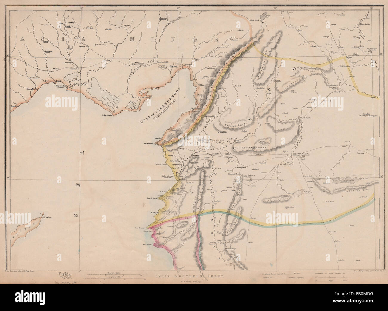
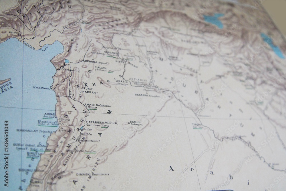
An ancient Antioch map offers an essential spatial key to understanding one of the late classical world's greatest metropolises. Founded in 300 BCE by Seleucus I Nicator, Antioch on the Orontes (modern-day Antakya, Turkey) grew into the third-largest city of the Roman Empire. Historical cartography and modern archaeological reconstructions illuminate its urban layout, major monuments, shifting river courses, and defensive fortifications across centuries of Hellenistic, Roman, and Byzantine rule.
Topography and Urban Layout of Ancient Antioch
Reconstructing the spatial footprint of ancient Antioch requires synthesized evidence from classical literature, archaeological surveys, and geomorphological data. Unlike cities planned on open plains, Antioch was tightly bound by dynamic natural features that dictated its expansion, urban defense, and infrastructure.
- Mount Silpius & Citadel
- Parmenius Torrent / Ravines
- Hellenistic Quarter (Old City) and Roman Extensions (connected by Cardo Maximus [Colonnaded Street])
- Orontes River
- The Island (Imperial Palace)
- Orontes River
- Hellenistic Quarter (Old City) and Roman Extensions (connected by Cardo Maximus [Colonnaded Street])
- Parmenius Torrent / Ravines
Natural Geography: Mount Silpius and the Orontes River
The physical location of Antioch was chosen for both military security and commercial connectivity. Situated in the fertile Orontes River valley, the city sat approximately 20 kilometers inland from the Mediterranean Sea, shielded to the east and south by the steep cliffs of Mount Silpius (modern Habib-i Neccar Mountain) and Mount Staurin.
The Orontes River flowed along the western side of the city. Over the millennia, alluvial silt deposits, earthquakes, and human intervention dramatically altered the river's path. Historical maps must account for these hydrological shifts:
- The Parmenius Torrent: A seasonal gorge cutting down from Mount Silpius directly through the urban core, requiring elaborate Roman bypass channels and stone bridges to prevent catastrophic flash flooding.
- Elevation Gradients: The city sloped upward from the marshy riverbanks toward the precipitous heights of the citadel on Mount Silpius, creating distinct terraces used for public monuments and private villas.
The Four Quarters: A Hellenistic Tetrapolis
Ancient historical accounts, particularly those of the geographer Strabo and the orator Libanius, describe Antioch as a Tetrapolis—a "fourfold city"—created through successive historical expansions:
- The Original Seleucid Settlement: Built by Seleucus I Nicator around 300 BCE, designed on a grid pattern by the architect Xenarius. It lay between Mount Silpius and the Orontes River.
- The Second Quarter: Added shortly after by Seleucus I to accommodate growing populations of Greek colonists and local Syrian populations.
- The Third Quarter (The Island): Developed under Seleucus II Callinicus (246–225 BCE) on a large island within the Orontes River. This quarter became the administrative heart of the city.
- The Fourth Quarter (Epiphania): Founded by Seleucus IV and expanded by Antiochus IV Epiphanes (175–164 BCE) along the foothills of Mount Silpius, featuring a senate house, council chamber, and grand temples.
The Island and the Imperial Palace Complex
The Island quarter was Antioch's most distinctive geographic feature. Reached via multi-arched Roman bridges, it hosted the royal Seleucid palace, which was later expanded into a massive Roman imperial palace complex under Emperor Diocletian in the late 3rd century CE.
Historical cartographic reconstructions show the Island centered around a grand hippodrome (circus) adjacent to the palace, mirroring the spatial layout of imperial centers like Rome (Palatine/Circus Maximus) and Constantinople (Great Palace/Hippodrome). Due to major river diversions and silting over the centuries, the original river arm surrounding the Island filled in, leaving the modern topography flattened where the imperial quarter once stood.
Major Historical and Archaeological Map Sources
No single surviving map from antiquity depicts Antioch with modern planimetric precision. Instead, researchers rely on a synthesis of late Roman itineraries, medieval map copies, mosaic visual depictions, and 20th-century archaeological surveys.
HISTORICAL MAP SOURCES FOR ANTIOCH
| Source Category | Key Attributes & Historical Value |
|---|---|
| Tabula Peutingeriana (4th–5th c.) | Schematic Roman road network; shows Antioch as an imperial enthroned figure. |
| Princeton Excavations (1932–1939) | Definitive physical surveys, grid trenches, mosaic findspots, and topographic contours. |
| French Mandate Surveys (1920s) | Precision military topography establishing pre-urbanization land elevation profiles. |
| Megalopsychia Mosaic (5th c. CE) | Topographical border illustration showing an architectural streetscape tour of Antioch. |
The Tabula Peutingeriana and Ancient Itineraries
The Tabula Peutingeriana (Peutinger Map) is a 13th-century parchment copy of an original Roman cursus publicus (state messenger) map dating to the late 4th or early 5th century CE. It presents a topological view of the Roman world, stretching from Britain to India, prioritizing administrative routes, distances in Roman miles (milia passuum), and staging posts (mansiones) rather than geographic scale.
In the Tabula, Antioch is highlighted as one of the three most important cities in the Roman Empire, alongside Rome and Constantinople. It is represented by a personalized icon (personification) featuring an enthroned goddess (Tyche of Antioch) holding a spear, surrounded by imperial architecture, underscoring its role as the capital of the Roman province of Syria and the seat of the Comes Orientis (Count of the East).
The 1932–1939 Princeton Archaeological Expedition Maps
The most accurate physical maps of ancient Antioch were produced between 1932 and 1939 by the Committee for the Excavation of Antioch and Its Vicinity, organized by Princeton University and supported by the Musées Nationaux de France, the Baltimore Museum of Art, and the Worcester Art Museum.
Led by archaeologists including Richard Stillwell, W. A. Campbell, and Jean Lassus, the expedition generated comprehensive topographical sheets mapping:
- The precise city wall perimeter extending over Mount Silpius.
- Excavation sectors (Sector 15-M, Sector 10-R, etc.) scattered across modern Antakya, Daphne (Harbiye), and the port town of Seleucia Pieria (Çevlik).
- Locations of major discovered mosaic floors, imperial baths, theater structures, and early Christian basilicas.
These maps remain the foundational spatial reference for all contemporary field archaeology in the Hatay region.
French Mandate Cartographic Surveys (1920s–1930s)
Prior to and alongside the Princeton excavations, French military cartographers operating under the French Mandate for Syria and the Lebanon produced high-resolution topographic relief maps (Cartes du Levant at 1:50,000 and 1:20,000 scales). These surveys recorded agricultural canals, aqueduct traces, surviving stone foundations, and elevation contours before 20th-century urban expansion covered the ancient ruins.
Mosaic Evidence: The Megalopsychia Mosaic Map
An invaluable visual "map" of Antioch comes not from paper or parchment, but from a floor mosaic discovered at Yakto near Daphne, dating to the late 5th century CE. Known as the Megalopsychia Mosaic, its outer border presents a visual topographical tour (topographia) of ancient Antioch and its suburbs.
The mosaic depicts a continuous architectural walk along the city's main colonnaded street. Key landmarks represented in the mosaic's decorative border include:
- Public baths (Thermae) including the Baths of Olympias.
- The Equestrian Statue of Tiberius.
- The Martyrium of Saint Babylas.
- Private suburban villas and aristocratic gardens.
- The road connecting central Antioch to the sanctuary suburb of Daphne.
Key Urban Landmarks on the Map of Antioch
Mapping ancient Antioch requires placing monumental structures within its urban grid. Hellenistic foundations were systematically embellished by Roman emperors including Julius Caesar, Augustus, Tiberius, Trajan, Hadrian, Antoninus Pius, and Diocletian.
- North Gate / Gate of Saint Paul
- Cardo Maximus (Colonnade)
- Forum of Valens
- Tetrapylon
- Roman Baths
- Theater of Dionysus
- South Gate / Iron Gate (Parmenius)
The Great Colonnaded Street (Cardo Maximus)
The defining arterial spine of ancient Antioch was its central colonnaded avenue (Cardo Maximus), laid out in its grandest form during the Early Roman Empire. Funded in part by Herod the Great and expanded under Tiberius and Antoninus Pius, this street ran for nearly two miles (approximately 3 kilometers) parallel to the Orontes River, stretching from the northern gate to the southern slopes of Mount Silpius.
Features mapped along this axis included:
- Colonnades: Double-tiered covered walkways flanking both sides of the paved thoroughfare, shielding pedestrians from rain and sun.
- Shops and Porticoed Fronts: Hundreds of commercial stalls integrated into the street facade.
- Street Lighting: Antioch was famed in antiquity for being one of the few ancient cities with illuminated streets at night, utilizing oil lamps suspended along the colonnades.
- The Tetrapylon: A grand four-way monumental arch built at the major intersection where the street crossed the path leading toward the main river bridge.
The Suburb of Daphne and the Sanctuary of Apollo
Located approximately 8 kilometers southwest of Antioch proper, Daphne (modern Harbiye) served as the primary elite residential suburb, religious park, and leisure center. Maps of greater Antioch treat Daphne as an integral satellite component.
Geographically situated on an elevated plateau supplied with abundant natural springs and waterfalls, Daphne was mapped with several critical features:
- The Temple of Apollo: Built by Seleucus I, housing a massive chryselephantine statue of Apollo sculpted by Bryaxis.
- The Imperial Villa Complexes: Richly appointed estates featuring vast courtyard gardens and intricate mosaic dining rooms (triclinia).
- The Olympic Stadium of Daphne: Site of the Antioch Olympic Games, authorized under Roman imperial decree.
Fortifications, Gates, and Aqueducts
Antioch’s defensive and hydraulic networks required major engineering feats visible on topographical plans:
- The City Walls of Justinian: Following catastrophic earthquakes and the Persian sack of Antioch by Khosrow I in 540 CE, Emperor Justinian I rebuilt the city's defensive perimeter on a reduced scale. The walls climbed dramatically up the precipitous cliffs of Mount Silpius, anchored by over 300 towers.
- The Iron Gate (Demirkapı): A massive stone wall and sluice gate built across the Parmenius gorge on Mount Silpius. Designed to control flash floodwaters flowing into the urban center, this towering structure remains one of the best-preserved architectural elements visible today.
- Aqueduct Systems: Multi-tiered aqueducts traversed valleys to bring fresh mountain water from the springs of Daphne directly into the public baths, fountains (nymphaea), and private residences of Antioch.
Comparative Analysis of Cartographic Records
To choose the appropriate map resource for research, historical analysis, or academic work, compare the strengths, spatial limits, and focus of each historical record:
| Map Source / Record | Date Range | Primary Focus | Geographic Scale | Accuracy & Resolution | Recommended Use Case |
|---|---|---|---|---|---|
| Tabula Peutingeriana | 4th–5th c. CE (Copy: 13th c.) | Empire-wide road network and administrative hubs | Macro-regional (Western Europe to Asia) | Topological (not to scale) | Studying Roman imperial connectivity and administrative status |
| Princeton Excavation Maps | 1932–1939 CE | Urban topography, dig trenches, mosaic findspots | City-wide to site-specific (1:500 to 1:5,000) | High archaeological precision | Academic research, mosaic contextualization, urban layout study |
| French Mandate Surveys | 1920s–1930s CE | Land contours, hydraulic features, regional geography | Regional & City (1:20,000 / 1:50,000) | High topographic precision | Environmental history, geomorphology, pre-modern landscape analysis |
| Megalopsychia Mosaic | Late 5th c. CE | Artistic streetscape and civic landmark sequence | Micro-local (Colonnaded street axis) | Pictorial / Schematic | Architectural history, civic identity, late antique visual culture |
| Digital Atlas of the Roman Empire (DARE) | Modern Digital GIS | Geo-referenced spatial database of ancient sites | Variable interactive GIS scale | Precise modern spatial coordinates | Digital humanities, GIS integration, interactive mapping |
How to Access and Study High-Resolution Ancient Antioch Maps
Scholars, students, and cartography researchers can access primary cartographic records and modern digital GIS models through specialized digital archives and research institutions.
Institutional Repositories and Digital Archives
Princeton University Art Museum & Special Collections: Princeton University holds the official archives of the 1932–1939 Antioch Excavations. Researchers can access field notebooks, architectural elevation drawings, trench plans, and high-resolution topographic maps via the Research Photographs Collection and online visual resources at Princeton's Department of Art and Archaeology.
The Ancient World Mapping Center (AWMC): Located at the University of North Carolina at Chapel Hill, the AWMC produces detailed map layers of the ancient Mediterranean. Their publications, including the Barrington Atlas of the Greek and Roman World (Map 67: Syria), offer the standard scholarly baseline for regional topography around Antioch and Seleucia Pieria.
Pleiades Gazetteer: A joint project by the Institute for the Study of the Ancient World (ISAW) at New York University and the AWMC, Pleiades provides geo-referenced spatial data, historical name variants, and authoritative coordinate boundaries for Antioch on the Orontes, Daphne, and associated regional infrastructure.
Harvard University Library Digital Maps: Harvard’s map collection holds rare 18th- and 19th-century cartographic engravings of Ottoman-era Antakya, which document surviving ruins before modern urban infill occurred during the mid-20th century.
GIS and Digital Humanities Frameworks
Modern researchers increasingly utilize vector-based geographic information system (GIS) datasets rather than static paper maps:
- Geo-referencing Historical Plans: Researchers overlay Princeton’s 1930s trench sheets onto satellite imagery (such as Sentinel-2 or historical CORONA satellite photos from the 1960s) to locate lost structures.
- Digital Atlas of the Roman Empire (DARE): Hosted by Gothenburg University, DARE provides vector layers depicting Roman road networks, provincial boundaries, and urban footprints integrated into interactive web maps.
Common Pitfalls in Interpreting Maps of Ancient Antioch
When evaluating cartographic depictions of ancient Antioch, guard against common spatial and historical errors:
- Conflating River Arm Positions: Assuming the modern Orontes River path matches the ancient configuration. Silt accumulation filled the eastern channel, eliminating the physical island that housed the Imperial Palace. Maps drawn without accounting for channel migration misplace the imperial quarter.
- Ignoring Geomorphological Changes: Destructive earthquakes—most notably in 115 CE, 526 CE, and 528 CE—caused massive landslides off Mount Silpius, burying Hellenistic and Early Roman strata under meters of debris. Modern ground elevations sit significantly higher than ancient street levels.
- Treating Justinian's Walls as the Original Perimeter: Justinian rebuilt the defensive walls in the 6th century CE on a drastically reduced perimeter. Maps showing only Justinian's wall circuit underestimate the actual urban size of Hellenistic and Early Roman Antioch.
- Confusing Antioch on the Orontes with Other Antiochs: Seleucus I Nicator founded over a dozen cities named Antioch across his empire in honor of his father Antiochus. Always confirm that a map depicts Antioch on the Orontes (Antiochia ad Orontem) rather than Antioch in Pisidia (Antiochia ad Pisidiam) or Antioch on the Maeander.
Frequently Asked Questions
What was the precise geographic location of ancient Antioch?
Ancient Antioch on the Orontes was located in southeastern Anatolia along the Orontes River valley, approximately 20 kilometers from the Mediterranean coast. Its historic site corresponds directly with the central core of modern Antakya, the capital of Hatay Province in southern Turkey.
Where was the Imperial Palace located on the map of Antioch?
The Imperial Palace was situated on "The Island"—a large landmass surrounded by two arms of the Orontes River on the northwestern side of the city. Developed by Seleucid monarchs and expanded under Roman Emperor Diocletian, the complex sat directly adjacent to the city's monumental hippodrome.
Why is the Orontes River shown differently on ancient maps compared to modern maps?
Centuries of natural alluvial silt accumulation, flash flooding from Mount Silpius, major seismic events, and modern agricultural engineering altered the river's hydrology. The eastern river arm that once created the central island silted up over time, joining the island directly to the eastern mainland.
Where can high-resolution copies of the 1930s Princeton excavation maps be accessed?
High-resolution maps, excavation plans, and trench diagrams are preserved in the Department of Art and Archaeology archives at Princeton University. Digital reproductions can be accessed through Princeton's institutional repository, the Ancient World Mapping Center (AWMC), and academic publications detailing the Antioch excavations.
How did the size of ancient Antioch compare to Rome and Alexandria?
At its peak during the 2nd and 3rd centuries CE, Antioch covered several square kilometers and had an estimated population between 200,000 and 500,000 residents. This made it the third-largest urban center in the Roman Empire, trailing only Rome and Alexandria in size, administrative status, and commercial volume.
Practical Research Recommendations
To effectively analyze or reconstruct the layout of ancient Antioch for scholarly projects or field study:
- Cross-Reference Historical Maps with Elevation Models: Do not rely on flat 2D maps alone; use digital elevation models (DEM) to understand how the steep relief of Mount Silpius shaped spatial defense and water runoff.
- Consult Primary Textual Descriptions Alongside Cartography: Read the spatial accounts of the 4th-century orator Libanius (Oration 11: Antiochikos) and the geographer Strabo (Geographica, Book 16) alongside Princeton field survey sheets to correlate ancient place names with physical excavation sectors.
- Use Geo-Referenced Open Datasets: Download spatial coordinates from the Pleiades Gazetteer or DARE to import verified ancient site locations directly into QGIS or ArcGIS for spatial research.