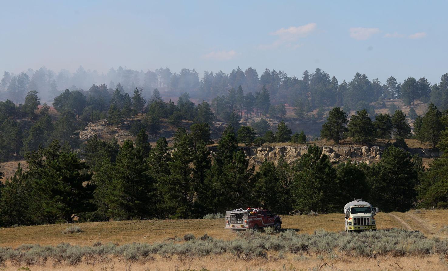
Wildfires near Billings, Montana, pose significant dangers ranging from direct structural threats in the Wildland-Urban Interface (WUI) to severe regional air quality degradation. While the Billings Fire Department is highly trained, rapid wind shifts and the city’s unique topography—specifically the Rimrocks and the sprawling prairie—increase the risk of fast-moving grass and timber fires. Residents must account for both immediate physical hazards and long-term health impacts from particulate matter.
Wildfire risk in the Magic City is a multifaceted issue that evolves with the changing climate of the American West. As we navigate the 2026 fire season, understanding the specific vulnerabilities of the Billings landscape is essential for every resident, from those living in the heart of downtown to those in the expanding suburban fringes of the West End and the Heights. The danger is rarely just about the flames themselves; it encompasses a complex web of environmental, health, and economic factors.
The Geography of Fire Risk in Yellowstone County
Billings occupies a unique geographical position that dictates its fire behavior. To the north and east, the city is flanked by the "Rimrocks"—sandstone cliffs that create a dramatic vertical boundary. To the south lies the Yellowstone River valley, and beyond that, the timbered foothills leading toward the Pryor and Beartooth Mountains. This diverse terrain creates different types of fire hazards.
The Wildland-Urban Interface (WUI)
The Wildland-Urban Interface is the zone where human developments meet or intermingle with undeveloped wildland or vegetative fuels. In Billings, the WUI is particularly dangerous around the Rimrocks and the Blue Creek area. Homes built along the Rims are at a higher risk because fire travels faster uphill, and the rugged terrain can make access difficult for heavy firefighting equipment. In 2026, urban expansion has pushed more residential developments into these high-risk zones, increasing the potential for property loss during a fast-moving blaze.
Grass Fires vs. Timber Fires
While the massive forest fires in Western Montana often dominate the headlines, Billings residents are more frequently threatened by grass fires. The cured grasslands surrounding the city can ignite from a single spark—be it a discarded cigarette, a dragging trailer chain, or a lightning strike. Grass fires move with incredible speed, often outpacing human flight if the wind is strong enough. In contrast, timber fires in the nearby mountains move more slowly but burn with much higher intensity, creating long-duration smoke events that settle into the Yellowstone River valley.
Immediate Hazards: Flames, Heat, and Evacuation
When a fire breaks out "near" Billings, the definition of "dangerous" changes based on proximity and wind direction. Montana’s notorious winds can turn a small brush fire into a multi-thousand-acre emergency in a matter of hours.
The "Ready, Set, Go!" Framework
Local emergency services, including the Yellowstone County Disaster and Emergency Services (DES), utilize the "Ready, Set, Go!" program. Understanding these stages is the difference between an orderly departure and a life-threatening crisis:
- Ready: Residents should have a "Go-Bag" prepared and a communication plan in place. This is the status for most of the Billings area throughout the peak summer months.
- Set: This indicates a high probability of evacuation. Residents should load their vehicles and be prepared to leave at a moment's notice.
- Go: Immediate evacuation is required. At this stage, the danger to life is imminent.
Structural Vulnerability and Embers
A common misconception is that a fire must reach a house to ignite it. In reality, wind-borne embers (firebrands) can travel over a mile ahead of the main fire front. These embers often land in gutters filled with pine needles, under wooden decks, or in attic vents, starting a fire from the inside out. For Billings residents, the danger often arrives from the sky long before the flames are visible on the horizon.
Air Quality and Respiratory Health Risks
Even if a fire is 50 miles away in the Custer Gallatin National Forest, it can be profoundly dangerous for Billings residents due to smoke. The geography of the Yellowstone Valley often leads to "temperature inversions," where cold air is trapped near the ground by a layer of warm air, effectively "capping" the valley and trapping smoke at lung level.
Understanding PM2.5
Wildfire smoke is composed of a complex mixture of gases and fine particles. The most concerning is PM2.5—particulate matter that is 2.5 micrometers or smaller in diameter. These particles are small enough to enter the bloodstream through the lungs, causing systemic inflammation. In 2026, health guidelines from the Montana Department of Environmental Quality (DEQ) emphasize that there is no "safe" level of smoke exposure for sensitive groups.
Vulnerable Populations
The danger of fire-related smoke in Billings is particularly high for:
- Individuals with Asthma or COPD: Smoke can trigger immediate and severe respiratory distress.
- The Elderly: Increased risk of heart attack and stroke during heavy smoke events.
- Children: Their lungs are still developing, and they breathe more air per pound of body weight than adults.
- Outdoor Workers: Construction crews, agricultural workers, and first responders face cumulative exposure that can lead to long-term health issues.
Economic and Infrastructure Impacts
The danger of fires near Billings extends into the financial and structural stability of the community. As wildfire seasons become more volatile, the indirect costs continue to rise.
Utility Disruptions
Fires frequently threaten power lines. NorthWestern Energy may implement Public Safety Power Shutoffs (PSPS) to prevent their equipment from sparking new fires during high-wind events. For residents, this means the loss of air conditioning during extreme heat, the potential for food spoilage, and the loss of communication if cell towers lack backup power. Furthermore, firefighting efforts often require massive amounts of water, which can stress municipal water systems and lead to temporary pressure drops in specific Billings neighborhoods.
The Insurance Landscape in 2026
By 2026, the insurance industry has significantly adjusted its risk models for the Mountain West. Residents in the WUI areas of Billings may face higher premiums or non-renewal notices if they do not meet strict "home hardening" requirements. The financial danger of being underinsured or uninsured in a high-risk fire zone is a growing concern for local homeowners. Property values in areas with a history of frequent evacuations or high smoke density are also being closely monitored by real estate analysts.
Monitoring Tools and Resources for Billings Residents
Staying informed is the most effective way to mitigate the danger of wildfires. In 2026, several digital tools provide real-time data that can save lives and protect health.
| Resource Name | Primary Function | Best Used For |
|---|---|---|
| InciWeb | National Incident Management System | Tracking the official size, containment, and map of active large fires. |
| AirNow.gov | Real-time Air Quality Index (AQI) | Monitoring PM2.5 levels and receiving health recommendations for smoke. |
| Yellowstone County Alerts | Local Emergency Notification | Receiving text alerts for evacuations and road closures in Billings. |
| Watch Duty | Citizen-Sourced and Official Reporting | Rapid updates on new ignitions and initial attack progress. |
| MT DEQ Air Quality | State-Specific Monitoring | Detailed analysis of smoke trends across Montana. |
Mitigating the Danger: Defensible Space and Home Hardening
While residents cannot control the wind or the ignition of a fire, they can control how their property reacts to the threat. Reducing the danger of fires near Billings starts at the property line.
Creating Defensible Space
The "Defensible Space" concept involves managing vegetation to reduce the fuel available to a fire.
- Zone 0 (0-5 feet): The "Immediate Zone." Remove all combustible materials, including mulch, firewood, and dry shrubs, from directly against the house.
- Zone 1 (5-30 feet): The "Intermediate Zone." Lean, clean, and green. Keep grass mowed and remove "ladder fuels" (low-hanging branches that allow a ground fire to climb into the tree canopy).
- Zone 2 (30-100 feet): The "Extended Zone." Thin out trees so their canopies do not touch, and remove dead vegetation and fallen leaves.
Home Hardening
Home hardening refers to building or retrofitting a house with ignition-resistant materials. For Billings residents, this includes installing 1/8-inch metal mesh over attic and crawlspace vents to prevent ember intrusion, replacing wood shingle roofs with Class A fire-rated materials, and ensuring that any fencing attached to the house is made of non-combustible material like metal or masonry.
The Role of Local Fire Departments and Mutual Aid
The Billings Fire Department (BFD) operates several stations across the city, equipped with both structural engines and "brush trucks" designed for off-road firefighting. However, during a major incident, the danger is managed through a "Mutual Aid" system.
When a fire exceeds local capacity, resources are brought in from the Bureau of Land Management (BLM), the Forest Service, and neighboring volunteer departments like Lockwood or Laurel. The danger to residents is significantly mitigated by this inter-agency cooperation, but it is important to remember that during peak fire season, these resources can be spread thin across the entire Pacific Northwest and Rocky Mountain regions.
Frequently Asked Questions
Are grass fires as dangerous as forest fires?
Yes, though they differ in behavior. Grass fires move much faster than timber fires and can trap residents or firefighters who underestimate their speed. While they produce less heat than a dense forest fire, they are more likely to occur near Billings residential areas and can easily jump roads and firebreaks.
Where can I find real-time evacuation maps for Billings?
The most reliable source for evacuation maps is the Yellowstone County Disaster and Emergency Services (DES) website or their official social media channels. During an active emergency, the city often provides an interactive "Public Information Map" that shows current evacuation zones (Red), pre-evacuation zones (Yellow), and road closures.
Does homeowner insurance in Billings cover fire damage?
Standard HO-3 homeowner policies generally cover fire damage. However, in 2026, many policies have specific exclusions or higher deductibles for homes located in designated high-risk wildfire zones. It is critical to review your "Replacement Cost" coverage to ensure it accounts for the current 2026 construction costs in Montana, which have risen significantly.
How does smoke from Canadian or Idaho fires affect Billings?
Billings is situated in a geographical "bowl" created by the Yellowstone River valley. Prevailing winds frequently carry smoke from massive fires in British Columbia, Alberta, or Central Idaho directly into Central Montana. This smoke often stays "aloft" (high in the atmosphere) but can be pushed to the ground by weather fronts, leading to several days of hazardous air quality even if no fires are burning in Montana.
What should be in a "Go-Bag" for Montana residents?
A Go-Bag should contain at least three days of essential supplies: N95 or P100 masks (specifically for smoke), prescription medications, copies of important documents (deeds, insurance, IDs), a portable radio, a flashlight, extra batteries, a first-aid kit, and basic toiletries. Don't forget supplies for pets, including food and leashes.
Final Recommendations for Residents
The danger of fires near Billings is a persistent reality of living in the Big Sky Country. To minimize risk, residents should take a proactive stance rather than a reactive one. Begin by signing up for Yellowstone County emergency alerts today. Perform a "home walk-around" to identify and remove combustible debris within five feet of your foundation. Finally, invest in high-quality HEPA air purifiers for at least one room in your home to create a "clean air refuge" during the inevitable smoke events of the 2026 season. Preparation is not a one-time event but a seasonal discipline that protects both your family's health and your property's value.