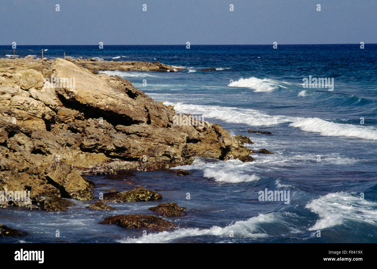
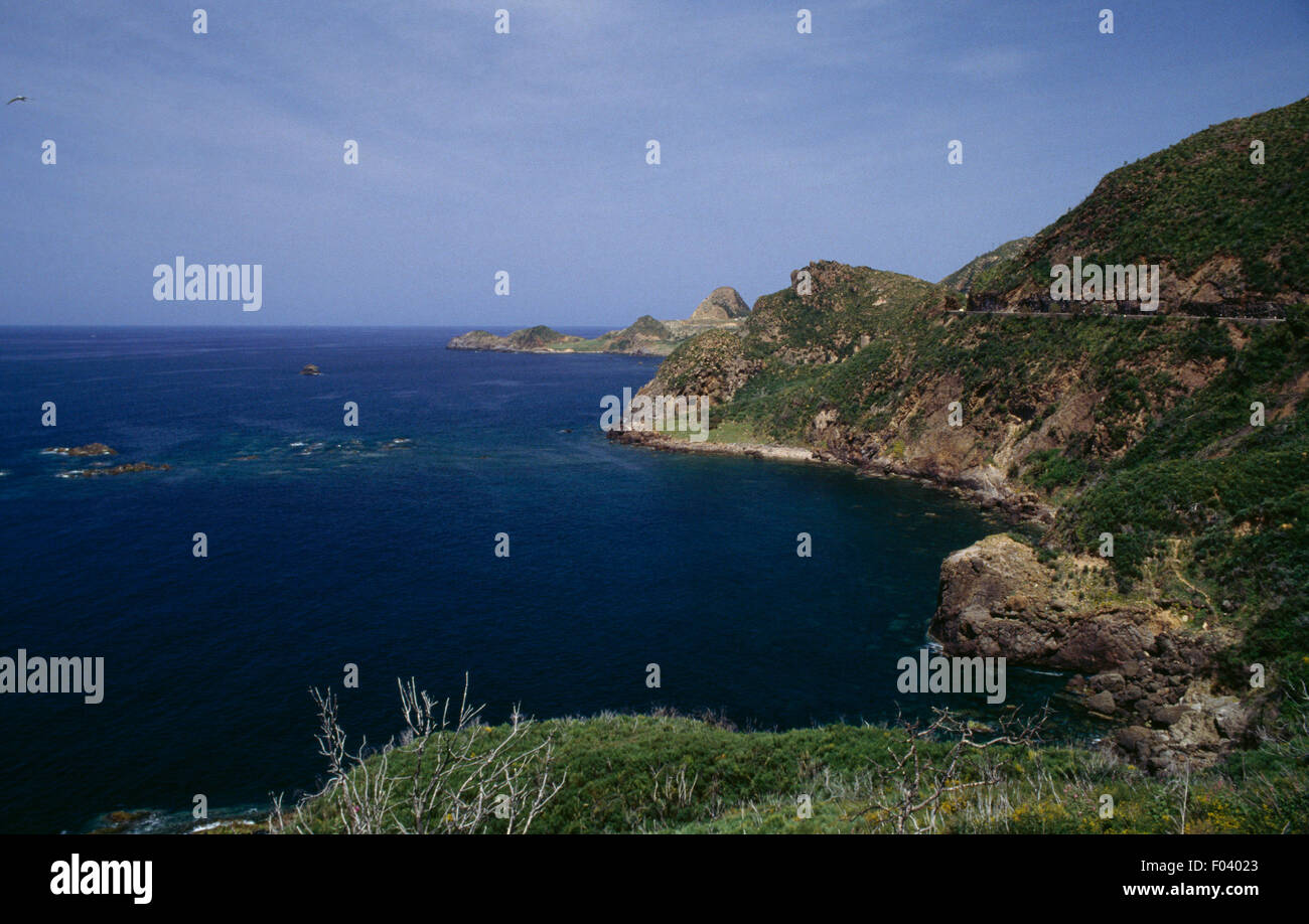
Algeria possesses a dynamic Mediterranean coastline stretching approximately 1,644 kilometers (1,022 miles) from the Moroccan border in the west to the Tunisian frontier in the east. Characterized by steep coastal massifs, expansive gulfs, critical deepwater commercial ports, and rich marine biodiversity, this coastal corridor serves as the demographic and economic backbone of the nation.
Geographic Dimensions and Coastal Topography
The Algerian littoral forms the southern perimeter of the Western Mediterranean Basin, specifically fronting the Alboran Sea in the extreme west and the Algerian Basin across the central and eastern extents. While older historical surveys frequently rounded the coast to approximately 1,200 kilometers, modern satellite geodesy and detailed hydrographic charting conducted by the Service Hydrographique des Forces Navales establish the actual shoreline length at roughly 1,644 kilometers, taking into account coastal indentations, coves, and promontories.
ALGERIAN MEDITERRANEAN COASTLINE (West to East)
- West (Alboran / Oran Basin) [Morocco Border]
- Rocky capes (Cap Falcon)
- Arid maritime vegetation
- Saltwater sebkhas
- Central (Algiers Basin) [Cherchell / Tipaza / Algiers]
- Mitidja littoral plain
- Semi-sheltered natural bays
- High urban density
- East (Annaba / El Kala) [Bejaia / Skikda / El Kala]
- Steep Kabylie massifs
- Dense oak forests & wetlands
- UNESCO Biosphere Reserves
The physical geomorphology of the coast is largely dictated by the Tell Atlas mountain range, which runs parallel to the Mediterranean Sea. This proximity creates an abrupt structural contrast:
- Western Sector (Ghazaouet to Mostaganem): Dominated by the Traras Mountains, the Oran Sahel, and arid coastal plateaus. Cliffs drop sharply into the sea, punctuated by open bays such as the Gulf of Oran and the Gulf of Arzew. Rainfall along this western shelf is relatively modest, creating a drier Mediterranean scrubland environment.
- Central Sector (Ténès to Dellys): Defined by the Dahra Range and the coastal hills of the Algiers Sahel. The littoral plain here narrows significantly, save for the fertile Mitidja Plain situated immediately inland behind coastal ridges. Prominent rocky headlands, such as Cap Caxine and Cap Matifou, frame the wide crescent of the Bay of Algiers.
- Eastern Sector (Dellys to El Kala): Marked by the rugged relief of the Greater and Lesser Kabylie massifs, the Collo Peninsula, and the Edough Massif. Mountains such as Djebel Gouraya plunge directly into the sea, forming dramatic coastal cliffs, deep fjords, and sheltered gulfs (notably the Gulf of Béjaïa and the Gulf of Annaba). The eastern zone receives significantly higher annual precipitation, resulting in dense cork oak forests that run directly down to the shoreline and sustain extensive freshwater coastal wetlands near the Tunisian border.
Maritime Zones, Sovereign Jurisdiction, and Legal Boundaries
Algeria exercises maritime sovereignty and jurisdiction in alignment with the United Nations Convention on the Law of the Sea (UNCLOS), which it ratified in 1996. The legal organization of Algeria's maritime space comprises three primary maritime zones:
- Internal Waters and Territorial Sea: Baselines are drawn using a system of straight baselines and closing lines of bays established by presidential decree. Algeria claims a territorial sea extending 12 nautical miles from these baselines, exercising absolute sovereignty over the seabed, water column, and overlying airspace.
- Contiguous Zone: Established to allow regulatory oversight regarding customs, fiscal, immigration, and sanitary laws, covering an additional 12 nautical miles beyond the territorial sea limit (up to 24 nautical miles from baselines).
- Exclusive Economic Zone (EEZ): Under Presidential Decree No. 18-96 (issued in March 2018), Algeria formally declared an Exclusive Economic Zone extending beyond its territorial waters into the Mediterranean Basin. Because the Mediterranean is a semi-enclosed sea where opposing coasts are separated by less than 400 nautical miles, the outer boundaries of this EEZ overlap with the declared or potential zones of neighboring nations, notably Spain (around the Balearic Islands) and Italy (south of Sardinia). Resolution of these overlaps relies on bilateral maritime boundary delimitation agreements based on the principle of equity outlined under international law.
Strategic Commercial Ports and Hydrocarbon Terminals
The Algerian coastline hosts an extensive network of commercial, fishing, and industrial ports. Historically focused on mixed bulk and passenger transport, coastal infrastructure has evolved into specialized hubs managing container traffic, refined goods, and international hydrocarbon exports.
PRINCIPAL COMMERCIAL & HYDROCARBON HUBS
| WESTERN HUBS | CENTRAL HUBS | EASTERN HUBS |
|---|---|---|
| Arzew (LNG/Crude) | Algiers (General/Containers/Ro-Ro) | Béjaïa (Oil/Dry Bulk/Agri-food) |
| Oran (Containers/General Cargo) | Djen Djen (Deep-water Transship.) | Skikda (LNG/Crude/Petrochemicals) |
| Mostaganem (Ro-Ro) | Cherchell (Feeder) | Annaba (Steel/Dry) |
| Ghazaouet (Bulk) |
Major Hydrocarbon Export Ports
Hydrocarbons represent a critical share of Algeria's export revenue, requiring specialized coastal terminals capable of loading large liquefied natural gas (LNG) carriers and crude tankers:
- Arzew: Located in the Gulf of Arzew east of Oran, Arzew is one of the world's pioneering natural gas liquefaction and export hubs. It features industrial jetties, offshore loading buoys (SPMs), and extensive storage facilities managed by national energy company Sonatrach.
- Skikda: Serving as the eastern terminus for pipelines originating in the Hassi Messaoud and Hassi R'Mel fields, Skikda features extensive refining and liquefaction complexes alongside dedicated petroleum berths.
- Béjaïa: Handles crude oil pipe exports alongside substantial general cargo operations.
General Cargo, Container, and Industrial Ports
To alleviate congestion in historic urban ports, port modernization programs have focused on deep-draft capacity:
- Port of Algiers: The country's primary gateway for general imports, container traffic, and passenger ferry connections to Southern Europe (such as Marseille and Alicante). Because it is hemmed in by urban development, capacity enhancements focus on terminal automation and off-dock dry ports.
- Port of Djen Djen (Jijel): Designed with deep-water berths exceeding 17 meters, Djen Djen is positioned to handle heavy bulk carriers (notably iron ore for the Bellara steel complex) and function as a major transshipment hub for the central Mediterranean basin.
- Port of Oran: A primary commercial junction for western provinces, equipped with modern container terminals and specialized roll-on/roll-off (Ro-Ro) ramps for automotive and agricultural logistics.
Detailed Comparison of Key Coastal Zones
The operational conditions, ecological balance, and economic profiles of Algeria's coastline differ markedly across its primary administrative and geographic zones:
| Coastal Segment | Key Coastal Cities | Dominant Geomorphology | Primary Maritime Activities | Major Environmental Features |
|---|---|---|---|---|
| Western Coast | Oran, Mostaganem, Ghazaouet, Béni Saf | Rocky capes, arid plateaus, semi-arid coastal plains | LNG exports (Arzew), commercial shipping, artisanal and industrial fishing | Marine protected areas (Habibas Islands), arid microclimates, saltwater wetlands |
| Central Coast | Algiers, Tipaza, Ténès, Dellys | Mountainous coast (Dahra), narrow alluvial plains (Mitidja) | Container logistics, international passenger ferries, coastal agriculture, tourism | UNESCO World Heritage sites (Tipasa ruins), urbanized coastal runoff, marine canyons |
| Eastern Coast | Béjaïa, Jijel, Skikda, Annaba, El Kala | High mountain cliffs (Kabylie), natural gulfs, alluvial basins | Hydrocarbon exports (Skikda), deep-draft bulk handling (Djen Djen), steel transport | El Kala National Park, extensive cork oak habitats, marine reserves (Taza) |
Climate, Oceanography, and Coastal Currents
The oceanographic system operating along the Algerian coast is dominated by the Algerian Current, a primary hydrographic feature of the Western Mediterranean.
The Algerian Current
Light, relatively fresh Atlantic water enters the Mediterranean through the Strait of Gibraltar and flows eastward along the North African coast. As this surface current moves past Oran and Algiers, it experiences baroclinic instability, generating intense mesoscale anticyclonic and cyclonic eddies. Some of these eddies detach and drift northward toward the Balearic Islands, while others stay anchored near coastal capes:
- Eddy Diameter: Often ranges from 50 to 150 kilometers.
- Velocity: Surface currents frequently exceed 1.5 to 2 knots within the core flow.
- Nutrient Cycling: Coastal upwelling generated along the shear zones of these eddies pulls cold, nutrient-rich deep water toward the photic zone, fueling pelagic fisheries (notably sardines and anchovies).
Wind and Wave Regimes
The coastline experiences a typical Mediterranean climate (Csa under the Köppen classification), shifting to semi-arid (BSk) in the extreme west.
- Winter: Characterized by moist, vigorous maritime winds blowing primarily from the northwest and west. These winds frequently produce rough sea states, particularly along exposed northern headlands between Dellys and Cap Bougaroûn, where significant wave heights ($H_s$) can exceed 5 to 7 meters during severe Mediterranean winter storms.
- Summer: Dominated by stable, warm conditions with persistent breezes from the east and northeast. While surface sea conditions remain predominantly calm from June to September, thermal sea breezes develop daily, affecting coastal microclimates and nearshore navigation.
Marine Ecology, Biodiversity, and Protected Areas
The interface between incoming Atlantic waters and the older Mediterranean water masses yields high biological diversity along the continental shelf and underwater canyons of Algeria.
COASTAL BIODIVERSITY ZONES
- Nearshore / Benthic
- Posidonia oceanica meadows
- Coralligenous formations
- Pelagic Zone
- Sardina pilchardus
- Engraulis encrasicolus
- Thunnus thynnus
- Protected Habitats
- Habibas Islands (SPAMI / Nature Res.)
- Taza National Park
- El Kala Biosphere
Posidonia oceanica Meadows
The endemic Mediterranean seagrass Posidonia oceanica forms extensive submarine meadows along undisturbed stretches of the Algerian shelf, particularly between Tipaza and Jijel, and throughout the Gulf of Annaba. These meadows perform vital ecosystem services:
- Stabilizing nearshore sediment against winter storm erosion.
- Oxygenating coastal waters through high photosynthetic rates.
- Serving as essential spawning and nursery habitats for economically valuable sparids (sea breams), serranids (groupers), and octopuses.
Key Marine Protected Areas (MPAs)
Several coastal zones have received national and international protection to safeguard fragile ecosystems:
- Habibas Islands Marine Nature Reserve: Situated northwest of Oran, this archipelago is designated as a Specially Protected Area of Mediterranean Importance (SPAMI) under the Barcelona Convention (UNEP/MAP). The surrounding marine waters harbor populations of the endangered giant limpet (Patella ferruginea), diverse coral biocoenoses, and feeding grounds for common dolphins (Delphinus delphis).
- Taza National Park Marine Component: Located in the Jijel province, Taza preserves a rare continuum from terrestrial coastal cliff forests down to submerged sea caves, supporting rare marine algae and remnants of the Mediterranean monk seal (Monachus monachus) habitat.
- El Kala Biosphere Reserve: Located in the far northeast, El Kala contains a network of freshwater and brackish coastal lakes (such as Lake Tonga and Lake Oubeira) designated under the Ramsar Convention, which open into coastal estuaries critical for migratory wildfowl and marine-estuarine fish exchanges.
Environmental Pressures and Coastal Zone Management
Algeria's littoral zone represents less than 4% of the country's total land area, yet it accommodates more than 60% of the national population and over 70% of its industrial infrastructure. This high concentration exerts sustained ecological and mechanical pressure on the coastal fringe.
COASTAL ZONE PRESSURES
- 60%+ Population on 4% of Land Area
- Coastal Erosion
- Shoreline retreat
- Dam trapped sed.
- Domestic/Urban
- Unchecked runoff
- Plastic waste
- Industrial/Port
- Hydrocarbon risk
- Thermal effluent
- Coastal Erosion
Anthropogenic Stressors
- Shoreline Erosion and Urbanization: Damming of major rivers (wadis) such as the Chelif, Soummam, and Rhumel has drastically curtailed the delivery of terrigenous sediment to the Mediterranean. Deprived of replenishment, sandy beaches along the Gulf of Algiers and Mostaganem suffer accelerating coastal retreat, exacerbated by unauthorized sand extraction for construction.
- Wastewater Discharge: Rapid coastal population growth has outpaced municipal sewerage capacity in select coastal hubs, leading to localized eutrophication near major urban bays. Ongoing investments in coastal wastewater treatment plants (STEPs) aim to remediate untreated industrial and domestic effluents entering the littoral.
- Industrial Concentration: Hydrocarbon processing, desalination facilities, and fertilizer manufacturing clusters at Arzew, Skikda, and Annaba release heated effluent and chemical byproducts that demand strict environmental compliance to protect benthic communities.
Regulatory Framework: Law No. 02-02
To resolve competing uses between economic development and environmental conservation, the Algerian government enacted Law No. 02-02 of February 5, 2002, governing the protection and valorization of the coastline:
- Non-Constructible Setback Zone: Establishes a strict coastal building setback ranging from 100 to 300 meters from the highest water mark, prohibiting permanent urban or industrial structures within this boundary.
- Integrated Coastal Zone Management (ICZM): Mandates provincial Coastal Development Plans (Plans d'Aménagement Côtier) to control real estate speculation, limit destructive tourist development, and preserve coastal forest cover from fragmentation.
Desalination Infrastructure and Water Security
Given the semi-arid climate of inland Algeria and cyclical droughts affecting northern reservoir levels, the coastline has evolved into a strategic platform for national water security.
Under the oversight of the Algerian Energy Company (AEC), the government operates and continues to expand a belt of Sea Water Reverse Osmosis (SWRO) desalination facilities strategically positioned along the Mediterranean shore.
TYPICAL REVERSE OSMOSIS DESALINATION WORKFLOW
- Sea Intake
- Pre-Treatment
- High-rate Sand Filtration & Ultrafiltration
- High-Pressure RO
- Semi-permeable Membranes (Pressure ~65-70 bar)
- Potable Water: Remineralization & Distribution
- Brine Discharge: Dense saline stream returned via outfall
- Capacity and Footprint: Facilities like Magtaa (Oran), Cap Djinet (Boumerdès), and Fouka (Tipaza) operate with individual capacities exceeding 200,000 to 500,000 cubic meters per day.
- Operational Demands: These industrial installations require specialized subsea seawater intakes, multi-stage pre-treatment filtration, and deepwater offshore discharge diffusors to safely disperse hyper-saline brine back into the Algerian Current, mitigating potential salinity damage to nearby Posidonia beds.
Coastal Tourism and Cultural Heritage
The Algerian littoral maintains an extensive cultural footprint reflecting Phoenician, Roman, Byzantine, Ottoman, and French colonial histories, alongside significant natural recreation potential.
Archaeological and Historical Sites
- Tipasa: Located 70 kilometers west of Algiers, this UNESCO World Heritage site displays Roman amphitheatres, basilicas, and domestic architecture constructed on coastal bluffs directly overlooking the Mediterranean waters.
- Casbah of Algiers: Built on the slopes of the Algiers Sahel, this historic Ottoman-era citadel descends toward the commercial harbor, forming the iconic white architectural amphitheater of the Bay of Algiers.
- Hippo Regius (Annaba): Situated on the eastern plain adjacent to the Mediterranean, Hippo Regius hosts extensive Numidian, Roman, and early Christian antiquities associated with Saint Augustine.
Recreation and Seaside Belts
Coastal domestic tourism concentrates along distinct vacation corridors during the summer months:
- The Turquoise Coast east of Algiers, extending through Boumerdès and the Kabylie coves around Tichy and Aokas.
- The Corniche of Oran, running past Aïn El Turk and the resort beaches of Les Andalouses.
- The secluded promontories of the Collo Peninsula, which offer opportunities for eco-tourism due to relatively low development levels and dense coastal pine vegetation.
Frequently Asked Questions
What is the exact length of the Algerian coastline?
The coastline measures approximately 1,644 kilometers (1,022 miles). While older secondary literature frequently rounds this figure to 1,200 kilometers, modern hydrographic surveys conducted using high-resolution geodetic modeling account for all bays, coves, and capes, establishing the 1,644-kilometer baseline.
Which is the largest commercial port along the Algerian coast?
The Port of Algiers handles the highest volume of general import and containerized break-bulk traffic. However, in terms of liquid bulk tonnage, the hydrocarbon ports of Arzew and Skikda process far higher total annual volumes due to crude oil and LNG exports. For deep-draft dry bulk shipping, the Port of Djen Djen in Jijel provides the deepest draft capabilities along the coastline.
Are there tides in the Mediterranean along the Algerian coast?
Tides along the Algerian coast are micro-tidal, with the astronomical tidal range typically varying between 10 and 35 centimeters. However, meteorological surges driven by strong, persistent winds and sharp barometric pressure drops can cause localized sea surface fluctuations exceeding 0.5 to 1 meter in shallow bays.
What are the main environmental threats affecting the coast?
The primary threats are coastal erosion caused by sand starvation (due to river damming), untreated domestic and municipal wastewater discharges in densely populated sectors, urban encroachment violating coastal setbacks, and industrial runoffs surrounding hydrocarbon processing terminals and desalination facilities.
Does Algeria have offshore oil and gas platforms in the Mediterranean?
Historically, Algeria’s upstream oil and natural gas production has been concentrated onshore within the Saharan basins (e.g., Hassi Messaoud, Hassi R'Mel). Although state enterprise Sonatrach has undertaken maritime seismic exploration and offshore surveying alongside international energy partners, commercial offshore oil platforms are not currently a primary feature of the Algerian Mediterranean coast.
Practical Guidance for Coastal Navigation and Project Planning
When planning maritime transit, engineering infrastructure, or scientific survey work along the Algerian coastline, adhere to the following practical baseline procedures:
- Consult Official Nautical Publications: Rely exclusively on official navigational charts issued by the Service Hydrographique des Forces Navales (SHFN) or reciprocal notices published by the International Hydrographic Organization (IHO). Avoid unverified digital basemaps when navigating coastal capes, as bathymetric contours drop precipitously near Kabylie and Dahra headlands.
- Verify Maritime Jurisdictional Boundaries: Ensure that maritime vessels, survey teams, and commercial operators maintain awareness of Algeria's declared Exclusive Economic Zone (EEZ) limits and specific coastal military security perimeters. Always log entry with coastal port authorities (Capitainerie du Port) when entering internal or territorial waters.
- Ensure Environmental Compliance (Law No. 02-02): Any coastal engineering, intake construction, or commercial development must execute a certified Environmental Impact Assessment (EIA). Ensure plans incorporate the mandatory statutory setback zones (100–300 meters) and avoid disrupting sensitive Posidonia oceanica meadows or Specially Protected Areas of Mediterranean Importance (SPAMI).