Modern urban planning relies heavily on diverse mobility strategies to reduce traffic congestion, lower carbon emissions, and enhance public accessibility across metropolitan areas. These strategies integrate advanced infrastructure, smart technology, and alternative transit methods to transform how populations move through built environments.
Urban planning has shifted away from a car-centric model toward multi-modal frameworks that prioritize sustainable movement. As cities grow denser, planners must deploy targeted solutions that balance pedestrian safety, mass transit efficiency, and micro-mobility integration. Understanding these core interventions helps municipalities design resilient transport networks that accommodate future population growth while improving everyday quality of life.
1. Bus Rapid Transit (BRT) Systems
Bus Rapid Transit systems represent a high-capacity, lower-cost alternative to traditional light rail or subway infrastructure. By combining the speed and quality of rail systems with the flexibility of bus networks, BRT delivers efficient public transportation across sprawling metropolitan corridors.
Core Components and Operational Mechanics
A true BRT system relies on several distinct design elements that set it apart from standard bus routes. Dedicated runningways, typically located in the center of the road, prevent buses from getting stuck in mixed traffic congestion. Off-board fare collection allows passengers to pay before boarding, significantly reducing the time a bus spends stopped at a station. Intersection treatments, such as transit signal priority, grant approaching buses green lights or extend green phases to keep vehicles moving.
Furthermore, platform-level boarding ensures a seamless transition for all passengers, including those using wheelchairs, strollers, or bicycles. Stations often feature enclosed ticketing areas, real-time arrival boards, and pre-board verification, mimicking the operational efficiency of metro stations.
Economic and Spatial Advantages
Implementing a rail network requires massive capital investments and years of civil engineering disruptions. BRT systems provide similar passenger throughput capacities at a fraction of the cost—often ten to thirty times cheaper per kilometer than light rail. This cost-efficiency allows growing cities to expand their rapid transit networks into underserved neighborhoods rapidly.
From a spatial perspective, BRT corridors stimulate transit-oriented development (TOD). Developers build mixed-use residential and commercial properties along the corridor, knowing residents will have reliable, high-frequency access to the broader city without relying on personal automobiles.
2. Protected Bicycle Networks and Micro-Mobility Integration
Cycling and micro-mobility devices, such as electric scooters and e-bikes, offer sustainable solutions for first-mile and last-mile trips. However, widespread adoption depends entirely on infrastructure safety. Protected bicycle networks provide physical barriers between cyclists and high-speed motor vehicle traffic, drastically reducing injury rates and encouraging broader demographic participation.
Infrastructure Typologies
Modern urban planning categorizes bicycle infrastructure by its level of protection. Traditional painted bike lanes offer minimal safety and often place cyclists in the "dooring" zone of parked cars. In contrast, modern protected bike lanes—sometimes called cycle tracks—utilize concrete curbs, parked vehicle buffers, or bollards to separate vulnerable road users from heavy traffic.
Intersection design has also evolved. Protected intersections incorporate corner refuge islands, setback crossings, and leading pedestrian intervals. These features slow turning vehicles and eliminate blind spots, making cycling viable for commuters of all ages and skill levels.
Micro-Mobility Management and Dockless Systems
The rise of dockless e-scooters and shared e-bikes introduced new challenges for municipal managers. Planners must balance the convenience of flexible, app-based micro-mobility with pedestrian walkway clutter and safety concerns. Effective integration requires designated parking zones, geofencing technology to restrict speeds in crowded pedestrian plazas, and sensible fleet caps that align with local demand. When managed correctly, micro-mobility acts as a feeder system for heavy rail and BRT networks, replacing short car trips with zero-emission alternatives.
3. Pedestrianization and Complete Streets Frameworks
Pedestrianization transforms vehicular-dominated roadways into people-first public spaces. By reallocating street space to sidewalks, public plazas, and green infrastructure, cities enhance local economic vitality and foster vibrant community interactions.
The Complete Streets Philosophy
The Complete Streets model mandates that roadways are planned, designed, operated, and maintained to enable safe travel for all users—including pedestrians, bicyclists, motorists, and transit riders of all ages and abilities. This framework rejects the historical approach of designing streets exclusively for the highest volume of automobiles.
Key elements of Complete Streets include:
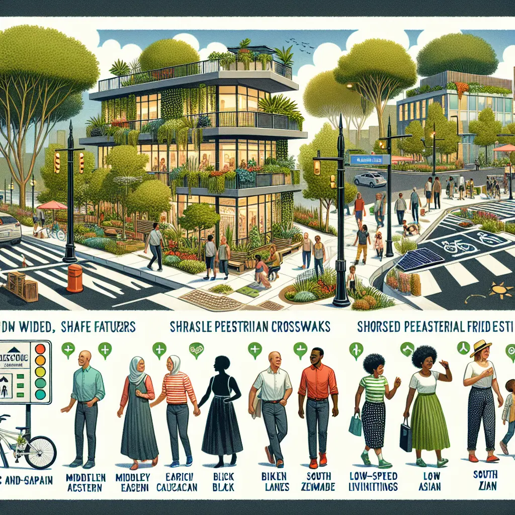
- Wider Sidewalks: Providing adequate clearance for wheelchairs, street furniture, and high volumes of foot traffic.
- Curb Extensions: Shortening crossing distances at intersections and improving visibility between pedestrians and drivers.
- Traffic Calming: Utilizing chicanes, speed cushions, and narrow lane widths to naturally reduce vehicular speeds.
- Green Infrastructure: Integrating bioswales, rain gardens, and street trees to manage stormwater runoff while shading walkways.
Economic and Social Impacts
Urban case studies consistently demonstrate that pedestrianization benefits local commerce. When streets are converted into pedestrian zones or shared spaces, retail foot traffic increases, leading to higher storefront sales. Furthermore, these zones reduce urban heat island effects, lower ambient noise pollution, and provide safe recreational spaces for neighborhoods lacking traditional parks.
4. Transit-Oriented Development (TOD)
Transit-Oriented Development integrates high-density residential, commercial, and retail spaces around high-capacity transit stations. This planning model deliberately connects land use with transportation networks to minimize automobile dependence.
Density, Diversity, and Design
Successful TOD relies on the "3 Ds" of urban planning: density, diversity, and design.
| TOD Dimension | Primary Objective |
|---|---|
| Density | Maximize housing and job capacity near transit hubs. |
| Diversity | Blend residential, retail, and office spaces in one area. |
| Design | Create pedestrian-friendly, human-scale streetscapes. |
By concentrating development within a 5-to-10-minute walking radius (roughly 400 to 800 meters) of a transit station, planners ensure that residents can easily access jobs, schools, and essential services without driving. Mixed-use zoning allows individuals to live, work, and shop within the same neighborhood ecosystem.
Mitigating Car Dependency
Automobile ownership carries high financial and environmental costs. TOD reduces parking minimums—regulatory requirements that force developers to build a specific number of parking stalls per residential unit. Removing these mandates lowers construction costs and discourages car ownership among residents who rely on the adjacent transit system. Consequently, cities experience reduced traffic congestion, lower greenhouse gas emissions, and more efficient land utilization.
5. Congestion Pricing and Demand Management
While infrastructure investments expand transit options, travel demand management (TDM) tools actively regulate vehicle use. Congestion pricing—charging motorists a fee to enter high-traffic urban zones during peak hours—is a proven economic mechanism for curbing traffic and funding public transit improvements.
Operational Mechanics of Congestion Pricing
Congestion pricing systems utilize automated license plate recognition (ALPR) cameras and electronic toll transponders to monitor vehicles entering designated urban pricing zones. Pricing structures are dynamic, meaning tolls increase during peak morning and evening commuting hours and decrease during off-peak times or weekends.
This financial incentive encourages drivers to adjust their behavior. Commuters may choose to shift their travel times, carpool, switch to public transit, or reroute around the city center. Pioneering implementations, such as those in Singapore, London, and Stockholm, have demonstrated sustained reductions in central-city traffic volumes alongside improvements in air quality.
Reinvesting Revenues and Equity Considerations
A critical component of successful congestion pricing is revenue reinvestment. Funds collected from tolls are typically funneled directly back into expanding and upgrading public transportation networks, ensuring that motorists who switch modes have reliable, high-quality alternatives.
However, equity remains a central concern for urban planners. Low-income commuters who lack access to robust transit options may bear a disproportionate financial burden. To address this, planning frameworks often incorporate targeted exemptions, sliding-scale discounts, or localized transit subsidies to ensure that mobility pricing does not unfairly penalize vulnerable populations.
Comprehensive Comparison of Modern Mobility Strategies
| Mobility Strategy | Primary Objective | Typical Capital Cost | Implementation Timeline | Impact on Car Dependency |
|---|---|---|---|---|
| Bus Rapid Transit (BRT) | High-capacity corridor transit | Moderate | Medium (2–5 years) | High reduction along corridor |
| Protected Bike Networks | Safe micro-mobility and cycling | Low to Moderate | Short (1–3 years) | Moderate for short trips |
| Complete Streets | Pedestrian safety and public space | Moderate | Medium (2–4 years) | Moderate across neighborhoods |
| Transit-Oriented Development | High-density mixed-use hubs | High (Private/Public) | Long (5–10+ years) | Very High within zone |
| Congestion Pricing | Traffic reduction and TDM funding | Low to Moderate | Short to Medium | High within target zone |
Frequently Asked Questions
What makes Bus Rapid Transit different from a standard bus route?
BRT systems feature dedicated runningways separated from mixed traffic, off-board fare collection to speed up boarding, and transit signal priority at intersections. These features allow buses to operate with the speed, reliability, and capacity typically associated with light rail systems rather than traditional street traffic.
How do protected bike lanes differ from painted bike lanes?
Protected bike lanes use physical barriers—such as concrete curbs, parked cars, or bollards—to separate cyclists from moving vehicle traffic. Painted bike lanes rely solely on floor markings, offering no physical protection against distracted or errant drivers.
What is the main goal of Transit-Oriented Development (TOD)?
TOD aims to reduce automobile dependence by concentrating high-density, mixed-use housing, and commercial spaces within easy walking distance of high-capacity public transit stations. This creates self-sustaining communities where residents can live, work, and travel without a car.
Does congestion pricing negatively impact low-income drivers?
Without mitigation, congestion pricing can place a heavy financial burden on low-income commuters who rely on personal vehicles. Modern planning addresses this through revenue reinvestment into public transit, as well as targeted exemptions, discounts, or subsidies for qualifying drivers.
How does micro-mobility integration benefit urban transportation?
Micro-mobility devices like e-scooters and shared e-bikes solve the "first-mile/last-mile" problem. They allow commuters to quickly travel between their front doors and transit stations, replacing short, polluting car journeys with zero-emission alternatives.
Conclusion and Next Actions
Modern urban planning requires a diverse toolbox of mobility strategies to address the complex challenges of urban congestion, carbon emissions, and population growth. Implementing solutions like Bus Rapid Transit, protected bike networks, Complete Streets, Transit-Oriented Development, and congestion pricing transforms metropolitan areas into sustainable, accessible ecosystems.
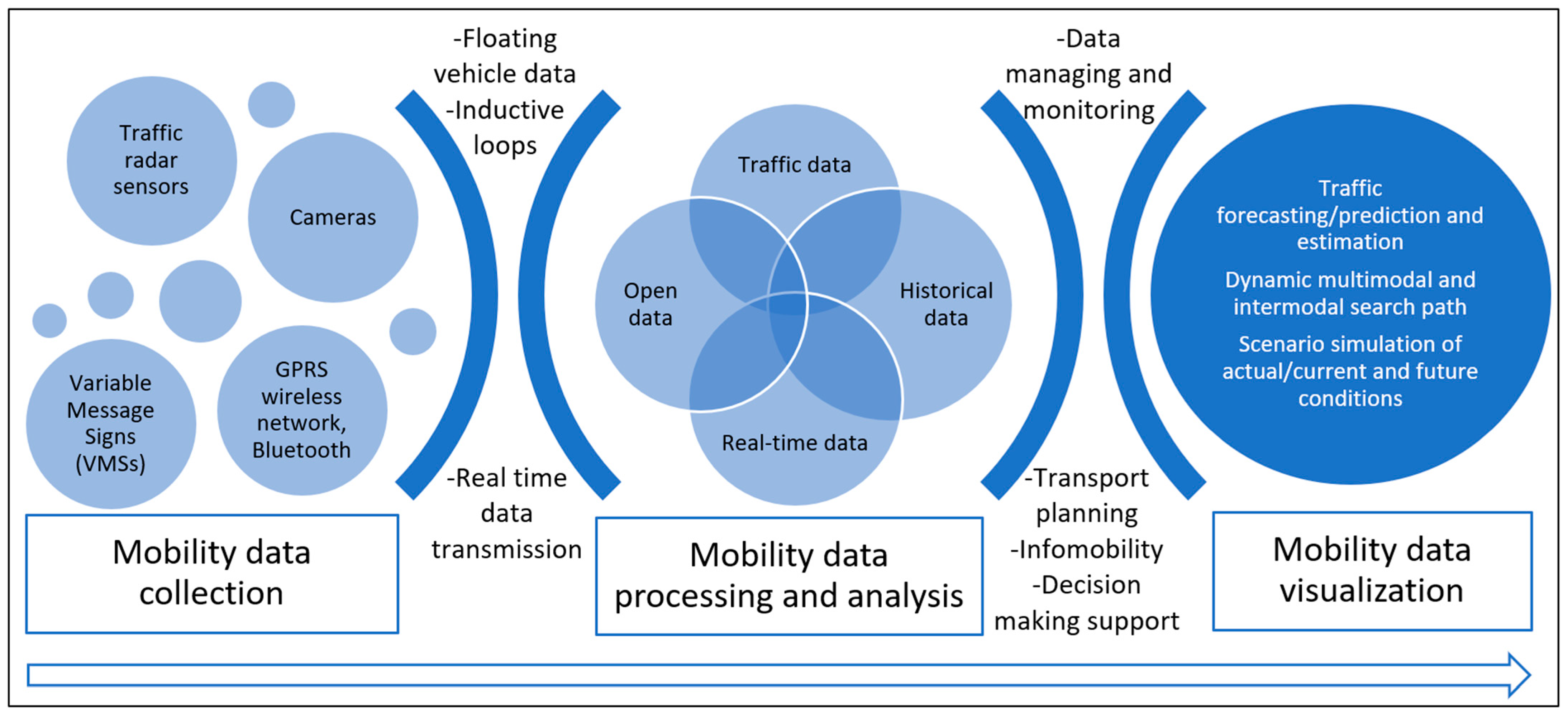
Municipal leaders, transportation planners, and community advocates must collaborate to tailor these interventions to local contexts. Prioritizing data-driven analysis, community engagement, and multi-modal integration ensures that future urban environments remain vibrant, equitable, and resilient.