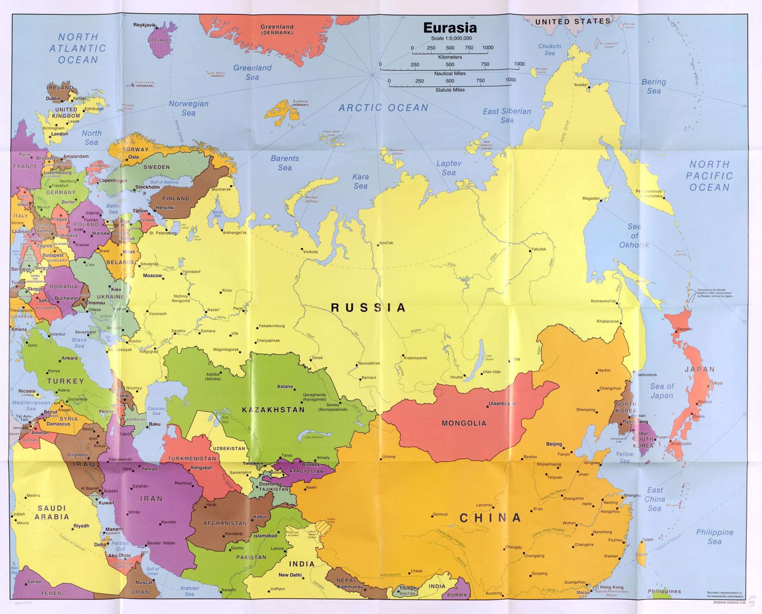
Asia is the largest and most populous continent on Earth, covering approximately 30% of the planet's total land area. While it stretches across vast latitudes, the overwhelming majority of its landmass and population is situated north of the equator. Only a small fraction of its territory, primarily involving islands in the Indonesian archipelago, crosses into the southern hemisphere.
The Geographic Scope of the Asian Continent
To understand why Asia is defined as being mostly in the northern hemisphere, one must examine its absolute location. Asia spans from the Arctic Circle in the north—roughly 77 degrees north latitude—down to approximately 11 degrees south latitude. Because the equator is the zero-degree line of latitude, this span dictates that the vast majority of the continent sits within the northern half of the globe.
The northern portion of Asia includes the expansive Siberian plains, the Tibetan Plateau, and the major population centers of China, India, and Japan. These regions represent the bulk of the continent's terrestrial area. In contrast, the southern extremity of Asia is fragmented. It consists of the Malay Archipelago, which serves as a natural transition zone between the Asian mainland and the Australian continent.
Defining the Hemispheric Divide
The Earth is divided into the northern and southern hemispheres by the equator, an imaginary line that circles the globe at 0 degrees latitude. Any landmass situated north of this line is part of the northern hemisphere, while landmasses to the south are in the southern hemisphere.
Asia’s position is unique because of its sheer scale. It touches the Arctic Ocean in the north, the Pacific Ocean in the east, and the Indian Ocean in the south. The mathematical distribution of its landmass clearly favors the northern hemisphere. When geographers calculate the land area of Asia, they include the entirety of the mainland, which sits entirely above the equator, and a significant portion of its island chains. Only a minor subset of the Indonesian islands—specifically those south of the equator such as parts of Sumatra, Kalimantan, Sulawesi, and the smaller islands of the Lesser Sunda chain—fall into the southern hemisphere.
The Significance of Latitudinal Distribution
The placement of Asia in the northern hemisphere has profound implications for climate, agriculture, and human activity. Because most of the continent is located north of the equator, the seasonal cycle in Asia is consistent with the standard northern hemisphere pattern.
Climate and Seasonal Variations
In the northern hemisphere, summer occurs when the northern half of the Earth is tilted toward the sun, typically between June and August. This results in the long, hot summers experienced in countries like India, South Korea, and Kazakhstan. Conversely, winter occurs when the northern hemisphere tilts away from the sun, leading to the frigid conditions associated with northern Siberia and the higher altitudes of the Himalayas.
The minority of Asian territory that lies in the southern hemisphere experiences the inverse. In these equatorial and southern regions, the climatic variations are less about distinct cold winters and hot summers and more defined by monsoon patterns and wet versus dry seasons.
The Role of the Equator in Regional Identification
The equator serves as more than just a cartographic marker; it influences the biological and meteorological identity of the region. As you move from the northern reaches of Asia toward the equator, the climate shifts from subarctic and temperate to tropical. By the time one reaches the parts of Indonesia that cross into the southern hemisphere, the geography is characterized by tropical rainforests, high humidity, and consistent temperatures year-round.
Geographic Comparison Table: Hemispheric Distribution
The following table compares the geographic placement of Asia’s regions relative to the equator to illustrate the disparity between the northern and southern portions of the continent.
| Region | Primary Hemispheric Location | Latitude Range (Approx.) | Climate Influence |
|---|---|---|---|
| North Asia (Siberia) | Northern Hemisphere | 50°N – 77°N | Subarctic / Tundra |
| East/Central Asia | Northern Hemisphere | 20°N – 50°N | Temperate / Continental |
| South/Southeast Asia | Northern Hemisphere | 1°N – 30°N | Tropical / Monsoon |
| Maritime Southeast Asia | Both (Mostly Northern) | 11°S – 6°N | Tropical / Maritime |
How Geographers Define Continental Boundaries
Determining whether a continent is "mostly" in one hemisphere involves calculating land area and population density. For Asia, the calculation is straightforward. Even if one were to include all of Indonesia as part of Asia, the sheer size of the mainland mass in the northern hemisphere dwarfs the southern island components.
The boundary between Asia and other continents also plays a role in this classification. To the west, the Ural Mountains and the Ural River are generally accepted as the dividing line between Europe and Asia. Because both continents are situated predominantly in the northern hemisphere, this divide does not alter Asia's hemispheric status but helps refine the territorial boundaries of the northern landmass.
Impact of Hemispheric Positioning on Navigation and Trade
Historically, the placement of the majority of Asia in the northern hemisphere facilitated the development of major land-based trade routes, such as the Silk Road. Because the northern hemisphere contains the largest continuous landmasses on Earth, the connection between East Asia, Central Asia, and Europe was geographically supported by the continuous northern terrain.
In the modern era, aviation and maritime shipping routes are heavily influenced by these latitudinal positions. Flights from North America to Asia often utilize "Great Circle" routes that arc over the Arctic—which is only possible because of the northern placement of the Asian landmass. Similarly, the primary sea lanes connecting Asia to Europe and the Americas are concentrated in the northern oceans.
Common Misconceptions Regarding Asia's Geography
A common misunderstanding arises from the term "East," which is often confused with "Southern." Because many maps traditionally place the equator centrally, users may inadvertently assume that regions labeled as "Southeast Asia" are entirely south of the equator.
It is vital to clarify that "Southeast Asia" is a geopolitical and cultural term, not a strictly latitudinal one. While parts of this region, such as Indonesia, do cross the equator, the majority of Southeast Asian nations—including Thailand, Vietnam, Cambodia, and the Philippines—are located entirely north of the equator. Recognizing that "Southeast" refers to the continent's relative position on a world map, rather than its proximity to the South Pole, is essential for accurate geographic study.
Frequently Asked Questions
Does any part of Asia touch the South Pole?
No. Asia is nowhere near the South Pole. Even the southernmost islands of Indonesia, which are in the southern hemisphere, are located well north of the Antarctic Circle and the Antarctic continent itself.
Why is Indonesia sometimes considered part of the southern hemisphere?
Indonesia is an archipelagic nation that straddles the equator. While a significant portion of its land area lies in the southern hemisphere, it is historically and geographically grouped with Southeast Asia, which is predominantly a northern hemisphere region.
How does being in the northern hemisphere affect agriculture in Asia?
The northern hemisphere location means that the main growing seasons for staple crops like rice, wheat, and soybeans follow the northern solar calendar. Farmers rely on the northern summer for peak growth, and the monsoon cycles are synchronized with the heating and cooling patterns of the northern Asian landmass.
Is the northern hemisphere placement of Asia fixed forever?
Geologically, the continents are in constant, slow motion due to plate tectonics. While Asia is currently situated in the northern hemisphere, the slow drift of the tectonic plates means that the continent's exact relationship to the equator changes over millions of years. However, for all human intents and purposes, this position remains constant.
Does the northern hemisphere classification change the time zones in Asia?
No, time zones are determined by longitude, not latitude or hemisphere. Asia’s time zones range from UTC+2 to UTC+12, based on the continent's extensive longitudinal spread from the Middle East to the far eastern reaches of Russia and the island nations.
Practical Next Steps for Geographic Research
If you are researching the specific coordinates of a region within Asia to determine its exact hemisphere, consider utilizing official cartographic resources. The United Nations Group of Experts on Geographical Names (UNGEGN) provides standardized data regarding regional and national boundaries.
For those studying climate patterns or agricultural cycles, verify the specific latitude and longitude of the area of interest using satellite data or topography maps. Even within the northern hemisphere, a difference of ten degrees of latitude can signify a transition from a tropical climate to a temperate one, drastically altering the environmental profile of the region.