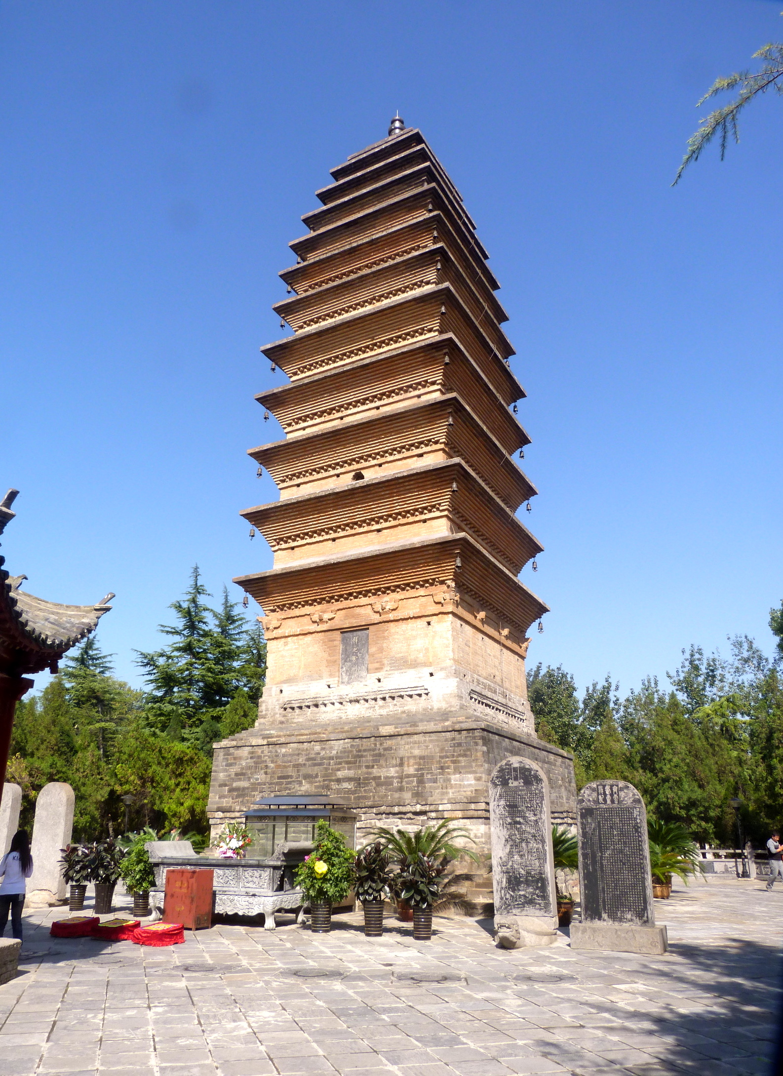
Over China’s multi-millennial history, the imperial capital shifted across the landscape depending on dynastic origins, strategic defense requirements, and economic imperatives. While dozens of cities served as political centers, four primary cities—Xi'an (Chang'an), Luoyang, Nanjing, and Beijing—historically formed the central political heartlands of imperial governance.
The Concept of the Imperial Capital in Ancient Chinese Governance
In ancient China, the selection and construction of an imperial capital (du or jing) was far more than an administrative decision; it was a profound political, cosmological, and ideological statement. According to traditional political theory, the emperor ruled under the Mandate of Heaven (Tianming). Consequently, the capital was designed to function as the physical pivot of the universe (Zhongguo, or the "Middle Kingdom"), linking the celestial realm with the earthly realm.
The spatial layout of traditional Chinese capitals followed strict cosmological and architectural principles codified as early as the Eastern Zhou period (770–256 BCE) in classical texts such as the Kao Gong Ji ("Artificers' Record"), a section of the Rites of Zhou (Zhou Li). This text laid out ideal specifications for imperial urban planning:
Grid Layout and Orientation: A square plan oriented strictly along a cardinal north-south axis, positioning the ruler facing south toward his subjects, symbolizing warmth, light, and authority.
Concentric Enclosures: A tiered system of defensible spaces, typically featuring an innermost Palace City (Zijincheng), an surrounding Imperial City (Huangcheng) housing administrative offices, and an outer City Wall (Guancheng) protecting residential wards and commercial markets.
Symmetry and Order: Major ancestral temples were built on the left (east) of the main palace axis, while the altars to the land and grain were positioned on the right (west).
Outer City Wall
- Residential Wards & Open Markets
- Imperial City
- Ministries & Admin Offices
- Palace City (Imperial Residence)
Beyond symbolism, capital selection was dictated by geography. Ancient Chinese strategists divided the primary geopolitical zones into three core regions: the Guanzhong Basin in the northwest (sheltered by natural mountain passes), the Central Plains (Zhongyuan) along the middle and lower Yellow River, and the fertile Yangtze River Delta (Jiangnan) in the south.
The Four Great Ancient Capitals of China
Chinese historical consensus traditionally emphasizes four major cities that served as the primary centers of power across the country's most expansive and influential dynasties: Xi'an, Luoyang, Nanjing, and Beijing.
Xi'an (Chang'an): The Cradle of Imperial Dynasties
Located in modern Shaanxi Province within the fertile Guanzhong Basin, Xi'an—known throughout most of imperial history as Chang'an ("Perpetual Peace")—is arguably the most historically significant capital in Chinese history. Protected by natural barriers like the Qinling Mountains to the south and the Yellow River bends to the east, Chang'an served as the capital for more than a dozen dynasties, including the Zhou, Qin, Western Han, Sui, and Tang.
The Han Dynasty Chang'an
During the Western Han Dynasty (202 BCE – 9 CE), Chang'an grew into one of the largest metropolitan centers in the ancient world. Imperial architects constructed massive complexes such as the Weiyang Palace and Changle Palace. The city served as the eastern terminus of the overland Silk Road, facilitating trade, diplomatic missions, and cultural exchanges across Central Asia to the Mediterranean.
The Tang Dynasty Masterpiece
Under the Sui and Tang dynasties (581–907 CE), Chang'an was completely redesigned under the direction of master architect Yuwen Kai. The Tang capital was a grand, meticulously planned grid spanning roughly 84 square kilometers—nearly seven times the size of ancient Rome at its peak. The city contained 108 enclosed residential wards (fang), two major government-supervised markets (East Market for domestic trade, West Market for international merchants), and towering imperial compounds like the Daming Palace.
Today, Xi'an retains extraordinary archaeological heritage. The world-renowned Terracotta Army guards the nearby mausoleum of Qin Shi Huang, the first emperor of unified China, while the network of Silk Road routes passing through Chang'an is recognized on the UNESCO World Heritage List.
Luoyang: The Central Plain Powerhouse
Situated in Henan Province along the Luo River, a major tributary of the Yellow River, Luoyang was regarded as the literal center of the Chinese world (Tianxia). Because of its position on the flat, arable Central Plains, Luoyang served as the primary capital or eastern administrative hub for thirteen dynasties, including the Eastern Zhou, Eastern Han, Cao Wei, Western Jin, and Northern Wei.
Geographical Centrality and Transport
Unlike the isolated Guanzhong Basin, Luoyang offered superior transport connections along the Yellow River system. During the Eastern Zhou (770–256 BCE) and Eastern Han (25–220 CE) periods, shifting trade routes and agricultural needs made Luoyang an ideal hub for distributing grain and tax revenues collected from eastern agricultural provinces.
Cultural and Religious Apex
During the Northern Wei Dynasty (386–534 CE), Emperor Xiaowen made the strategic decision to move the imperial capital south from Pingcheng (Datong) to Luoyang as part of a sweeping campaign of cultural integration. Under his reign and subsequent rulers, Luoyang became a major center of Chinese Buddhism. This era saw the creation of the monumental Longmen Grottoes, a vast complex of cave temples carved into the limestone cliffs south of the city, which today stands as a masterwork of ancient Buddhist art. During the Tang Dynasty, Empress Wu Zetian elevated Luoyang as her primary capital, renaming it Shendou ("Divine Capital").
Nanjing: The Southern Haven of Culture and Governance
Situated along the lower reaches of the Yangtze River in Jiangsu Province, Nanjing ("Southern Capital") served historically as the premier capital of southern China. It provided a secure administrative sanctuary whenever northern nomads or civil wars disrupted the Yellow River heartlands.
The Six Dynasties and Southern Refinement
Nanjing first emerged as an imperial center during the Three Kingdoms period (220–280 CE) as the capital of Eastern Wu under Sun Quan, then known as Jianye. Following the fall of Western Jin to northern invasions, southern China entered the Six Dynasties period, during which Nanjing (under the names Jiankang or Jiangning) served as the capital for a succession of native southern regimes: Eastern Jin, Liu Song, Southern Qi, Southern Liang, and Southern Chen.
During these centuries, northern aristocratic families fled south, bringing classical Han literacy, calligraphy, painting, and agricultural technology to the Yangtze region. Nanjing became the intellectual and cultural capital of East Asia, renowned for refined literature, philosophy, and Buddhist scholarship.
The Early Ming Dynasty
Nanjing reached a peak of political dominance under the Ming Dynasty (1368–1644). The founding Hongwu Emperor (Zhu Yuanzhang) chose Nanjing as his capital to signify the restoration of Han Chinese rule following the collapse of the Mongol Yuan Dynasty. He constructed a massive city wall spanning over 35 kilometers—one of the longest surviving urban stone fortifications in the world—and built a grand imperial palace that directly inspired the design of the later Forbidden City in Beijing.
Beijing: The Northern Frontier Stronghold and Imperial Pinnacle
Located at the northern edge of the North China Plain, Beijing ("Northern Capital") developed into the political command center of late imperial China. Its strategic geography bridged the agricultural heartlands of northern China with the Eurasian steppe and Manchurian woodlands.
Nomadic and Conquest Dynasties
Beijing’s rise as an imperial capital was heavily driven by non-Han conquest dynasties. During the Jin Dynasty (1115–1234), the Jurchen rulers established their primary capital, Zhongdu, in modern-day southern Beijing. Following the Mongol conquest, Kublai Khan chose the location to establish Dadu (also known as Khanbaliq), the grand capital of the Yuan Dynasty (1271–1368), recorded by Venetian traveler Marco Polo.
Ming and Qing Dynasty Hegemony
In 1403, the third Ming emperor, the Yongle Emperor, initiated a massive project to relocate the imperial seat from Nanjing to Beijing. Completed in 1420, this shift allowed the Ming court to directly supervise military defense against northern Mongol groups along the Great Wall. The Yongle Emperor constructed the Forbidden City (Zijincheng) and the Temple of Heaven (Tiantan), establishing the spatial structure that defined Beijing for six centuries.
When the Manchu Qing Dynasty (1644–1912) conquered China, they retained Beijing as their administrative center. The Qing emperors expanded the capital complex, building expansive imperial garden estates on the city's northwestern outskirts, such as the Old Summer Palace (Yuanmingyuan) and the Summer Palace (Yiheyuan).
The Expanded Canon: Other Essential Ancient Capitals
While the "Four Great Capitals" dominate historical narratives, modern Chinese historians often refer to the Eight Great Ancient Capitals to account for other cities that served as long-term seats of political power.
Historical Capital Trajectory Across Major Eras:
- Bronze Age (Shang/Zhou)
- Zhengzhou
- Anyang
- Classical / Early Imperial (Han / Tang / Song)
- Xi'an
- Luoyang
- Kaifeng
- Hangzhou
- Late Imperial (Ming / Qing)
- Nanjing
- Beijing
Kaifeng: The Commercial Hub of Northern Song
Located in Henan Province, Kaifeng (historically known as Bianjing or Bianliang) served as the capital of the Northern Song Dynasty (960–1127). Positioned directly at the intersection of major canal networks, Kaifeng developed into the world's most populous commercial metropolis of its era.
Unlike the tightly regulated grid layouts of Tang Chang'an, Kaifeng featured an open, vibrant urban landscape where commercial shops, night markets, and entertainment venues operated without strict ward curfews. This commercial dynamism is famously depicted in the masterpiece panoramic painting Along the River During the Qingming Festival (Qingming Shanghe Tu). However, Kaifeng’s location on flat terrain left it militarily vulnerable, leading to its fall to the Jurchen Jin forces in the Jingkang Incident of 1127.
Hangzhou: The Cultural Apex of Southern Song
Following the loss of northern China, the Song court retreated south and established its temporary capital (Xingzai) at Hangzhou (then called Lin'an) in Zhejiang Province. Surrounded by West Lake and the Qiantang River, Hangzhou grew into an extraordinary center of maritime commerce, silk production, tea processing, and artistic creation. Marco Polo famously described Hangzhou as "without doubt the finest and most splendid city in the world."
Anyang and Zhengzhou: Bronze Age Origins
- Zhengzhou: Archaeological excavations at the Zhengzhou Shang City site reveal a massive walled settlement that served as an early capital during the middle Shang Dynasty (c. 1600–1046 BCE).
- Anyang: Located in northern Henan, Anyang was home to Yinxu ("Ruins of Yin"), the final capital of the late Shang Dynasty. Excavations here yielded the oldest direct written records of Chinese history in the form of oracle bone inscriptions (jiaguwen), alongside monumental bronze ritual vessels. The Yinxu archaeological site is protected as a UNESCO World Heritage Site.
Comparative Analysis of Ancient China's Major Capitals
To understand how these cities differed in function, location, and dynastic association, the following table summarizes the primary capitals of imperial China:
| Capital Name (Historic / Modern) | Dominant Dynasties Served | Geographical Region | Primary Strategic Advantage | Key Historical Landmarks |
|---|---|---|---|---|
| Chang'an (Xi'an) | Western Zhou, Qin, Western Han, Sui, Tang | Guanzhong Basin (Northwest) | Defensible mountain passes; access to Central Asia via Silk Road | Terracotta Army, Weiyang Palace, Daming Palace, Big Wild Goose Pagoda |
| Luoyang | Eastern Zhou, Eastern Han, Cao Wei, Western Jin, Northern Wei, Tang | Central Plains (Henan) | Central location along Yellow River transport networks | Longmen Grottoes, White Horse Temple, Luolong Imperial City |
| Nanjing | Eastern Wu, Eastern Jin, Southern Dynasties, Early Ming | Lower Yangtze River Delta (South) | Natural river barrier against northern cavalry; rich agrarian base | Ming City Wall, Xiaoling Mausoleum, Qinhuai River district |
| Beijing | Jin (Zhongdu), Yuan (Dadu), Ming, Qing | Northern Frontier (Hebei Plain) | Proximity to steppe borderlands; defense against northern nomads | Forbidden City, Temple of Heaven, Summer Palace, Ming Tombs |
| Bianjing (Kaifeng) | Northern Song, Five Dynasties | Central Plains (Henan) | Grand Canal crossroads; commercial trade hub | Iron Pagoda, Millennium City Park (Song Dynasty reconstructions) |
| Lin'an (Hangzhou) | Southern Song | Coastal South (Zhejiang) | Maritime trade access; secure terrain protected by lakes and rivers | West Lake, Lingyin Temple, Imperial Kiln Sites |
| Yin (Anyang) | Late Shang Dynasty | North China Plain (Henan) | Arable Yellow River floodplain; ritual and sacrificial grounds | Yinxu Oracle Bone Pit, Tomb of Lady Fu Hao |
Urban Planning and Architectural Principles of Chinese Capitals
The physical layout of ancient Chinese capitals reflected imperial ideology and administrative control. Rather than evolving organically, major capitals were designed from the ground up according to strict geopolitical rules.
The Axis and North-South Orientation
Chinese cosmology associated the North Star (Ziwei) with the celestial emperor. Earthly emperors constructed their thrones to face south, taking in the positive energy (yang) of the southern sky while turning their backs to the cold, hostile winds and potential military threats of the north. Every major administrative building, throne hall, and grand courtyard was laid out along a strict Central Axis (Zhongzhoudian). In Beijing, this axis stretches over nearly eight kilometers, running from the South Gate (Yongdingmen) through the Forbidden City to the Drum and Bell Towers in the north.
- [N] North Star Alignment
- Bell & Drum Towers
- Palace City (Forbidden City)
- Hall of Supreme Harmony
- Imperial Throne (Facing South)
- Imperial City Gates
- [S] South Gate Alignment
Enclosure, Fortification, and Wards
Urban security was paramount in imperial city design. Capital layout was divided into nested defensive layers:
- Outer Walls (Guancheng): Built of rammed earth (hangtu) or brick, often reaching heights of 10 to 15 meters, reinforced with corner towers, moat systems, and heavily defended barbicans (wengcheng).
- Ward System (Fangzhi): In Tang Chang'an and Han Chang'an, residential areas were divided into enclosed rectangular blocks surrounded by high walls. Gates were locked at dusk following curfew drum signals, allowing imperial guards to monitor movement and prevent unrest.
- Market Oversight: Economic activity was isolated to designated markets overseen by imperial officials who standardized weights, verified currencies, and regulated operating hours.
Why Did Ancient China Change Its Capitals?
The decision to move an imperial capital was an expensive, risky undertaking. Dynasties shifted their seats of power for several major reasons:
1. Shift in Military Threats
During early imperial history (Qin, Han, Sui, Tang), the primary foreign security threats originated from Central Asian nomad confederations (such as the Xiongnu and Göktürks) northwest of China. Consequently, keeping the capital in the western Guanzhong region (Chang'an) allowed fast military deployment. By the late imperial period (Song, Ming, Qing), threats shifted to northeastern steppe groups (such as the Khitans, Jurchens, and Mongols), prompting the migration of the capital northeastward toward Beijing.
2. Economic and Ecological Shifts
Over centuries of intensive farming, deforestation, and soil erosion, the Guanzhong Basin around Chang'an suffered environmental degradation and declining agricultural output. By the mid-Tang Dynasty, the local countryside could no longer support the capital's population. The court relied on grain shipments shipped via the Grand Canal from the Yangtze Delta. When political chaos disrupted canal traffic, starvation quickly struck the capital, forcing courts to relocate closer to eastern agricultural regions like Luoyang or Kaifeng.
Ecological & Logistical Shift:
- Northwest Soil Erosion (Guanzhong / Chang'an) and Yangtze Agricultural Boom (Jiangnan / Delta Region)
- Connected via [GRAND CANAL]
- Grain Transport Vulnerability
- Capital Re-location East & North (Luoyang to Kaifeng to Beijing)
- Grain Transport Vulnerability
- Connected via [GRAND CANAL]
3. Political Strategy and Dynastic Identity
Rulers often established capitals in their native regional bases to secure their loyalty. When the Hongwu Emperor founded the Ming Dynasty, he chose Nanjing, his regional base of power. When his son, the Prince of Yan (later the Yongle Emperor), seized the throne in a civil war, he moved the capital to his personal power center in Beijing.
Frequently Asked Questions
What was the first documented capital of ancient China?
The earliest archaeologically verified capital of China is Zhengzhou Shang City (c. 1600 BCE) and later Yinxu (modern Anyang), which served as the capital during the late Shang Dynasty (c. 1046 BCE). Earlier capitals associated with the semi-legendary Xia Dynasty (such as Erlitou) exist in archaeological records, but lack direct contemporary written text to conclusively verify their exact administrative identity.
Why was Xi'an (Chang'an) chosen by so many early dynasties?
Xi'an sat within the Guanzhong Basin, an extremely fertile agricultural plain surrounded by mountain ranges. Access to the plain was controlled by four fortified mountain passes (most notably the Hangu Pass and Tong Pass). This unique terrain allowed dynasties like the Qin and Western Han to secure their home territory easily while launching military campaigns into the Central Plains.
Which ancient Chinese capital served for the longest combined period?
Luoyang and Xi'an frequently compete for this title depending on historical criteria. Luoyang served as a capital across thirteen dynasties for over 1,500 years of combined political status. Xi'an served as a capital for thirteen major dynasties spanning more than 1,100 years, including pivotal golden ages under the Han and Tang dynasties.
How did the Grand Canal influence imperial capital selection?
The Grand Canal—first constructed on a massive scale under the Sui Dynasty (581–618 CE)—connected the agricultural output of the southern Yangtze River basin to the political centers of northern China. As northwest China suffered ecological decline, access to the Grand Canal became essential for capital survival. Cities directly along the canal network, such as Kaifeng and later Beijing, grew rapidly because they could receive reliable grain shipments from the south.
Can you visit the remains of ancient Chinese capitals today?
Yes. Modern Chinese cities have preserved, excavated, and reconstructed significant portions of their imperial heritage. Visitors in Xi'an can explore the ancient Ming Dynasty city walls, the Terracotta Army, and the excavated foundations of the Daming and Weiyang Palaces. In Beijing, the Forbidden City and Temple of Heaven remain fully preserved. In Luoyang and Anyang, world-class museums and UNESCO sites like the Longmen Grottoes and Yinxu offer extensive access to ancient ruins and artifacts.
Exploring China's Ancient Capitals: Practical Guidance
For historians, students, and travelers examining the historical geography of imperial China, understanding the shift of imperial capitals provides a clear framework for navigating Chinese history:
- Study Dynastic Timelines Alongside Geography: Recognize that China's historical center of gravity shifted progressively over time: from the Northwest (Bronze Age to Tang) to the Central/Eastern Plains (Song) and ultimately to the Northeast and South (Ming and Qing).
- Examine Primary Museum Collections: To view physical artifacts from these capitals, prioritize visiting the Shaanxi History Museum (Xi'an) for Zhou, Qin, Han, and Tang artifacts; the Luoyang Museum for Eastern Han and Northern Wei relics; and the Palace Museum (Forbidden City, Beijing) for late imperial imperial collections.
- Trace Urban Topography: When visiting modern sites, look for the enduring rectangular grid patterns and preserved city gates that reveal how ancient cosmological principles continue to shape modern urban landscapes across East Asia.