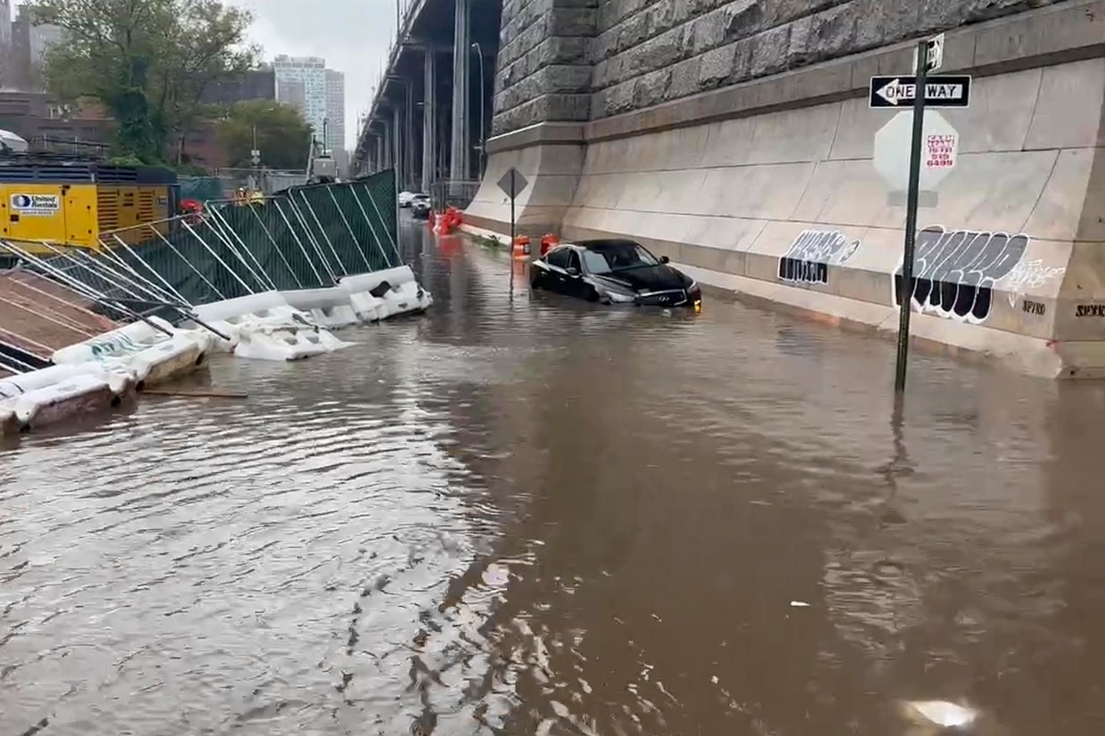
Atlantic City experiences frequent tidal flooding and severe storm surges due to its barrier island geography, low-lying elevation, and rising sea levels, which routinely inundate streets, damage property, and strain municipal infrastructure.
Understanding Atlantic City’s Vulnerability to Flooding
Atlantic City, New Jersey, is situated primarily on Absecon Island, a barrier island separated from the mainland by an extensive expanse of salt marshes and back bays. This geographic layout leaves the municipality uniquely exposed to coastal hazards. The city is bounded by the Atlantic Ocean to the east and southeast, and by bays, inlets, and tidal wetlands to the west and northwest. This configuration creates a dual vulnerability: water can breach the oceanfront beaches and dunes during major nor'easters and hurricanes, while elevated tides and storm winds can push water from the back bays directly into neighborhoods, a process known as back-bay flooding.
The underlying topography of the island compounds these physical exposures. Much of the urbanized land sits at very low elevations relative to modern high-tide marks, with historical fill materials varying widely in stability and permeability. Consequently, when meteorological conditions align to raise sea levels—such as during astronomical high tides, colloquially termed "king tides," combined with persistent onshore winds—water easily bypasses traditional bulkheads. It flows directly onto low-lying streets, municipal parking lots, and residential yards.
Furthermore, climate change and accelerated sea-level rise along the mid-Atlantic coast have amplified the frequency and severity of these events. According to data tracked by the National Oceanic and Atmospheric Administration (NOAA) through its Atlantic City tide gauge station, the number of nuisance flooding days—minor tidal floods that do not cause major structural damage but disrupt daily commerce and transportation—has risen dramatically over the past several decades. What were once considered rare, severe meteorological occurrences now happen multiple times a year, transforming tidal inundation into an ongoing challenge for municipal planners, property owners, and emergency management personnel.
Primary Causes and Meteorological Drivers of Flood Events
Flooding in Atlantic City is rarely driven by a single weather phenomenon; rather, it is typically the result of complex atmospheric and oceanographic interactions. Understanding these distinct drivers is essential for distinguishing between routine tidal inundation and catastrophic storm surges.
Nuisance and Sunny Day Flooding (King Tides)
Nuisance flooding occurs in the absence of severe storms. These events are primarily governed by astronomical cycles, specifically the alignment of the Earth, moon, and sun that produces gravitational forces maximizing tidal ranges. When these king tides coincide with seasonal weather patterns, water overtops bulkheads and drainage systems during high tide, flooding streets even on clear, sunny days. Because these floods recede with the falling tide, they rarely cause structural collapse, but they repeatedly expose vehicles to saltwater, disrupt traffic flow, and accelerate wear on local infrastructure.
Nor'easters
Nor'easters are large-scale extratropical cyclones that form along the East Coast of the United States, typically between September and April. These storms generate persistent, gale-force winds blowing from the northeast over long stretches of the Atlantic Ocean. This sustained fetch pushes massive volumes of water toward the New Jersey coastline. Because nor'easters often stall off the coast, they can batter Atlantic City across multiple consecutive tidal cycles, preventing back bays from draining effectively and prolonging inundation periods.
Tropical Systems and Hurricanes
While direct landfalls by major hurricanes are less frequent in New Jersey than in southern states, tropical storms, remnants of hurricanes, and offshore storm passages routinely impact Atlantic City. These systems bring torrential rainfall, extreme storm surges, and destructive wave action. When heavy precipitation from a tropical system coincides with a high tide, stormwater drainage systems become completely overwhelmed. Unable to discharge accumulated rainwater into swollen bays, the city's drainage network reverses, causing urban flooding from both the streets up and the bays in.
| Flood Type | Primary Meteorological Driver | Typical Duration | Main Impact |
|---|---|---|---|
| Nuisance / King Tide | Astronomical alignment, seasonal high tides | 2 to 4 hours per tide cycle | Street closures, saltwater vehicle corrosion, minor property access issues |
| Nor'easter | Slow-moving extratropical low-pressure systems | 12 to 72 hours (multiple tide cycles) | Prolonged coastal erosion, persistent back-bay flooding, structural damage |
| Tropical Storm / Hurricane | Warm-core tropical cyclones, intense winds, heavy rain | 6 to 24 hours | Catastrophic storm surge, widespread urban flooding, structural failures |
Infrastructure Impact and Municipal Vulnerabilities
The physical infrastructure of Atlantic City faces relentless stress from recurrent saltwater immersion. Roads, stormwater networks, electrical grids, and coastal protection structures are constantly tested by the corrosive and dynamic nature of floodwaters.
Stormwater Management and Tidal Valves
Atlantic City relies heavily on gravity-fed stormwater drainage networks to channel rainwater off the streets and into the surrounding bays. However, during high tides and storm surges, the water level in the bays rises above the outfall pipes. Without mechanical intervention, bay water flows backward through the pipes, flooding the streets from below. To mitigate this, the city and state agencies have increasingly installed backflow preventers and tidal check valves. Despite these upgrades, extreme storm events routinely overwhelm the capacity of legacy drainage systems, necessitating the installation of auxiliary portable pumps during severe weather.
Transportation and Evacuation Routes
The city's connectivity to the mainland depends on a limited number of arterial roadways, including the Atlantic City Expressway, the Black Horse Pike (Route 322/40), and the White Horse Pike (Route 30). Portions of these approach roads, particularly where they traverse low-lying salt marshes before reaching the island, are highly susceptible to flooding during major storm surges. When these evacuation corridors are submerged, emergency access is severely restricted, complicating both pre-storm evacuations and post-storm emergency response operations.
Bulkheads and Shoreline Protection
Bulkheads serve as the primary line of defense for private and commercial properties along Atlantic City's back bays and canals. Many older bulkheads were constructed decades ago to lower height and structural standards. As sea levels rise, these barriers are frequently overtopped or compromised by structural fatigue. Recognizing this vulnerability, municipal codes and state regulations administered by the New Jersey Department of Environmental Protection (DEP) have established higher minimum elevation standards for new or reconstructed bulkheads, though retrofitting the entire shoreline remains a slow, capital-intensive undertaking.
Socioeconomic and Economic Consequences
The repeated inundation of Atlantic City extends far beyond immediate property damage, exerting a profound influence on the local economy, real estate market, and municipal budget.
Real Estate, Property Values, and Insurance
Property owners in Atlantic City face significant financial obligations related to flood risk. Because much of the city lies within Special Flood Hazard Areas (SFHAs) as mapped by the Federal Emergency Management Agency (FEMA), mortgage lenders generally require property owners to carry flood insurance through the National Flood Insurance Program (NFIP) or private providers.
Under FEMA's Risk Rating 2.0 methodology, premium calculations are individualized based on specific structural characteristics, distance to water, and elevation, rather than broad zone maps alone. Consequently, properties with lower elevation profiles often experience substantial annual premium increases. These rising insurance costs, combined with the physical wear and tear of recurring floods, can influence property valuations and long-term investment decisions for both residential homeowners and commercial enterprises.
Tourism, Hospitality, and Commercial Operations
As a major regional hub for tourism, gaming, and entertainment, Atlantic City’s economic vitality depends heavily on visitor accessibility and perception of safety. While the major casino-resorts along the Boardwalk are engineered to withstand significant weather events and feature elevated main structures, surrounding access roads, parking areas, and employee commute routes remain vulnerable. Temporary street flooding can deter visitors, disrupt convention schedules, and temporarily depress gaming and hospitality revenues during critical weekend periods.
Municipal Fiscal Pressures
Maintaining and upgrading aging coastal infrastructure places a heavy burden on municipal finances. Local governments must continuously balance operating budgets against the capital costs of raising roads, installing stormwater pump stations, repairing bulkheads, and replenishing beaches. While federal grants from agencies like FEMA and the U.S. Army Corps of Engineers often subsidize large-scale mitigation projects, local matching funds and ongoing maintenance obligations require careful long-term fiscal planning.
Mitigation Strategies, Adaptation, and Resilience Planning
Mitigating the impacts of water inundation in Atlantic City requires a multi-layered approach combining hard engineering, ecological restoration, and regulatory policy changes.
Beach Nourishment and Dune Systems
Along the oceanfront, the U.S. Army Corps of Engineers, in partnership with the New Jersey Department of Environmental Protection, regularly executes beach nourishment and dune construction projects. Wide sandy beaches and heavily vegetated dunes act as natural shock absorbers, dissipating wave energy before it can reach boardwalks, hotel foundations, and coastal neighborhoods. These engineered shores require periodic sand replenishment, particularly after severe nor'easters strip away protective sediment.
Raising Infrastructure and Elevation Standards
Municipal engineering efforts increasingly focus on elevating critical infrastructure. Road raising projects in chronic flood zones help maintain vital transportation links during high tides. Furthermore, local building codes mandate that new residential and commercial construction must adhere to strict base flood elevation requirements, often building well above historical flood levels to account for projected future sea-level rise.
Nature-Based Solutions and Living Shorelines
In addition to concrete bulkheads and steel seawalls, planners are turning to nature-based adaptation strategies. Restoring degraded salt marshes, creating living shorelines using native vegetation and oyster reefs, and preserving permeable open spaces help absorb excess stormwater and buffer wave action naturally. These ecological buffers offer sustainable, long-term resilience benefits while simultaneously improving local water quality and wildlife habitats.
Frequently Asked Questions
Why does Atlantic City flood even when it is not raining?
Atlantic City experiences "sunny day" or nuisance flooding primarily due to astronomical high tides, often enhanced by seasonal weather patterns and rising sea levels. When high tides exceed normal thresholds, seawater overtops low-lying bulkheads and bubbles up through stormwater drainage systems, inundating streets without a single drop of rain falling locally.
Are the casinos and the Boardwalk safe from flooding?
The major casino-resorts and the iconic Boardwalk are engineered at higher elevations and are exceptionally resilient against typical coastal storms. However, the surface-level streets, parking structures, and access routes leading to the casino district can experience temporary flooding during severe nor'easters or major tropical storms, which can temporarily disrupt local transportation.
How does FEMA determine flood insurance rates in Atlantic City?
FEMA utilizes Risk Rating 2.0, an actuarial pricing methodology that evaluates a property's specific flood risk characteristics—including foundation type, distance to water, and structural elevation—rather than relying solely on traditional flood zone maps. This approach ensures that rates reflect individual property risk, often resulting in higher premiums for low-elevation structures.
What is being done to protect Atlantic City from future sea-level rise?
Local, state, and federal agencies are implementing a comprehensive resilience strategy. This includes ongoing beach nourishment and dune maintenance by the U.S. Army Corps of Engineers, installation of tidal check valves and auxiliary drainage pumps, road-raising initiatives in vulnerable zones, and strict enforcement of elevated building and bulkhead codes.
Practical Next Steps for Property Owners and Visitors
For individuals owning property, managing businesses, or planning visits in Atlantic City, proactive awareness of flood risks is essential for safety and asset protection. Property owners should verify their specific flood zone designation through official FEMA resources, review their insurance coverage limits with a qualified professional to ensure adequate protection against water damage, and elevate critical mechanical equipment such as HVAC units and electrical panels above potential flood levels. Visitors and commuters should monitor local weather advisories, check municipal traffic alerts regarding road closures during high-tide cycles, and avoid driving through standing saltwater, which can stall vehicles and conceal hidden roadway hazards.