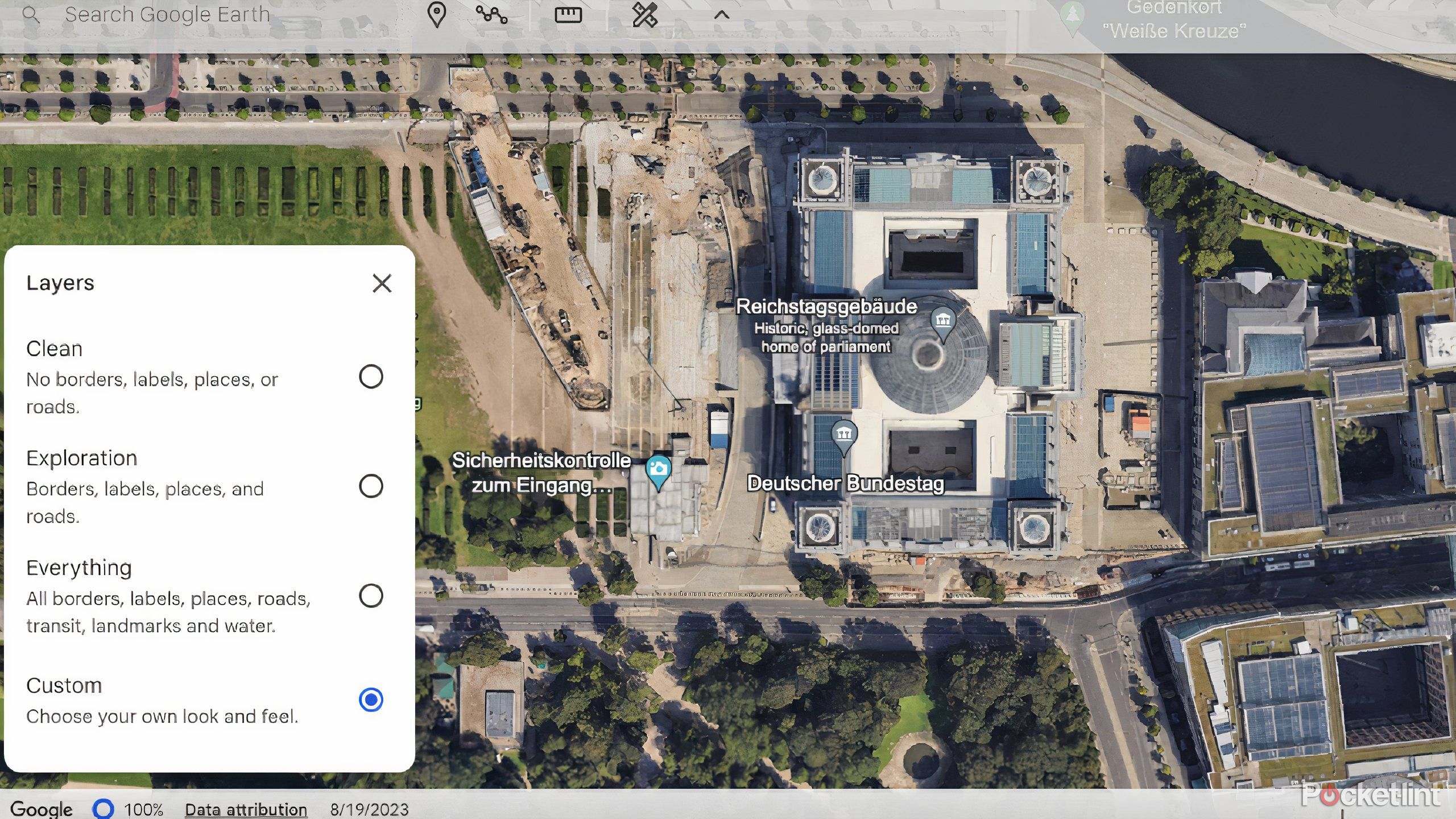
The 2005 launch of Google Earth revolutionized digital cartography by introducing a seamless, 3D interactive globe built from satellite imagery, aerial photography, and GIS data. Acquired initially as Keyhole EarthViewer, the software allowed users to zoom from space down to street level, setting a new standard for geographic visualization.
Introduction to the 2005 Mapping Revolution
In June 2005, Google officially released Google Earth, transforming an enterprise-grade, niche visualization tool into a consumer phenomenon. Before this release, interacting with geographic data usually meant static web pages, clunky desktop atlases, or expensive professional Geographic Information Systems (GIS) software like ESRI ArcGIS. The launch bridged the gap between complex geospatial databases and everyday internet users.
By leveraging broadband expansion and rapidly advancing graphics processing units (GPUs), Google made it possible to render the entire planet on a standard home computer. Users no longer needed specialized training to explore remote mountain ranges, check out their own neighborhoods from above, or measure distances across continents. This historical milestone laid the groundwork for modern digital navigation, urban planning tools, and location-based services that define the contemporary digital landscape.
Origins: The Transition from Keyhole EarthViewer to Google
To understand the impact of the 2005 launch, it is necessary to examine its origins. Google Earth was not built entirely from scratch by Google engineers; rather, it was born out of Keyhole, Inc., a geospatial technology startup founded in 2001. Keyhole originally developed EarthViewer 3D, a software application designed for enterprise and defense markets that required high-performance rendering of 3D terrain and satellite imagery.
The Keyhole Acquisition
In October 2004, Google acquired Keyhole, recognizing the immense potential of merging geospatial data with Google's massive indexing infrastructure, web servers, and search algorithms. The Keyhole technology relied heavily on proprietary compression algorithms that streamed massive image files over the internet in real-time, loading high-resolution tiles only as the user navigated to specific coordinates.
Rebranding and Launch
Following the acquisition, Google engineers integrated the technology into their ecosystem, streamlined the user interface, lowered the consumer barrier to entry, and officially rebranded the software as Google Earth on June 28, 2005. Initially deployed as a free downloadable client for Microsoft Windows (with Mac OS X and Linux versions following later), the software immediately captured public attention. The transition shifted geospatial software from a closed, expensive corporate asset to an accessible, consumer-facing digital globe.
Core Architecture and Technical Specifications
The technical achievement behind the 2005 launch of Google Earth cannot be overstated. Running a fluid 3D globe smoothly on consumer hardware in 2005 required clever engineering, efficient data streaming, and advanced rendering techniques.
Client-Server Architecture
Google Earth operated on a client-server model. The client application handled the heavy lifting of 3D rendering using local graphics hardware, while Google's massive server clusters stored petabytes of satellite imagery, vector data, and digital elevation models (DEM).
Data Streaming and Caching
Because the entire globe's high-resolution data could not possibly fit on a standard 2005 hard drive, Google Earth used an intelligent streaming protocol. As a user tilted, rotated, or zoomed the globe, the software requested only the necessary image tiles and vector layers for the visible viewport. A local disk cache stored recently viewed tiles, ensuring that revisiting an area was instantaneous and reduced bandwidth consumption.
Polygonal Terrain Meshing
To create the 3D illusion of mountains, valleys, and canyons, Google Earth applied flat satellite imagery over a digital elevation model. This DEM consisted of a hierarchical grid of triangular polygons. As the user zoomed closer to a mountainous region like the Himalayas or the Grand Canyon, the software dynamically increased the polygon density in that specific area, providing realistic topographic relief without overloading the computer's memory.
Key Features of the Original 2005 Release
The initial 2005 version of Google Earth introduced several groundbreaking features that captivated early adopters and set the blueprint for future geographic software updates.
Seamless Global Zooming
The signature feature of Google Earth was its fluid, continuous zoom capability. Users could start with a view of the entire Earth floating in black space and seamlessly zoom down through the atmosphere to inspect individual city blocks, highways, and landmarks. This was a radical departure from traditional map software that required users to click through discrete zoom levels or separate regional maps.
Layer-Based Data Exploration
Google Earth organized supplementary geographic data into toggleable layers in a sidebar. In 2005, these layers included:
- Roads: Major highways and local streets overlaid directly onto the imagery.
- Borders and Labels: Country boundaries, state lines, and names of cities, towns, and geographic features.
- Geographic Features: Mountains, rivers, lakes, and deserts.
- Points of Interest (POIs): Hotels, restaurants, gas stations, and tourist attractions sourced from early business directories.
3D Buildings in Major Cities
While most of the world appeared flat in 2005, Google Earth included rudimentary 3D polygonal models for iconic structures and downtown areas in major global cities, particularly within the United States. Users could view low-poly, texture-mapped 3D models of landmarks like the Eiffel Tower, the Empire State Building, and the Golden Gate Bridge, giving the globe a sense of verticality and realism.
Measurement Tools
Early versions included built-in measurement utilities that allowed users to calculate straight-line distances between two points, measure perimeters, and calculate areas in various units (miles, kilometers, feet, meters, acres). This made the tool useful for educators, amateur planners, and real estate enthusiasts.
Comparison of Early Google Earth vs. Modern Mapping Platforms
To contextualize the 2005 software, it is helpful to compare its capabilities against contemporary mapping standards of that era and today.
| Feature / Capability | Google Earth (2005 Initial Release) | Traditional Web Maps (Circa 2005) | Modern Web/Mobile Earth (2026) |
|---|---|---|---|
| Interface | Downloadable desktop application | Static web pages or basic raster tiles | Browser-based, mobile apps, and VR |
| Dimension | 3D interactive globe | 2D flat maps | 3D globe, street-level panorama, photorealistic 3D meshes |
| Data Delivery | Dynamic streaming from servers | Static image loading per click | Real-time cloud rendering and vector tiles |
| Imagery Resolution | Variable; high-res in major US cities, low-res globally | Low-resolution raster across the board | Sub-meter HD imagery and AI-enhanced textures |
| User Contributions | KML/KMZ files and basic annotations | None for end-users | User reviews, real-time traffic, local edits |
The Impact of KML (Keyhole Markup Language)
One of the most enduring legacies of the 2005 Google Earth launch was the popularization of KML (Keyhole Markup Language). Originally developed by Keyhole, Inc. as EarthViewer Markup Language (EML), KML became an open standard maintained by the Open Geospatial Consortium (OGC) in 2008.
KML is an XML-based file format used to display geographic data in an Earth browser like Google Earth. In 2005, it empowered educators, scientists, journalists, and hobbyists to create custom map overlays without writing complex code. Users could define custom placemarks with specific geographic coordinates, add rich HTML descriptions, draw custom polygons, and embed external image links.
By sharing small .kml or compressed .kmz files via email or early web forums, communities quickly formed around sharing custom geographic datasets, ranging from historical battle sites to tracking migratory animals and mapping natural disaster zones.
System Requirements and Technical Hurdles in 2005
Running Google Earth in 2005 was a demanding task for personal computers of that era. While modern users take instantaneous 3D rendering for granted on smartphones and cheap laptops, the hardware landscape in 2005 posed significant hurdles.
Hardware Demands
The official minimum system requirements for the 2005 release called for a 500 MHz Pentium III processor, 128 MB of RAM, 200 MB of free hard disk space, and a graphics card capable of supporting 32-bit true color with 16 MB of VRAM. However, to experience smooth zooming and rendering, users typically needed a dedicated graphics card with hardware 3D acceleration—a component many standard home office PCs lacked at the time.
Connection Speeds
Broadband adoption was still growing rapidly in 2005, with many home users still relying on dial-up connections. Google Earth was explicitly designed for broadband users (DSL or cable); running the application on a dial-up connection resulted in extremely slow tile loading times, blurry textures that took minutes to resolve, and frequent connection timeouts.
Frequently Asked Questions
What was Google Earth called before Google acquired it?
Before Google acquired Keyhole, Inc. in October 2004, the software was known as EarthViewer 3D. Google maintained the Keyhole branding briefly before officially renaming and launching it as Google Earth in June 2005.
Was the original 2005 Google Earth free to download?
Yes, Google released a free version of Google Earth for consumers upon its 2005 launch. At the same time, Google offered paid tiers—such as Google Earth Plus and Google Earth Pro—which provided advanced features like GPS device integration, higher-resolution printing, and specialized data import tools for enterprise users.
How did Google Earth get its imagery in 2005?
The imagery came from a combination of public domain satellite data (such as NASA's Landsat program), commercial satellite providers, and aerial photography collections. Because commercial high-resolution imagery was expensive and less ubiquitous in 2005, coverage varied wildly; major metropolitan areas in the United States featured crisp aerial photography, while rural areas and international locations were often limited to low-resolution satellite patches.
Can you still run the original 2005 version of Google Earth today?
Technically, installation files for older versions can sometimes be found in software archives, but they are generally non-functional. The original 2005 client relies on obsolete network protocols, legacy authentication servers, and discontinued API endpoints maintained by Google, meaning historical versions can no longer connect to Google's modern geospatial database.
Practical Next Actions and Historical Exploration
For those interested in exploring the history of cartography and digital geography, studying the 2005 launch of Google Earth offers valuable insights into how consumer technology scales complex data. To dive deeper into this subject:
- Examine historical digital archiving projects that document the evolution of GIS software from enterprise command-and-control rooms to consumer web browsers.
- Review the evolution of the OGC KML standard to understand how geographic data formatting matured alongside web development standards.
- Explore modern web-based mapping implementations that demonstrate how client-side rendering has shifted from resource-heavy desktop applications to lightweight browser engines.