Atlantic Ocean sea conditions vary significantly by latitude and season, characterized by significant wave heights ranging from 1 to 3 meters in the tropics to over 10 meters during North Atlantic winter storms. Prevailing conditions are driven by major pressure systems like the Azores High and Icelandic Low, alongside the powerful Gulf Stream current.
Navigating or studying the Atlantic Ocean requires an intricate understanding of how atmospheric pressure, water temperature, and bathymetry interact to create specific sea states. As of 2026, advancements in satellite altimetry and AI-driven fluid dynamics modeling have provided mariners and researchers with unprecedented precision in predicting these conditions. However, the fundamental physics of the Atlantic remain a challenge for even the most sophisticated vessels.
Regional Variability and The North-South Divide
The Atlantic is traditionally divided into the North and South Atlantic, separated by the Intertropical Convergence Zone (ITCZ). Each region exhibits distinct sea conditions based on global wind patterns and thermal gradients.
The North Atlantic: The Engine of Volatility
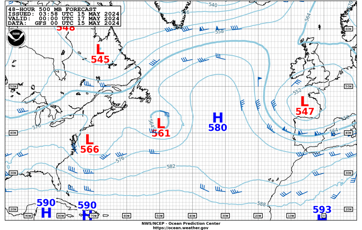
The North Atlantic is widely considered one of the most treacherous maritime environments in the world, particularly during the boreal winter (November through March). The primary driver of sea conditions here is the North Atlantic Oscillation (NAO). This phenomenon involves the pressure difference between the Icelandic Low and the Azores High. When this gradient is steep, westerly winds intensify, leading to massive swells and frequent gale-force conditions.
In 2026, monitoring stations across the North Atlantic continue to record "significant wave heights"—the average height of the highest one-third of waves—that frequently exceed 12 meters during "bomb cyclones" or rapid extratropical cyclogenesis. These conditions are not merely products of local wind but are often the result of long-distance swells generated thousands of miles away near the Labrador Sea.
The South Atlantic: Persistence and Fetch
The South Atlantic is characterized by a more consistent, albeit often rough, sea state. Unlike the North Atlantic, which is hemmed in by large landmasses that disrupt wind flow, the South Atlantic is open to the "Roaring Forties"—strong westerly winds that blow between 40 and 50 degrees south latitude.
Because there is little land to provide friction, the "fetch" (the distance over which wind blows without obstruction) is immense. This results in long-period swells that are highly predictable but can be structurally taxing for vessels. Sea conditions in the South Atlantic are also influenced by the Benguela Current and the Brazil Current, which can create confused seas where they meet colder Antarctic waters.
Key Factors Determining Sea State
To accurately assess Atlantic Ocean sea conditions, one must look beyond simple wind speed. Several interconnected physical factors determine whether a sea is "slight," "moderate," or "phenomenal."
Wind Velocity, Duration, and Fetch
The energy transferred from the atmosphere to the ocean surface is a function of three variables:
- Wind Speed: How fast the air is moving.
- Duration: How long the wind blows consistently from one direction.
- Fetch: The unobstructed distance over which the wind acts on the water.
In the mid-Atlantic, a sustained 30-knot wind blowing over a 500-mile fetch for 24 hours will produce a fully developed sea with significant wave heights of approximately 6 to 7 meters. If any of these three variables increase, the sea state escalates.
The Role of Bathymetry
While much of the Atlantic is deep ocean (averaging 3,600 meters), sea conditions change dramatically as water moves over underwater features. The Mid-Atlantic Ridge, a massive underwater mountain range, can cause "internal waves" and surface turbulence. More critically, as deep-ocean swells approach the continental shelves of Europe or North America, the decreasing depth causes wave shoaling. This process increases wave height and steepness, often turning a manageable deep-water swell into a dangerous breaking wave near the coast.
Sea Surface Temperature (SST) and Stability
Warm water in the Tropical Atlantic acts as fuel for atmospheric disturbances. High SSTs (above 26.5°C) are a prerequisite for tropical cyclone development. Conversely, the cold waters of the North Atlantic can create "stable" air-sea interfaces where thick fog forms, particularly where the warm Gulf Stream meets the cold Labrador Current near the Grand Banks of Newfoundland. Visibility is a critical component of sea conditions that directly impacts maritime safety.
Major Currents and Navigational Impacts
Ocean currents do more than move water; they fundamentally alter the shape and behavior of waves. When waves move against a strong current, they become shorter, steeper, and more prone to breaking.
The Gulf Stream
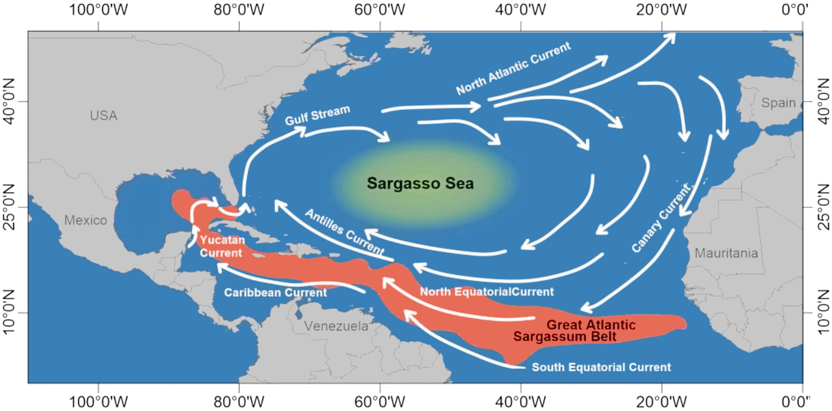
The Gulf Stream is the most influential current in the North Atlantic, transporting warm water from the Gulf of Mexico toward Europe at speeds up to 5 knots. When strong northerly winds blow against the northward-flowing Gulf Stream, the resulting sea conditions can be catastrophic. This "wind-against-current" phenomenon creates exceptionally steep waves that can easily swamp smaller vessels and cause structural damage to larger ships.
The Atlantic Meridional Overturning Circulation (AMOC)
In 2026, the AMOC remains a primary focus of oceanographic study. This system of currents, which includes the Gulf Stream, acts as a global conveyor belt. Changes in the strength of the AMOC influence sea level along the U.S. East Coast and alter the frequency of storm surges. A slowing AMOC can lead to higher regional sea levels, which in turn exacerbates the impact of rough sea conditions during high tide events.
Comparative Atlantic Sea Conditions by Region (2026 Data)
The following table summarizes typical sea conditions encountered across different Atlantic sectors during peak seasons.
| Region | Primary Season | Typical Wave Height (m) | Peak Wave Height (m) | Dominant Current | Primary Risk Factor |
|---|---|---|---|---|---|
| North Atlantic | Dec - Feb | 4.0 – 8.0 | 15.0+ | North Atlantic Drift | Extratropical Cyclones |
| Tropical Atlantic | Jun - Nov | 1.5 – 3.0 | 12.0+ (Hurricanes) | North Equatorial | Tropical Cyclones |
| South Atlantic | Jun - Aug | 3.0 – 6.0 | 10.0+ | Brazil Current | Long-period Swells |
| Sargasso Sea | Year-round | 0.5 – 2.0 | 4.0 | Circular Gyre | Low Wind (Doldrums) |
| Grand Banks | Mar - May | 2.0 – 5.0 | 8.0 | Labrador/Gulf Stream | Fog & Icebergs |
Modern Forecasting and Real-Time Monitoring in 2026
The ability to monitor Atlantic sea conditions has been revolutionized by the integration of multi-modal data streams. Mariners no longer rely solely on barometric pressure readings.
Satellite Altimetry and SAR
Synthetic Aperture Radar (SAR) satellites now provide high-resolution imagery of the sea surface regardless of cloud cover. These satellites can detect individual wave patterns and surface roughness, allowing for the identification of rogue waves—statistically rare waves that are more than twice the height of the surrounding sea state. In 2026, the Copernicus Marine Service provides real-time global ocean analysis that is essential for routing.
The Argo Float Program and Moored Buoys
The National Data Buoy Center (NDBC) maintains a network of "Weather and Ocean Platform" (WOP) buoys throughout the Atlantic. These buoys provide ground-truth data, measuring wave period, direction, and height. Supplementing these are thousands of Argo floats—autonomous devices that profile the upper 2,000 meters of the ocean, providing the salinity and temperature data necessary for accurate long-term forecasting.
AI and Machine Learning Models
Traditional numerical weather prediction (NWP) models have been augmented by machine learning algorithms that can process historical sea-state data to predict "confused seas"—areas where multiple swell systems intersect. This is particularly useful in the "Graveyard of the Atlantic" off the coast of North Carolina, where the collision of currents and varying depths creates notoriously unpredictable conditions.
Safety and Operational Limits
Understanding sea conditions is a prerequisite for any maritime operation, from offshore wind farm maintenance to trans-Atlantic shipping.
- Small Craft Advisories: Generally issued when sustained winds reach 20–33 knots or sea conditions are deemed hazardous for vessels under 65 feet.
- Significant Wave Height Limits: Most commercial ferries and passenger vessels have operational limits between 3.5 and 5.0 meters of SWH. Beyond this, the risk of passenger injury and vehicle shifting becomes unacceptably high.
- Dynamic Positioning (DP) Challenges: Offshore drilling and construction vessels using DP systems must account for the "heave" and "pitch" caused by specific swell frequencies. If the wave period matches the resonant frequency of the hull, the vessel can experience extreme motion even in moderate wave heights.
Seasonal Hazards: Hurricanes and Nor'easters
The Atlantic is subject to two primary types of large-scale hazardous weather systems that dictate sea conditions for months at a time.
Tropical Cyclones (Hurricanes)
During the Atlantic hurricane season (June 1 to November 30), sea conditions in the tropical and subtropical Atlantic can transition from calm to "phenomenal" (waves over 14 meters) in less than 24 hours. The National Hurricane Center tracks these systems, but the sea conditions often precede the storm itself. Long-period swells from a distant hurricane can reach shorelines thousands of miles away, creating dangerous rip currents and high surf.
Nor'easters
Common along the East Coast of North America, Nor'easters are cold-core storms that can be as powerful as hurricanes. They are particularly dangerous because they often move slowly, allowing the wind to act on the water for a long duration over a vast fetch. This results in significant coastal erosion and prolonged periods of extreme sea states that can trap vessels in port for days.
Interpreting Wave Spectra and Period
A critical mistake made by many is focusing only on wave height while ignoring the "period." The wave period is the time (in seconds) between two successive wave crests.
- Short Period Waves (4–7 seconds): Often called "chop." These are steep, uncomfortable, and can be dangerous for smaller boats as they don't allow the vessel to recover between waves.
- Long Period Waves (10–20 seconds): These are "swells." In deep water, these may be barely noticeable to a large ship, but they contain massive amounts of energy. As they reach shallow water, they can grow significantly in height and power.
In the Atlantic, a 2-meter wave with a 5-second period is often more dangerous for a 30-foot boat than a 4-meter swell with a 15-second period.
Frequently Asked Questions
What is the safest time of year to cross the Atlantic?
For a West-to-East crossing (North America to Europe), May and June are generally considered the safest months. During this window, the frequency of North Atlantic winter gales has diminished, and the Atlantic hurricane season has either not yet begun or is in its early, less active stages. However, mariners must still remain vigilant for late-season fog near the Grand Banks and the potential for early tropical disturbances.
How do "rogue waves" form in the Atlantic?
Rogue waves form through two primary mechanisms: constructive interference and non-linear interactions. Constructive interference occurs when waves of different speeds and directions happen to align their crests simultaneously. Non-linear interactions often occur in strong currents like the Gulf Stream, where the current focuses wave energy into a smaller area, causing a massive, sudden spike in wave height.
Are Atlantic sea conditions getting rougher?
Data from 2026 and preceding years suggest a trend toward increased wave energy in the North Atlantic. This is attributed to the warming of the atmosphere, which allows for more intense low-pressure systems. Higher wind speeds naturally lead to higher significant wave heights. Additionally, rising sea levels mean that the same sea conditions now result in more significant coastal flooding than they did in previous decades.
How can I check real-time sea conditions?
The most reliable source for real-time data is the National Data Buoy Center (NDBC). Users can click on specific buoy stations to see live readings of wind speed, wave height, swell period, and water temperature. For a broader view, the European Centre for Medium-Range Weather Forecasts (ECMWF) provides high-resolution sea-state modeling that is used globally by professional weather services.
What is the Beaufort Scale and how is it used?
The Beaufort Scale is an empirical measure that relates wind speed to observed conditions at sea or on land. In the Atlantic, it is the standard for communicating sea state. For example, a "Force 6" (Strong Breeze) corresponds to 22–27 knot winds and waves of 3–4 meters, characterized by whitecaps and some spray. A "Force 10" (Whole Gale) involves 48–55 knot winds and very high waves with long overhanging crests.
Professional Recommendation for Maritime Planning
When planning any Atlantic transit or offshore activity in 2026, rely on a "layered" forecasting approach. Start with broad-scale atmospheric models (ECMWF or GFS) to identify large pressure systems 7–10 days out. As your window approaches, switch to high-resolution regional models and real-time buoy data to identify local wind-against-current hazards. Always prioritize wave period and direction over simple height metrics, and maintain a minimum 30% safety margin relative to your vessel’s certified operational limits.