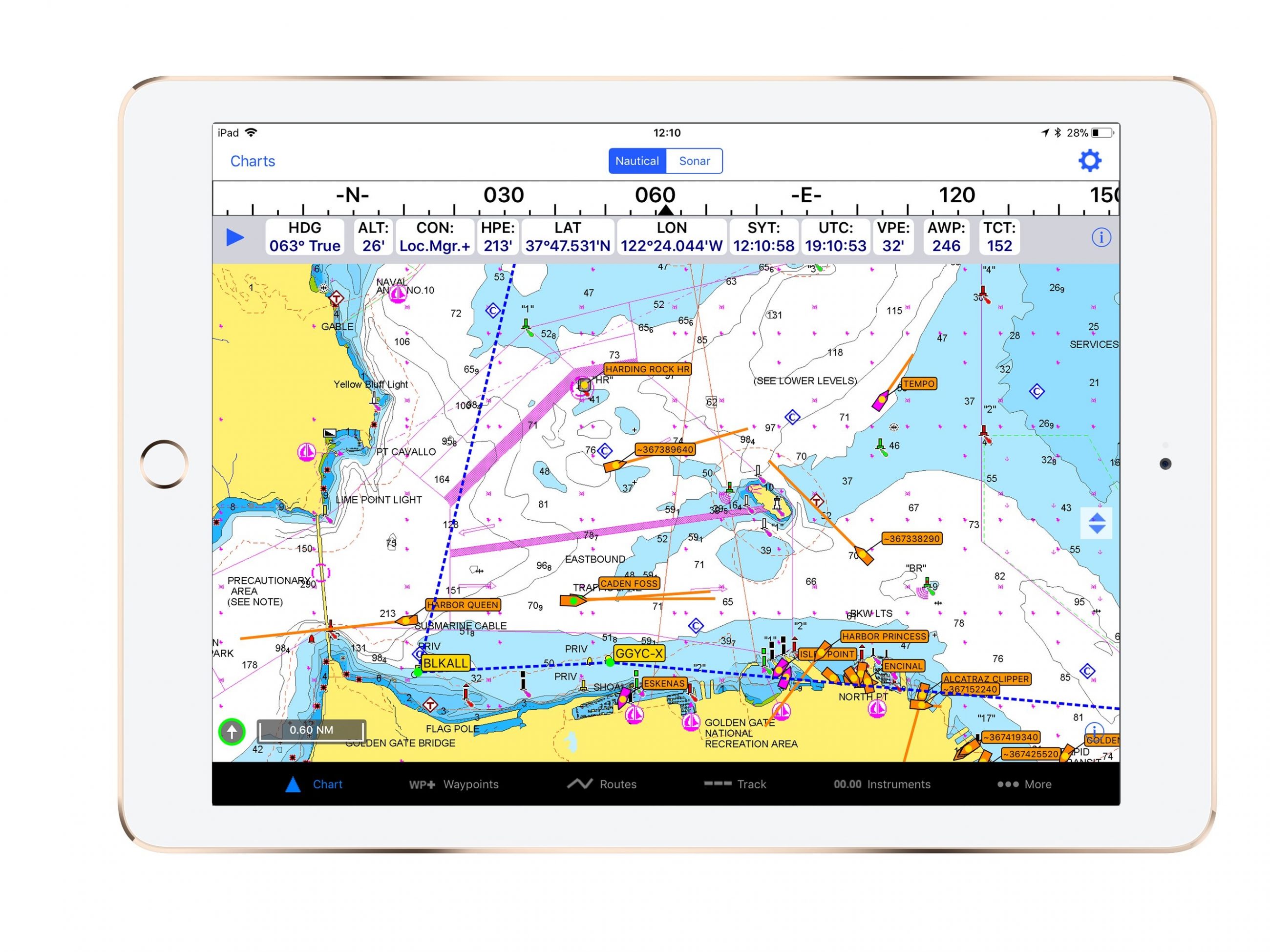
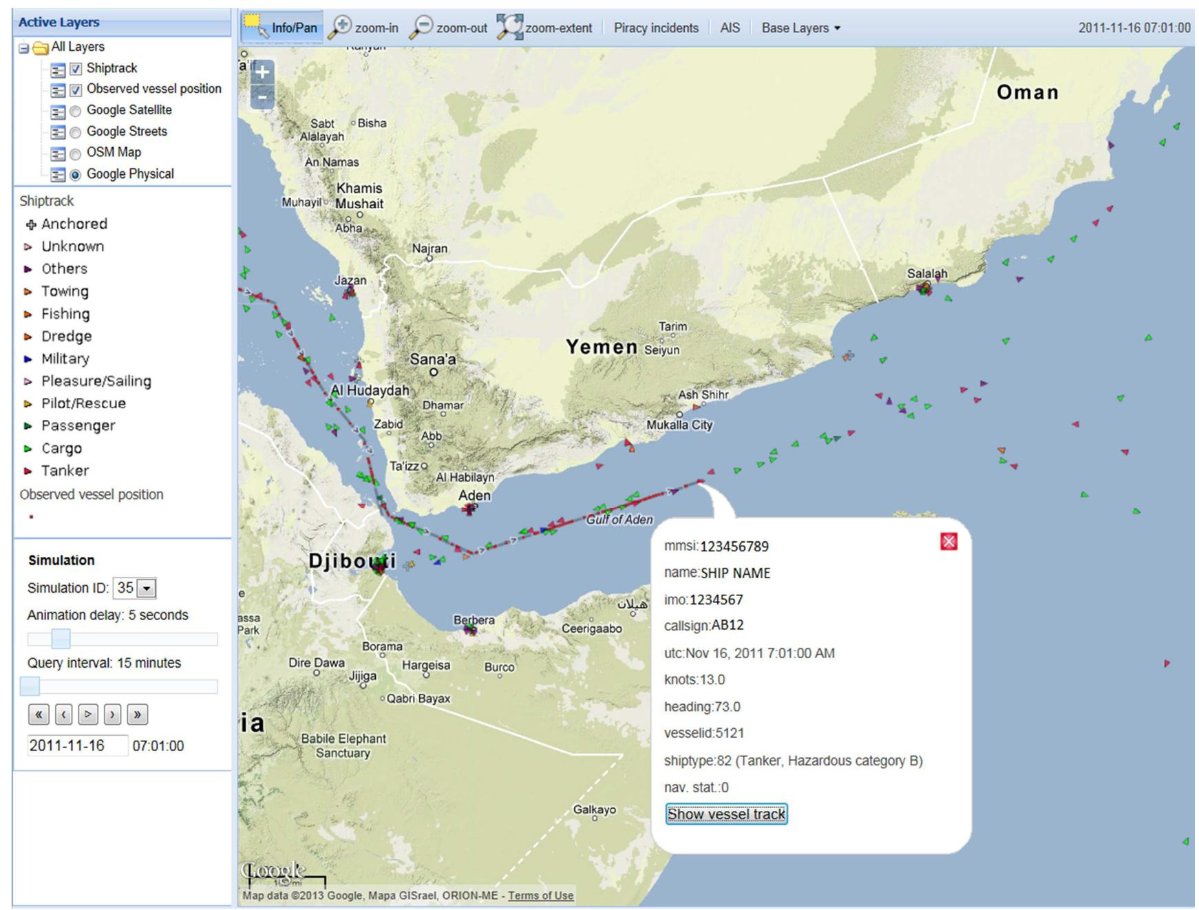
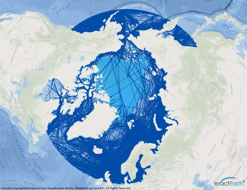
AIS live map services provide real-time geospatial tracking of maritime vessels by aggregating data from the Automatic Identification System (AIS). These platforms utilize a network of terrestrial receivers and satellite constellations to display ship positions, speeds, and routes. They are vital for maritime logistics, safety monitoring, and global supply chain transparency.
The maritime industry has undergone a significant digital transformation, and by 2026, AIS live map services have evolved from simple "ship finders" into sophisticated data ecosystems. Whether you are a logistics professional tracking cargo, a port authority managing traffic, or a maritime enthusiast, understanding how these services function and which ones offer the best reliability is essential for navigating the modern seas.
Understanding the Foundation: How AIS Data Reaches the Map
To effectively use an AIS live map service, one must understand the two primary ways data is collected: Terrestrial AIS (T-AIS) and Satellite AIS (S-AIS). The distinction between these two is the most common cause of confusion regarding why a ship might "disappear" from a map.
Terrestrial AIS (T-AIS)
Terrestrial AIS relies on a global network of ground-based receivers. These receivers pick up VHF (Very High Frequency) signals broadcast by ships within a limited range—typically 15 to 40 nautical miles depending on the height of the antenna and atmospheric conditions. Most free AIS live map services rely heavily on terrestrial data. If a ship moves further than 40 miles from the coast, it will often appear "static" or out-of-date on a standard free map because it has left the range of terrestrial antennas.
Satellite AIS (S-AIS)
Satellite AIS solves the problem of mid-ocean tracking. Low Earth Orbit (LEO) satellites are equipped with AIS receivers that can pick up signals from ships anywhere on the globe, including the middle of the Atlantic or Pacific Oceans. In 2026, the density of these satellite constellations has increased significantly, reducing the latency of updates. However, because satellite data is expensive to collect and process, most AIS live map services gate this information behind premium subscription tiers.
Class A vs. Class B Transponders
The quality and frequency of the data you see on a live map also depend on the vessel's hardware.
- Class A: Mandatory for all vessels over 300 gross tonnage on international voyages and all passenger ships. These broadcast at higher power and more frequently (as often as every 2 seconds when moving fast).
- Class B: Designed for smaller commercial and recreational vessels. They have lower power and broadcast less frequently, meaning their positions on a live map may jump or lag more than larger ships.
Top AIS Live Map Services in 2026
The market for maritime tracking is dominated by a few key players, each catering to different segments of the industry. Choosing the right one depends on whether you require historical data, API integration, or simple visual tracking.
| Service Provider | Primary Strength | Best For | Satellite Data Availability |
|---|---|---|---|
| MarineTraffic | Largest terrestrial network | General users & port agents | Premium / Pay-per-vessel |
| VesselFinder | User interface speed | Casual tracking & ship spotting | Premium |
| FleetMon | Data depth & API quality | Logistics & supply chain | Enterprise tiers |
| MyShipTracking | Free feature set | Budget-conscious enthusiasts | Limited / Add-on |
| AISHub | Raw data sharing | Developers & researchers | N/A (Data sharing pool) |
MarineTraffic: The Industry Standard
MarineTraffic remains the most widely recognized AIS live map service. Its primary advantage is the sheer scale of its terrestrial network, which is bolstered by thousands of community-hosted receivers. In 2026, MarineTraffic has integrated more advanced weather overlays and port congestion analytics, making it a "one-stop shop" for maritime situational awareness. Their "augmented reality" feature on mobile apps allows users to point their device at the horizon and identify ships in real-time.
VesselFinder: Reliability and Speed
VesselFinder is often praised for its lightweight interface. While its feature set is similar to MarineTraffic, many users find its map rendering to be faster on mobile devices. It offers a robust "vessel photos" database and is highly popular among the ship-spotting community. Their premium services provide high-frequency satellite updates, which are essential for tracking long-haul voyages across the "blue water" gaps where terrestrial signals fail.
FleetMon: The Professional Choice
FleetMon positions itself more toward the commercial logistics sector. It provides extensive historical data (often going back several years) and specialized tools for calculating the Estimated Time of Arrival (ETA) based on real-time speed and historical route performance. For businesses that need to integrate AIS data into their own software, FleetMon’s API is widely considered the most stable and well-documented.
Key Features to Look for in an AIS Service
When evaluating "ais live map services," look beyond the basic ship icons. The value of a service is found in its data enrichment and analytical tools.
Real-Time Weather Overlays
Wind speed, wave height, and tropical storm tracking are now standard features on professional AIS maps. By overlaying a ship’s path with weather data, users can understand why a vessel may be slowing down or taking a seemingly inefficient route to avoid a storm.
Port Call History and Port Congestion
Knowing where a ship is currently located is only half the battle. Professional services track the "Port Call History," showing every dock a vessel has visited. More importantly, in 2026, services have moved toward "Port Congestion Analytics," which show the average waiting time for berths at major hubs like Singapore, Rotterdam, or Los Angeles. This allows logistics managers to redirect cargo or adjust expectations for delivery.
Vessel Density and Heatmaps
For environmental researchers or offshore developers, heatmaps are invaluable. They visualize the busiest shipping lanes over time, helping to identify areas with high risks of collisions or environmental impact. These maps can be filtered by vessel type, such as tankers, cargo ships, or fishing vessels.
Custom Alerts and Geofencing
A critical feature for operational efficiency is the ability to set geofences. A user can draw a virtual boundary around a specific port or coastal area; when a tracked vessel enters or leaves that zone, the service sends an instant notification via email or mobile push. This eliminates the need to manually check the map every hour to see if a shipment has arrived.
Technical Limitations and Data Accuracy
While AIS live map services are incredibly accurate, they are not infallible. Users must be aware of certain limitations to avoid misinterpreting the data.
Signal Spoofing and AIS "Ghosts"
Vessels can manually input incorrect data into their AIS transponders. This can lead to "spoofing," where a ship broadcasts a false location or identity to hide its activities (often seen in illegal fishing or sanctions evasion). Furthermore, "ghost ships" can appear on maps when a receiver picks up a distorted signal or when multiple signals collide in a high-traffic area, creating a duplicate vessel icon.
Update Latency
The term "live" is relative. Terrestrial data is usually updated every few seconds or minutes. However, satellite data might only update every 15 to 60 minutes depending on the service tier and satellite orbital passes. In 2026, while LEO satellites have reduced this lag, it is still rarely "instantaneous" for ships in the middle of the ocean.
Atmospheric Interference
VHF signals travel in a line of sight. Certain atmospheric conditions, such as temperature inversions, can cause "tropospheric ducting," which allows AIS signals to travel much further than usual. Conversely, heavy rain or solar activity can degrade signal reception, leading to gaps in the tracking line on your map.
How to Contribute to the AIS Network
Most major AIS live map services are built on the backs of volunteers. If you live near a coastline, you can host a terrestrial AIS receiver. Most platforms, including MarineTraffic and VesselFinder, provide free hardware to users in strategic locations who are willing to install an antenna on their roof and share the data back to the network.
Benefits of hosting a receiver include:
- Free Premium Access: In exchange for your data, providers usually grant you a high-tier professional subscription for free.
- Local Awareness: You get the fastest, most accurate data for your immediate area directly from your own hardware.
- Community Support: You contribute to global maritime safety by filling in coverage gaps that help search and rescue operations or environmental monitoring.
Practical Comparison of AIS Data Tiers
To help you decide which level of service you need, consider the following breakdown of features typically found in 2026 AIS service tiers.
| Feature | Free Tier | Basic/Pro Tier | Enterprise Tier |
|---|---|---|---|
| Terrestrial Position | Real-time (Delayed on some) | Real-time | Real-time |
| Satellite Position | None or 24hr delayed | Limited (e.g., 50 vessels) | Unlimited global tracking |
| Historical Data | 24 - 48 Hours | 30 - 90 Days | Multi-year archives |
| Weather Maps | Basic Current | Advanced Forecasts | Historical weather correlation |
| Notifications | 1 - 2 basic alerts | 50+ custom geofences | API-integrated alerts |
| Vessel Photos | Full access | Full access | Commercial usage rights |
Common Troubleshooting for AIS Services
"My ship hasn't updated in 12 hours." This is the most common issue. Check if the ship is in the open ocean. If so, you likely need a satellite subscription to see its current position. If the ship is near the coast, it may have turned off its AIS (a common practice for some vessels in sensitive areas) or is in a "dead zone" where there are no shore-based receivers.
"The ship is showing it's on land." This usually occurs due to a GPS error on the vessel's transponder or a coordinate decimal error during data transmission. Most services have filters to remove these, but occasionally an "impossible" position will slip through.
"Two vessels have the same name." Vessel names are not unique. To identify a ship accurately, always search by its MMSI (Maritime Mobile Service Identity) or IMO number. The IMO number stays with a ship for its entire life, even if the name or owner changes, making it the most reliable identifier.
Frequently Asked Questions
Is there a completely free AIS live map with satellite data?
No. Collecting satellite AIS data involves significant costs for satellite launches and data processing. While some services offer a "delayed" satellite view or a limited number of satellite refreshes for free, continuous real-time satellite tracking is almost exclusively a paid service in 2026.
Can I use AIS live map services for navigation on my own boat?
No. AIS live map services should be used for situational awareness and planning only. They are subject to internet latency and data processing delays. For actual navigation and collision avoidance, you must rely on a dedicated on-board AIS transponder and radar system that receives signals directly from nearby vessels.
Why do some ships appear as "Unidentified Vessel"?
A vessel appears as unidentified if the receiver has picked up its position (Type 1, 2, or 3 messages) but has not yet received its static data (Type 5 message), which includes the ship's name and dimensions. Static data is broadcast less frequently than position data, so it may take several minutes for the name to populate on the map.
How accurate are the ETA (Estimated Time of Arrival) predictions?
In 2026, ETA accuracy has improved significantly due to AI-driven models that account for port congestion and typical sailing speeds. However, they cannot account for sudden mechanical failures, local pilotage delays, or customs holdups. Treat ETAs as an "earliest possible" arrival time rather than a guarantee.
Are AIS live map services legal to use everywhere?
Generally, yes. AIS data is a public broadcast intended for safety. However, some countries may restrict the public display of their naval or sensitive government vessels. Most AIS providers automatically filter out sensitive military data to comply with international security requests.
Recommendation for Next Actions
If you are new to vessel tracking, start by exploring MarineTraffic or VesselFinder on their free web tiers. This will give you a feel for terrestrial coverage in your area of interest. For those managing a supply chain or tracking specific high-value cargo, we recommend requesting a trial of FleetMon’s enterprise tools, as their API integration and historical data are superior for professional logistics planning. Always verify a vessel's identity using the IMO number to ensure you are tracking the correct ship across different platforms.