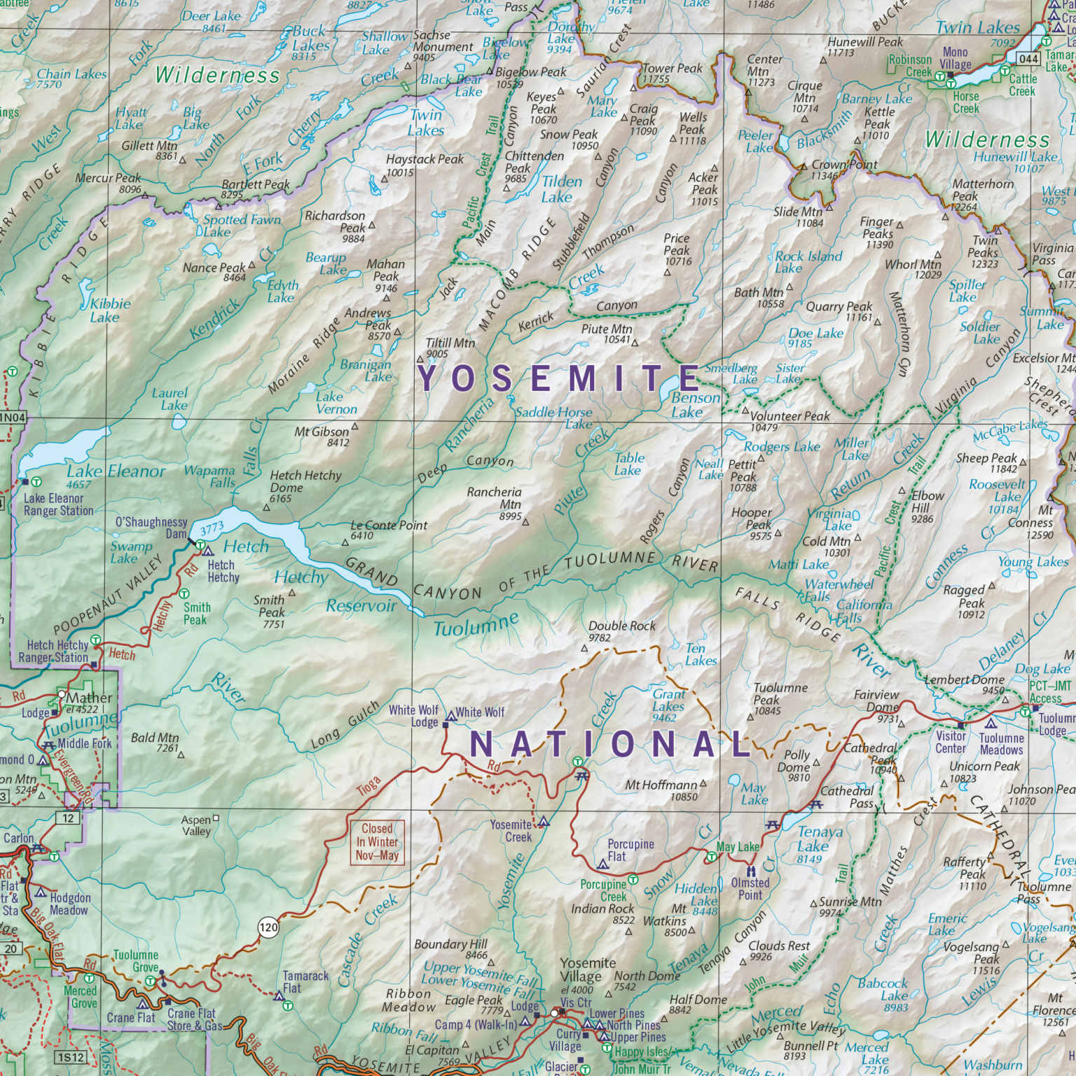
For visitors planning a trip in 2026, the best airport for Yosemite National Park depends on your starting location and preferred park entrance. Fresno Yosemite International Airport (FAT) is the closest commercial hub, located approximately 65 miles (1.5 to 2 hours) from the South Entrance. For more flight options and lower fares, San Francisco International (SFO) and Oakland International (OAK) are popular alternatives, though they require a 4-hour drive.
Selecting the right airport is the first critical step in a Yosemite itinerary. Because the park covers nearly 1,200 square miles of the Sierra Nevada mountains, your choice of landing spot dictates which entrance you will use, how much you will pay for a rental car, and whether you can rely on public transportation. In 2026, with peak-hour reservation systems and shuttle logistics remaining a core part of the visitor experience, aligning your flight with your lodging location is more important than ever.
Fresno Yosemite International Airport (FAT): The Primary Gateway
Fresno Yosemite International Airport (FAT) remains the most convenient option for the vast majority of visitors. Situated in the San Joaquin Valley, it serves as the central jumping-off point for both Yosemite and neighboring Sequoia & Kings Canyon National Parks.
Proximity and Drive Times
FAT is roughly 65 miles from the South Entrance (Highway 41), which leads directly to the Mariposa Grove of Giant Sequoias and the Wawona area. Under normal traffic conditions in 2026, you can expect a drive of about 1 hour and 30 minutes to the park gate. If your destination is Yosemite Valley, plan for an additional 45 to 60 minutes of driving once inside the park.
Flight Availability and Carriers
While smaller than the coastal hubs, FAT has expanded its service significantly. Major carriers including United, American, Delta, and Alaska Airlines offer daily non-stop flights from hubs like Denver, Dallas, Phoenix, Salt Lake City, and Seattle. This allows travelers from across the United States to reach Yosemite with only one connection.
Rental Cars and Infrastructure
The airport features a consolidated rental car center located directly across from the terminal. Because FAT is specifically geared toward national park tourism, many rental agencies stock SUVs and vehicles equipped with AWD, which are highly recommended for the winding mountain roads. However, during the peak 2026 summer season, it is essential to book vehicles months in advance, as local inventory can sell out during holiday weekends.
San Francisco (SFO) and Oakland (OAK): The Coastal Hubs
Many international and cross-country visitors choose to fly into the San Francisco Bay Area. While these airports are further from the park, they offer advantages in terms of flight frequency and competitive pricing.
San Francisco International (SFO)
SFO is the primary choice for international travelers. It offers the most direct flights from Europe, Asia, and South America. The drive to Yosemite Valley from SFO typically takes 4 to 5 hours, depending heavily on Bay Area traffic.
- Best For: Visitors combining Yosemite with a trip to San Francisco or the Pacific coast.
- Route: Usually involves taking I-580 East to Highway 120, entering through the Big Oak Flat Entrance.
Oakland International (OAK)
Oakland is often preferred by savvy domestic travelers because it is slightly closer to the Sierras and avoids some of the congestion associated with SFO. The drive time is approximately 3.5 to 4 hours. OAK is a major hub for Southwest Airlines, which can often result in lower baggage fees for hikers carrying heavy gear.
San Jose Mineta International (SJC)
San Jose is the third Bay Area option. It is particularly convenient if you are traveling from other West Coast cities. SJC offers a straightforward route through the Pacheco Pass (Highway 152) to connect with Highway 99, leading toward the park’s western gates.
Sacramento International Airport (SMF): The Northern Alternative
Sacramento International (SMF) is an underrated but excellent choice for Yosemite visitors, particularly those visiting in the 2026 season who wish to avoid the heavy traffic of the Bay Area.
Strategic Location
SMF is located north of the park, making it the ideal entry point for those planning to use the Big Oak Flat Entrance (Highway 120) or visit the Hetch Hetchy Reservoir. The drive from Sacramento to Yosemite Valley is typically 3 hours.
Ease of Transit
The Sacramento airport is generally less crowded than SFO, meaning shorter security lines and faster rental car pickups. The route from SMF to Yosemite takes you through California’s Gold Country, offering a scenic and historically rich drive through towns like Groveland. This path is often less steep and winding than the Highway 41 climb from Fresno, which can be a relief for drivers nervous about mountain roads.
Reno-Tahoe (RNO) and Mammoth Yosemite (MMH): The Eastern Gateways
For visitors planning a trip during the summer or early autumn (typically June through October), the eastern side of the park offers a completely different perspective.
Reno-Tahoe International (RNO)
Reno is the best airport for accessing the Tioga Pass (Highway 120 East). This high-altitude pass provides stunning views of Tuolumne Meadows and the high Sierra peaks. The drive from Reno to the Lee Vining entrance is about 2.5 hours.
- Important Constraint: Tioga Pass is closed in the winter (usually November to May). If you fly into Reno when the pass is closed, you would have to drive 6+ hours around the mountains to reach Yosemite Valley.
Mammoth Yosemite Airport (MMH) and Bishop (BIH)
Mammoth Yosemite and nearby Bishop (BIH) are small regional airports. While they are the closest to the park's eastern boundary, flights are often seasonal and expensive. They are most useful for visitors who are focusing exclusively on the Eastern Sierra or who are participating in backcountry treks starting from Tuolumne Meadows.
Comparison of Major Airports for Yosemite Visitors (2026)
| Airport | Code | Distance to Valley | Typical Drive Time | Best Entrance |
|---|---|---|---|---|
| Fresno Yosemite | FAT | 95 miles | 2.5 hours | South (Hwy 41) |
| San Francisco | SFO | 195 miles | 4 - 5 hours | Big Oak Flat (Hwy 120) |
| Oakland | OAK | 175 miles | 3.5 - 4 hours | Big Oak Flat (Hwy 120) |
| Sacramento | SMF | 175 miles | 3 - 3.5 hours | Big Oak Flat (Hwy 120) |
| San Jose | SJC | 185 miles | 4 hours | Arch Rock (Hwy 140) |
| Reno-Tahoe | RNO | 170 miles | 3.5 hours* | Tioga Pass (Hwy 120 E) |
| Merced Regional | MCE | 80 miles | 2 hours | Arch Rock (Hwy 140) |
*Note: Reno-Tahoe access via Tioga Pass is seasonal and typically only available from June to October.
Public Transportation Options from Airports
In 2026, many visitors are opting to skip the rental car to avoid parking hassles within Yosemite Valley. The Yosemite Area Regional Transportation System (YARTS) is the primary public transit provider.
From Fresno (FAT)
The YARTS Highway 41 line runs directly from Fresno Yosemite International Airport to Yosemite Valley. This service typically operates year-round, though the frequency increases during the summer months. It is a cost-effective way to reach the park, and the ticket price usually includes the park entrance fee.
From Merced (MCE)
Merced Regional Airport is served by Boutique Air. While it is a very small airport, it is a major stop for the YARTS Highway 140 line. This route is significant because Highway 140 follows the Merced River canyon and is the lowest-elevation route into the park, making it the most reliable during winter snowstorms.
Connecting from SFO/OAK via Amtrak
Travelers landing in the Bay Area can take the BART (Bay Area Rapid Transit) to an Amtrak station (such as Richmond or Oakland Jack London Square). From there, the San Joaquins train line runs to Merced, where passengers can transfer to a YARTS bus. While this journey takes 6 to 7 hours, it allows visitors to reach the heart of the park without ever getting behind the wheel.
Critical Considerations for 2026 Travel
Vehicle Reservations and Entry Requirements
As of 2026, Yosemite National Park continues to manage congestion through a reservation system during peak periods. Flying into an airport and renting a car does not guarantee entry into the park. Visitors must secure a peak-hour reservation through Recreation.gov in advance. If you are using YARTS or staying at an in-park lodge (like The Ahwahnee or Yosemite Valley Lodge), your entry is generally included, but you should verify current 2026 policies on the official NPS website.
Winter Travel and Snow Chains
If flying into any of these airports between November and April, you must be prepared for winter driving. California law requires all vehicles (including rentals and AWD/4WD vehicles) to carry snow chains when entering chain-control zones. Most major rental agencies at SFO or FAT do not provide chains. Visitors may need to purchase them at an auto parts store in Fresno, Orem, or Mariposa before ascending into the mountains.
Fuel and Charging Stations
If renting an Electric Vehicle (EV) from SFO or OAK, be aware that charging infrastructure is robust in the Bay Area but thins out as you enter the Sierras. There are limited chargers in Yosemite Valley and at the Wawona Hotel. Plan your charging stops in cities like Oakdale or Oakhurst before entering the park gates.
Frequently Asked Questions
What is the closest airport to Yosemite National Park?
Fresno Yosemite International Airport (FAT) is the closest major commercial airport, located about 65 miles from the South Entrance. Merced Regional Airport (MCE) is technically closer to the Arch Rock Entrance, but it serves very few commercial flights and is primarily used for regional connections.
Can I fly into Yosemite directly?
No, there are no commercial airports located inside Yosemite National Park. The park is a protected wilderness area. All visitors must fly into a nearby city and drive or take a shuttle into the park.
Which airport is best for avoiding mountain driving?
If you are uncomfortable with steep drop-offs and winding roads, fly into Merced (MCE) or San Jose (SJC) and use the Arch Rock Entrance (Highway 140). This route follows the river bed and is much flatter and less intimidating than the Highway 41 route from Fresno or the Highway 120 route from San Francisco.
Should I rent a car at the airport or take a bus?
Renting a car provides the most flexibility for visiting spots like Glacier Point or the Hetch Hetchy area. However, if you only plan to visit Yosemite Valley, taking the YARTS bus from Fresno or Merced is highly recommended. Parking in the Valley can be extremely difficult in 2026, and the park’s internal shuttle system is efficient for moving between trailheads.
Is it better to fly into SFO or FAT for a family trip?
For families, Fresno (FAT) is usually better because it cuts the driving time by more than half. Long drives through California traffic after a cross-country flight can be taxing for children. However, if you are looking to save money on a group of five or more, the lower airfare and rental car costs at SFO might outweigh the convenience of FAT.
Final Recommendation for 2026 Visitors
For the most seamless experience, book your flights into Fresno Yosemite International (FAT). The time saved on the road—roughly 4 to 5 hours round-trip compared to the Bay Area—allows for an extra half-day of hiking or sightseeing. If you are traveling on a budget or from an international location, Oakland International (OAK) offers the best balance of lower costs and slightly easier access than the massive SFO complex. Regardless of your choice, ensure your vehicle reservation is confirmed before your flight departs, as the park’s popularity in 2026 remains at an all-time high.