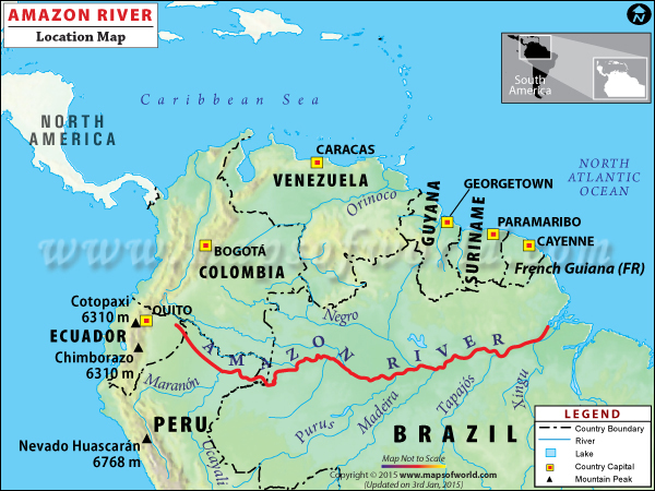
The Amazon River maintains an average discharge of approximately 209,000 cubic meters per second (m³/s), making it the largest river by volume globally. This immense flow rate accounts for roughly 20% of the total riverine freshwater entering the world's oceans, driven by a massive 7-million-square-kilometer drainage basin and intense tropical precipitation.
The sheer scale of the Amazon River’s flow rate is often difficult to visualize. To put it in perspective, the amount of water the Amazon releases into the Atlantic Ocean every second is enough to fill more than 80 Olympic-sized swimming pools. As of 2026, hydrologists and climatologists continue to monitor this system as the primary regulator of the South American climate and a significant driver of global ocean circulation. Understanding the mechanics behind this flow rate requires an analysis of geography, meteorology, and the complex seasonal cycles of the Amazon Basin.
Quantifying the Volume: What Makes the Amazon Unique?
When discussing the Amazon River flow rate explained, it is essential to distinguish between river length and discharge volume. While the Nile River often competes with the Amazon for the title of "longest river," there is no competition regarding volume. The Amazon’s average discharge of 209,000 m³/s far exceeds its closest rival, the Congo River, which averages about 41,000 m³/s.
The discharge of the Amazon is so powerful that it creates a "freshwater plume" in the Atlantic Ocean. This plume can be detected up to 400 kilometers (250 miles) away from the river’s mouth, significantly reducing the salinity of the ocean surface in that region. This phenomenon demonstrates that the Amazon is not merely a channel of water but a massive hydrological engine that influences marine ecosystems far beyond the South American coastline.
The Scale of Discharge Compared to Other Giants
To understand the magnitude, one must look at the combined output of other major rivers. The Amazon’s flow is greater than the next seven largest independent rivers combined. In the United States, the Mississippi River—a hydrological giant in its own right—averages approximately 16,792 m³/s. This means the Amazon is more than 12 times more voluminous than the Mississippi.
| River Name | Country/Region | Average Discharge (m³/s) | Drainage Basin Area (km²) |
|---|---|---|---|
| Amazon | South America | 209,000 | 7,050,000 |
| Congo | Africa | 41,000 | 3,687,000 |
| Ganges-Brahmaputra | Asia | 38,000 | 1,731,334 |
| Orinoco | South America | 33,000 | 880,000 |
| Madeira (Amazon Trib.) | South America | 31,200 | 1,420,000 |
| Yangtze | China | 30,166 | 1,808,500 |
| Mississippi | United States | 16,792 | 3,202,230 |
The Mechanics of Discharge: Why Is the Flow So High?
The Amazon's record-breaking flow rate is the result of a "perfect storm" of geographical and meteorological conditions. Three primary factors contribute to this hydrological dominance: the size of the drainage basin, the presence of the Andes Mountains, and the equatorial rainfall patterns.
The Vastness of the Amazon Basin
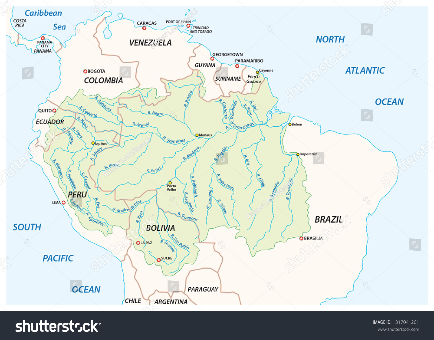
The Amazon Basin covers nearly 40% of the South American continent. Every drop of rain that falls within this 7-million-square-kilometer area (roughly the size of the contiguous United States) is funneled toward the Amazon mainstem. This basin acts as a massive collector, gathering water from diverse ecosystems, including the high-altitude Andean peaks, the sprawling Matto Grosso plateaus, and the low-lying rainforests of the central basin.
The Orographic Effect of the Andes
The Andes Mountains, running along the western edge of South America, serve as a massive wall for moisture-laden air masses traveling from the Atlantic. As trade winds push humid air westward across the basin, the air hits the Andes and is forced upward. This process, known as orographic lift, causes the moisture to cool and condense, resulting in persistent, heavy rainfall on the eastern slopes. This runoff feeds the headwaters of major tributaries like the Marañón and Ucayali, providing the initial momentum for the river's massive flow.
Tropical Rainfall and "Rivers in the Sky"
The Amazon is situated in the Intertropical Convergence Zone (ITCZ), a region characterized by high humidity and frequent thunderstorms. Additionally, the rainforest itself contributes to its own rainfall through a process called evapotranspiration. Trees pull water from the soil and release it into the atmosphere, creating "flying rivers"—massive currents of water vapor that circulate throughout the basin and fall again as rain. This recycling of water ensures that the river remains consistently fed throughout the year, even during the "drier" months.
Seasonal Variability and the Hydrograph
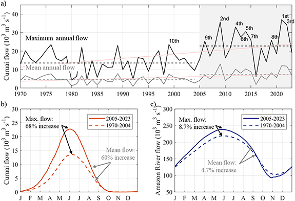
While the average flow rate is 209,000 m³/s, the Amazon experiences significant seasonal fluctuations. The hydrological cycle of the Amazon is characterized by a "flood pulse," which is the predictable rise and fall of water levels throughout the year.
The Wet Season Peak
During the peak of the wet season, which generally occurs between May and July, the flow rate can surge to over 300,000 m³/s. At this time, the river's depth can increase by 12 to 15 meters (40 to 50 feet), and the width can expand from 10 kilometers to over 40 kilometers in some sections. These floodwaters spill into the várzea (flooded forests), which are crucial for nutrient cycling and the life cycles of many aquatic species.
The Dry Season Trough
In the dry season, typically between September and November, the discharge drops. Even at its lowest point, however, the Amazon remains the largest river in the world, often maintaining a flow of approximately 100,000 m³/s. By 2026, researchers have noted that climate anomalies, such as El Niño and La Niña cycles, are increasingly causing extremes in these seasonal variations, leading to record-breaking droughts or unprecedented flooding in certain sub-basins.
Key Monitoring Stations: The Role of Óbidos
Measuring the flow of a river as large as the Amazon presents significant technical challenges. The primary point for quantifying the total discharge of the Amazon is the Óbidos gauging station in Brazil.
Located about 600 kilometers from the Atlantic Ocean, Óbidos is the last point where the river is confined to a single, deep channel before it begins to branch out into the massive delta and estuary system. At Óbidos, the river is approximately 2.3 kilometers wide and reaches depths of over 90 meters.
Hydrologists use Óbidos as the gold standard for data collection because:
- Channel Geometry: The narrowing of the river at this point allows for more accurate cross-sectional measurements.
- Tidal Influence: It is far enough upstream to be largely unaffected by the daily tidal fluctuations of the Atlantic, which can push seawater back into the river mouth.
- Historical Continuity: Decades of data from Óbidos allow scientists to track long-term trends in water volume, sediment transport, and the impacts of deforestation on the water cycle.
Technical Challenges in Measuring Flow
As of 2026, the methodology for measuring river discharge has evolved from simple mechanical flow meters to advanced satellite and acoustic technologies. Measuring the Amazon requires a multi-faceted approach due to its depth and velocity.
Acoustic Doppler Current Profilers (ADCP)
The most common tool for modern flow measurement is the ADCP. Mounted on boats, these devices emit sound pulses that bounce off particles in the water. By measuring the frequency shift (the Doppler effect) of the returning sound, hydrologists can determine the water's velocity at different depths and across the entire width of the river. This data is then combined with sonar-based depth mapping to calculate the total discharge.
Satellite Altimetry and GRACE-FO
Because the Amazon is so vast, ground-based stations cannot capture every nuance of the basin’s water storage. NASA and European Space Agency (ESA) satellites, such as the Gravity Recovery and Climate Experiment Follow-On (GRACE-FO), measure changes in Earth's gravity caused by shifting water masses. This allows scientists to calculate the total volume of water moving through the entire basin, including groundwater and soil moisture, providing a comprehensive view of the hydrological state that complements the flow rate data from Óbidos.
Environmental and Global Impacts of the Flow
The Amazon's flow rate is not just a statistic; it is a vital component of the Earth's climate system. The massive injection of freshwater and sediment into the Atlantic has several far-reaching consequences.
- Oceanic Salinity and Currents: The freshwater plume alters the density of the North Brazil Current. This helps drive the global "conveyor belt" of ocean currents, which regulates temperatures across the Northern Hemisphere.
- Carbon Sequestration: The Amazon carries billions of tons of sediment and organic matter. When this material reaches the ocean, much of it sinks to the seafloor, sequestering carbon for millennia and acting as a buffer against climate change.
- The Amazon Coral Reef: Interestingly, the massive flow of the Amazon initially led scientists to believe that coral reefs could not exist at the river's mouth due to the murky, freshwater conditions. However, a massive, 9,000-square-kilometer reef system was discovered beneath the plume, adapted to the unique conditions created by the river's discharge.
Frequently Asked Questions
Is the Amazon River flow rate increasing or decreasing?
Trends vary by sub-basin, but overall data suggests an increase in the intensity of the hydrological cycle. While some years see record droughts (like 2023-2024), the frequency of extreme high-water events at Óbidos has increased over the last two decades. This is attributed to both climate change and the impact of deforestation on the "flying rivers" that regulate rainfall.
How much sediment does the Amazon carry?
The Amazon transports an estimated 1.2 billion tons of sediment annually. Most of this sediment originates in the Andes Mountains. The high flow rate is essential for moving this material, which provides vital nutrients to both the floodplain forests and the marine life in the Atlantic.
How does the flow rate affect navigation?
Large ocean-going vessels can navigate the Amazon as far as Manaus, Brazil (1,500 km inland), and smaller ships can reach Iquitos, Peru (3,700 km inland). During the dry season, however, the dropping flow rate can expose sandbars and drastically limit the draft of vessels, sometimes cutting off remote communities from essential supplies.
What is the "Pororoca" and is it related to the flow rate?
The Pororoca is a tidal bore—a wave that travels up the Amazon River from the Atlantic. It occurs when the incoming high tide meets the powerful outflow of the river. The collision of the river's discharge and the ocean's tide creates waves up to 4 meters high that can travel 800 kilometers upstream.
Does deforestation affect the river's flow?
Yes. Forests act like a sponge, regulating the release of water into the river system. Deforestation leads to faster runoff, which can increase the severity of floods during the wet season and lead to lower flow rates during the dry season, as there is less evapotranspiration to create rain.
Recommendation for Further Action
For those interested in real-time monitoring of the Amazon River, the Brazilian National Water Agency (ANA) provides accessible hydrological data through its HidroWeb portal. Additionally, the UNESCO World Water Assessment Programme offers comprehensive reports on the status of major river basins. If you are conducting research or planning a project related to South American hydrology, prioritize data from the Óbidos station, as it remains the most reliable point for measuring the total output of this extraordinary river system.