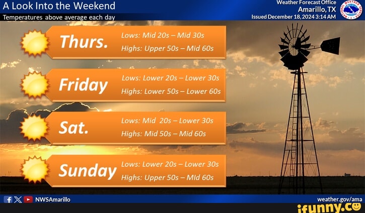
Amarillo, Texas, features a semi-arid climate characterized by significant seasonal variations and large daily temperature swings. The average annual high is approximately 71°F (22°C), while the average low is 44°F (7°C). July is the hottest month, averaging 92°F, while January is the coldest, with lows averaging 24°F.
The climate of Amarillo is defined by its position in the Texas Panhandle, sitting atop the Llano Estacado at an elevation of approximately 3,670 feet. This high-altitude location, combined with its mid-continent position, creates a weather profile that is vastly different from the humid subtropical regions of East or South Texas. As of 2026, climate data continues to show that while Amarillo enjoys over 260 days of sunshine annually, it remains one of the most volatile weather environments in the United States due to its exposure to rapid atmospheric changes.
Understanding the "average" temperature in Amarillo requires more than looking at a single number. Because the air is relatively dry, the region experiences high diurnal temperature variation—a technical term for the difference between the daily high and the daily low. It is common for temperatures to fluctuate by 30 to 40 degrees Fahrenheit within a single 24-hour period.
Annual Temperature and Climate Overview
The following data represents the standard meteorological averages for Amarillo. These figures are based on long-term climate normals provided by the National Weather Service and updated observations through 2026.
| Month | Average High (°F) | Average Low (°F) | Average Mean (°F) | Record High (°F) | Record Low (°F) |
|---|---|---|---|---|---|
| January | 50 | 24 | 37 | 84 | -16 |
| February | 54 | 27 | 41 | 89 | -11 |
| March | 63 | 34 | 49 | 96 | -3 |
| April | 71 | 43 | 57 | 99 | 13 |
| May | 80 | 53 | 67 | 104 | 26 |
| June | 89 | 62 | 76 | 111 | 38 |
| July | 92 | 67 | 80 | 108 | 51 |
| August | 90 | 66 | 78 | 107 | 48 |
| September | 83 | 58 | 71 | 103 | 30 |
| October | 72 | 46 | 59 | 95 | 14 |
| November | 60 | 34 | 47 | 88 | -1 |
| December | 50 | 25 | 38 | 83 | -8 |
Winter: December through February
Winter in Amarillo is characterized by cold nights and surprisingly mild afternoons. Because of the low humidity and high elevation, the sun feels quite warm even when the ambient air temperature is in the 40s. However, the region is famous for "Blue Northers"—powerful cold fronts that sweep down from the Rockies or the Great Plains, causing temperatures to drop 30 degrees or more in just a few hours.
In January, the coldest month, the average high is 50°F, but this is a mathematical average of extremes. On many days, the temperature may reach 65°F under clear skies, while on others, it may struggle to rise above 20°F during a snowstorm. The average low of 24°F means that freezing temperatures are a nightly occurrence.
February begins the slow climb toward spring, with an average high of 54°F. While statistically warmer than January, February often sees some of the region's most significant snowfall events. The air remains very dry, which contributes to the "static electricity" season that many residents find notable during these months.
Spring: March through May
Spring is arguably the most volatile season in the Texas Panhandle. This is the period when the "clash of air masses" occurs: cold, dry air from the north meets warm, moist air from the Gulf of Mexico. This interaction results in the high winds for which Amarillo is well-known.
March averages a high of 63°F, but it is also the windiest month of the year. Average wind speeds often hover around 13-15 mph, but gusts exceeding 40 mph are frequent. The temperature swings in March are legendary; it is entirely possible to experience a 75°F afternoon followed by a 25°F morning with a light dusting of snow.
By May, the average high reaches 80°F. This month marks the beginning of the "wet" season. While Amarillo is semi-arid, most of its annual precipitation comes from thunderstorms in the late spring and early summer. The average low in May is a comfortable 53°F, making it one of the most pleasant times for outdoor activities, provided one keeps an eye on the rapid development of afternoon storms.
Summer: June through August
Summer in Amarillo is hot but lacks the oppressive humidity found in Dallas or Houston. The high elevation (nearly 4,000 feet) provides a significant advantage: as soon as the sun sets, the temperature drops rapidly. This "radiative cooling" is a hallmark of the High Plains climate.
July is the peak of summer, with an average high of 92°F. On average, Amarillo sees about 40 to 50 days per year where the temperature reaches or exceeds 90°F. However, heatwaves can push temperatures above 100°F. Unlike the coastal regions, the "heat index" in Amarillo rarely exceeds the actual temperature because the low dew points allow the body's natural cooling (sweat evaporation) to work efficiently.
August remains hot with an average high of 90°F, but the nights begin to cool down slightly toward the end of the month. This period is also characterized by "monsoonal" moisture patterns, where moisture from the Pacific and Gulf can trigger localized, heavy downpours that provide brief relief from the heat.
Fall: September through November
Autumn is widely considered the most stable and pleasant season in Amarillo. The high winds of spring have subsided, and the intense heat of July has passed.
September averages a high of 83°F. The days are typically sunny and calm, though the first "cool fronts" begin to arrive late in the month. By October, the average high drops to 72°F, and the foliage in the Palo Duro Canyon begins to change. The air becomes crisp, and the average low of 46°F necessitates a light jacket in the mornings.
November marks the transition back to winter. The average high is 60°F, but the lows frequently dip toward the freezing mark (34°F). This is the month when the first freezes typically occur, ending the growing season for local agriculture.
Technical Factors Influencing Amarillo's Temperatures
Several geographical and meteorological factors contribute to the specific temperature patterns observed in the Texas Panhandle.
The Impact of Elevation
Amarillo’s elevation of 3,670 feet is a primary driver of its climate. In the troposphere, temperature generally decreases with height (the lapse rate). This is why Amarillo is consistently 5 to 10 degrees cooler than lower-elevation cities at the same latitude, such as Wichita Falls or Oklahoma City. The thinner atmosphere also allows solar radiation to be more intense during the day and allows heat to escape more quickly at night.
Diurnal Temperature Variation
In humid climates, water vapor in the air acts as a greenhouse gas, trapping heat near the surface at night. Because Amarillo is semi-arid, there is less water vapor to hold onto that heat. Consequently, even after a 95°F day in June, the temperature will often fall to a refreshing 62°F by sunrise. This 30-plus degree swing is a critical consideration for HVAC planning and energy consumption in the region.
The "Blue Norther" Phenomenon
The geography of the Great Plains acts as a funnel for cold arctic air. With no mountain ranges to the north to block the wind, cold fronts can accelerate across the flat terrain. Meteorologically, these are known as "anafronts." When a Blue Norther hits Amarillo, the temperature can drop from 70°F to 30°F in less than three hours. This necessitates a "layered" approach to clothing that is a staple of Panhandle life.
Comparison: Amarillo vs. Other Texas Cities
To put Amarillo's average temperatures in perspective, it is helpful to compare them with other major Texas metropolitan areas. As of 2026, the temperature disparities remain a key factor for those relocating within the state.
| City | July Avg High | Jan Avg Low | Elevation (ft) | Climate Type |
|---|---|---|---|---|
| Amarillo | 92°F | 24°F | 3,670 | Semi-Arid |
| Dallas | 96°F | 37°F | 430 | Humid Subtropical |
| Houston | 94°F | 45°F | 50 | Humid Subtropical |
| Austin | 96°F | 42°F | 489 | Humid Subtropical |
| El Paso | 95°F | 33°F | 3,740 | Desert |
Amarillo is significantly colder in the winter than any other major Texas city. While El Paso shares a similar elevation, its more southern latitude and desert classification mean it stays slightly warmer on average during the winter nights than Amarillo.
Frequently Asked Questions
What is the hottest temperature ever recorded in Amarillo?
The record high for Amarillo is 111°F, which occurred on June 26, 2011. While temperatures over 100°F occur annually, reaching the 110s is extremely rare and usually requires a combination of a stagnant high-pressure system and extreme drought conditions.
Does it snow often in Amarillo during the winter?
Yes, Amarillo receives an average of 17.8 inches of snow per year. However, snowfall is highly variable. Some years see less than 5 inches, while others, like the winter of 1918-1919, recorded over 40 inches. Because of the wind, snow in Amarillo often drifts, meaning that a 4-inch snowfall can create 3-foot drifts in some areas.
Why is Amarillo so much colder than Dallas?
The primary reason is elevation and latitude. Amarillo is roughly 250 miles north of Dallas and over 3,000 feet higher in elevation. For every 1,000 feet of elevation gain, the temperature typically drops by 3.5°F. Additionally, Amarillo is closer to the source of arctic air masses moving down from Canada.
When is the first frost usually expected?
Historically, the first freeze (32°F or below) occurs in late October, usually around October 20th to 25th. The last freeze of the spring typically occurs in mid-to-late April. This provides a growing season of approximately 180 to 200 days.
Is the humidity really that low?
Yes. The average afternoon relative humidity in the summer often drops to 20% to 30%. While this makes the heat more tolerable, it also increases the risk of wildfires during dry spells and causes rapid evaporation of surface water, which is a major concern for the regional Ogallala Aquifer.
Planning for the Amarillo Climate
If you are visiting or moving to Amarillo in 2026, the best strategy for managing the temperature is preparedness for change. Even in the height of summer, a light sweater may be necessary for late-evening outdoor events once the sun goes down. In the winter and spring, always check the short-term forecast for "wind chill" values, as the constant breeze can make a 40°F day feel like 25°F.
For those managing properties or gardening, pay close attention to the "hardiness zone." Amarillo is generally classified in USDA Zone 7a, meaning plants must be able to withstand temperatures as low as 0°F to 5°F during the peak of winter.