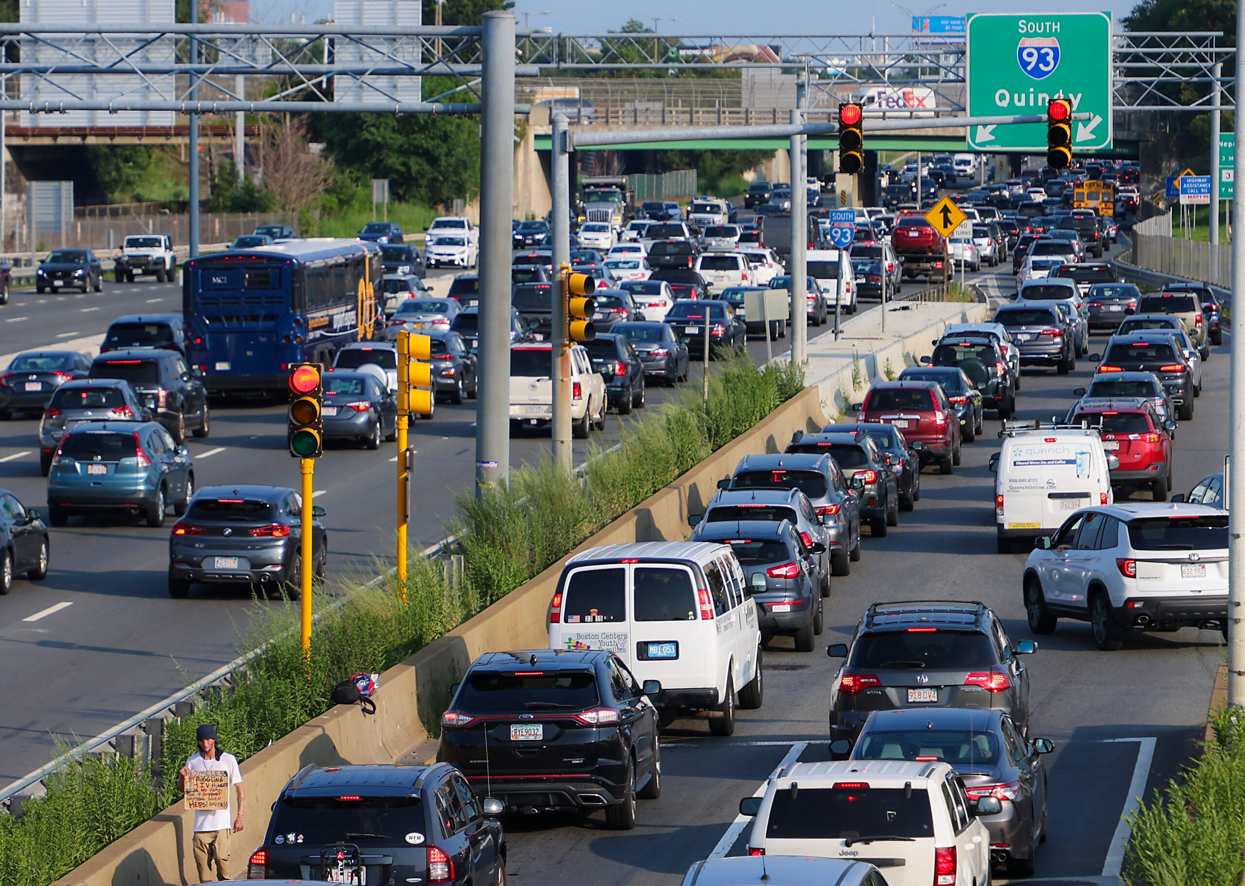
Navigating I-93 traffic in Boston requires a strategic approach to peak commuting windows, typically 6:30 AM to 9:30 AM and 3:30 PM to 7:00 PM. Success depends on utilizing real-time MassDOT data, understanding the specific mechanics of chokepoints like the Braintree Split and the Zakim Bridge, and leveraging HOV "zipper" lanes during high-volume periods.
Interstate 93 (I-93) serves as the primary north-south artery for the Greater Boston metropolitan area, cutting directly through the heart of the city via the Thomas P. "Tip" O'Neill Jr. Tunnel. In 2026, it remains one of the most heavily congested stretches of highway in the United States. For residents of the North Shore, the South Shore, and the technical hubs of the 128-belt, I-93 is an unavoidable reality of daily life. Understanding the nuances of this corridor—from the technical layout of the Central Artery to the seasonal patterns of New England weather—is essential for minimizing travel time and ensuring road safety.
The Geography of I-93: Segments and Characteristics
To master I-93 traffic, one must first understand that the highway is effectively divided into three distinct psychological and physical segments: the Northern Expressway, the Central Artery (the Tunnel), and the Southeast Expressway. Each segment presents unique challenges to the motorist.
The Northern Expressway (I-93 North of Boston)
Extending from the New Hampshire border down through Methuen, Andover, and Medford, the northern stretch of I-93 facilitates the "super-commute" for those living in the Merrimack Valley. As the road approaches the city, traffic density increases exponentially near the intersection with I-95 (Route 128) in Woburn. This interchange is a notorious "cloverleaf" style friction point where merging traffic from the tech corridor slows the main line to a crawl during morning hours.
The Central Artery (The O'Neill Tunnel and Zakim Bridge)
The crown jewel of the "Big Dig," the Central Artery is a marvel of underground engineering. However, the transition from the wide-open spans of the Leonard P. Zakim Bunker Hill Memorial Bridge into the enclosed O'Neill Tunnel creates a "canyon effect" that causes drivers to instinctively brake, leading to "phantom traffic jams." In 2026, the tunnel's advanced ventilation and monitoring systems are fully operational, but the sheer volume of vehicles—often exceeding 200,000 per day—frequently surpasses the design capacity of the three to four lanes available.
The Southeast Expressway (I-93 South of Boston)
Running from the South Station area down toward the Braintree Split, the Southeast Expressway is perhaps the most scrutinized stretch of road in Massachusetts. It is characterized by the "Zipper Lane," a moveable barrier system that creates a High-Occupancy Vehicle (HOV) lane to favor the direction of peak travel. The "S-curves" in Milton remain a significant safety hazard and a primary cause of rubbernecking delays.
Identifying Key Chokepoints and Bottlenecks
Reliable navigation of 93 Boston traffic depends on anticipating specific locations where flow consistently breaks down. These bottlenecks are not random; they are the result of infrastructure limitations and high-density merging.
- The Braintree Split: This is where I-93, Route 3, and I-95 (Route 128) converge. It is arguably the most complex interchange in New England. Southbound traffic heading toward Cape Cod via Route 3 often backs up for miles, spilling over into the I-93 travel lanes.
- The Leverett Circle Connector: For those merging onto I-93 from the West End or Storrow Drive, the Leverett Circle ramp is a frequent site of minor collisions and aggressive merging, which ripples back through the Zakim Bridge.
- The "S-Curves" in Milton: These sharp turns were designed for lower speeds than modern traffic attempts to maintain. In wet or icy conditions, this segment becomes a hotspot for accidents that can paralyze the Southeast Expressway for hours.
- The Sullivan Square/Assembly Square Merge: In the north, the influx of commuters from Somerville and Everett via Route 28 and Route 99 creates a "turbulence zone" where I-93 enters the inner core of the city.
Real-Time Monitoring and 2026 Traffic Technology
In 2026, the methods for checking 93 Boston traffic have evolved beyond traditional radio reports. While 1030 AM (WBZ) remains a staple for many, digital integration provides more granular data.
MassDOT Integrated Systems
The Massachusetts Department of Transportation (MassDOT) operates a sophisticated network of overhead sensors and cameras. Drivers should utilize the Mass511 system, which provides real-time speed data and incident reports. In 2026, this data is often fed directly into vehicle heads-up displays via V2I (Vehicle-to-Infrastructure) protocols, alerting drivers to slowdowns before they become visible.
Predictive Analytics
Modern navigation apps like Waze and Google Maps now use predictive AI to suggest "time-to-leave" windows based on historical 93 traffic patterns and current weather forecasts. For example, if a Nor'easter is predicted for the afternoon, these systems will often suggest a 2:00 PM departure to avoid the total gridlock that occurs when snow begins to accumulate on the Zakim Bridge.
| Feature | Segment: Northern Expressway | Segment: Central Artery | Segment: Southeast Expressway |
|---|---|---|---|
| Primary Peak Direction | Southbound (AM) / Northbound (PM) | Bi-directional Congestion | Northbound (AM) / Southbound (PM) |
| Key Interchange | I-95/Rt 128 (Woburn) | Zakim Bridge / Storrow Dr | The Braintree Split |
| HOV Facilities | None | Limited Access | "Zipper Lane" (Moveable Barrier) |
| Typical Delay (Peak) | 20–45 Minutes | 15–30 Minutes | 30–60 Minutes |
| Speed Limit | 55–65 MPH | 45 MPH | 45–55 MPH |
The Impact of the MBTA and Public Transit
The state of the Massachusetts Bay Transportation Authority (MBTA), or "The T," is inextricably linked to I-93 traffic levels. When the Red Line or the Commuter Rail (specifically the Old Colony and Lowell Lines) experiences service interruptions, the volume on I-93 increases almost immediately.
In 2026, the "South Coast Rail" project has shifted some volume away from the Southeast Expressway, but the highway remains the preferred method for those requiring "last-mile" flexibility. Commuters are encouraged to use the Park and Ride lots at stations like Anderson/Woburn or Quincy Adams to bypass the most congested urban segments of I-93.
Seasonal and Environmental Factors
Boston’s weather is a primary variable in I-93 traffic reliability. The highway’s North-South orientation means it often crosses "snow lines" where rain in the city becomes ice in the suburbs.
- Winter Operations: MassDOT utilizes a "liquid-only" de-icing strategy in certain sections of the O'Neill Tunnel to prevent drainage clogs. However, the open-air sections of the Southeast Expressway are prone to black ice, particularly on the bridge decks over the Neponset River.
- The "Sun Glare" Effect: During the autumn and spring equinoxes, the morning commute southbound into Boston and the evening commute northbound out of the city face intense sun glare. This leads to a measurable drop in average speeds as drivers adjust their visors and increase following distances.
- Event Traffic: Proximity to the TD Garden (located directly above the tunnel) means that Boston Celtics or Bruins home games, as well as major concerts, can create localized gridlock on I-93 ramps starting two hours before event time.
Strategies for the Daily Commuter
To survive I-93, one must adopt a tactical mindset. Relying on "luck" is not a viable strategy for 2026.
The Zipper Lane Rules
If you are traveling on the Southeast Expressway with two or more occupants, the HOV lane (Zipper Lane) is your best tool. It typically runs Northbound from 5:00 AM to 10:00 AM and Southbound from 2:00 PM to 7:00 PM. Note that electric vehicles (EVs) with specific clean-air decals may also be eligible for this lane, though regulations are strictly enforced by the State Police.
Off-Peak Flexibility
If your employment allows for a "shifted" schedule, traveling even 30 minutes outside of the core peak (e.g., leaving at 6:00 AM instead of 6:30 AM) can reduce your commute by up to 50%. The "rebound" traffic—the secondary wave of commuters who try to wait out the rush—usually hits the 93 corridor around 10:30 AM.
Toll Management (EZPass)
While I-93 itself is not a tolled road in the traditional sense, many of its exits lead directly into tolled infrastructure, such as the Sumner, Callahan, and Ted Williams Tunnels (connecting to Logan Airport and East Boston). Ensure your EZPass MA transponder is mounted correctly; "pay-by-plate" invoices are significantly more expensive and can lead to registration non-renewal if ignored.
Safety and Incident Response
Because of the narrow shoulders in the O'Neill Tunnel and on the Zakim Bridge, even a minor "fender bender" can cause a five-mile backup within minutes.
- Move It Law: If you are involved in a minor accident on I-93 with no injuries, Massachusetts law requires you to move your vehicle to the shoulder or the next exit to keep travel lanes clear.
- MassDOT Highway Assistance Program: Sponsored by private entities but operated by the state, these "Yellow Trucks" patrol I-93 during peak hours. They provide free jump-starts, flat tire changes, and a small amount of fuel to get stalled vehicles moving again.
- Tunnel Safety: If your vehicle breaks down inside the O'Neill Tunnel, stay in your vehicle and call 911. The tunnel is monitored by 24/7 video, and dispatchers will immediately send a tow unit to pull you to a safe "refuge" area.
Frequently Asked Questions
Why is I-93 traffic so bad at the Braintree Split?
The Braintree Split is a major convergence point where three high-volume routes (I-93, I-95, and Route 3) merge. The design forces drivers to make quick lane changes across multiple lanes of high-speed traffic, causing significant "merging friction." Additionally, the volume of cars coming from the South Shore and Cape Cod frequently exceeds the capacity of the two-lane ramps leading onto the Southeast Expressway.
Are there tolls on Interstate 93 in Boston?
No, I-93 is not a tolled highway. However, it is the primary feeder for several tolled routes, including the Massachusetts Turnpike (I-90) and the harbor tunnels (Ted Williams, Sumner, and Callahan). If you accidentally exit 93 into one of these tunnels, you will be charged via the EZPass electronic tolling system.
How do I check the 93 "Zipper Lane" status?
The Zipper Lane status is usually posted on overhead Electronic Message Signs (EMS) along I-93 and Route 3. Generally, it is open for the Northbound commute in the mornings (5 AM – 10 AM) and the Southbound commute in the afternoons (2 PM – 7 PM). MassDOT may adjust these times during holidays or major weather events.
What is "Storrowing" and does it affect I-93?
"Storrowing" occurs when an over-height truck becomes wedged under a low-clearance bridge on Storrow Drive. While this happens on a parallel road, it has a massive impact on I-93. When Storrow Drive is shut down due to a stuck truck, thousands of vehicles are diverted onto I-93, often causing gridlock in the O'Neill Tunnel and on the Zakim Bridge.
What is the best time to avoid 93 Boston traffic?
To avoid the worst congestion, aim to be through the downtown Boston segment before 6:15 AM or after 7:30 PM. On weekends, traffic is surprisingly heavy on Saturday afternoons (12:00 PM – 4:00 PM) due to shopping and sporting events, and Sunday evenings as people return from the North or South Shores.
Practical Recommendation for 2026 Commuters
For anyone regularly dealing with 93 Boston traffic, the most effective tool is information redundancy. Never start your engine without checking a real-time GPS app, even if you have driven the route for twenty years. In 2026, the volatility of the road—driven by construction, weather, and the sheer density of the Boston metro area—means that a route that was clear five minutes ago could be blocked now. If the "T" is running reliably, consider using the Commuter Rail for trips into the Financial District or North End; the time saved in the Zakim Bridge bottleneck often outweighs the lack of a personal vehicle.