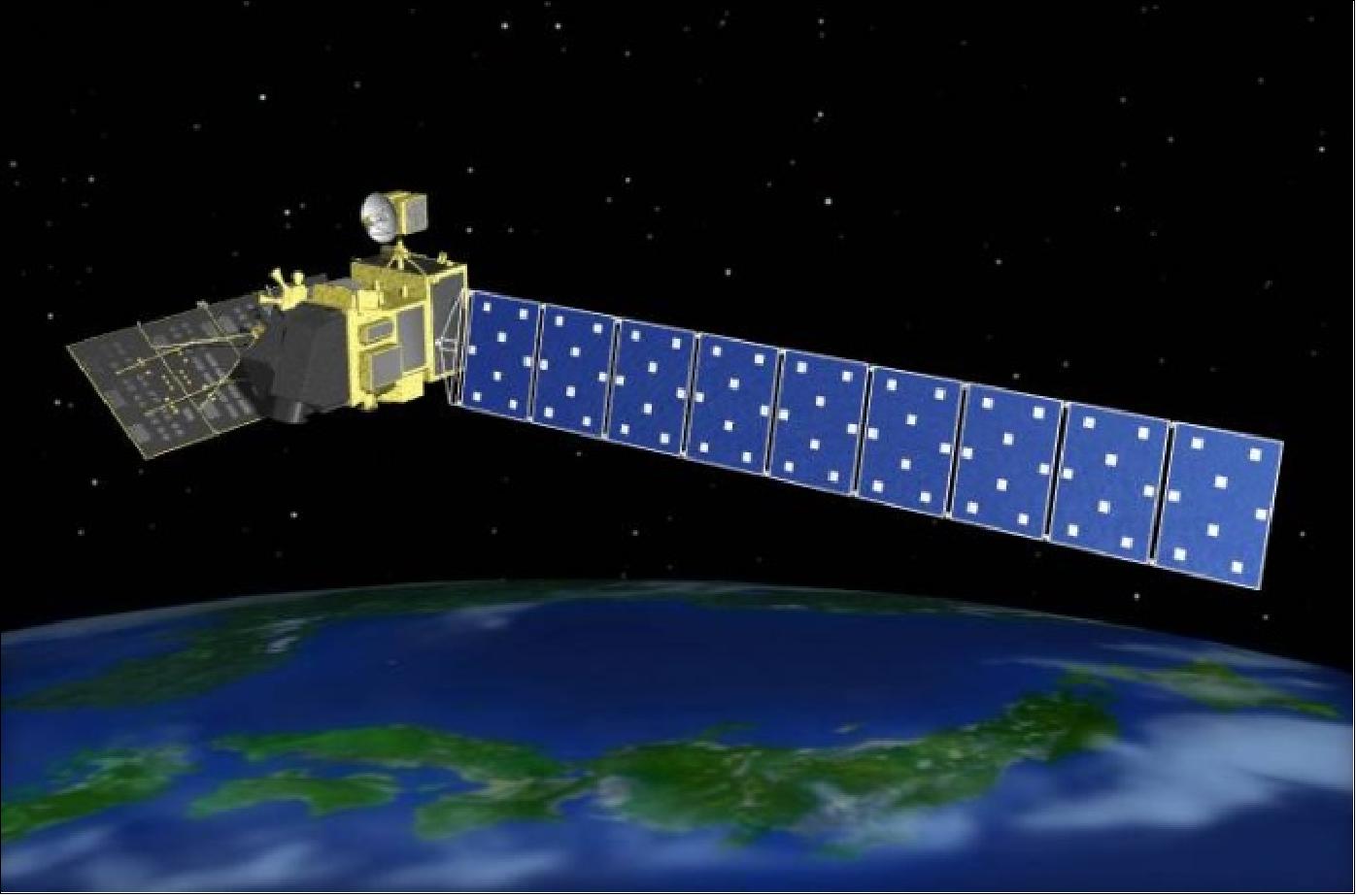
The Advanced Land Observing Satellite-2 (ALOS-2), designated "DAICHI-2," provides critical high-resolution Earth imaging capabilities using advanced L-band synthetic aperture radar technology. Operated by the Japan Aerospace Exploration Agency (JAXA), the satellite enables continuous day-and-night, all-weather monitoring of the Earth's surface for disaster management, environmental observation, infrastructure monitoring, and maritime surveillance.
Introduction to ALOS-2 and Its Mission Objectives
Launched on May 24, 2014, by the Japan Aerospace Exploration Agency (JAXA), the Advanced Land Observing Satellite-2 (ALOS-2) represents a cornerstone in spaceborne Earth observation. Building upon the legacy of its predecessor, ALOS (DAICHI), the mission was designed to overcome the limitations of optical imaging sensors, which are frequently hindered by cloud cover, darkness, and severe weather events. By relying on active microwave remote sensing, ALOS-2 can penetrate clouds and capture detailed surface data regardless of atmospheric conditions or illumination.
The primary mission objectives of ALOS-2 focus on high-priority societal needs. These include disaster monitoring for earthquakes, volcanic eruptions, landslides, and floods; environmental monitoring of global forests and agricultural regions; infrastructure assessment for ground subsidence and structural deformation; and maritime surveillance for sea ice mapping and illegal vessel detection. Through its sophisticated radar payload, the satellite delivers the high-resolution imagery required by scientific researchers, emergency response agencies, and commercial entities to analyze changing terrestrial dynamics with precision.
Technical Specifications of the PALSAR-2 Radar Instrument
At the heart of ALOS-2's high-resolution imaging capability is the Phased Array type L-band Synthetic Aperture Radar 2 (PALSAR-2). L-band radar operates at a longer wavelength (approximately 24 centimeters) compared to C-band or X-band systems. This longer wavelength provides distinct advantages for Earth observation, particularly in vegetated areas, because L-band microwaves can penetrate forest canopies to interact with woody trunks and the underlying ground surface.
PALSAR-2 features several observing modes that balance spatial resolution, swath width, and polarization configurations to suit diverse operational requirements:
- Spotlight Mode: Delivers the highest spatial resolution, achieving ground resolutions of up to 1 to 3 meters within a focused, targeted footprint. This mode is ideal for detailed structural assessments of specific urban areas, disaster sites, or critical infrastructure.
- Stripmap Mode: Provides standard high-resolution imaging with resolutions ranging from 3 to 10 meters across a moderate swath width, balancing detail and spatial coverage.
- ScanSAR Mode: Maximizes coverage efficiency by offering wide swaths up to 350 to 490 kilometers, albeit with lower spatial resolution (typically 60 to 100 meters). This mode is essential for broad-area monitoring, such as tracking seasonal deforestation or regional sea ice movement.
Additionally, PALSAR-2 supports advanced polarimetric capabilities, including dual-polarization and full quad-polarization modes. Quad-pol data allows scientists to analyze the physical scattering mechanisms of surface materials, distinguishing between surface bounce, volume scattering (from vegetation), and double-bounce scattering (from urban structures or flooded forests).
Orbit Characteristics and Observation Geometry
The operational performance of ALOS-2 is heavily dictated by its orbital configuration. The satellite occupies a Sun-synchronous subrecurrence orbit at an altitude of approximately 628 kilometers. This orbit inclination ensures that the satellite passes over any given location on Earth at roughly the same local solar time, maintaining consistent illumination and shadowing conditions for optical comparisons, though radar systems are less dependent on solar angle.
Key orbital parameters of ALOS-2 include:
| Orbital Parameter | Specification | Operational Significance |
|---|---|---|
| Altitude | ~628 km | Optimizes radar signal return strength while maintaining manageable atmospheric drag. |
| Inclination | 97.9 degrees | Provides near-polar coverage, enabling observation of high-latitude regions and global landmasses. |
| Revisit Time | 14 days | Allows regular monitoring intervals for change detection and Interferometric SAR (InSAR) processing. |
| Orbit Period | ~97 minutes | Determines the frequency of data passes over specific geographic zones. |
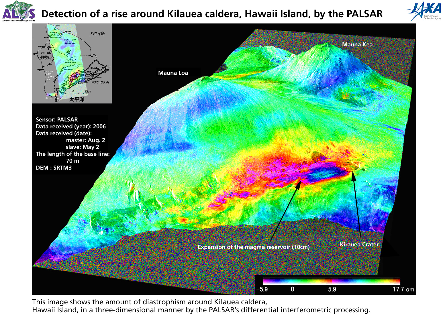
The 14-day repeat cycle is particularly crucial for Interferometric Synthetic Aperture Radar (InSAR) applications. By comparing phase data from two distinct passes over the same location separated by 14 days or multiples thereof, geophysicists can generate millimeter-scale displacement maps. These maps reveal subtle ground deformations caused by tectonic faults, volcanic inflation, landslides, and urban subsidence.
Disaster Management and Emergency Response Applications
One of the most vital functions of ALOS-2 is providing rapid-response imagery during natural disasters. When earthquakes, tsunamis, volcanic eruptions, or major typhoons occur, traditional optical satellites often face delays due to persistent cloud cover or smoke. ALOS-2 bypasses these visual barriers, delivering actionable radar imagery to disaster management authorities within hours of data acquisition.
In the wake of seismic events, emergency response agencies utilize PALSAR-2 ScanSAR and Spotlight data to map affected infrastructure, identify blocked roads, and assess widespread structural damage. By applying InSAR techniques to pre- and post-disaster acquisitions, researchers can map coseismic crustal deformation fields, pin-pointing fault ruptures and slip distributions. Similarly, during flood events, the high contrast between dry land and water in L-band radar imagery allows accurate delineation of inundated zones, helping civil protection agencies direct rescue and relief operations effectively.
Environmental Monitoring and Carbon Accounting
Beyond emergency response, ALOS-2 plays a pivotal role in long-term environmental monitoring, particularly regarding global carbon cycles and tropical forest dynamics. Deforestation and forest degradation significantly contribute to global carbon emissions. The L-band radar frequency of PALSAR-2 is uniquely suited for forest observation because the microwaves interact directly with tree trunks and branches, which represent the primary biomass pool.
JAXA utilizes ALOS-2 data to generate global forest/non-forest maps and above-ground biomass estimates. These datasets support international climate initiatives, such as REDD+ (Reducing Emissions from Deforestation and Forest Degradation), by providing transparent, verifiable measurements of forest cover changes over time. Furthermore, the satellite monitors agricultural lands, tracking crop growth cycles, soil moisture variations, and irrigation patterns across large spatial scales.
Infrastructure Monitoring and Ground Deformation Analysis
Infrastructure integrity relies heavily on continuous monitoring to detect early warning signs of failure. ALOS-2 provides engineers and urban planners with the tools necessary to monitor ground stability over extensive geographic areas. Subsidence caused by groundwater extraction, tunneling, mining activities, or heavy structural loads can be tracked with high precision using persistent scatterer interferometry (PSI) and differential InSAR (DInSAR) methodologies applied to ALOS-2 archives.
The satellite's high-resolution spotlight and stripmap modes enable localized tracking of critical assets such as dams, bridges, pipelines, and transportation networks. Detecting millimeter-level shifts in these structures long before visible cracking occurs allows asset owners to implement proactive maintenance, mitigating catastrophic failure risks and reducing long-term repair costs.
Maritime Surveillance and Cryosphere Observation
Maritime domains and polar regions present continuous observational challenges due to harsh weather and remote locations. ALOS-2 contributes significantly to maritime security and environmental safety through dedicated observation modes tailored for water surfaces and ice sheets.
In maritime surveillance, the satellite detects vessels, monitors oil spills, and tracks illegal, unreported, and unregulated (IUU) fishing activities. Because radar backscatter from the ocean surface is altered by surface roughness and ship wakes, PALSAR-2 can identify metallic targets even under heavy cloud cover or at night. For cryosphere research, ALOS-2 maps sea ice extent, ice-shelf velocity, and iceberg drift. This data aids navigation routing in polar waters and provides essential climate indicators regarding polar ice mass balance.
Data Access, Processing, and User Integration
Accessing and utilizing ALOS-2 data involves established distribution channels managed by JAXA and authorized commercial partners. While raw Level-1 data requires specialized remote sensing software and technical expertise to process, processed derivative products are increasingly accessible to researchers, government bodies, and commercial enterprises.
To effectively work with ALOS-2 data, users generally follow a structured workflow:
- Needs Assessment: Define the required spatial resolution, polarization mode, and geographic area of interest.
- Data Ordering: Search JAXA’s science portal or authorized commercial distributors to identify available archive scenes or task new acquisitions.
- Preprocessing and Calibration: Apply orbit ephemeris data, radiometric calibration, and geometric terrain correction using digital elevation models (DEMs).
- Advanced Analysis: Perform InSAR processing, polarimetric decomposition, or object-based image classification depending on the specific application.
While research applications often qualify for subsidized data access through JAXA cooperative research agreements, commercial users typically acquire data through licensed distributors based on per-square-kilometer pricing models.
Frequently Asked Questions
What makes L-band radar superior to C-band or X-band for forestry applications?
L-band radar utilizes a longer wavelength of approximately 24 centimeters, allowing the microwaves to penetrate deeper into dense vegetation canopies. While C-band and X-band radars primarily reflect off the top layers of leaves and small branches, L-band waves interact directly with major branches, trunks, and the forest floor. This deeper penetration provides a more accurate measurement of total woody biomass and structural forest characteristics.
How does ALOS-2 perform observations during nighttime or cloudy conditions?
As an active radar satellite, ALOS-2 does not rely on reflected sunlight or optical clarity. Instead, it transmits its own microwave pulses toward the Earth's surface and measures the intensity and phase of the returning echo. Because microwaves freely pass through clouds, water vapor, smoke, and darkness, the satellite maintains identical imaging performance day and night, regardless of weather conditions.
What is the typical revisit frequency for ALOS-2 over a specific location?
ALOS-2 operates in a Sun-synchronous orbit with a exact repeat cycle of 14 days. This means the satellite passes over the exact same ground track every two weeks, providing a consistent temporal baseline for change detection and interferometric displacement analysis.
Can ALOS-2 data be used for real-time disaster response?
While ALOS-2 cannot stream continuous live video, it provides rapid tasking capabilities and expedited data delivery during major emergencies. JAXA frequently activates emergency observation protocols to retask the satellite over disaster zones, processing and distributing imagery to civil protection authorities within hours of downlink to support immediate rescue and assessment operations.
Conclusion and Operational Outlook
The Advanced Land Observing Satellite-2 remains a vital instrument in the global Earth observation architecture. By combining high-resolution L-band synthetic aperture radar with flexible observation modes and a stable orbital geometry, ALOS-2 delivers indispensable data for disaster mitigation, environmental protection, infrastructure management, and scientific research. As spaceborne radar technologies continue to evolve, the operational methodologies established by ALOS-2 lay a robust foundation for future land observation missions.