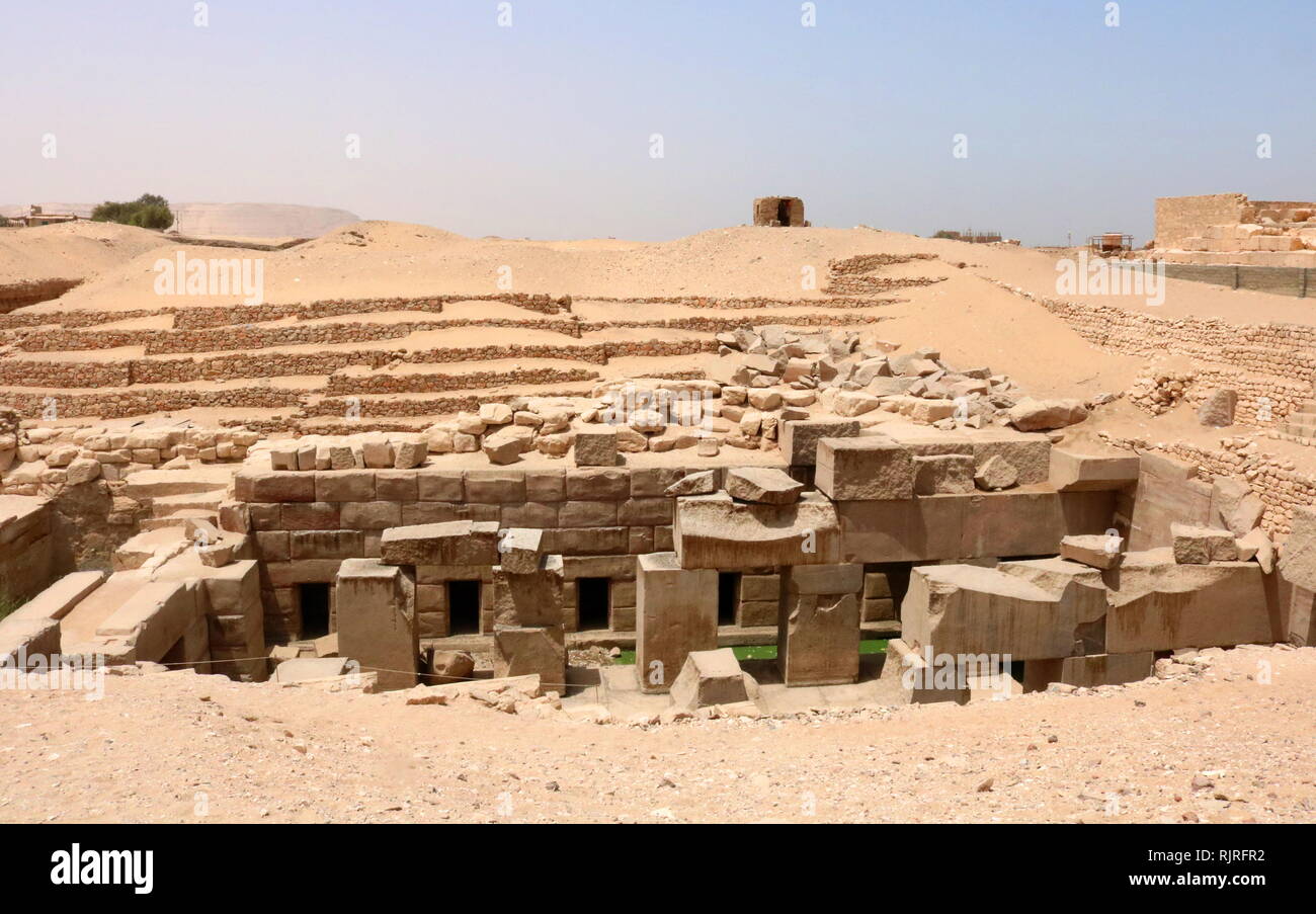
Ancient Egyptian cities were sophisticated urban centers characterized by grid-based planning, advanced hydrologic engineering, specialized social zoning, and climate-adapted architecture. Rather than existing merely as ceremonial temple sites, cities like Memphis, Thebes, Kahun, and Amarna integrated municipal water channels, administrative districts, residential quarters, and worker housing designed to maximize environmental control and state efficiency.
For centuries, popular perception framed ancient Egypt primarily as a civilization of stone monuments, tombs, and temples. However, modern archaeological methods—including satellite remote sensing, ground-penetrating radar, and targeted excavations—have revealed that ancient Egypt was home to dynamic, densely populated, and highly planned cities. These urban centers adapted to the unique ecology of the Nile River Valley, balancing annual flooding cycles with civic infrastructure, industrial zones, and residential sanitation.
The Foundations of Ancient Egyptian Urbanism
Urban development in ancient Egypt relied on a delicate balance between natural geography and state organization. The annual inundation (Hapy) of the Nile River dictated where and how communities could build. To survive and thrive, Egyptian architects and royal surveyors developed sophisticated approaches to land management and urban design.
- NILE RIVER & FLOODPLAIN ZONE
- Seasonal inundation deposits nutrient-rich silt
- Agricultural fields and primary water access
- ELEVATED LEVEE / LEVEE EDGES
- Natural high ground (Tells / Koms)
- Dense residential quarters & market districts
- PLANNED CIVIC & SACRED ENCLOSURES
- Thick perimeter mudbrick walls protecting temples
- State granaries, royal palaces, administrative hubs
Environmental Adaptation and the Nile Landscape
Egyptian cities were predominantly constructed on natural high ground—known as levees or tells (mounds formed by centuries of human habitation)—to protect residents from the high water levels of the annual flood. Agricultural fields occupied the low-lying basin lands, while habitations were clustered tightly on elevated ground to conserve precious arable land.
To manage the seasonal rise of the river, urban planners constructed network systems of canals, dikes, and artificial basins. These waterworks served a dual purpose: they directed floodwaters away from residential quarters during peak inundation and stored freshwater for domestic consumption, urban gardens, and transport during the dry season.
Zoned Urban Planning: Orthogonal vs. Organic City Growth
Archaeologists divide ancient Egyptian cities into two main structural categories: state-planned (orthogonal) cities and naturally evolved (organic) cities.
- State-Planned (Orthogonal) Settlements: Built by royal decree for specific purposes, such as royal jubilees, pyramid construction, or capital relocations. These cities featured strict grid layouts, uniform street widths, outer boundary walls, and clear socioeconomic segregation.
- Organic Municipalities: Developed over centuries around administrative or religious hubs. These cities grew radially, with narrow, winding alleys branching off major arterial roads that connected temple compounds to harbor fronts.
Regardless of overall growth patterns, internal zoning was standard. Urban space was systematically divided into distinct functional sectors: administrative hubs housing government archives, walled temple precincts, industrial sectors for metallurgy and pottery, commercial harbor docks, and segregated residential quarters.
Key Examples of Advanced Ancient Egyptian Cities
Several major urban centers highlight the versatility, scale, and technical ingenuity of ancient Egyptian city design across different historical periods.
Kahun (El-Lahun): The Earliest Documented Planned Worker City
Built during the Middle Kingdom under Pharaoh Senusret II (c. 1895 BCE), Kahun (located near modern El-Lahun) is one of the earliest preserved examples of fully planned orthogonal urbanism in the world. Constructed to house the priests, administrators, and craftsmen working on the nearby royal pyramid complex, the city covered approximately 14 acres within a heavy mudbrick perimeter wall.
Archaeological excavations led by Sir Flinders Petrie revealed a rigid, grid-based street pattern. Kahun was divided into two main sectors separated by an internal stone wall:
- The Eastern Sector: Contained large, multi-room villas for high-ranking officials and overseers. These homes featured central courtyards, private reception rooms, storage magazines, and dedicated drainage installations.
- The Western Sector: Consisted of uniform, smaller worker dwellings arranged in tight rows along narrow, straight streets.
A primary technical highlight of Kahun was its street drainage system. Excavations uncovered stone-lined channels running down the center of paved streets, designed to channel domestic wastewater and occasional storm runoff away from residential doorways.
Memphis: The Imperial Administrative Metropolis
Founded around 3100 BCE near the apex of the Nile Delta, Memphis (Mennufer) served as the capital of Egypt during the Old Kingdom and remained a premier administrative and economic hub for thousands of years. Its location was chosen for strategic control over both Upper and Lower Egypt, commanding major trade routes across the Delta and Sinai Peninsula.
Memphis was a sprawling metropolis containing royal palaces, administrative departments, international trading quarters, and large-scale industrial complexes. Historical records describe the city as being protected by massive whitewashed walls, earning it the early moniker Ineb-Hedj ("The White Walls").
While much of ancient Memphis lies buried beneath modern agricultural fields and silt, excavations at nearby Mit Rahina demonstrate that the city possessed extensive harbor networks along a main branch of the Nile, capable of docking international merchant fleets and housing royal naval arsenals.
Thebes (Waset): The Sacred and Civic Powerhouse
Serving as the capital during peak eras of the Middle and New Kingdoms, Thebes (Waset) was a sprawling urban center split by the Nile River into two distinct yet integrated functional zones:
- The East Bank: The civic center of daily urban life. It contained the monumental temple complexes of Karnak and Luxor, connected by the Avenue of Sphinxes, as well as dense residential neighborhoods, royal palaces, administrative offices, and active river ports.
- The West Bank: The monumental necropolis zone, featuring mortuary temples, royal tombs in the Valley of the Kings, administrative centers like Medinet Habu, and specialized artisan villages like Deir el-Medina.
Thebes demonstrated advanced spatial organization, utilizing processional avenues—wide, paved stone walkways flanked by statues—that doubled as major municipal transport spines during civic and religious festivals.
Akhetaten (Amarna): A Purpose-Built Royal Capital
Founded around 1346 BCE by the Pharaoh Akhenaten, Akhetaten (modern Amarna) was built on a virgin site on the east bank of the Nile in Middle Egypt. Because the city was occupied for less than two decades before being abandoned after Akhenaten's death, Amarna provides an unmatched archaeological snapshot of New Kingdom urban design.
- NORTH PALACE & CITY
- Walled royal residence
- Administrative compounds & security posts
- Royal Road / Central Transport Spine
- CENTRAL CITY
- Great Aten Temple & Small Aten Temple
- House of the King's Reconciliation
- House of Correspondence (Amarna Letters Archive)
- Southward Expansion / Main Thoroughfares
- SOUTH SUBURB & TOWN
- High-status estates surrounded by worker housing
- Industrial workshops (sculptors, glassmakers)
The city stretched over eight miles along the river bank and was linked by a monumental boulevard known as the Royal Road. Amarna featured distinct civic zones:
- The Central City: Housed major official buildings, including the Great Aten Temple, the Great Palace, and the House of Correspondence (where the famous Amarna Letters—diplomatic clay tablets—were excavated).
- The Main City and South Suburb: Blended elite residential villas with smaller worker homes. Elite estates were self-contained compounds featuring private wells, granaries, bakeries, and gardens.
- The Workmen's Village: A walled, highly regulated grid-planned community located east of the main city in the desert, constructed specifically for the tomb builders working on the royal cliff tombs.
Pi-Ramesses: The Bronze Age Megacity and Logistics Hub
Constructed under Ramesses II in the northeastern Nile Delta (near modern Qantir), Pi-Ramesses ("House of Ramesses") grew into one of the largest cities of the Ancient Near East, covering over 18 square kilometers with an estimated population exceeding 100,000 residents.
Pi-Ramesses was an engineering marvel tailored for military logistics and international diplomacy. Archaeologists utilizing geophysical magnetometry discovered that the city was crisscrossed by canals connected to the Pelusiac branch of the Nile, creating an inland port network. Key technical features included:
- Industrial Bronze Smelting Complexes: Large-scale foundries equipped with advanced high-temperature furnaces capable of mass-producing bronze weaponry, chariot fittings, and tools.
- State-of-the-Art Royal Stables: Excavatiors uncovered a massive complex of military stables covering over 17,000 square meters. The facilities featured sloped stone floors with liquid drainage channels, tethering points, and watering troughs capable of housing up to 460 horses.
Civic Infrastructure and Engineering Innovations
Ancient Egyptian urban centers relied on sophisticated engineering techniques to support dense populations, maintain public health, and adapt to harsh desert and riverine climates.
Water Management, Well Systems, and Drainage
Access to clean water was vital for domestic life, agriculture, and religious rituals. While everyday citizens retrieved water directly from the Nile or municipal canals using water skins and pottery jars, advanced cities integrated local groundwater wells:
- Stone-Lined Wells: In cities located away from the immediate riverbank, such as Amarna and Deir el-Medina, engineers dug deep vertical shafts lined with limestone blocks down to the water table. These wells provided a constant supply of filtered freshwater.
- Drainage Systems: Rainwater and domestic wastewater were managed using sloped stone gutters embedded in paved roadways, as seen in Kahun. In elite homes and palace complexes, stone latrines and bathing slabs drained through clay pipes or stone channels into outside settling pits or public street gutters.
ANCIENT EGYPTIAN MUNICIPAL DRAINAGE
- Private Bathing Slab / Latrine
- Terracotta / Cut-Stone Drainage Channel
- External Sloped Street Gutter
- External Settling Pit / Runoff Basin
Residential Architecture and Climate-Responsive Building Materials
Egyptian urban planning prioritized thermal comfort and resource conservation. The primary building material for both humble residences and grand palaces was sun-dried mudbrick (tob), made from Nile mud, straw, and sand. Mudbrick provided superior thermal mass compared to stone, absorbing daytime heat and radiating it away during cold desert nights.
Residential structures featured several passive cooling innovations:
- Wind-Catchers (Malqaf): Roof openings angled toward the prevailing northern winds to capture cool breezes and direct them down into lower living quarters, driving warmer air out through clerestory vents.
- High Windows and Clerestories: Rooms were built with small, high-set windows fitted with stone grilles. This limited direct solar radiation while allowing hot air to escape near the ceiling.
- Thick Exterior Walls and Shared Party Walls: Homes in dense urban areas shared lateral walls, reducing the surface area exposed to direct sunlight and minimizing heat absorption.
- Whitewashing: External walls were routinely plastered and painted white using lime or gypsum wash, reflecting sunlight to keep internal temperatures down.
Municipal Organization, Sanitation, and Waste Management
Maintaining sanitation in cities housing tens of thousands of residents required administrative oversight. While modern automated sewage systems did not exist, Egyptian cities implemented functional waste management practices:
- Refuse Disposal: Waste was transported outside town walls to dedicated municipal rubbish mounds (koms). Excavations of these mounds at Amarna and Kahun have yielded valuable organic remains, broken ceramics, and papyri that document daily city life.
- Sanitation Infrastructure: Elite residences and royal quarters included dedicated bath chambers featuring sloped limestone floors where water flowed into collection vessels. Toilets consisted of limestone or wood seats positioned over sand-filled brick pits, which were emptied periodically by city laborers.
- Food Security and Storage: Cities were anchored around centralized state granaries—large cylindrical mudbrick structures built on raised platforms to prevent moisture penetration and rodent infestation. These granaries stored surplus grain, acting as the foundation of the state's ration-based economy.
Comparative Analysis of Major Ancient Egyptian Urban Centers
The following table summarizes the structural characteristics, primary functions, and municipal infrastructure of key Egyptian cities:
| City Name | Dominant Era | Layout Type | Primary Municipal Function | Key Architectural & Infrastructure Features |
|---|---|---|---|---|
| Kahun (El-Lahun) | Middle Kingdom (c. 1895 BCE) | Orthogonal Grid | Pyramid Worker Town & Administration | Perimeter wall, central street drainage channels, strict social zoning. |
| Memphis (Mennufer) | Old to New Kingdom (c. 3100–1070 BCE) | Hybrid (Organic core with planned districts) | Imperial Capital & Commerce | Massive harbor complexes, international docks, major military arsenals. |
| Thebes (Waset) | Middle & New Kingdom (c. 2055–1070 BCE) | Bipartite Organic / Processional | Religious & Administrative Capital | East/West Bank division, stone processional avenues, deep groundwater wells. |
| Akhetaten (Amarna) | New Kingdom (c. 1346–1332 BCE) | Linear Planned Spine | Royal Capital & Ceremonial Hub | 8-mile Royal Road, central state archives, passive cooling residential design. |
| Pi-Ramesses | New Kingdom (c. 1279–1078 BCE) | Planned Regional Grid | Military Capital & Logistics Hub | Canal network, large-scale bronze smelting foundries, 460-horse drained stable complex. |
Archaeological Preservation and Common Misconceptions
Understanding ancient Egyptian cities requires addressing several historical and preservation biases that shaped early Egyptology.
The Mudbrick Preservation Bias
A common misconception is that ancient Egyptians built only temples and tombs, living in primitive, scattered huts. This myth stems from material selection:
- Stone for Eternity: Stone was reserved for sacral architecture—temples and tombs—intended to endure forever.
- Mudbrick for Daily Life: Mudbrick was used for domestic residences, palaces, administrative quarters, and city fortification walls.
Because mudbrick degrades over centuries when exposed to moisture or agricultural reuse, many ancient cities were buried beneath modern Delta towns or eroded by shifting river paths. As a result, stone monuments survived intact while domestic cities disappeared beneath the soil, creating a skewed visual record of ancient Egyptian life.
| SACRED ARCHITECTURE (Temples, Tombs) | CIVIC ARCHITECTURE (Homes, Palaces) |
|---|---|
| Material: Cut Stone (Limestone, Granite) | Material: Sun-dried Mudbrick (tob) |
| Purpose: Permanent ("Eternity") | Purpose: Temporal (Living cities) |
| Result: Preserved monuments above ground | Result: Eroded into alluvial tells |
Deconstructing the "Temple-Only" Myth
Early 19th-century archaeology focused heavily on clearing monumental temples, often discarding surrounding mudbrick strata. Modern urban archaeology uses subsurface imaging technology to map ancient cities without excavating entire sites:
- Magnetometry Surveys: Detect subtle magnetic anomalies in the soil, mapping buried mudbrick walls, streets, and furnaces across square miles of farmland.
- Satellite Remote Sensing: Identifies subsurface urban structures by measuring soil moisture and vegetation pattern variations from space.
These modern survey tools demonstrate that major temples did not stand in isolation; they served as the fortified anchors of dense, vibrant metropolitan centers.
Frequently Asked Questions
Did ancient Egyptian cities have planned street grids?
Yes. While older cities often grew organically around trade routes and temple precincts, state-sponsored cities were designed using precise orthogonal grid systems. Kahun, Amarna's worker village, and the administrative sectors of Pi-Ramesses were planned with straight streets, standardized housing blocks, and clear perimeter walls.
How did ancient Egyptian cities handle sewage and water supply?
Ancient Egyptian cities combined local well networks with natural river access for their water supply. Wealthier homes featured stone-lined wells within private courtyards. Sanitation systems relied on stone latrines draining into sand-filled pits outside the home, while paved streets in planned worker cities like Kahun featured sloped stone gutters to channel domestic wastewater and rainwater runoff.
Why are so few ancient Egyptian cities visible today compared to temples?
Ancient Egyptian civil infrastructure was built primarily out of sun-dried mudbrick, while temples and tombs were built from durable stone. Over millennia, mudbrick structures decomposed back into the soil, were built over by modern settlements, or were covered by Nile silt during annual floods. Modern geophysical surveys continue to locate and map these subterranean urban sites.
What role did worker villages like Deir el-Medina play in Egyptian urban design?
Worker villages served as specialized, high-security residential communities for skilled artisans, sculptors, and scribes working on royal projects. Towns like Deir el-Medina were fully planned by the state, featuring shared party walls, municipal water delivery runs by state porters, local courts (kenbet), and dedicated administrative records detailing municipal management.
How large were the populations of major ancient Egyptian cities?
Population sizes varied by era and function. Major national capitals like Memphis, Thebes, and Pi-Ramesses reached estimated populations between 50,000 and 100,000 residents during peak New Kingdom periods. Secondary administrative towns and specialized worker cities like Kahun typically housed between 3,000 and 10,000 residents.
Exploring Egyptian Urban History: Practical Guidance for Researchers
For students, researchers, and history enthusiasts seeking to explore ancient Egyptian urban planning in greater depth, the following resources provide clear avenues for investigation:
- Examine Subsurface Survey Reports: Review publications by organizations like the Egypt Exploration Society (EES) and the German Archaeological Institute (DAIK), which document remote-sensing work at Amarna, Pi-Ramesses, and Memphis.
- Visit Open-Air Municipal Sites: When traveling to Egypt, visit sites with preserved civic footprints—such as the site of Akhetaten (Amarna) in Middle Egypt, the worker village of Deir el-Medina in Luxor, or the open-air museum at Mit Rahina (Memphis)—to study city layouts beyond sacred monuments.
- Utilize Spatial Archaeology Portals: Access digital mapping databases provided by academic institutions (such as the Oriental Institute of the University of Chicago) to view reconstructed city maps, residential architectural drawings, and street survey data.