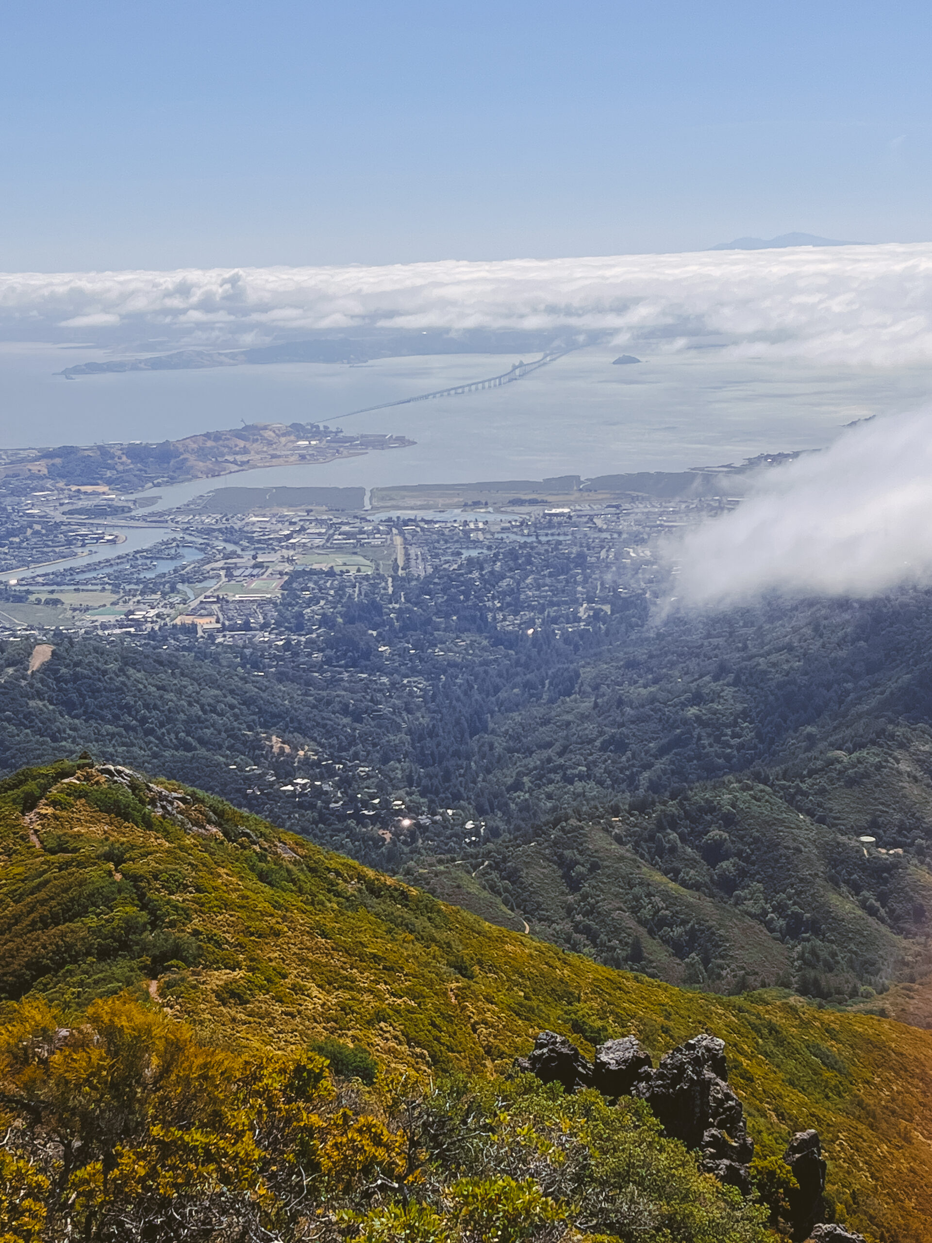
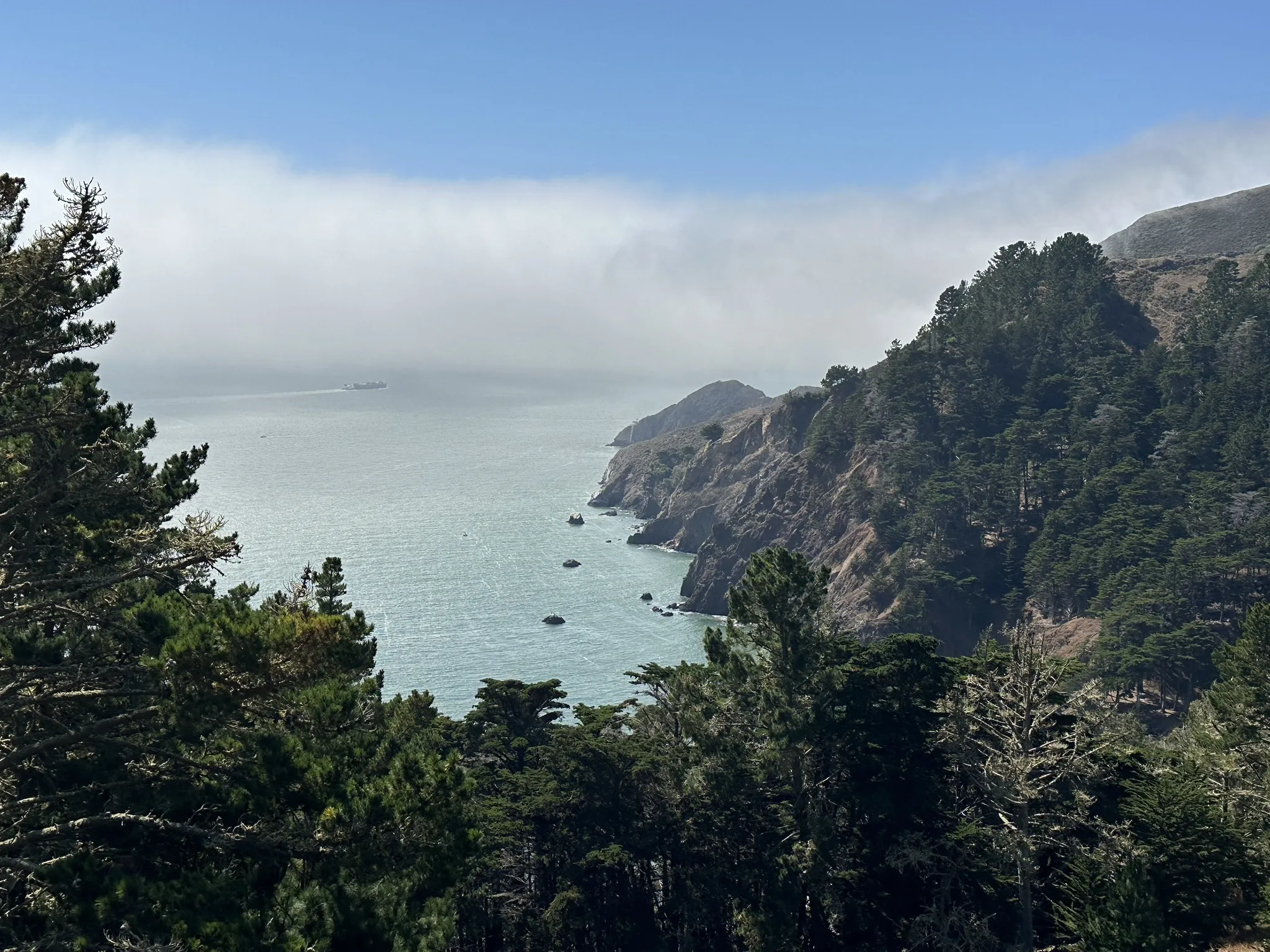
The hike to Alamere Falls in the Point Reyes National Seashore is widely considered the most rewarding trek in the San Francisco Bay Area. This 13.7-mile round-trip journey rewards hikers with a rare "tidefall"—a waterfall that flows directly into the Pacific Ocean—set against a backdrop of rugged coastal bluffs and pristine backcountry lakes.
For those seeking a "Bay Area hike worth the effort," Alamere Falls stands as the quintessential choice. While the distance and terrain require a full day of physical exertion, the payoff is a geological rarity found in only a handful of locations worldwide. Unlike shorter, high-traffic trails, the path to Alamere Falls via the Palomarin Trailhead offers a true wilderness experience, transitioning from dense eucalyptus groves to coastal scrub and freshwater basins before reaching the dramatic basalt cliffs of the Pacific.
Understanding the "Worth" of Alamere Falls
To appreciate why this hike is worth the effort, one must understand the unique nature of its destination. Alamere Falls is a tidefall, a type of waterfall that drops directly into the sea during high tide. In the United States, there are very few of these; McWay Falls in Big Sur is more famous, but Alamere Falls is one of the few that allows hikers to stand at both the brink and the base of the cascade.
The effort involved is not merely physical. It is logistical and educational. Reaching the falls requires careful timing with the tides, an understanding of coastal erosion, and a commitment to preserving a fragile ecosystem. As of 2026, the National Park Service (NPS) continues to manage high visitor volumes, emphasizing the importance of staying on the official, designated trails to prevent further cliff degradation.
Planning and Logistics for the 2026 Season
A successful trip to Alamere Falls begins long before you reach the trailhead. Because the hike is located within the Point Reyes National Seashore, it is subject to specific federal regulations and environmental conditions that can change based on the season and recent weather patterns.
The Palomarin Trailhead
The most common access point is the Palomarin Trailhead, located at the end of Mesa Road in Bolinas. The parking lot is notorious for filling up by 8:00 AM on weekends and holidays. If you arrive late, you may find yourself adding several miles to your hike just by walking from your car to the trailhead.
Permit and Fee Requirements
As of 2026, there are no day-use fees for hiking in Point Reyes, and no permits are required for a standard day hike to Alamere Falls. However, if you plan to turn this into an overnight trip by staying at Wildcat Camp, you must secure a wilderness permit via Recreation.gov. These permits are often booked months in advance, especially for Saturday nights.
The Critical Role of Tides
The "worth" of this hike is significantly diminished if you arrive at the beach during an exceptionally high tide. At high tide, the waves can reach the base of the cliffs, making it dangerous or impossible to stand safely near the falls. Before departing, consult the NOAA Tide Predictions for the Point Reyes station. Aim to arrive at the beach within two hours of low tide for the best viewing and photography experience.
The Trail Breakdown: A Step-by-Step Guide
The hike can be divided into three distinct segments, each offering different ecological and visual experiences.
Segment 1: The Coastal Bluffs to Bass Lake
Starting from the Palomarin Trailhead, the first two miles of the trail wind through a mix of eucalyptus forest and open coastal scrub. This section offers sweeping views of the Pacific Ocean and the Farallon Islands on clear days. The elevation gain here is moderate but steady.
Approximately 2.5 miles in, you will pass Bass Lake. This is a popular spot for a mid-hike break. While the lake is scenic, hikers are reminded to stay on the main trail to protect the surrounding vegetation. The trail continues past Pelican Lake, another freshwater gem nestled in the hills, before descending toward the coast.
Segment 2: The Choice of Route
This is where the hike requires the most decision-making. There are two ways to reach the falls:
- The Official Route (via Wildcat Camp): This is the safest and only NPS-sanctioned route. You continue on the Coast Trail to Wildcat Campground, then walk approximately 1.1 miles south along the beach to the base of the falls. This adds mileage but avoids the dangerous "Alamere Falls Shortcut."
- The Unofficial Shortcut: You will likely see a narrow, unmaintained path branching off toward the ocean about 4 miles into the hike. The National Park Service strongly discourages using this route. It involves a precarious scramble down a crumbling cliffside. Every year, hikers are injured here, and the resulting erosion is permanently damaging the cliff face.
Segment 3: The Beach and the Tidefall
The final stretch along the sand from Wildcat Camp is breathtaking. The sound of the surf competes with the roar of the falls as you approach. Standing at the base of the 40-foot drop, you can see how the freshwater of Alamere Creek carves a path through the sand before meeting the saltwater of the Pacific.
Comparative Analysis: Bay Area "Effort" Hikes
To understand how Alamere Falls compares to other strenuous local favorites, consider the following data. This comparison helps hikers choose a trail based on their specific fitness level and desired reward.
| Hike Name | Total Distance (RT) | Elevation Gain | Primary Reward | Technical Difficulty |
|---|---|---|---|---|
| Alamere Falls | 13.7 Miles | ~1,600 ft | Tidefall Waterfall | Moderate (Distance/Tides) |
| Mission Peak | 6.2 Miles | 2,150 ft | Panoramic Views | High (Incline) |
| Mount Diablo (Summit) | 13.0 Miles | 3,200 ft | 360-degree Bay Views | Very High (Endurance) |
| Mount Saint Helena | 10.0 Miles | 2,000 ft | Highest Point in Bay | Moderate (Consistent Grade) |
| Berry Creek Falls | 10.5 Miles | 2,300 ft | Redwood Waterfalls | High (Terrain) |
Safety and Environmental Stewardship
Because Alamere Falls is a high-profile destination, the environmental impact is significant. In 2026, the focus on "Leave No Trace" principles is more critical than ever to ensure the trail remains open and beautiful for future generations.
Trail Safety
- Poison Oak: The Palomarin trail is notorious for heavy poison oak growth, particularly in the shaded sections near the lakes. Wear long pants and learn to identify the plant's oily leaves.
- Hydration: There is no potable water along the trail until you reach Wildcat Camp (and even then, it must be filtered). Carry at least 2–3 liters of water per person.
- Cell Service: Expect zero cell service once you leave the town of Bolinas. Download offline maps (such as Topo Maps+ or AllTrails) before you arrive.
Wildlife Awareness
Point Reyes is a thriving habitat for bobcats, coyotes, and various bird species. While mountain lion sightings are rare, they are possible. Always hike with a partner and keep children close. If you encounter a mountain lion, do not run; make yourself appear large and speak in a firm, loud voice.
The Erosion Crisis
The cliffs at Alamere Falls are composed of sedimentary rock and volcanic basalt, which are highly susceptible to crumbling. Using unofficial shortcuts not only risks your safety but also accelerates the rate at which the coastline is receding. By sticking to the Wildcat Camp route, you contribute to the longevity of this natural wonder.
Recommended Gear for the 13.7-Mile Journey
Given the length and coastal environment, your gear list should prioritize layers and foot protection.
- Footwear: Mid-weight hiking boots with good ankle support are recommended. The beach section can be rocky, and the trail itself has several segments with loose gravel.
- Clothing: Coastal weather is unpredictable. Use a moisture-wicking base layer, a fleece mid-layer, and a windproof/waterproof outer shell. Even if it is 80 degrees in San Francisco, the Point Reyes coast can be shrouded in cold, 55-degree fog.
- Navigation: A physical map or a dedicated GPS device is superior to a smartphone, which may lose battery quickly when searching for a signal.
- Tide Table: Keep a printed or saved copy of the day's tide chart.
Frequently Asked Questions
Can I bring my dog to Alamere Falls?
No. Dogs are not permitted on the Palomarin Trail or on the beach at Alamere Falls. This regulation is strictly enforced to protect local wildlife and ensure hiker safety on narrow trail sections. For dog-friendly alternatives in Point Reyes, consider Kehoe Beach or Limantour Beach.
Is the "shortcut" really that dangerous?
Yes. The unofficial shortcut is not a maintained trail. It is a social path created by erosion and foot traffic. The final descent to the beach involves a near-vertical scramble on loose shale. Multiple search-and-rescue operations occur every year for hikers who get stuck or injured on this section.
When is the best time of year to see the falls?
The falls are most impressive in late winter and early spring (January through April) after the regional rains have replenished the creek. By late summer or during drought years, the flow can dwindle to a trickle, though the coastal views still make the hike worthwhile.
Are there bathrooms on the trail?
There are vault toilets at the Palomarin Trailhead and at Wildcat Camp. There are no facilities along the 5.5 miles between these two points. Hikers should plan accordingly and follow "Pack It Out" rules for all waste.
Is the hike suitable for children?
Only for older children or teenagers with significant hiking experience. The 13.7-mile distance is taxing, and there are several exposed cliff edges. If you are bringing younger children, consider hiking only as far as Bass Lake (approx. 5 miles round trip).
Final Recommendation: How to Maximize the Experience
To ensure that this Bay Area hike is truly worth the effort, aim for a Tuesday or Wednesday departure if your schedule allows. Avoiding the weekend crowds transforms the experience from a busy tourist attraction into a serene wilderness retreat.
Start your hike no later than 8:30 AM to allow for a leisurely pace, a long lunch at the base of the falls, and a safe return before sunset. By prioritizing the official route through Wildcat Camp, you not only protect the environment but also gain the unique experience of walking the shoreline, which is often the most peaceful part of the entire journey. The combination of forest, lake, and ocean makes this trail a masterclass in Northern California’s natural diversity.