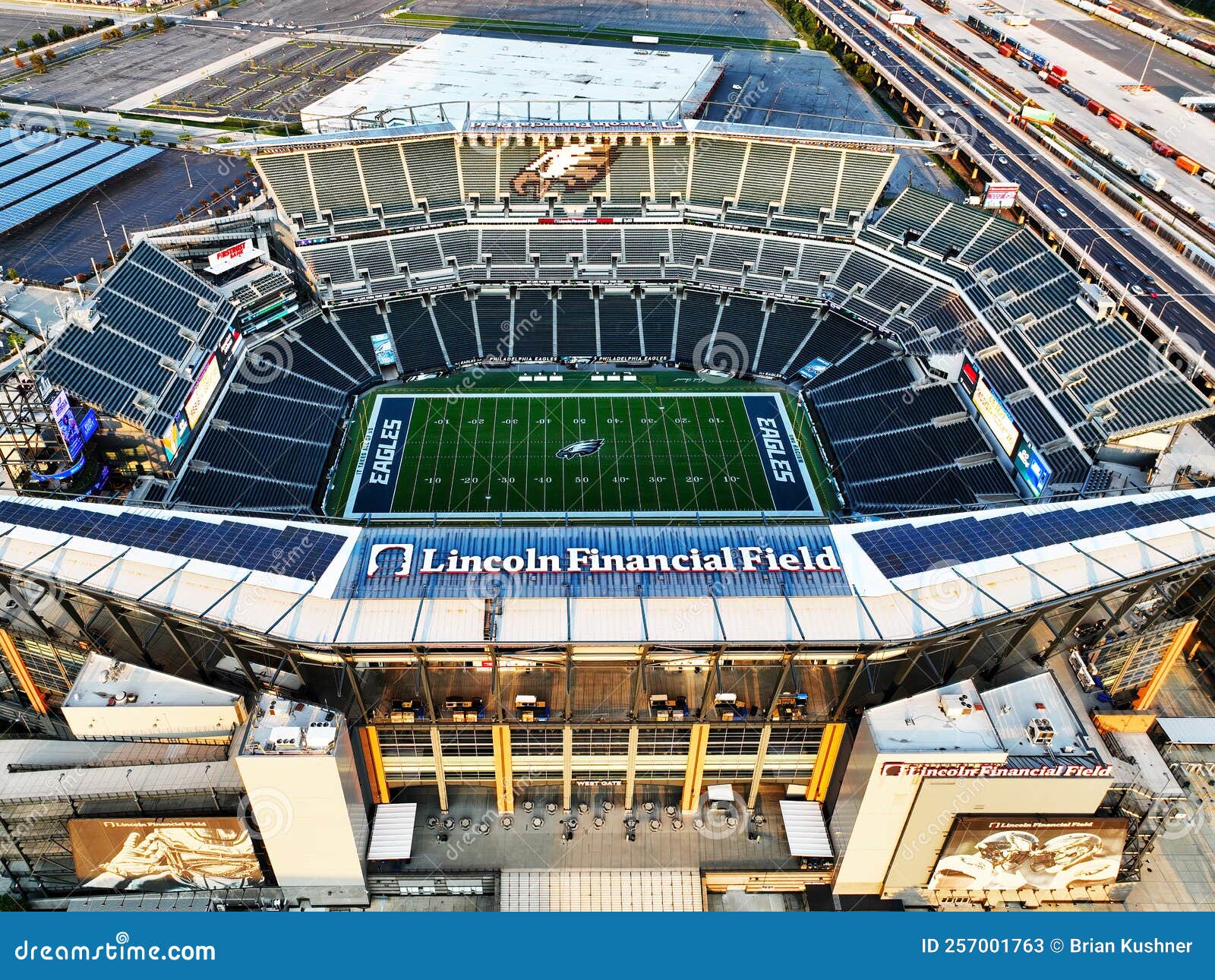
The aerial view of NFL stadiums provides a unique perspective on the intersection of massive-scale engineering, urban planning, and sports culture. From 30,000 feet, these structures transform from roaring centers of entertainment into intricate architectural landmarks that define city skylines, reveal complex transit patterns, and showcase the sheer physical footprint required to host professional football.
The Architectural Evolution Seen from Above
Looking down at the 32 stadiums currently housing NFL franchises in 2026, one can trace the history of American sports architecture. Historically, aerial views of the 1960s and 70s revealed a landscape of "cookie-cutter" stadiums—perfectly circular, multipurpose concrete bowls like the former Three Rivers Stadium or Veterans Stadium. Today, the view from above tells a much more diverse and complex story.
Modern NFL stadiums are designed with specific "top-down" aesthetics in mind. Architects now recognize that a stadium's roof or upper profile is its "fifth facade," visible to millions via satellite imagery, drone footage, and passengers flying into major metropolitan airports. For instance, the aerial profile of SoFi Stadium in Inglewood is designed to mimic a giant, translucent sail, integrated into the flight path of Los Angeles International Airport (LAX). Its roof features embedded LED technology that can display massive images or advertisements directly to passengers flying overhead, a feature that only makes sense from an aerial vantage point.
The shift toward retractable roofs has also changed the aerial landscape. From above, the mechanical complexity of Mercedes-Benz Stadium in Atlanta is perhaps the most striking. Its "pinwheel" roof consists of eight translucent ETFE (ethylene tetrafluoroethylene) petals that slide open like a camera aperture. This is a far cry from the static, monochromatic domes of the 1980s, showcasing a move toward kinetic architecture that looks as good on a map as it does from the sidelines.
The Geography of the NFL Footprint
The aerial view reveals a stark contrast in how NFL teams integrate into their environments. Generally, these stadiums fall into two geographic categories: the urban anchor and the suburban island.
The Urban Anchor
Stadiums like Lumen Field in Seattle, U.S. Bank Stadium in Minneapolis, and Allegiant Stadium in Las Vegas are tightly woven into the city grid. From above, you can see how these structures are squeezed into existing neighborhoods, often resulting in unique, non-symmetrical shapes.
In Minneapolis, the jagged, asymmetrical roof of U.S. Bank Stadium was designed specifically to shed snow and reflect the city’s Nordic heritage, but from the air, it looks like a massive shard of glass dropped into the downtown core. The aerial view highlights the proximity to light rail stations and pedestrian bridges, emphasizing a design philosophy focused on urban density and public transit rather than massive parking lots.
The Suburban Island
Conversely, stadiums like Gillette Stadium (Foxborough) or MetLife Stadium (East Rutherford) are surrounded by "seas of asphalt." From an aerial perspective, the stadium itself often occupies less than 20% of the total cleared land, with the remainder dedicated to the logistical necessity of tailgating and parking. These views highlight the immense land-use requirements of the NFL, where a single venue can necessitate hundreds of acres of infrastructure to support 70,000 to 80,000 fans arriving simultaneously.
Technical Logistics of Aerial Views: Drones and FAA Regulations
As of 2026, the technology used to capture aerial views of NFL stadiums has become highly sophisticated, but it is also strictly regulated. For hobbyists and professional photographers alike, understanding the legal landscape is as important as the equipment itself.
Temporary Flight Restrictions (TFRs)
The Federal Aviation Administration (FAA) maintains strict Temporary Flight Restrictions (TFRs) over all NFL stadiums. Specifically, the FAA prohibits all aircraft—including drones (UAS)—from flying within a three-nautical-mile radius of any stadium with a seating capacity of 30,000 or more during a window starting one hour before the scheduled start time of an NFL game and ending one hour after the game concludes.
Violating these TFRs can lead to significant fines and criminal charges. For those seeking "live" aerial views during game day, the only legal options are usually the official broadcast blimps or high-altitude news helicopters that have received specific clearance from Air Traffic Control (ATC) and the league.
Remote ID and Drone Compliance
In 2026, all drones operating in U.S. airspace must be equipped with Remote ID technology. This acts as a digital license plate, allowing law enforcement to identify the drone’s location and the pilot’s ground station in real-time. If you are attempting to capture an aerial view of an empty NFL stadium for architectural photography, you must ensure your drone is compliant and that you are not infringing on "No Fly Zones" (NFZ) often established around critical infrastructure or high-profile private property.
Top 5 Most Iconic NFL Stadiums from the Air
Certain stadiums offer a more compelling visual experience from above due to their unique shapes, materials, or settings.
| Stadium Name | Location | Primary Aerial Feature | Design Firm |
|---|---|---|---|
| SoFi Stadium | Inglewood, CA | Translucent ETFE canopy and integrated landscape | HKS |
| Mercedes-Benz Stadium | Atlanta, GA | Eight-petal retractable "Oculus" roof | HOK |
| Allegiant Stadium | Las Vegas, NV | "The Death Star" - sleek black glass and LED ribbon | MANICA Architecture |
| Lambeau Field | Green Bay, WI | Historical bowl nestled in a residential neighborhood | Ellerbe Becket (Renovations) |
| U.S. Bank Stadium | Minneapolis, MN | Sharp, angular peaks and "Clear" roof visibility | HKS |
1. SoFi Stadium: The Master of the Flyover
Because of its location directly under the approach path to LAX, SoFi Stadium is likely the most viewed stadium from the air in the world. Its massive, sprawling roof is not actually connected to the walls of the stadium; rather, it is a separate structure held up by massive columns. From above, you can see the "Hollywood Park" development, which includes a 2.5-acre lake and a 6,000-seat performance venue, all sheltered under the same massive canopy.
2. Allegiant Stadium: The Desert Jewel
Known colloquially as "The Death Star," Allegiant Stadium’s aerial view is defined by its smooth, black exterior and the massive silver trim. In the bright Nevada sun, the stadium looks like a high-tech obsidian gemstone. Its proximity to the Las Vegas Strip allows for aerial shots that capture the contrast between the neon lights of the casinos and the dark, imposing presence of the stadium.
3. Mercedes-Benz Stadium: The Mechanical Marvel
From a satellite perspective, the "Oculus" roof is the star. When closed, the petals overlap in a geometric pattern that resembles a pinwheel. When open, the view looks directly down onto the "Halo Board," the largest 360-degree LED screen in professional sports. This creates a "stadium within a stadium" visual effect that is unique to this venue.
4. Lambeau Field: The Neighborhood Icon
Lambeau Field offers a completely different aerial aesthetic. While most modern stadiums are surrounded by commercial districts or massive parking plazas, Lambeau is famously nestled within a residential Green Bay neighborhood. From the air, you can see the "Frozen Tundra" surrounded by modest family homes, highlighting the unique community-owned nature of the Packers and the historic scale of the venue compared to its surroundings.
5. AT&T Stadium: The "Big Top"
The aerial view of "Jerry World" in Arlington, Texas, emphasizes its sheer scale. The two massive arches that support the roof are over a quarter-mile long. From above, the stadium looks like a futuristic dirigible hangar. The vast expanses of silver roofing reflect the Texas sun, making it one of the brightest objects in the Dallas-Fort Worth metroplex when viewed from a plane.
How to Access High-Quality Aerial Views
For researchers, fans, or planners, there are several ways to explore these stadiums from above without needing a pilot's license.
3D Photogrammetry Tools
Platforms like Google Earth Pro and Apple Maps have revolutionized aerial viewing. Using a technique called photogrammetry, these services combine thousands of aerial images to create high-resolution 3D models. This allows users to "fly" around the stadium, zoom in on the textures of the roof, and see how the shadows fall across the field at different times of day.
Satellite Imagery Providers
For the most up-to-date views (useful for tracking renovations or new construction, like the new stadiums in Buffalo or Nashville), high-resolution satellite providers like Maxar Technologies offer imagery that is far more current than standard consumer maps. These are often used by urban planners to analyze traffic flow and pedestrian movement during large-scale events.
Professional Sports Photography
Stock photo agencies and specialized aerial photographers often use high-end gyro-stabilized cameras mounted on helicopters to capture "hero shots" of stadiums. These images provide a level of clarity and dynamic lighting that satellite imagery cannot match, often capturing the stadium at "blue hour"—just as the sun sets and the internal lights begin to glow.
Impact on Urban Planning and Infrastructure
The aerial view of an NFL stadium is more than just a pretty picture; it is a diagnostic tool for urban health. When planners look at these views, they are analyzing:
- Heat Island Effect: Massive asphalt parking lots visible from the air contribute significantly to urban heat. Aerial thermal imaging often shows stadiums as "hot spots," leading many teams to experiment with "green roofs" or solar panel arrays.
- Egress and Ingress: By studying aerial time-lapse footage, logistics experts can identify bottlenecks in stadium exit routes. This has led to the redesign of many stadium plazas to improve fan safety and reduce congestion.
- Ancillary Development: In 2026, the trend is the "Stadium District." From above, you can see how stadiums are no longer isolated buildings but the center of "live-work-play" developments. The aerial view of the Titletown District next to Lambeau or the Battery around Truist Park (MLB, but a model for NFL) shows a dense mix of hotels, offices, and apartments that didn't exist a decade ago.
Frequently Asked Questions
Can I fly my drone over an NFL stadium for personal photos?
Generally, no. While you can fly over an empty stadium if it is not in restricted airspace (like near an airport), you must stay away during game days due to FAA TFRs. Additionally, many stadiums are private property and have policies against drone operation on their premises. Always check the B4UFLY app or a similar FAA-approved airspace map before launching.
Why do some NFL stadiums look "transparent" from above?
Many modern stadiums use ETFE (ethylene tetrafluoroethylene) for their roofs. This is a lightweight, durable plastic that is highly transparent. From the air, it allows you to see the seating bowl and sometimes even the field through the roof, while still providing a weather barrier for the fans inside.
Which NFL stadium has the largest aerial footprint?
MetLife Stadium and the surrounding Meadowlands Sports Complex currently hold one of the largest continuous footprints due to the massive parking requirements and the proximity of the MetLife Stadium, the American Dream mall, and the racetrack. However, in terms of the building itself, AT&T Stadium and SoFi Stadium are among the largest enclosed volumes.
How often is satellite imagery of NFL stadiums updated?
Consumer tools like Google Maps usually update their high-resolution 3D data every 1 to 3 years. However, 2D satellite views are often updated more frequently, sometimes every few months, depending on the city's priority and the satellite's orbit path.
Are there any NFL stadiums with solar panels on the roof?
Yes, several. From an aerial view, Lincoln Financial Field in Philadelphia is one of the most prominent, featuring thousands of solar panels and micro-wind turbines. This "green" aerial profile is becoming more common as teams strive for LEED certification and energy independence.
Practical Recommendations for Enthusiasts
If you are looking to appreciate the aerial beauty of NFL stadiums, start by using the 3D view in Google Earth. Toggle the "historical imagery" feature to see how the stadium's site has changed over the decades. For those who want a physical experience, booking a window seat on a flight into cities like Los Angeles, Chicago, or Atlanta often provides a spectacular "free" aerial tour of the local stadium. Finally, always respect FAA regulations; the best aerial view is one that is captured legally and safely, preserving the integrity of the airspace and the privacy of the venue.