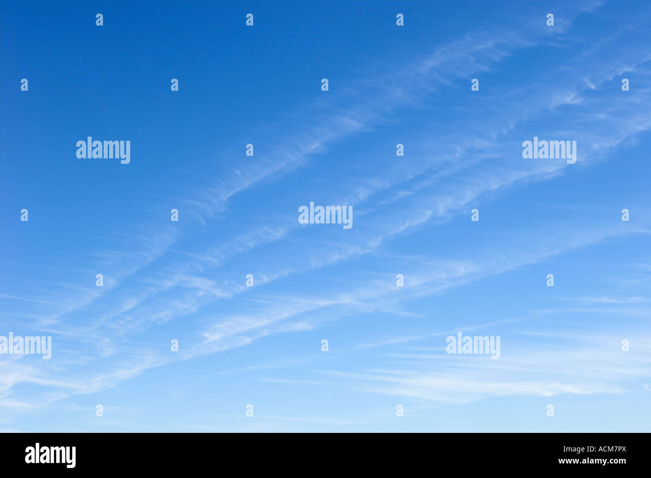
The primary scientific name for a wispy cloud is Cirrus. These high-altitude clouds are characterized by their delicate, hair-like strands and are composed entirely of ice crystals. While "Cirrus" is the general genus, specific wispy forms are further classified into species such as Cirrus uncinus (commonly called "mare's tails") and Cirrus fibratus.
High in the troposphere, where temperatures remain well below freezing, the atmosphere creates a canvas of ethereal, thread-like formations. To the casual observer, they may look like simple brushstrokes of white paint against a deep blue sky. However, to a meteorologist or a dedicated sky-watcher in 2026, these "wispy clouds" are complex indicators of atmospheric dynamics, moisture levels, and impending weather changes. Understanding the specific names and types of these clouds requires a look at the International Cloud Atlas standards and the physics of ice crystal formation.
The Taxonomy of Wispy Clouds: The Cirrus Genus
In the system of cloud classification established by Luke Howard in 1803 and maintained today by the World Meteorological Organization (WMO), the word Cirrus (abbreviated as Ci) is the Latin term for a "lock of hair" or a "curl." This is the foundational name for all clouds that appear wispy, fibrous, or feathery.
Cirrus clouds exist in the highest levels of the troposphere, typically above 20,000 feet (6,000 meters). At these altitudes, the air is extremely cold, meaning these clouds are not made of water droplets like the puffy cumulus clouds seen lower down. Instead, they are composed of billions of tiny ice crystals. The "wispy" appearance is a direct result of these crystals falling through different layers of wind, a process that creates the long, trailing filaments we see from the ground.
Defining Characteristics of Cirrus
To accurately identify a wispy cloud as a Cirrus, one must look for several defining physical traits:
- Fibrous Structure: They always appear to have a grain or a fiber-like texture, never appearing solid or "bloppy."
- Whiteness: Because they are thin, they do not usually have shadows. They appear brilliant white during the day.
- Silky Sheen: Due to the ice crystal composition, they often have a distinct shimmer or silky luster that water-based clouds lack.
- Color at Twilight: Because of their high altitude, Cirrus clouds are the first to catch the light of the rising sun and the last to lose it at sunset, often turning vivid shades of yellow, orange, or red while the lower atmosphere is in darkness.
Specific Species of Wispy Clouds
Not all wispy clouds look the same. In professional meteorology, the genus Cirrus is broken down into five distinct species, each describing a specific "flavor" of wispiness.
Cirrus fibratus
This is the most common form of "wispy" cloud. Cirrus fibratus consists of thin, straight, or slightly curved filaments. They do not end in hooks or tufts. These strands are often separated from one another, looking like individual threads of silk laid out across the sky. They are typically produced by high-altitude winds that stretch out moisture into long, orderly lines.
Cirrus uncinus (The "Mare's Tails")
Commonly known as "mare's tails," Cirrus uncinus is perhaps the most famous wispy cloud. The name uncinus means "hooked" in Latin. These clouds feature a distinct "comma" shape, where a small tuft at the top trails a long, wispy streak behind and below it. The hook is formed when ice crystals fall from the head of the cloud into a region of different wind speed or direction (wind shear), causing the trail to curve.
Cirrus spissatus
While most wispy clouds are translucent, Cirrus spissatus is the "thick" variety. These are dense enough to appear greyish when viewed against the sun. They often look like tangled bundles of white hair. In many cases, these wisps are the remnants of the upper parts (the anvil) of a thunderstorm that has dissipated, leaving only the high-altitude ice behind.
Cirrus floccus
The term floccus refers to a tuft of wool. These clouds appear as very small, white, wispy tufts, often with very short trails (virga) hanging below them. They look more "ragged" than the long strands of fibratus.
Cirrus castellanus
These are rarer and look like tiny turreted towers rising from a wispy base. Cirrus castellanus indicates significant instability at high altitudes and can sometimes be a precursor to high-based thunderstorms or a change in air mass.
The Physics of Wispiness: Why They Look Thin and Feathery
The "wispy" nature of these clouds is not accidental; it is a product of deposition and wind shear.
At altitudes of 6 to 12 kilometers, water vapor turns directly into ice crystals (deposition) around microscopic particles called ice nuclei. Because there is relatively little water vapor at these heights compared to the lower atmosphere, the clouds cannot become "thick" or "heavy." Instead, they remain sparse and delicate.
The trailing "tails" seen in wispy clouds are technically known as fallstreaks or virga. As ice crystals become heavy enough, they begin to fall. However, as they descend into drier air, they often sublimate—turning from solid ice back into water vapor—before they reach the ground. If the wind speed increases or decreases as the crystals fall, the trail is stretched or curved, creating the artistic, wispy patterns we identify as Cirrus.
Comparison of Wispy Cloud Species
The following table summarizes the primary types of wispy clouds found in the Cirrus genus.
| Species Name | Common Description | Visual Characteristics | Meteorological Significance |
|---|---|---|---|
| Cirrus fibratus | Silk Threads | Long, straight, or slightly curved thin strands. | Indicates stable, high-altitude winds. |
| Cirrus uncinus | Mare's Tails | Commas or hooks with a "head" and a "tail." | Often indicates a warm front is approaching. |
| Cirrus spissatus | Dense Wisps | Thick, opaque patches with wispy edges. | Usually the remnants of a dead storm (Cumulonimbus). |
| Cirrus floccus | Woolly Tufts | Small, ragged tufts with short trails. | Indicates high-altitude turbulence or instability. |
| Cirrus castellanus | Wispy Towers | Small turrets or battlements rising from a line. | Suggests mid-to-high level atmospheric instability. |
Other Clouds That Appear Wispy
While the Cirrus genus is the most common answer, two other "high cloud" genera can exhibit wispy characteristics, though they usually have more structure.
Cirrostratus
Cirrostratus clouds appear as a very thin, whitish veil that covers the sky. While they are often more uniform than Cirrus, their edges can be incredibly wispy. A key identifier of Cirrostratus is the halo phenomenon. Because these clouds are a vast sheet of ice crystals, they act like millions of tiny prisms, often creating a 22-degree ring or "halo" around the sun or moon. If you see a wispy veil that makes the sun look slightly blurred but still bright enough to cast shadows, you are likely looking at Cirrostratus.
Cirrocumulus
Cirrocumulus clouds are sometimes called "mackerel sky" because they look like the scales of a fish. While they consist of small ripples or grains, they are frequently seen in the company of Cirrus. When Cirrocumulus begins to dissipate, it often leaves behind wispy, shredded remnants that are indistinguishable from Cirrus to the naked eye.
Weather Forecasting with Wispy Clouds
For centuries, sailors and farmers used the appearance of wispy clouds to predict the weather. In 2026, despite advanced satellite arrays and AI-driven forecasting models, these visual cues remain highly reliable for short-term local predictions.
The Warm Front Indicator
Cirrus clouds are often the "vanguard" of an approaching weather system. When a warm air mass moves toward a cold air mass, it is forced upward. As the warm air rises along the slope of the cold air, moisture begins to freeze at the highest levels first.
- First Sign: Sparse Cirrus fibratus appears.
- Second Sign: The wisps thicken into Cirrus uncinus (mare's tails).
- Third Sign: The sky becomes covered in a Cirrostratus veil.
- Result: Usually, precipitation (rain or snow) follows within 12 to 36 hours.
If the wispy clouds are moving rapidly and the "tails" of the mare's tails are pointing in a specific direction, it often indicates the position of the jet stream, a river of fast-moving air that steers storm systems across the globe.
Radiative Forcing and Climate
In the context of modern climate science, wispy clouds play a dual role. Unlike thick, low-level clouds that reflect a large amount of sunlight back into space (cooling the Earth), thin Cirrus clouds allow most sunlight to pass through to the surface. However, they are very effective at trapping the infrared heat rising from the Earth. This means that an increase in wispy Cirrus coverage can contribute to atmospheric warming, a topic of significant study in 2026 as researchers monitor the impact of aircraft-induced cirrus (contrails) on global temperatures.
Common Misidentifications
It is easy to confuse other atmospheric phenomena with wispy clouds. Here are a few things that are not naturally occurring Cirrus clouds but look similar:
- Contrails: Short for "condensation trails," these are the lines left behind by jet engines. At high altitudes, the soot and water vapor from engines trigger the formation of ice crystals. If the air is moist, these contrails can persist and spread out, eventually becoming indistinguishable from natural Cirrus fibratus. These are often called "Cirrus homogenitus."
- Virga: As mentioned earlier, this is rain or ice that falls from a cloud but evaporates before hitting the ground. While it makes a cloud look wispy, virga can occur under low-level clouds (like Altocumulus), which are made of water, not just high-altitude ice.
- Noctilucent Clouds: These are "night-shining" clouds. They are the highest clouds in the atmosphere (located in the mesosphere) and appear wispy and electric blue. However, they are only visible during deep twilight and are much higher and rarer than standard Cirrus.
Frequently Asked Questions
What is the difference between Cirrus and Cirrostratus?
Cirrus clouds are detached, individual strands or tufts that do not cover the entire sky. Cirrostratus is a continuous, thin veil that covers large portions of the sky. While both are made of ice and are "wispy," Cirrus looks like separate hair-like pieces, whereas Cirrostratus looks like a thin, milky sheet that often creates a halo around the sun.
Why are wispy clouds called "mare's tails"?
The nickname "mare's tails" specifically refers to Cirrus uncinus. These clouds have a tufted head and a long, curved tail created by wind shear. To early observers, these long, flowing white strands resembled the tail of a horse (a mare) blowing in the wind.
Do wispy clouds mean it is going to rain?
Not always, but they are often the first sign of a change. If you see wispy clouds thickening and being replaced by a solid grey layer, rain is likely within 24 hours. However, if the wisps stay thin and scattered, they may simply be remnants of fair-weather moisture or high-altitude winds that do not signal a storm.
Are all wispy clouds made of ice?
Yes, by definition, clouds that have a fibrous, wispy appearance at high altitudes (the Cirrus genus) are composed entirely of ice crystals. Clouds made of water droplets, like Cumulus or Stratus, have much sharper, more defined edges because water droplets do not sublimate or blow into long strands as easily as ice crystals do.
What is the name of the wispy cloud that looks like a fish scale?
That is Cirrocumulus. While it has a slightly different structure (appearing as small clumps or ripples), it is part of the high-altitude cloud group. When these clouds are arranged in a pattern resembling the scales of a mackerel, it is called a "mackerel sky," which often appears alongside wispy Cirrus strands.
Summary Recommendation
If you are looking for the most accurate name for a wispy cloud, use Cirrus. If the cloud looks like long, straight threads, call it Cirrus fibratus. If it has hooks at the end, the correct term is Cirrus uncinus. For those interested in photography or weather tracking, observing these wisps is the best way to visualize the high-speed winds of the upper atmosphere and predict arriving weather fronts before they are visible on the horizon.