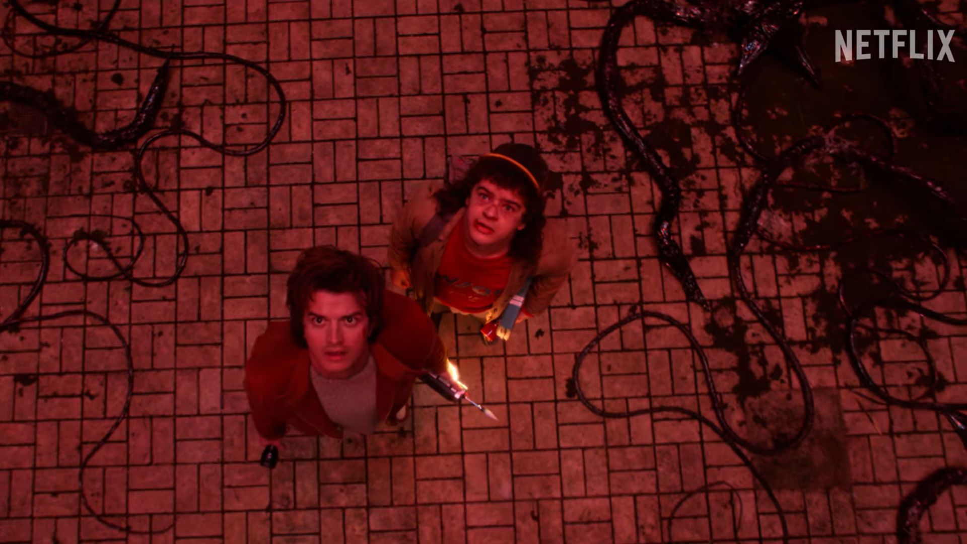
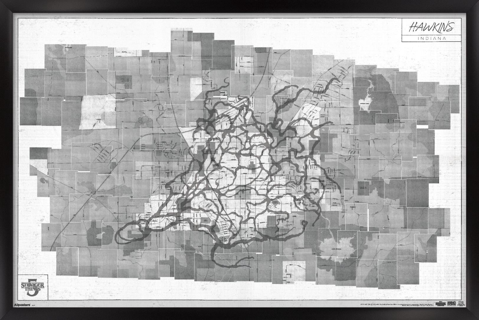
The final chapter of Netflix’s flagship sci-fi series brings a convergence of Hawkins, Indiana, and the Upside Down, encoded within cryptic production maps, set layouts, and official promotional art that reveal crucial plot dynamics, structural transformations, and spatial geography for the final season.
As the hit sci-fi phenomenon reaches its epic conclusion, fans and analysts alike have meticulously examined every piece of promotional material, set leak, and official teaser released by the Duffer Brothers and Netflix. Among the most closely analyzed artifacts is the fictional and production cartography of Hawkins, Indiana, and the encroaching realm of the Upside Down. Far from being random background designs, the map layouts for the final run hold intricate visual storytelling cues, geographical truths, and narrative hints. Understanding these cartographic secrets requires looking past surface-level aesthetics to evaluate production design notes, geographical continuity from previous seasons, and explicit hints dropped by the creators regarding the war for Hawkins.
1. The Dimensional Bleed and Border Expansion
The foundational secret of the cartography centers on how the Upside Down has shifted from a contained subterranean mirror to an active, expanding territorial overlay. In earlier seasons, portals operated as localized tears—such as the tree trunk in the Mirkwood forest, the Hawkins National Laboratory water tank, or the Starcourt Mall basement.
The new map framework highlights a total border collapse. Rather than discrete gate sites, the frontier between the normal town and the alternate dimension has transformed into a jagged, organic perimeter. Production layout documents leaked from set builders indicate that entire sectors of Hawkins are mapped with dual-layer overlays, showing how municipal infrastructure overlaps with crystalline vines and particulate atmospheric hazards. This structural expansion explains why standard containment protocols used by the military are obsolete, as the geographic barrier separating the two worlds has effectively dissolved into a sprawling quarantine zone.
2. The Centrality of the Creel House Nexus
While Season 4 established the Creel House as the psychic epicenter for Vecna, the spatial layout for the final episodes elevates the location to the primary geographical anchor of the entire conflict. Cartographic analysis of the town grid reveals that all major dimensional fissures radiate outward from 828 McKinley Richard Drive in a symmetrical geometric pattern reminiscent of a spiderweb.
This positioning is not merely symbolic. The map underscores how Henry Creel/Vecna has anchored his psychic architecture directly into the bedrock of Hawkins. Analysts studying production blueprints note that underground subterranean tunnels mapped by Hopper and Dustin in previous years now connect directly to the Creel basement, turning the dilapidated Victorian home into a military stronghold for the antagonists and the primary tactical objective for Eleven and her allies.
3. Municipal Grid Fractures and Quarantine Zones
Hawkins is no longer a functioning municipality on the production maps; it is a heavily militarized sector divided into strict containment zones. The map details a grid system imposed by the United States Department of Energy and military forces commanded by Dr. Owens' successors or hostile military factions.
Key features of this militarized layout include:
- The Red Perimeter: An outer ring blocking all major federal highways (Route 11 and surrounding county roads) with checkpoints, barbed wire, and mobile laboratory units.
- The Dead Zones: Neighborhoods evacuated entirely due to toxic spore contamination, marked by tactical hazard symbols on town planning grids.
- The Siphon Points: Industrial zones repurposed by the military to drain or study residual dimensional energy bleeding through the soil.
4. Hidden Subterranean Railway and Utility Tunnels
A recurring structural element in the cartography is the extensive network of utility tunnels, storm drains, and abandoned mining shafts running beneath Hawkins. While viewers first glimpsed these paths during the Mind Flayer's infiltration in Season 2, the expanded map for the final chapter exposes a vastly larger subterranean matrix.
Production layout schematics show that these tunnels have been heavily mutated by the Upside Down, turning concrete storm drains into organic, pulsing arteries. More importantly, the map reveals secret maintenance access points utilized by both the Hawkins heroes and government operatives to bypass surface military checkpoints. These subterranean routes serve as the primary stealth network for the characters, allowing them to traverse the quarantined town undetected.
5. The Radical Transformation of Hawkins National Laboratory
Hawkins National Laboratory has always been ground zero for the supernatural incursions, but the spatial arrangement of the facility on the production blueprints shows a total structural inversion. The laboratory is no longer a clandestine research facility hidden in plain sight; it is a massive, exposed crater site where the boundary walls have completely caved inward.
Cross-sectional map views indicate that the subterranean "Breach" level—where the original mothergate was opened—has expanded upward to the surface, swallowing the upper research wings. This structural change signifies that the laboratory is no longer a place of human experimentation, but rather a permanent, bleeding scar on the landscape where the two realities actively churn against one another.
| Map Sector | Previous Status (Seasons 1-4) | Season 5 Status | Tactical Significance |
|---|---|---|---|
| Hawkins National Lab | Clandestine underground research facility | Exposed dimensional crater | Primary threshold for interdimensional travel |
| The Creel House | Abandoned suburban residence | Psychic and structural nexus | Vecna's stronghold and core anchor point |
| Downtown Hawkins | Functioning commercial district | Militarized quarantine zone | Site of civilian evacuation and military skirmishes |
| The Quarry | Abandoned industrial limestone pit | Staging ground for military operations | Extraction and heavy artillery deployment zone |
6. Cartographic Symmetry: Mirroring Past Seasons
One of the most compelling artistic secrets embedded within the promotional maps is intentional visual symmetry with the geographic layout of Hawkins from Season 1. Careful juxtaposition of early conceptual maps with recent production designs reveals that the encroaching Upside Down follows the exact inverse of Will Byers' original drawing and the lights-on-the-wall alphabet grid.
This circular storytelling through geography suggests that the conflict must resolve precisely where it began. The map layouts deliberately highlight cyclical paths, pointing toward narrative resolutions that mirror the initial rescue mission of Will Byers, scaled up to encompass the entire town and its remaining inhabitants.
7. The Omission of Safe Havens and Outer Townships
A chilling detail evident in the comprehensive town maps is the complete erasure or redesignation of surrounding rural landmarks. Locations like Roane County, local farms, and nearby state parks that once offered peripheral escape routes are now entirely grayed out or marked as "Unstable Topography."
This cartographic shift emphasizes the psychological and physical isolation trapping the characters inside Hawkins. There is no running away to a neighboring town; the geographic anomaly has quarantined a massive swath of Indiana, cutting off communication lines, radio towers, and interstate highways. The map effectively paints Hawkins as an inescapable island trapped between the real world and a encroaching void.
8. Environmental Hazards and Spore Wind Patterns
Advanced production maps shared by concept artists incorporate meteorological overlays detailing wind currents, spore density, and atmospheric pressure zones. The Upside Down is depicted not just as a static physical space, but as a dynamic, breathing ecosystem with weather patterns driven by the hive mind.
The maps mark specific danger zones where toxic spore fallout reaches lethal levels, dictating the necessity of specialized protective gear for any character venturing into the open air. These meteorological markers provide crucial context for action sequences, explaining why certain tactical routes are impassable without risking immediate physiological contamination.
9. Coded Easter Eggs and Production Lore
Examining the fine print, marginalia, and grid coordinates printed along the borders of official map assets reveals a treasure trove of hidden lore for eagle-eyed fans. Production designers frequently embed numerical codes, dates, and fictional scientific designations into the margins of prop maps used on set.
These margin notes reference past containment protocols, historical dates from Hawkins' founding in the 19th century, and subtle nods to classic tabletop roleplaying game modules that inspired the series' structure. While many of these details function primarily as set dressing to enhance realism, they offer a cohesive internal logic that satisfies deep lore enthusiasts.
10. The Ultimate Endgame Coordinates
The final and most heavily guarded secret found within the cartography pertains to the ultimate convergence point—the geographic center where the final confrontation between the heroes and the forces of the Upside Down is projected to take place.
Unlike previous seasons where battles were fought in isolated basement rooms or shopping mall atriums, the final map converges all major paths onto a single, highly unstable topographical anomaly right at the boundary line between the forest and the town square. This calculated convergence point dictates the tactical flow of the final episodes, serving as the blueprint for the narrative climax of the entire series.
Frequently Asked Questions
Is the Season 5 map of Hawkins an official release from Netflix?
The detailed cartographic breakdowns are synthesized from official promotional art, production designer blueprints, set leaks, and authorized companion materials released by Netflix and the Duffer Brothers.
How does the Upside Down's geography differ in Season 5 compared to Season 1?
In earlier seasons, the Upside Down was a static, frozen-in-time mirror of Hawkins accessible only through localized portals. In Season 5, the map reveals a total territorial expansion where the dimension's borders have ruptured, actively merging with and overtaking municipal infrastructure.
Why is the Creel House so important on the town map?
The Creel House serves as the psychic and structural nexus for Vecna, anchoring the dimensional bleed directly into the bedrock of Hawkins and connecting to the underground tunnel network.
Are there any safe areas left in Hawkins on the map?
The map shows that standard civilian zones have been entirely evacuated, militarized, or designated as hazardous quarantine sectors, leaving no traditional safe havens within the municipal boundaries.
What do the meteorological overlays on the production maps indicate?
The overlays track spore density, toxic wind patterns, and atmospheric pressure changes, which dictate the physical safety of characters navigating the ruined town.
Conclusion
The cartographic secrets of Hawkins in the final chapter do more than map out a fictional town; they provide a visual roadmap for the narrative stakes, environmental dangers, and tactical challenges facing the characters. By examining the intricate details of the town's structural collapse, fans gain a deeper appreciation for the meticulous world-building underpinning the conclusion of the series. Review the official teaser materials and production art closely to spot these geographical shifts as the final battle for Hawkins unfolds.