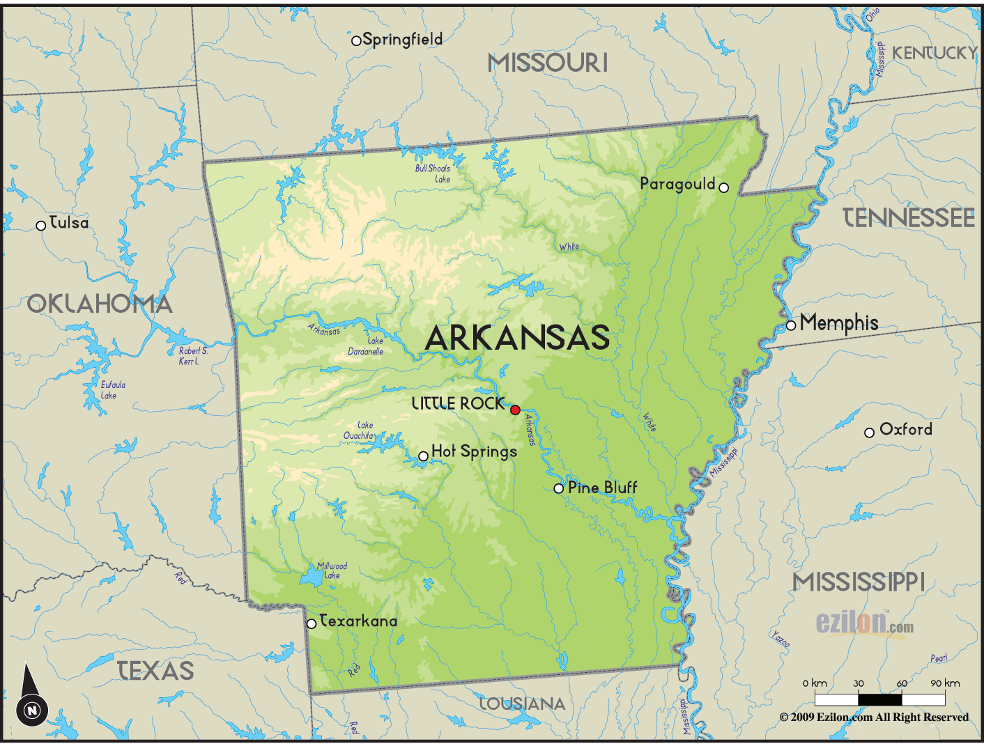
An Arkansas Ozark Mountains map serves as the definitive blueprint for navigating over 1.2 million acres of rugged terrain, encompassing the Ozark National Forest and the Buffalo National River. These maps detail the region’s three distinct plateaus—the Salem, Springfield, and Boston Mountains—providing critical elevation data, trailheads, and waterway access points for outdoor recreation and geographic study across Northern Arkansas.
The Ozark Mountains, often referred to as the Ozark Plateau, are not mountains in the traditional sense of tectonic uplifting. Instead, they are a deeply dissected plateau. When you look at an Arkansas Ozark Mountains map, you are looking at millions of years of erosion carved into limestone and dolomite. For the traveler in 2026, understanding this map is the difference between a successful backcountry expedition and becoming lost in the "hollers" where cellular signals rarely penetrate. This guide breaks down the layers of the Ozark map to help you master the geography of one of Mid-America’s most stunning natural landscapes.
The Three Physiographic Regions of the Arkansas Ozarks
To read an Arkansas Ozark Mountains map effectively, one must first understand that the region is divided into three distinct "steps" or plateaus that rise in elevation as you move from north to south.
1. The Salem Plateau
The Salem Plateau occupies the northeastern and north-central portion of the Arkansas Ozarks. On a topographic map, this area appears less rugged than the sections to the south. It is characterized by thin soils and a foundation of Ordovician dolomite. Map users will notice a high concentration of "karst" features here—caves, sinking springs, and losing streams. Cities like Mountain Home and Salem sit within this region. When navigating this area, maps focus heavily on the river systems, particularly the White and North Fork Rivers, which are world-renowned for trout fishing.
2. The Springfield Plateau
Moving west and slightly south, the Springfield Plateau covers a vast area including Fayetteville, Bentonville, and Rogers. On a map, this region shows a notable increase in elevation compared to the Salem Plateau. It is primarily composed of Mississippian limestone. The maps of this region are often a blend of urban development and rural beauty. For hikers, the Springfield Plateau section of the map highlights the "Beaver Lake" area and the rolling hills that transition into the much steeper Boston Mountains.
3. The Boston Mountains
The Boston Mountains represent the highest and most rugged section of the Arkansas Ozarks. This is the area most people visualize when they think of the "Ozark Mountains." On a topographic map, the contour lines here are tightly packed, indicating steep ridges and deep, narrow valleys known locally as hollers. The Boston Mountains reach elevations of over 2,500 feet. This region contains the bulk of the Ozark National Forest. Mapping this area requires high-resolution USGS (United States Geological Survey) data because the terrain is so complex that a standard road map cannot convey the vertical challenges of the landscape.
Navigating the Ozark National Forest
The Ozark National Forest is the primary entity managed within the Arkansas Ozark Mountains map. Spanning across multiple counties, the forest is not one contiguous block but a patchwork of public and private land.
Understanding the Ranger Districts
A comprehensive forest map is usually divided into Ranger Districts. In 2026, the primary districts include:
- Big Piney Ranger District: Home to the Richland Creek Wilderness and some of the most dramatic waterfalls in the state. Maps of this district are essential for "bushwhacking" or off-trail hiking.
- Pleasant Hill Ranger District: Located in the western Ozarks, this area is popular for ATV use and long-distance backpacking on the Ozark Highlands Trail.
- Cassidy/Boston Mountain Districts: These areas surround the scenic Highway 23 (The Pig Trail) and offer various developed campgrounds.
Identifying Wilderness Areas
On an official Arkansas Ozark Mountains map, you will see shaded regions designated as Wilderness Areas. These include the Upper Buffalo, Hurricane Creek, and Leatherwood Wilderness. Navigating these areas requires a map that shows topographical detail because no motorized vehicles or mechanical transport (including bicycles) are allowed. Trails in these areas are often minimally marked, making a high-quality physical map and compass—or a dedicated GPS unit with offline topographic layers—mandatory for safety.
The Buffalo National River: A Mapping Priority
The Buffalo National River was the first national river designated in the United States, and it remains the crown jewel of the Arkansas Ozarks. A map of the Buffalo River is typically divided into three sections: Upper, Middle, and Lower.
The Upper Buffalo (Ponca to Pruitt)
This is the most photographed section of the river, featuring the massive bluffs like Big Bluff and Roark Bluff. Mapping this area is crucial for paddlers because the water levels are highly seasonal. The map details "put-in" and "take-out" points. It also includes the famous Lost Valley Trail and the Steel Creek campground.
The Middle Buffalo (Pruitt to Tyler Bend)
The middle section of the river map reveals a widening valley. It is more accessible for casual floaters and includes the Gilbert area. Map users should look for the various "low water bridges" that can be hazards during high rain events.
The Lower Buffalo (Tyler Bend to Buffalo City)
The lower section maps out the most remote parts of the river, passing through the Lower Buffalo Wilderness. This area is where the Buffalo meets the White River. For those using a map for a multi-day float trip, this section requires careful planning of campsites, as the terrain becomes increasingly isolated.
Topographic vs. Road Maps: Which Do You Need?
Depending on your activity, the type of Arkansas Ozark Mountains map you choose will vary.
Road Maps and Scenic Byway Guides
If you are visiting for the scenery by car, a road map highlighting the Arkansas Scenic Byways is your best tool.
- Highway 7: Traverses the heart of the Ozarks from Harrison down through Jasper and into Hot Springs.
- Highway 23 (The Pig Trail): Famous for its hairpin turns and tunnel of trees.
- Highway 21: Provides access to the Boxley Valley, famous for elk viewing.
Topographic Maps for Hikers and Hunters
For those stepping off the pavement, a 7.5-minute quadrangle map from the USGS is the gold standard. These maps provide a scale of 1:24,000, where one inch represents approximately 2,000 feet. They show every ridge, stream, and elevation change. In 2026, many explorers use digital versions of these through apps like Avenza or Gaia GPS, but carrying a printed, waterproof version is a fundamental safety practice in the Ozarks.
Waterway Maps for Anglers and Paddlers
Specialized maps exist for the White River and Norfolk Tailwaters. These maps focus on river miles, shoal locations, and public access points. For anglers, these maps often include "depth charts" and "structure maps" to identify where trout are likely to congregate based on water flow from the dams.
| Map Feature | Best For | Recommended Source |
|---|---|---|
| Contour Lines | Hikers & Backpackers | USGS Topographic Quads |
| River Miles | Paddlers & Anglers | National Park Service (NPS) |
| Forest Roads | Overlanders & Hunters | US Forest Service (USFS) |
| Scenic Byways | Road Trippers | ArDOT (Arkansas DOT) |
| Township/Range | Landowners & Geologists | Arkansas GIS Office |
Digital Mapping and the "No Service" Reality
While we are living in 2026, the physical geography of the Ozarks still defies modern telecommunications. A common mistake for visitors is relying on Google Maps or other cloud-based navigation.
Once you descend into a valley in the Boston Mountains, your GPS may maintain a satellite connection, but your base map will fail to load without cellular data. To use a digital Arkansas Ozark Mountains map effectively, you must download offline layers before leaving a major town like Fayetteville or Harrison.
The US Forest Service provides PDF maps that are "geo-referenced." When opened in a compatible app, a blue dot will appear on the map showing your exact location using the phone's internal GPS, even without a cell signal. This is the most reliable way to navigate the 200+ miles of the Ozark Highlands Trail or to find remote waterfalls like Hemmed-in Hollow.
Essential Waypoints and Geographic Landmarks
When studying your map, there are several key landmarks that serve as essential navigation anchors:
- Mount Magazine: While technically in the Ouachita range to the south, it is often included in regional Ozark maps as the highest point in Arkansas (2,753 ft) and serves as a primary visual landmark.
- Whitaker Point (Hawksbill Crag): Located in the Upper Buffalo area, the trailhead for this iconic spot is a major waypoint on any hiking map.
- Blanchard Springs Caverns: Situated in the eastern Ozarks near Mountain View, this is a critical geographic marker for those exploring the Ozark National Forest’s Sylamore District.
- The Buffalo River Confluence: Where the Buffalo River meets the White River. This is a major navigational point for long-haul paddlers.
Safety Considerations for Map Users
The Ozark Mountains are deceptive. On a map, a distance might look like a short two-mile hike. However, the topographic lines may reveal a 1,000-foot descent followed by a 1,000-foot ascent.
- Flash Floods: Maps show "drainages." In the Ozarks, a drainage can turn into a raging torrent in minutes during a storm. Always cross-reference your map with local weather reports.
- Private Property: The Ozarks are a "checkerboard" of ownership. Respect the purple paint on trees, which in Arkansas signifies "No Trespassing." High-quality maps like those from OnX Hunt or the Arkansas GIS Office clearly delineate these boundaries.
- Seasonal Changes: A map of the Ozarks looks different in winter than in summer. In winter, the lack of foliage reveals "bluff lines" and "glades" that are invisible on standard satellite imagery during the summer.
Frequently Asked Questions
Where can I get a free physical Arkansas Ozark Mountains map?
Free basic maps are available at the Arkansas Welcome Centers, specifically those in Bella Vista, Mammoth Spring, and Harrison. For more detailed forest maps, visit the Ozark-St. Francis National Forests Supervisor’s Office in Russellville or the Buffalo National River visitor centers in Tyler Bend and Ponca.
What is the best app for Ozark hiking maps in 2026?
AllTrails remains popular for crowd-sourced info, but for technical accuracy and offline reliability, Gaia GPS and Avenza Maps are the preferred choices for professionals. Avenza allows you to upload official US Forest Service Motor Vehicle Use Maps (MVUM), which are crucial for knowing which forest roads are open to the public.
How do I read the contour lines on an Ozark topo map?
Contour lines connect points of equal elevation. In the Ozarks, if the lines are very close together, you are looking at a bluff or a steep mountainside. If they form a "V" shape pointing uphill, that indicates a valley or a stream bed. If the "V" points downhill, it represents a ridge.
Are Ozark Mountain maps updated frequently?
Topographic features rarely change, but human elements do. Road closures, new trail spurs (like the recent expansions in the Monument Trails system), and changes in land ownership are updated annually. Always ensure your digital map layers are refreshed or check the "edition date" on paper maps, especially when exploring the rapidly developing Northwest Arkansas corridor.
Can I find a map specifically for Ozark waterfalls?
Yes, there are specialized "Waterfall Guide" maps. Since many Ozark waterfalls are "wet-weather" falls, these maps are often sold as companions to hiking guides. They provide GPS coordinates for falls that are not named on standard USGS maps, such as those in the Richland Creek area.
Practical Recommendation for Your Trip
Before heading into the heart of the Ozarks, your first action should be to purchase the National Geographic Trails Illustrated Map for the Buffalo National River (Map #233) or the Ozark National Forest. These maps are printed on waterproof, tear-resistant paper and offer a perfect balance between topographic detail and navigational ease. Even if you plan to use your phone, having this physical backup is the industry-standard safety protocol for the Arkansas backcountry. Ensure you have marked your planned route and shared your "map coordinates" with someone back home before you lose signal at the trailhead.