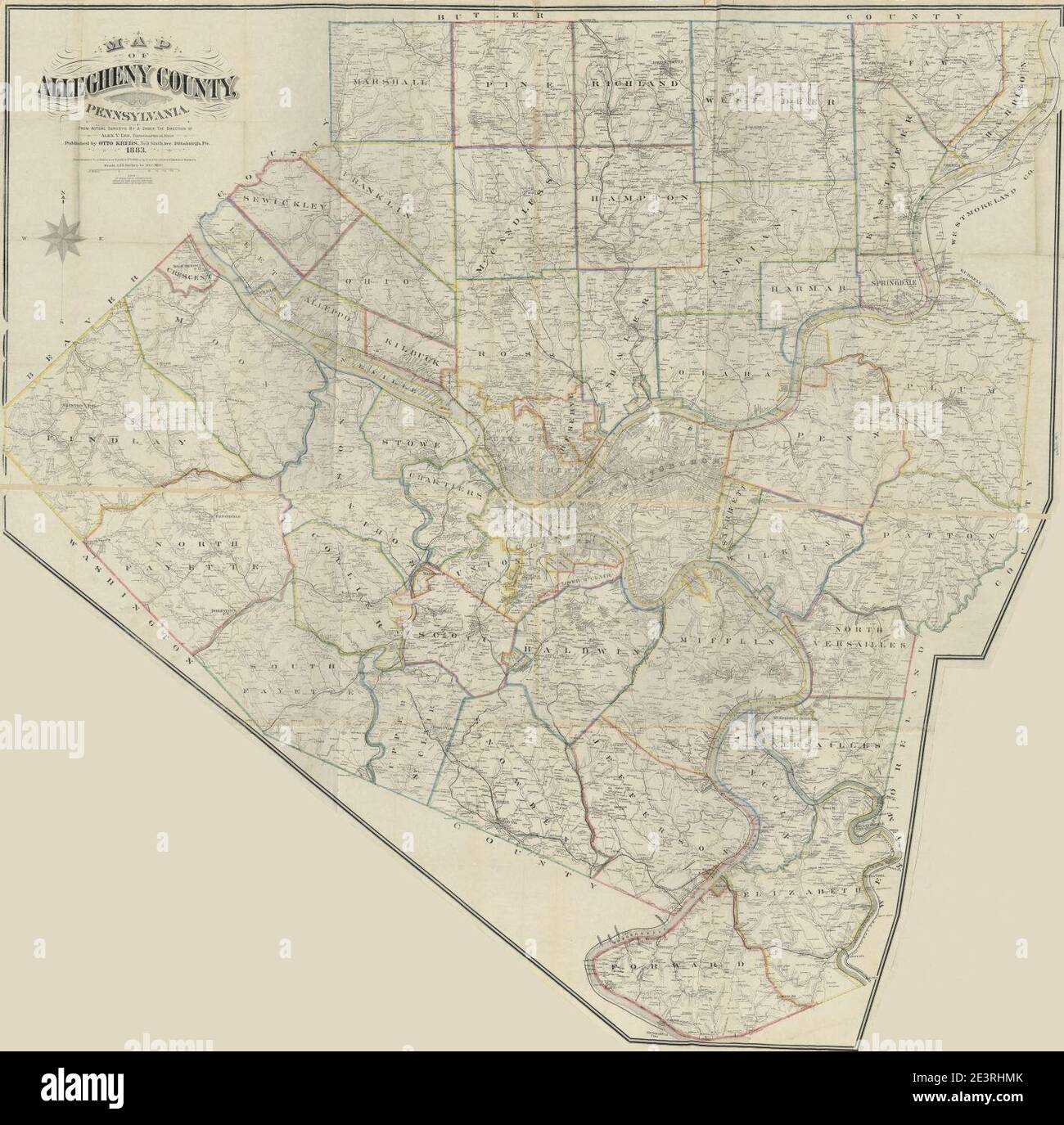
Allegheny County GIS (Geographic Information System) provides public access to vast spatial and property datasets through tools like the Real Estate Portal and interactive mapping viewers. Residents and professionals use these platforms to verify property assessments, analyze land use, view tax records, and examine geographical features across the Pittsburgh metropolitan area.
Understanding the Allegheny County GIS Ecosystem
The Geographic Information System for Allegheny County is not a single website but a sophisticated infrastructure maintained by the Allegheny County Department of Information Technology in collaboration with the Office of Property Assessment (OPA) and the Department of Real Estate. In 2026, these systems represent the primary method for the public to interact with the county’s administrative and physical geography.
GIS technology functions by layering different types of data—such as parcel boundaries, topography, and utility lines—over a coordinate-based map. For Allegheny County, this system serves as the digital "source of truth" for over 580,000 individual property parcels. Whether you are a homeowner contesting a tax assessment or a developer scouting for new project sites, understanding how to navigate these digital layers is essential.
The ecosystem is broadly divided into two functional areas: property-centric data (the Real Estate Portal) and spatial/environmental data (Interactive Maps). While they share a backend database, they serve different primary search intents. The Real Estate Portal is optimized for textual queries about specific addresses, while the Interactive Maps are designed for visual exploration and relationship analysis between different land features.
The Allegheny County Real Estate Portal: Property Data Search
The Real Estate Portal is the most frequently accessed component of the Allegheny County GIS system. It provides a detailed snapshot of every registered parcel in the county. As of 2026, the portal remains the starting point for anyone conducting real estate due diligence or researching market trends in Southwestern Pennsylvania.
Searching for Property Records
Users can search the database using three primary criteria: Parcel ID (lot and block number), owner name, or property address. For the most accurate results, the Parcel ID is the preferred method, as it is a unique identifier that does not change even if the street address is modified or the owner changes.
When searching by address, the system requires a specific format. It is often more effective to enter only the house number and the street name without the suffix (e.g., "436 Grant" instead of "436 Grant Street") to avoid errors caused by slight variations in street abbreviations.
Interpreting Assessment and Tax Data
Once a property is selected, the portal displays several tabs of information. The "General Information" tab provides the current assessed value, subdivided into land value and building value. In Allegheny County, the relationship between "Market Value" and "Assessed Value" is a critical distinction. The assessed value is what the county uses to calculate property taxes, whereas the market value is an estimate of what the property would sell for under current conditions.
The portal also links to the "Tax Bill" information, often processed through third-party collectors like Jordan Tax Service or the municipality itself. Here, users can see the millage rates for the three taxing bodies: Allegheny County, the local municipality, and the school district. Understanding these rates is vital for calculating the total annual tax liability of a property.
Building Characteristics and Sales History
The "Buildings" and "Sales" tabs offer deeper insights into the physical and financial history of a parcel. The building data includes the year built, square footage, number of rooms, and construction materials. Researchers should note that this data is updated periodically by county assessors; however, recent renovations may not appear immediately until a new assessment or permit trigger occurs.
The sales history provides a chronological list of transfers. This section is particularly useful for verifying the last "arms-length" transaction, which is a sale between two unrelated parties at market value. In 2026, this data remains a cornerstone for real estate agents performing Comparative Market Analysis (CMA).
Navigating Interactive Mapping Tools
While the Real Estate Portal provides the "what," the Interactive Mapping tools provide the "where." Allegheny County’s map viewers allow users to see how a property sits within its environment, including its proximity to floodplains, steep slopes, and administrative boundaries.
Layer Management and Visualization
The power of the GIS viewer lies in its layers. Users can toggle various data sets on and off. Some of the most critical layers for users in 2026 include:
- Parcel Boundaries: The digital lines showing the approximate extent of a property. (Note: These are for planning purposes and are not a legal substitute for a professional survey).
- Topography (Contours): Essential in Allegheny County due to the region’s hilly terrain. These layers show elevation changes and help identify potential landslide risks or drainage issues.
- Zoning Districts: Information on how a piece of land can be used (residential, commercial, industrial). This data is often linked directly to the specific municipality's zoning code.
- School Districts: Since school taxes often comprise the largest portion of a property tax bill, verifying the exact school district boundary is a high-priority task for many users.
Measurement and Analysis Tools
Advanced users can utilize tools within the GIS interface to measure distances and areas. For example, a homeowner can estimate the square footage of a backyard or the distance from a house to a property line. Additionally, many viewers now include "Historical Imagery" layers, allowing users to compare current satellite photos with those from previous decades to see how the land has changed over time.
Open Data and Technical Integration
For data scientists, urban planners, and developers, Allegheny County provides access to raw GIS data through the Western Pennsylvania Regional Data Center (WPRDC). This platform allows for the bulk download of datasets in formats such as CSV, KML, and Shapefiles (SHP).
The WPRDC and Bulk Data Access
Instead of looking up one property at a time, the WPRDC enables users to download the entire county’s assessment database. This is particularly useful for large-scale analysis, such as identifying all vacant lots within a specific ZIP code or analyzing the impact of new infrastructure on local property values. In 2026, many local tech startups use these APIs (Application Programming Interfaces) to power real estate apps and urban development tools.
Accuracy and Metadata
When using open data, it is crucial to consult the "metadata"—data about the data. This documentation explains when the information was last updated and any known limitations. For instance, GIS parcel lines in Allegheny County may have an accuracy variance of several feet. This margin of error is standard in municipal GIS but must be accounted for when making precise engineering or legal decisions.
Comparison of Allegheny County GIS Access Points
The following table summarizes the different ways to access Allegheny County GIS data and the primary utility of each method.
| Portal Name | Primary Audience | Best Used For | Format |
|---|---|---|---|
| Real Estate Portal | Homeowners, Realtors | Checking assessments, tax history, and building specs. | Web-based Search |
| Interactive Map Viewer | Planners, Engineers | Visualizing parcel boundaries, topography, and zoning. | Map Interface |
| WPRDC (Open Data) | Data Analysts, Developers | Bulk data downloads and API integration. | CSV, SHP, JSON |
| Department of Records | Legal Professionals | Accessing recorded deeds, mortgages, and liens. | Document Images |
| Court Records Portal | Attorneys, Researchers | Tracking tax liens, foreclosures, and civil suits. | Case Search |
Common Challenges and Troubleshooting
Users often encounter hurdles when navigating the Allegheny County GIS system. Addressing these issues early can save significant time during a property search.
Address Mismatches and Search Errors
If an address does not appear in the Real Estate Portal, it is often due to a naming convention mismatch. Many streets in Allegheny County have multiple names (e.g., a state route number and a local street name). If a search fails, try searching by the "Owner Name" or zooming into the "Interactive Map" to click on the parcel directly. This "click-to-identify" method bypasses the need for correct text entry.
Data Latency
There is a natural lag between a real estate transaction and its appearance in the GIS system. Deeds are typically recorded at the Department of Real Estate first. It may take several weeks for the GIS database to reflect a change in ownership or a new subdivision of land. If the information seems outdated, users should check the "Last Updated" timestamp usually found at the bottom of the portal page.
Understanding the "Common Level Ratio"
In 2026, the Common Level Ratio (CLR) remains a complex but vital factor in Allegheny County GIS data. The CLR is a number used to adjust current market values to the base year of the last county-wide reassessment. When reviewing your data, if the "Assessed Value" seems significantly lower than recent sales in the area, it is often because of the application of this ratio. GIS users should always check the "Assessment History" tab to see how these calculations have evolved over time.
Practical Applications for GIS Data
The utility of Allegheny County GIS extends far beyond simple property lookups. It is a powerful tool for civic engagement and professional planning.
- Environmental Due Diligence: By layering "Undermined Areas" or "Landslide Susceptibility" data over a parcel, prospective buyers can identify hidden risks associated with the region's coal mining history and steep topography.
- Election and Governance: GIS data allows residents to identify their specific voting precincts, council districts, and legislative boundaries.
- Public Safety: Emergency services use GIS to map hydrants, fire stations, and response zones, ensuring that infrastructure is placed where it is most needed based on population density.
FAQ: Frequently Asked Questions
How often is the Allegheny County Real Estate Portal updated?
The portal typically updates its assessment and ownership data on a weekly basis, though some administrative data may refresh daily. However, there is a delay between the physical recording of a deed at the courthouse and the digital update on the website. For the most current legal information, users should consult the Department of Real Estate's official deed records.
Can I use Allegheny County GIS maps to settle a boundary dispute?
No. While the GIS maps provide a high-quality visual representation of property lines, they are not legally binding. The parcel boundaries in a GIS system are created for taxing and planning purposes and may contain inaccuracies. A professional land survey conducted by a licensed surveyor is the only legal method to determine precise property boundaries.
Is there a fee to access Allegheny County GIS data?
General access to the Real Estate Portal and Interactive Map Viewers is free to the public. However, downloading large datasets from certain repositories or requesting certified copies of property records from the Department of Real Estate may involve nominal administrative fees.
What should I do if my property information is incorrect on the GIS site?
If you find a factual error in your property’s characteristics—such as the wrong number of bedrooms or incorrect square footage—you should contact the Allegheny County Office of Property Assessment. They have specific procedures for "Data Corrections" that allow homeowners to update the record without filing a formal assessment appeal.
How do I find flood zone information in Allegheny County?
The Interactive Map Viewer includes a layer for FEMA Flood Hazard Areas. By turning this layer on, you can see if a property falls within a 100-year or 500-year floodplain. This is critical for determining if flood insurance will be required by a mortgage lender.
Next Steps for Users
To get the most out of Allegheny County GIS, start by locating your property’s Parcel ID on the Real Estate Portal. Once you have this number, move to the Interactive Map Viewer to examine the environmental and administrative layers associated with that ID. If you are conducting professional research, visit the Western Pennsylvania Regional Data Center to explore historical trends and bulk data. Always cross-reference GIS findings with official recorded documents at the Department of Real Estate for legal certainty.