Apple Maps provides a comprehensive satellite imagery layer that allows users to view the Earth's surface in high resolution, offering a "Satellite" view that complements standard map, transit, and navigation modes. By combining global aerial photography with integrated location services, the platform enables users to explore geographical details, analyze topographies, and plan routes with visual context across Apple devices.
The Architecture of Apple’s Satellite Imagery
Apple Satellite Maps is not a single live feed but a sophisticated synthesis of high-resolution aerial and satellite photography, processed to provide a seamless, zoomable globe experience. Unlike raw satellite data, which may be obscured by clouds or inconsistent in color, Apple’s implementation involves extensive post-processing. This includes orthorectification—correcting the geometry of the images so they represent a flat plane—and color balancing to ensure that transitions between different captured tiles are invisible to the end user.
The imagery relies on a distributed network of data providers who capture high-resolution snapshots of the Earth. When you open the Satellite view in Apple Maps, your device requests tiles corresponding to your current coordinates and zoom level. As you pan or zoom, the application pre-fetches surrounding tiles to maintain a fluid navigation experience. This architectural design ensures that even on mobile devices with constrained bandwidth, the interface remains responsive.
Accessing and Utilizing Satellite View
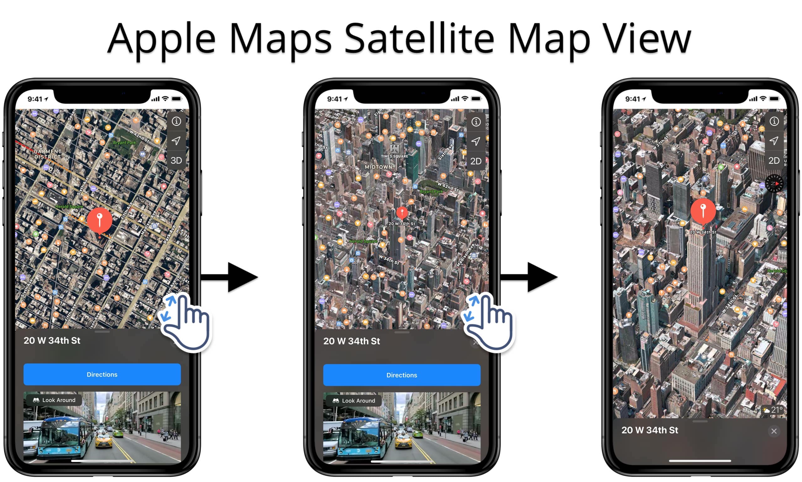
Accessing satellite imagery is a standard procedure across the Apple ecosystem, including iPhone, iPad, Mac, and Apple Vision Pro. The interface is designed for intuitive interaction, though the method of activation varies slightly depending on the operating system version.
On iOS and iPadOS
- Open the Maps application.
- Tap the Map Settings button, typically represented by a stacked-layer icon or your profile picture circle located in the bottom-right corner of the screen.
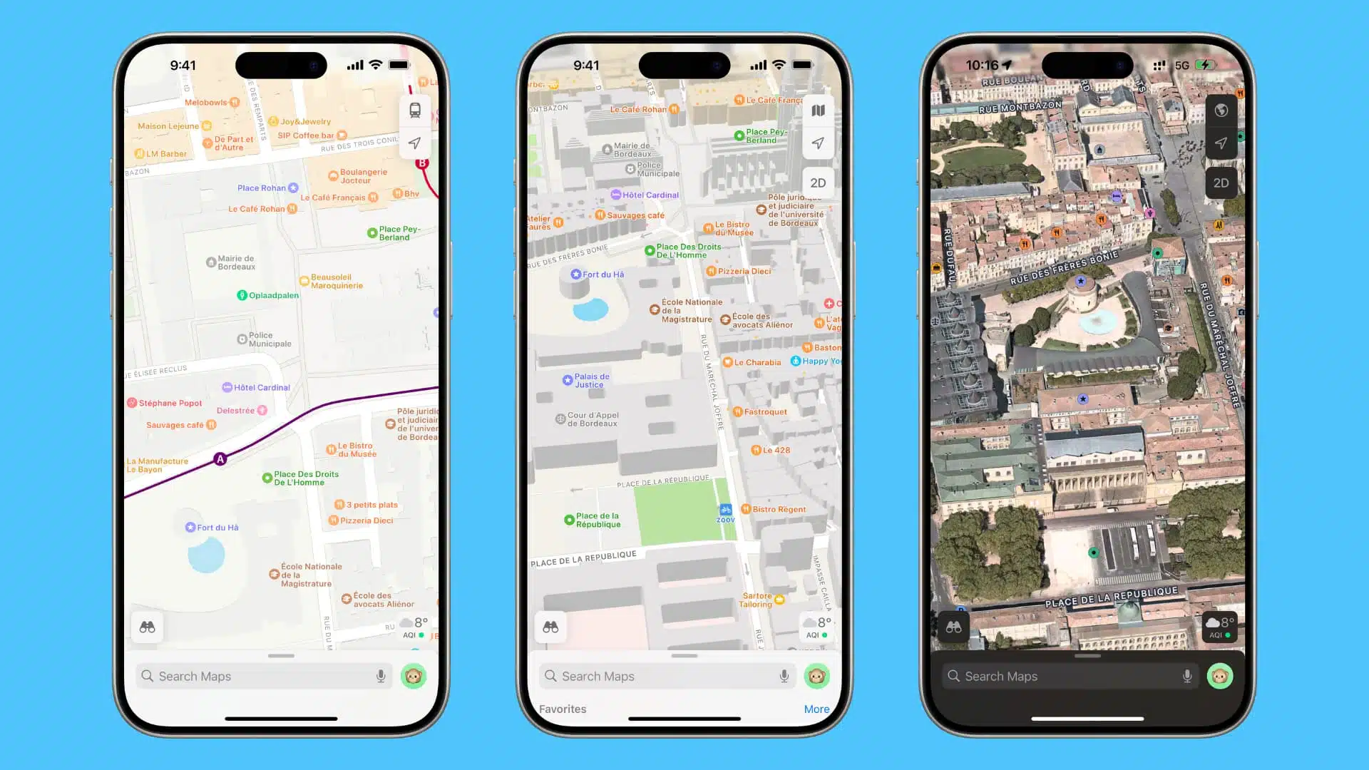
- Within the menu that appears, select the Satellite option.
- Once enabled, you can toggle additional layers like "Traffic" or "Weather" if supported in your region, or tap the "X" to return to the map.
On macOS
- Open the Maps app on your Mac.
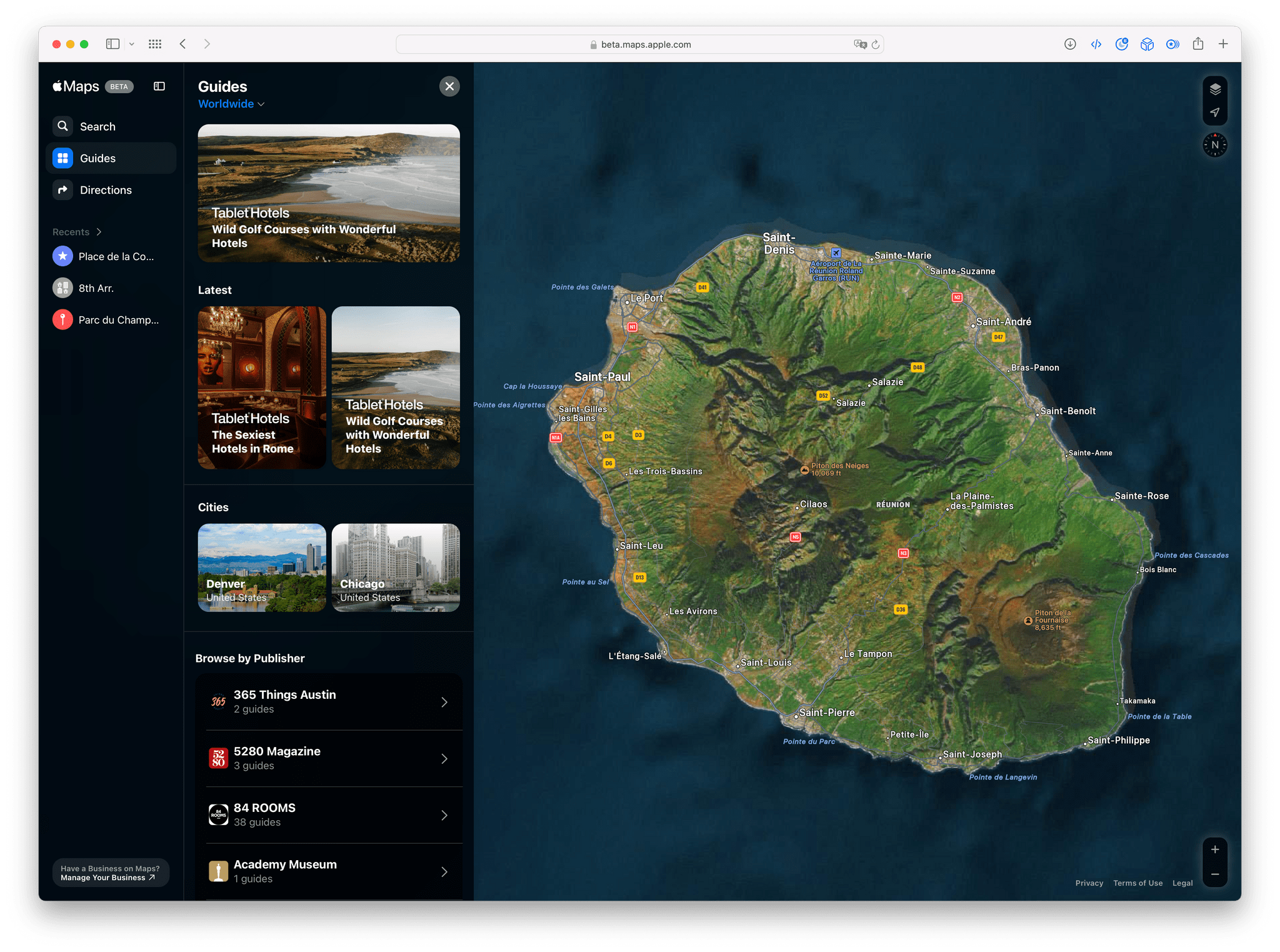
- Click the Map View menu in the top-right corner of the window.
- Select Satellite from the available options.
- Use your trackpad or mouse to scroll, pinch to zoom, and rotate the view to inspect specific geographic features.
On Apple Vision Pro
The integration on Vision Pro utilizes the same spatial awareness principles. Users can interact with the globe in a 3D immersive environment, allowing for a perspective that mimics an aerial reconnaissance flight. Hand gestures act as the primary input mechanism, allowing for smooth panning and zooming across 3D terrain models where available.
Key Features and Practical Applications
Beyond mere observation, Apple Satellite Maps serves several functional purposes. Understanding these features can help users maximize the utility of the application for both professional and recreational tasks.
1. Urban and Topographical Analysis
The primary benefit of satellite view is the ability to see the "ground truth" of a location. For travelers, this means identifying parking lots, entrance locations, or potential terrain obstacles that a standard 2D map might omit. For homeowners or developers, the satellite layer provides a bird's-eye view of property lines, vegetation, and adjacent structures, which is invaluable for initial planning or site assessment.
2. Flyover and 3D Modeling
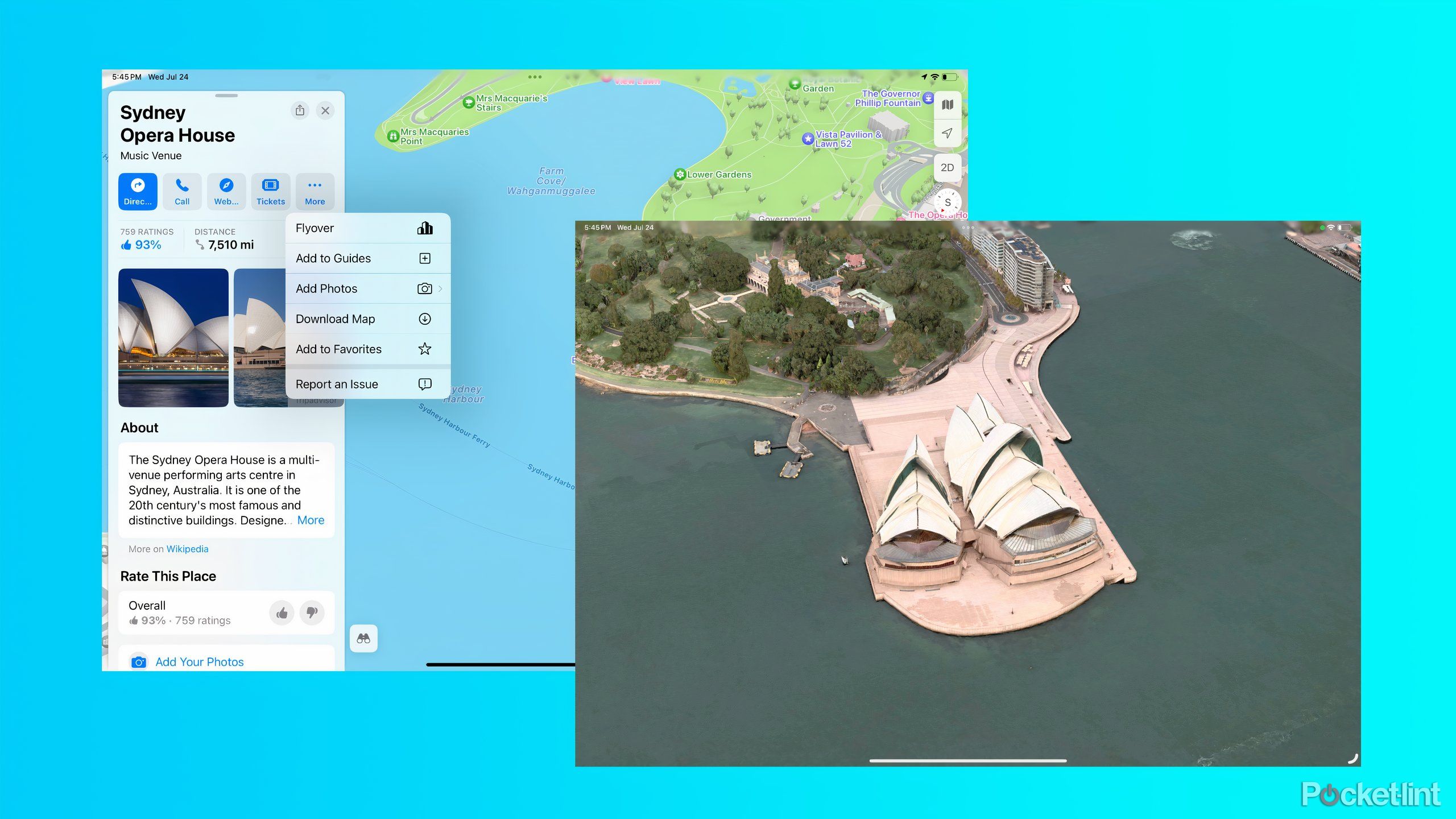
In select metropolitan areas, Apple Maps offers "Flyover" or 3D view capabilities. This is an evolution of standard satellite imagery where 3D geometry of buildings and landscapes is mapped onto high-resolution textures. By rotating the map, users can achieve a perspective that provides a sense of scale and height, which is particularly useful for visualizing urban density or complex interchanges.
3. Offline Capabilities and Caching
While Apple Maps remains primarily a connected service, it employs aggressive local caching. If you view an area while connected to Wi-Fi, the application stores those high-resolution textures on your device’s local storage. This allows users to retain access to satellite imagery in areas with intermittent connectivity, provided the tiles were loaded during the preceding session.
Comparison of Map Layers
To understand where Satellite fits into your workflow, consider the following table comparing the three primary modes available within the Apple Maps environment.
| Map Layer | Primary Intent | Best Used For |
|---|---|---|
| Explore | Navigation and discovery | Finding businesses, transit routes, and traffic updates. |
| Satellite | Visual reconnaissance | Assessing terrain, property layouts, and physical landmarks. |
| Transit | Public transportation | Locating train lines, bus stops, and metropolitan transit hubs. |
Troubleshooting Common Display Issues
Users may occasionally encounter issues where satellite imagery fails to load or appears blurry. Most of these issues are transient and can be resolved through basic troubleshooting steps.
- Connectivity Bottlenecks: Satellite imagery consumes significantly more data than vector-based maps. If you are on a metered or slow cellular connection, Apple Maps may prioritize low-resolution tiles to save data. Try moving to a Wi-Fi connection to force the app to fetch high-resolution assets.
- Storage Limitations: If your device is critically low on storage, the map cache may not be able to write new image tiles. Ensure you have at least 1–2 GB of free space to allow the mapping engine to cache visual data.
- Outdated Assets: If an area appears blurry even after loading, the imagery for that specific coordinate may not have been updated in the recent flyover cycle. Apple periodically updates its global imagery, but remote or rural areas may have a longer update cadence than major cities.
- Location Services: Ensure "Precise Location" is enabled in your Privacy settings. While imagery doesn't require precise GPS to display, local context and loading priorities often depend on your device’s detected location.
Privacy and Data Usage Considerations
It is important to note that while Apple emphasizes privacy, using the satellite view transmits data to Apple’s servers to retrieve the necessary imagery. Apple does not link your search queries or map interactions to your Apple ID in a way that creates a profile of your movements. All satellite image requests are anonymized and associated with randomized identifiers, ensuring that your exploration of specific locations remains private.
Furthermore, data usage should be monitored if you have a capped mobile data plan. Exploring large geographic areas at high zoom levels can quickly consume several hundred megabytes of data. If you are traveling abroad or have limited data, consider downloading offline maps (if the feature is supported in your specific region and version) or disabling the Satellite layer while on cellular data to conserve your bandwidth.
Frequently Asked Questions
Does Apple Satellite Maps show real-time live footage? No. The imagery provided is a collection of static aerial and satellite photographs taken at various times. It does not reflect real-time activity such as current traffic flow or people walking.
How often is the satellite imagery updated? Update frequency varies by region. Highly populated urban centers and major landmarks receive updates more frequently, sometimes every few months, whereas remote or rural areas may remain unchanged for several years.
Can I see historical satellite imagery on Apple Maps? Apple Maps does not currently provide a native feature to scrub through historical imagery (a "time-slider" function). It displays the most recent high-quality data available in their database.
Is satellite view available for navigation during driving? While you can keep the map in satellite mode while navigating, it is generally discouraged for high-speed driving as the visual complexity of the imagery can make turn-by-turn prompts harder to distinguish compared to the high-contrast Explore mode.
Why does my map look like a 2D drawing instead of real photos? You are likely in the "Explore" or "Transit" mode. You must manually switch to the "Satellite" layer via the map settings menu to see aerial photography.
Recommendation for Effective Use
For the best results, use the Satellite layer as a contextual tool rather than a primary navigation tool. If you are preparing for a trip or a site visit, open Apple Maps while on a stable Wi-Fi connection and "pan" over the target area to ensure all high-resolution tiles are cached. This preemptive loading ensures that when you arrive on-site, the imagery will remain sharp even if cellular service is degraded. When navigating in dense urban environments, switch back to the "Explore" mode to ensure you can clearly see street names and transit overlays, which are often obscured by the visual density of the satellite photography.