Minnesota’s snow season is shifting due to long-term climate trends, making the arrival of the first significant snowfall increasingly variable from year to year. While historical averages point to mid-to-late October or November for measurable snow in northern regions and late November for the Twin Cities, a comprehensive 10-year outlook suggests that warmer autumns and erratic precipitation patterns will likely delay permanent snowpack formation further into December across the state.
Understanding when and how snow arrives in the North Star State requires looking beyond simple daily forecasts. Residents, agricultural planners, transportation departments, and winter tourism operators must analyze decadal climate models, historical meteorological records, and regional atmospheric phenomena. This guide examines the 10-year outlook for snowfall timing in Minnesota, breaking down the climatological science, historical shifts, regional variations, and practical preparations required for an evolving winter landscape.
The Climatological Baseline: When Minnesota Typically Sees Its First Snow
To evaluate a 10-year outlook, one must first establish the historical baseline. Minnesota’s winter climate is traditionally characterized by long, cold, and snowy conditions lasting from late autumn through early spring. However, the onset of the snow season varies dramatically by latitude and elevation.
In the Arrowhead region and the far northern reaches of Minnesota, such as International Falls or Duluth, the first measurable snowfall (defined as 0.1 inches or more) typically occurs in mid-to-late October. Occasionally, a stray dusting can happen even earlier in September during unusual cold snaps, though this rarely persists. Moving southward toward the Twin Cities metro area, the historical average for the first measurable snow shifts to early November, with a lasting snowpack—defined as at least one inch of snow staying on the ground for an extended period—usually establishing itself by late November or early December.
| Region of Minnesota | Average First Measurable Snow | Average First Lasting Snowpack | Primary Driving Factor |
|---|---|---|---|
| Northern (Arrowhead / Border) | Mid to Late October | Early to Mid November | Latitude, Canadian air masses |
| Central (Brainerd / St. Cloud) | Late October to Early November | Mid to Late November | Continental polar air integration |
| Twin Cities Metro | Early November | Late November to Early December | Urban heat island effect, regional convergence |
| Southern Minnesota | Mid November | Early December | Agricultural plains exposure, jet stream tracks |
These dates represent long-term climatological averages compiled over decades by the National Oceanic and Atmospheric Administration (NOAA) and the Minnesota State Climatology Office. Yet, these averages are increasingly acting as historical benchmarks rather than reliable predictors for upcoming years.
Factors Influencing Minnesota's 10-Year Snow Outlook
Forecasting snowfall timing over a 10-year horizon involves synthesizing complex atmospheric and oceanic cycles. Meteorologists do not look at specific storms ten years in advance—as chaotic weather systems cannot be predicted with accuracy past ten to fourteen days—instead, they examine macro-scale climate drivers that dictate seasonal trends, temperatures, and moisture availability.
The Role of El Niño-Southern Oscillation (ENSO)
The El Niño-Southern Oscillation is one of the most prominent cyclical climate drivers affecting North American weather. During an El Niño phase, Pacific jet streams tend to push further north, bringing warmer and drier conditions to the Upper Midwest, which frequently translates to delayed first snowfalls and reduced overall accumulations. Conversely, La Niña phases often steer cold, moisture-laden Arctic air masses directly into Minnesota, resulting in earlier autumn snows and heavier winter storms. Over a 10-year outlook, the fluctuating frequency and intensity of ENSO phases play a primary role in modulating seasonal arrival times.
Arctic Oscillation (AO) and Polar Vortex Behavior
The Arctic Oscillation and the stability of the polar vortex dictate how effectively extreme cold can plunge southward. When the polar vortex is strong and stable, frigid air remains bottled up in the high latitudes. When it weakens or becomes disrupted, lobes of Arctic air spill down across Canada and into Minnesota. Climate models suggest that Arctic amplification—the faster warming of the Arctic relative to lower latitudes—may influence the behavior of the polar vortex, potentially leading to more erratic winter onsets characterized by sudden, violent transitions from unseasonably warm autumns to severe early-season blizzards.
Long-Term Warming Trends
Decadal temperature trends in Minnesota show a clear trajectory toward warmer autumns and winters. According to data from the Minnesota Department of Natural Resources, winter temperatures in the state have warmed at a faster rate than summer temperatures over the past several decades. This warming directly impacts the phase of precipitation. Late-autumn precipitation that historically fell as snow is increasingly falling as cold rain or mixed precipitation. Consequently, while total annual precipitation may remain steady or even increase, the window for early-season snow accumulation is compressed.
Regional Variations in Snow Timing Across the State
Minnesota is geographically diverse, featuring the flat agricultural expanses of the Red River Valley, the rugged boreal forests of the north, the bluff country of the southeast, and the heavily urbanized environment of the Minneapolis-St. Paul metropolitan area. Each of these zones experiences a distinct microclimate that alters the 10-year snowfall outlook.
The Twin Cities Urban Heat Island Effect
For the millions of residents living in the Minneapolis-St. Paul metro area, the urban heat island effect significantly influences snow accumulation. Concrete, asphalt, and dense human activity trap heat, keeping urban ground temperatures higher than surrounding rural areas well into late autumn. As a result, early-season snowstorms that drop several inches in the outer suburbs often produce slush or immediate melting within the city core, delaying the visual onset of winter for urban dwellers.
Lake Superior Snow Belts
The North Shore and the higher terrain inland from Lake Superior operate under an entirely different meteorological regime. Lake-effect snow occurs when cold winds blow across the relatively warm waters of Lake Superior, picking up moisture and dumping heavy snow bands along the elevated terrain of the Duluth area and the Iron Range. Over the coming decade, these lake-effect zones will remain the most reliable areas for early snowfalls, provided that late-autumn water temperatures in Lake Superior remain high enough to generate sufficient thermal contrast with dipping atmospheric temperatures.
Practical Impacts of Shifting Snow Patterns
Changes in the timing and predictability of Minnesota's first snow have wide-ranging socioeconomic, ecological, and infrastructural consequences. Recognizing these impacts helps communities adapt to a shifting climate regime.
Transportation and Municipal Preparedness
State and local departments of transportation rely on predictive models to budget for road salt, plow maintenance, and staffing. A delayed snow season can result in cost savings early in the fiscal year, but it can also catch municipal agencies off guard if a sudden, high-intensity transition occurs in late November or December. Furthermore, freeze-thaw cycles—becoming more common in late autumn—increase road wear and tear through accelerated pothole formation.
Agriculture and Hydrology
For farmers, the timing of the first snowpack has critical implications for soil moisture and frost penetration. An early, insulating blanket of snow prevents deep frost from penetrating agricultural soils, protecting winter wheat and perennial crops while allowing moisture to gradually replenish groundwater tables during spring melt. Conversely, a prolonged bare-ground period combined with deep freezes can damage root systems and alter spring runoff dynamics.
Winter Recreation and Tourism Industry
Minnesota’s winter economy—encompassing snowmobiling, cross-country skiing, ice fishing, and downhill resort operations—relies heavily on predictable snow schedules. A delayed start to the snow season compresses the economic window for outfitters and resorts, prompting many operators to invest heavily in artificial snowmaking infrastructure to ensure holiday-season viability regardless of natural precipitation timing.
Preparing for Variable Winters: Actionable Guidance
Given the projected variability in Minnesota's winter onset over the next decade, individuals, homeowners, and businesses must adopt flexible preparedness strategies rather than relying on traditional calendar dates.
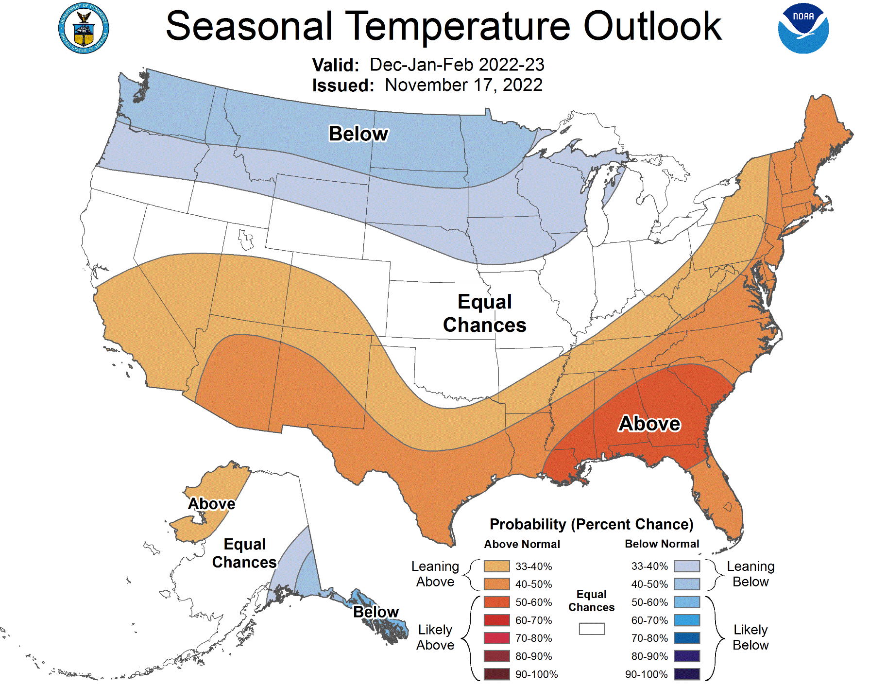
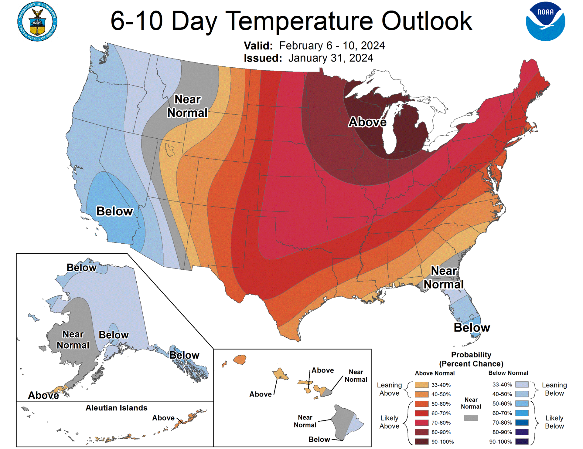
- Monitor Extended Climate Outlooks: Utilize seasonal outlooks published by the NOAA Climate Prediction Center (CPC) to gauge whether an upcoming autumn will lean warmer or colder than average due to ENSO conditions.
- Upgrade Winter Vehicle Maintenance Early: Do not wait for the first snowflake to service snow blowers, inspect winter tires, and check emergency car kits. Because transition storms can strike unexpectedly, early readiness prevents emergency situations.
- Implement Smart Home Winterization: Clear gutters, disconnect outdoor hoses, and inspect weatherstripping by mid-October, regardless of outdoor temperatures, to protect against sudden hard freezes.
- Diversify Recreation Planning: For tourism and outdoor recreation businesses, developing all-season attractions or investing in reliable snowmaking technology mitigates the financial risks of late-arriving natural snow.
Frequently Asked Questions
Will Minnesota stop getting snow entirely in the next 10 years?
No. Climate projections do not indicate the complete disappearance of snow in Minnesota. While winters are trending warmer on average, the state's continental position ensures that cold Arctic air masses will continue to reach the region, guaranteeing future snow seasons, though the timing of the initial snowfall may become increasingly compressed and volatile.
Why does it sometimes snow heavily in October if winters are warming?
Global warming shifts baseline averages rather than eliminating weather extremes. Paradoxically, a warming atmosphere can hold more moisture, which, when combined with a sudden injection of early Arctic air, can fuel high-impact, intense early-season snowstorms in northern and central Minnesota.
How can I check when the first snow is predicted for my specific county?
Local National Weather Service (NWS) forecast offices—such as those in Twin Cities, Duluth, and Grand Forks—provide localized seasonal discussions, climate normals, and probabilistic snowfall outlooks tailored to specific counties.
Does El Niño mean Minnesota will not get a white Christmas?
Not necessarily, but an active El Niño phase significantly increases the statistical probability of a brown or low-snow Christmas, particularly in the southern and central parts of the state, due to prevailing warmer Pacific air patterns.
What is the most reliable part of Minnesota for early snow?
The Arrowhead region, specifically areas surrounding Duluth and the higher elevations inland from Lake Superior, consistently records the earliest reliable snowpacks due to a combination of higher latitude, lower average temperatures, and lake-effect enhancement.
Conclusion and Next Steps
The 10-year outlook for when it will snow in Minnesota points toward continued variability, characterized by delayed initial snowpacks, warmer autumn transitions, and localized extremes. While northern lake-effect zones will continue to see traditional October and November snows, central and southern regions should prepare for winter arrivals that increasingly push into late November and December. To stay ahead of these shifts, homeowners, municipal planners, and outdoor operators should monitor seasonal NOAA outlooks, maintain flexible winterization schedules, and avoid relying solely on historical calendar dates for operational planning.