The Alaska Avalanche Information Center (AAIC) serves as a critical public resource dedicated to promoting backcountry safety through education, communication, and the dissemination of regional avalanche hazard information. By aggregating data and fostering community awareness, the organization helps recreationists and professionals navigate Alaska’s complex, high-stakes mountainous terrain while minimizing the risks associated with winter snow instabilities.
Alaska’s topography presents a unique set of challenges that differ significantly from the more localized snowpack conditions found in the Lower 48 states. Because the state encompasses a vast, geographically diverse landscape—ranging from the maritime-influenced Chugach Mountains to the continental climates of the Interior—avalanche hazards are highly variable. The Alaska Avalanche Information Center operates as a primary hub for those seeking to understand these dangers, offering essential guidance, training, and real-time situational awareness for individuals venturing into the backcountry.
The Role and Mission of the AAIC
The primary mission of the Alaska Avalanche Information Center is to enhance public safety by bridging the gap between raw meteorological data and actionable backcountry intelligence. Unlike organizations that provide localized, daily forecasts for specific mountain ranges, the AAIC often functions as an educational and structural backbone for the broader avalanche community in Alaska.
Its objectives are centered on three pillars: education, observation, and communication. By sponsoring training courses, hosting workshops, and maintaining a digital repository of snow safety information, the center ensures that participants have access to standardized protocols for decision-making. In a state where search and rescue resources may be hours away due to weather and remoteness, the ability to self-assess risk is not just a best practice; it is a fundamental survival skill.
Navigating Backcountry Risk in Alaska
Backcountry travel in Alaska requires a heightened level of self-reliance. When utilizing the resources provided by the Alaska Avalanche Information Center, users should understand that the responsibility for safety rests entirely on the individual. The nature of avalanche forecasting in such a large state means that the data provided is often intended to supplement, rather than replace, on-the-ground observations.
Assessing the Snowpack
Avalanche safety begins with recognizing the signs of instability. Whether you are backcountry skiing, snowmachining, or mountaineering, you must evaluate the following indicators:
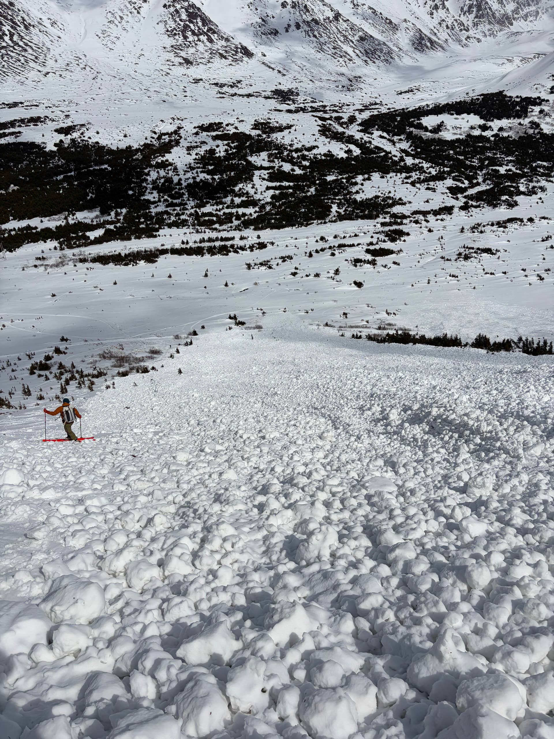
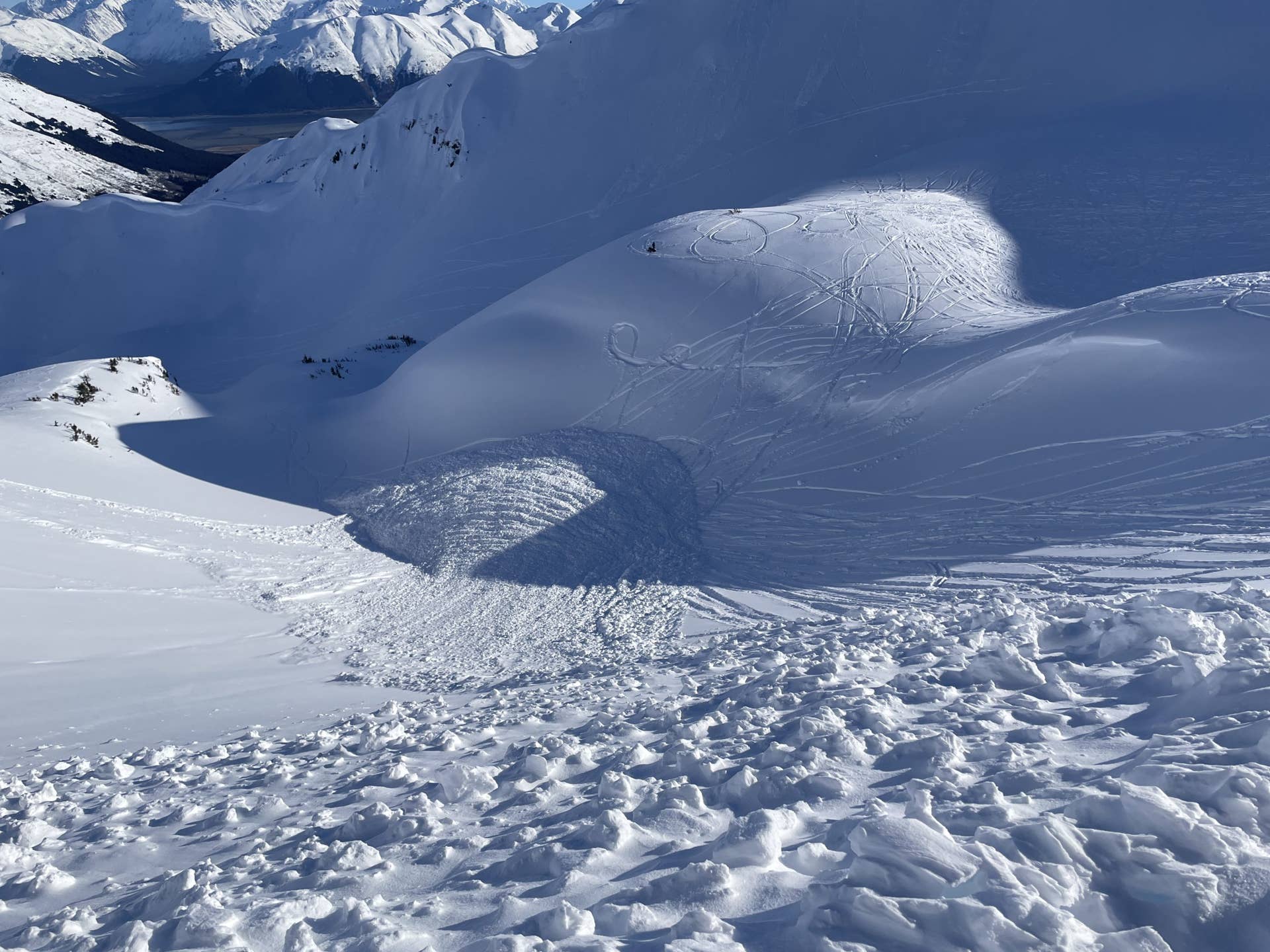
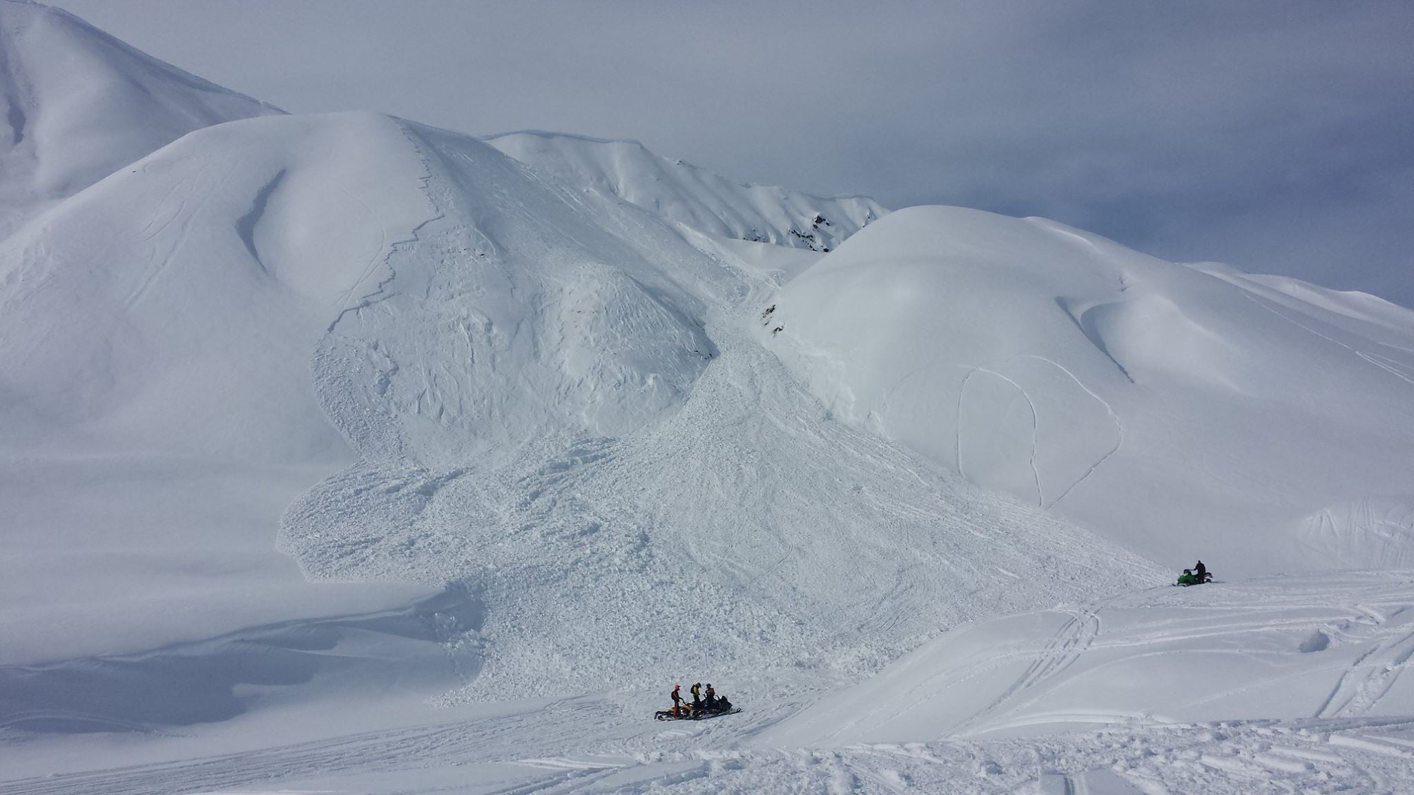
- Recent Avalanche Activity: Observing natural or human-triggered slides in the area is the most definitive sign that the snowpack is unstable.
- Wind Loading: High-altitude winds can transport vast amounts of snow, depositing it on leeward slopes and creating "wind slabs" that are prone to failure.
- Persistent Weak Layers: Alaska’s climate can create depth hoar or surface hoar layers that remain buried, waiting for a trigger to collapse.
- Rapid Temperature Changes: Significant fluctuations in temperature—especially sudden warming—can weaken snow bonds or cause wet-slab avalanches.
Training and Education Requirements
The AAIC advocates for formal avalanche education as the cornerstone of winter safety. Simply reading a forecast is insufficient without the training required to interpret it. The following training levels are widely accepted as industry standards for those venturing into avalanche terrain.
| Certification Level | Target Audience | Primary Focus |
|---|---|---|
| Awareness | Casual users, snowshoers | Recognizing hazard signs and avoiding danger. |
| Level 1 (Rec) | Backcountry skiers, riders | Systematic decision-making and rescue skills. |
| Level 2 (Rec) | Advanced backcountry users | Detailed snowpack analysis and group management. |
| Pro 1/2 | Guides, instructors, ski patrol | Professional-level forecasting and terrain assessment. |
The AAIC frequently provides information on where these courses can be accessed and why they are vital. A common mistake among newcomers to the Alaskan backcountry is overestimating the safety of terrain that "looks" flat or "seems" popular. Education provides the vocabulary to communicate risks to your partners and the technical skills to conduct a beacon search should an incident occur.
Essential Gear and Pre-Trip Planning
Before departing, planning is the most effective safety tool. The Alaska Avalanche Information Center emphasizes that "gear is not a substitute for judgment." However, having the right equipment is a legal and survival necessity in the Alaskan wilderness.
- Avalanche Transceiver (Beacon): A triple-antenna digital beacon is standard. Ensure it is worn on your body, not in your pack, and that it has fresh batteries.
- Probe: A collapsible probe (at least 280-300 cm in length) is essential for pinpointing a burial.
- Shovel: A metal, UIAA-certified shovel is required. Plastic shovels are prone to breaking in the dense, set snowpack often found in Alaska.
- Communication Device: Because cell service is nonexistent in most Alaskan mountain ranges, a satellite messaging device (such as an InReach or Zoleo) is essential for emergency coordination.
Understanding the Limitations of Information
It is crucial to resolve a common misconception regarding the AAIC: it is not a daily, mountain-by-mountain forecast service in the same vein as the Chugach National Forest Avalanche Information Center (CNFAIC). While the AAIC provides massive value through advocacy, education, and community outreach, users must check for the specific center responsible for their exact geographic zone. Alaska is too large for a single agency to provide daily, site-specific alerts for every drainage and peak.
When reviewing resources, always verify the geographic scope of the data. If you are operating in the Girdwood, Turnagain Pass, or Hatcher Pass areas, you must reference the specific, localized reports provided by the regional centers dedicated to those zones. The AAIC serves as a portal to these localized resources, and failing to distinguish between general safety guidance and daily, location-specific forecasts is a critical error.
Common Mistakes in Alaskan Backcountry Travel
Even experienced individuals fall victim to "heuristic traps"—mental shortcuts that lead to poor decision-making. The AAIC highlights these patterns to help users stay vigilant:
- Social Proof: Following tracks into hazardous terrain simply because others have done so.
- Expert Halo: Deferring judgment to the most experienced or vocal member of the group, rather than voicing individual concerns.
- Scarcity: Feeling forced to hit a specific line because you only have one day of good weather, even if the avalanche hazard is high.
- Commitment: Persisting with an original plan despite clear evidence (e.g., shooting cracks or whumpfing noises) that the snowpack is unstable.
Frequently Asked Questions
1. Does the Alaska Avalanche Information Center provide daily avalanche forecasts for the entire state? No. Due to Alaska’s massive size, the AAIC provides educational resources and advocacy. Daily forecasts are produced by localized centers such as the Chugach National Forest Avalanche Information Center, the Hatcher Pass Avalanche Center, and others. Always confirm which center covers your specific destination.
2. Is there a cost to access the safety information provided by the AAIC? Educational resources and general safety information provided by the center are free to the public. However, formal training courses (like AIARE-certified classes) managed by partners or affiliated instructors will have associated enrollment fees and physical requirements.
3. What should I do if I trigger an avalanche? If you are caught, fight to stay on the surface, discard heavy equipment if possible, and attempt to create an air pocket in front of your face as the snow slows down. If you are a witness, immediately ensure your safety, switch your beacon to "search," and initiate a rescue according to the protocols you learned in your avalanche training.
4. How does the maritime climate of Alaska affect my safety decisions? Alaska’s maritime regions often feature high moisture content, which can lead to deep, dense, and "fat" snowpacks. While these may appear more stable than the "dry" snowpacks of the Rockies, they are prone to rain-on-snow events and extreme wind loading, which can cause massive, destructive avalanches.
5. How far in advance should I plan for a backcountry trip in Alaska? You should begin monitoring regional weather patterns and snow conditions at least one week prior to your trip. By 2026 standards, the use of automated weather stations and remote sensing data allows for sophisticated planning, but your actual trip plan must be flexible enough to change at the trailhead based on real-time assessments.
Moving Forward with Safety-First Protocols
The goal of utilizing the Alaska Avalanche Information Center is to transition from a passive observer of winter conditions to an active, informed participant. Safety is an ongoing process of data collection and humility. Before your next outing, verify your local center’s current advisory, ensure your gear is inspected and functional, and maintain open communication with your partners.
By prioritizing education and respecting the inherent volatility of Alaska’s mountainous terrain, you can manage the risks effectively. Never rely on a single source of information; instead, use the AAIC as a starting point to build a comprehensive picture of the environment you intend to enter. Whether you are a professional or a weekend enthusiast, the best trip is the one that ends safely, allowing you to return to the mountains another day.