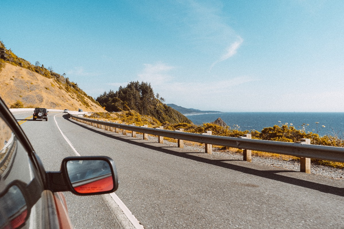
Embarking on a long-distance road trip requires a route that balances scenic variety, engineering marvel, historical depth, and reliable infrastructure to ensure an unforgettable journey. Selecting the right asphalt corridor transforms a simple commute from one point to another into an expedition of discovery, featuring sweeping vistas, dynamic topography, and iconic milestones that test the endurance of both driver and machine.
Long-distance driving demands more than just a full tank of gas; it requires thorough route planning, vehicle preparation, and an understanding of the geographical and logistical challenges inherent to extended travel. Whether traversing vast continental expanses, carving through dramatic mountain passes, or hugging rugged coastlines, the best driving routes offer a harmonious blend of isolation and accessibility, ensuring drivers experience the raw beauty of a landscape without sacrificing essential safety services.
Planning the Ultimate Long-Distance Road Trip
Before turning the ignition key for an extended driving journey, meticulous preparation is paramount. Long-distance driving introduces variables ranging from unpredictable weather shifts and remote fuel deserts to mechanical wear and driver fatigue. Successful long-distance drivers treat preparation as an integral part of the travel experience, ensuring that every mile covered is safe, legal, and comfortable.
Vehicle Readiness and Maintenance
Your vehicle is the lifeline of any long-distance road trip. Prior to departure, a comprehensive mechanical inspection is mandatory. This process goes beyond a standard oil change and includes evaluating critical systems under stress:
- Tire Integrity and Alignment: Inspect tread depth, sidewall integrity, and tire pressure (including the spare). Long miles at sustained highway speeds generate significant heat, increasing the risk of blowouts on worn rubber.
- Fluid Levels and Filtration: Verify engine oil, coolant, transmission fluid, brake fluid, and windshield washer fluid. Replace cabin and engine air filters to maintain optimal fuel efficiency and air quality.
- Braking and Suspension Systems: Mountainous routes and heavy cargo demand responsive brakes and stable suspension components. Listen for squeals, check rotor thickness, and test shock absorber performance.
- Electrical and Lighting Check: Ensure all headlights, high beams, taillights, turn signals, and hazard lights function correctly. Test the battery's cold-cranking amps, especially if driving through high-altitude or freezing environments.
Logistics, Navigation, and Safety Supplies
Relying entirely on cellular data for navigation is a common mistake on remote long-distance routes. Cell service can drop entirely in canyons, national parks, and rural stretches, leaving drivers stranded without digital maps.
- Offline Mapping: Download regional offline maps via GPS applications or carry physical paper road atlases as a failsafe.
- Emergency Roadside Kit: Pack a heavy-duty jumper cables set, a portable tire inflator, a reflective warning triangle, flares, a multi-tool, flashlights with extra batteries, and a basic first-aid kit.
- Sustenance and Hydration: Carry non-perishable high-protein snacks and an ample supply of drinking water to handle unexpected traffic delays or vehicle breakdowns.
- Weather and Road Condition Monitoring: Check local departments of transportation (DOT) websites or official travel apps daily for construction zones, seasonal road closures, and weather advisories.
1. Route 66 (United States)
Stretching approximately 2,440 miles from Chicago, Illinois, to Santa Monica, California, Route 66 remains the definitive symbol of American automotive culture and long-distance exploration. Established in 1926, the "Main Street of America" traverses three time zones and eight states, offering a cross-section of the nation's diverse geography, architecture, and mid-century nostalgia.
| ROUTE 66 QUICK FACTS | |
|---|---|
| Total Distance | ~2,440 miles (3,927 kilometers) |
| Termini | Chicago, IL to Santa Monica, CA |
| States Crossed | IL, MO, KS, OK, TX, NM, AZ, CA |
| Recommended Duration | 10 to 14 days |
Geographical Progression and Highlights
Driving Route 66 is a journey through shifting landscapes. Departing the industrial cityscape of Chicago, the route rolls through the agricultural heartland of Illinois and Missouri before crossing the rolling hills of Kansas and the expansive plains of Oklahoma.
As you push further west into Texas and New Mexico, the terrain transforms into arid high deserts and sweeping mesas. The Arizona segment treats travelers to awe-inspiring stretches near the Grand Canyon and the Painted Desert, culminating in the final descent through California's Mojave Desert to the Pacific Ocean at the historic Santa Monica Pier.
Driving Challenges and Infrastructure
While parts of historic Route 66 have been decommissioned or replaced by modern interstate highways (such as I-40), much of the original alignment remains drivable under designations like "Historic Route 66."
- Navigational Complexity: Because the route weaves in and out of modern highway systems, staying on the historic path requires paying close attention to brown historic markers and specialized guidebooks.
- Infrastructure Gaps: Some rural stretches feature sparse gas stations and limited cellular reception. It is advisable to refuel whenever your tank drops below the halfway mark.
- Pavement Quality: Certain sections feature original cracked concrete or uneven asphalt, which can test vehicle suspension and demand alert steering.
2. The North Coast 500 (Scotland)
Often dubbed Scotland's answer to Route 66, the North Coast 500 (NC500) loops around the rugged northern coast of the Scottish Highlands. Starting and ending at Inverness Castle, this 516-mile scenic route packs dramatic coastal cliffs, deep lochs, pristine white-sand beaches, and winding single-track mountain passes into an intense, breathtaking driving adventure.
Navigating Highland Terrain
The NC500 is not a traditional multi-lane highway; a significant portion consists of single-track roads with designated passing places. Mastering these roads requires specific driving etiquette and acute spatial awareness:
- Passing Places: When a car approaches from the opposite direction or a vehicle behind wants to overtake, pull safely into the designated passing place on your left, or wait for the vehicle to pass if the bay is on your right. Never park in a passing place.
- Livestock on Roads: Sheep and Highland cattle frequently roam freely across Highland roads, especially in rural open-range areas. Drivers must maintain moderate speeds and remain prepared to brake suddenly.
- Weather Volatility: Highland weather can shift from bright sunshine to dense fog, rain, or high winds in a matter of minutes. Drivers must be comfortable handling slick surfaces, poor visibility, and sudden crosswinds.
Key Cultural and Scenic Stops
The allure of the NC500 lies in its dramatic isolation and historic landmarks. Notable waypoints include the imposing ruins of Dunrobin Castle, the breathtaking sea stacks of Duncansby Head at the UK's northeastern mainland tip, and the sweeping curves of the Bealach na Bà—a historic mountain pass featuring hairpin turns and gradients reaching 20 percent, reminiscent of Alpine switchbacks.
3. The Great Ocean Road (Australia)
Spanning 151 miles along the southeastern coast of Australia between Torquay and Allansford, the Great Ocean Road is an engineering masterpiece built by returned soldiers between 1919 and 1932. Dedicated as a war memorial, it is the world's largest war memorial and offers one of the most visually stunning coastal drives on earth.
Coastal Engineering and Scenic Features
Carved directly into sheer sandstone cliffs overlooking the churning waters of the Southern Ocean, the road demands absolute driver focus due to its continuous curves and dramatic drop-offs.
- The Twelve Apostles: Located within Port Campbell National Park, these majestic limestone stacks rise towering out of the Southern Ocean, created by constant erosion from harsh ocean elements.
- Loch Ard Gorge and The Grotto: These geological formations showcase the raw, sculptor-like power of wind and water against coastal rock faces.
- Ecosystem Diversity: The route winds through temperate rainforests in the Otway Ranges before opening up to sweeping ocean vistas, providing opportunities to spot wild koalas in eucalyptus trees along the roadside near Kennett River.
Practical Driving Considerations
Traffic density on the Great Ocean Road can be high, particularly during peak holiday seasons and weekends. Tour buses, campervans, and local traffic share the narrow two-lane corridor. Drivers should utilize designated slow-vehicle turnouts to allow impatient traffic to pass safely, and maintain strict adherence to local speed limits, which fluctuate frequently due to sharp turns and pedestrian activity in coastal towns.
4. The Atlantic Ocean Road (Norway)
For drivers seeking a shorter yet intensely dramatic long-distance connection, Norway’s Atlantic Ocean Road (Atlanterhavsveien) delivers an engineering marvel across an archipelago. While the core scenic stretch spans just over 5 miles, it forms a vital and unforgettable segment of the broader coastal route connecting Kårvåg and Averøy to the mainland.
| THE ATLANTIC OCEAN ROAD TECHNICAL PROFILE | |
|---|---|
| Core Length | 5.2 miles (8.3 kilometers) |
| Location | Møre og Romsdal county, Norway |
| Key Engineering | 8 bridges spanning small islands |
| Highest Point | Storseisundet Bridge (23 meters clearance) |
Architectural Triumph Over the Sea
The Atlantic Ocean Road zigzags across low bridges, causeways, and skerries directly above the surface of the Norwegian Sea. The most famous structure, the Storseisundet Bridge, curves dramatically upward, creating an optical illusion for drivers approaching from certain angles that the road simply drops off into the ocean.
Environmental Elements and Safety
Driving this route is heavily influenced by meteorological conditions. When the weather is calm, the ocean sparkles like glass, and travelers can spot seals and whales breaking the surface. However, during autumn and winter storms, ocean swells crash violently over the guardrails and roadway.
- Wind Shear: High winds sweeping across the open ocean can buffet high-profile vehicles, campers, and motorcycles. Drivers must maintain a firm grip on the steering wheel and reduce speed during gale warnings.
- Salt Spray: Continuous sea spray coats vehicles in salt, making a post-drive undercarriage wash essential to prevent long-term corrosion.
5. The Transfăgărășan (Romania)
Rising through the Făgăraș Mountains of the Southern Carpathians, Romania’s DN7C—popularly known as the Transfăgărășan—is frequently cited as one of the most challenging and exhilarating mountain driving routes in the world. Spanning approximately 90 miles, the road connects the historical regions of Transylvania and Wallachia, climbing to an altitude of 6,699 feet (2,042 meters) near Bâlea Lake.
High-Altitude Switchbacks and Tunnels
Built in the 1970s as a strategic military transport route under Nicolae Ceaușescu, the Transfăgărășan is defined by its sheer vertical ambition:
- Hairpin Geometry: The northern slope features a dizzying array of looping switchbacks, sharp descents, and viaducts that test steering responsiveness and braking stamina.
- Tunnel Network: The route passes through the longest road tunnel in Romania, the Bâlea Tunnel, measuring 2,900 feet (884 meters) through solid mountain rock.
- Seasonal Closures: Due to heavy snowfall and extreme avalanche risks at high altitudes, the Transfăgărășan is officially closed to vehicular traffic for most of the year, typically remaining open only from late June through October. Drivers must verify seasonal opening dates before planning an itinerary.
Vehicle Stress and Driver Focus
Navigating the Transfăgărășan requires active driving management. Riding the brakes on long descents can cause brake fade due to overheating; manual downshifting or utilizing lower gears for engine braking is crucial. Furthermore, drivers must watch out for roaming sheep, wandering stray dogs, and tourists parked precariously along narrow shoulders to photograph the dramatic scenery.
Comparative Overview of Top Driving Routes
To help travelers select the ideal expedition for their driving style, time constraints, and environmental preferences, the following comparison highlights key characteristics of each route:
| Route Name | Location | Approximate Length | Primary Terrain Type | Key Challenge |
|---|---|---|---|---|
| Route 66 | United States | 2,440 miles | Plains, high desert, urban corridors | Navigational complexity, remote fuel gaps |
| North Coast 500 | Scotland | 516 miles | Coastal cliffs, single-track mountain passes | Single-track passing etiquette, volatile weather |
| Great Ocean Road | Australia | 151 miles | Sheer coastal cliffs, rainforests | High traffic density, continuous tight curves |
| Atlantic Ocean Road | Norway | 5.2 miles (core) | Ocean causeways, archipelago bridges | High winds, ocean spray, severe storm surges |
| Transfăgărășan | Romania | 90 miles | High-altitude alpine switchbacks | Seasonal closures, steep grades, brake management |
Frequently Asked Questions
How many hours per day should I drive on a long-distance road trip?
Aim for a maximum of 5 to 6 hours of actual driving time per day, broken up into manageable 2-hour blocks. This prevents driver fatigue, maintains alertness, and leaves ample time for sightseeing, meals, and unexpected traffic delays.
What is the best way to prevent driver fatigue on remote routes?
Combat fatigue by rotating drivers every two to three hours if possible. If driving solo, take a 15-minute break every 100 miles or two hours to step outside, walk, stretch, and hydrate. Avoid heavy meals before driving, as they induce drowsiness.
Are all of these roads open year-round?
No. While coastal routes like the Great Ocean Road and Route 66 are accessible year-round, high-altitude alpine routes like the Transfăgărășan close during winter and spring due to heavy snow and ice. Always verify local road authorities' status updates before departure.
How should I prepare my car for driving through remote areas with limited fuel stations?
Always refuel when your fuel gauge reaches the halfway mark, especially on rural stretches of Route 66 or the Scottish Highlands. Carry a physical map to identify upcoming towns, and keep a registered emergency roadside assistance card in your glove compartment.
What paperwork do I need for driving international routes?
Depending on your destination, you may need a valid passport, an International Driving Permit (IDP) alongside your domestic driver's license, proof of cross-border insurance coverage, and vehicle registration documents. Check specific national entry and transit regulations well in advance.
Conclusion and Final Recommendations
Choosing the right long-distance driving route transforms ordinary travel into an extraordinary exploration of geography and culture. Whether you test your endurance across the historic expanses of Route 66, navigate the single-track bends of the North Coast 500, hug the crashing surf of the Great Ocean Road, brave the ocean winds of Norway's Atlantic causeways, or conquer the alpine switchbacks of the Transfăgărășan, success lies in thorough preparation. Prioritize vehicle maintenance, respect local driving customs, monitor changing weather patterns, and allow yourself the flexibility to pull over and appreciate the journey rather than just focusing on the destination.