Navigating Highway 40 requires understanding the distinction between the historic U.S. Route 40 and the modern Interstate 40. As of 2026, I-40 serves as the primary 2,556-mile east-west artery connecting Barstow, California, to Wilmington, North Carolina, while segments of U.S. 40 offer a slower, historical journey through the nation's midsection.
Whether you are a logistics professional, an RV enthusiast, or a cross-country traveler, mastering the "40" corridor involves more than just following a GPS. This guide provides a comprehensive breakdown of the route’s geography, technical specifications, and regional challenges to help you plan an efficient and safe transit across the United States.
Defining the "40": I-40 vs. U.S. Route 40
The term "Highway 40" is often used interchangeably to describe two distinct road systems. To use a map guide effectively, one must first identify which "40" they are traveling.
Interstate 40 (I-40)
Interstate 40 is a major controlled-access highway that spans the southern half of the United States. It is the third-longest Interstate in the country. It was designed for high-speed travel, heavy freight, and military mobility. In the western U.S., I-40 largely replaced the famous Route 66, bypassing many of the original towns to provide a more direct path through the Mojave Desert and the Ozark Plateau.
U.S. Route 40
U.S. Route 40, also known as the National Road in its eastern sections, predates the Interstate Highway System. While much of it has been supplanted by I-70 and I-80 in the north, significant portions remain active. Unlike the Interstate, U.S. 40 often passes directly through town centers and features traffic lights, lower speed limits, and historic landmarks. This guide focuses primarily on the modern Interstate 40 corridor, as it is the dominant path for 21st-century commerce and long-distance travel.
Geographic Breakdown: A State-by-State Guide
Understanding the map of I-40 requires breaking the route into its regional segments. Each state offers unique terrain, weather patterns, and logistical hurdles.
The Western Segment: California and Arizona
The journey begins (or ends) in Barstow, California. This section is characterized by extreme temperature fluctuations and high-elevation passes.
- California: The route starts at the junction with I-15. Travelers move through the Mojave National Preserve. Fuel stops are sparse here, making it critical to monitor tank levels before entering the desert stretches.
- Arizona: Entering Arizona, the elevation rises significantly. I-40 passes through Kingman and Flagstaff. At Flagstaff, the highway reaches an elevation of nearly 7,000 feet. This is a critical point on the map for winter travelers, as heavy snow and ice frequently impact the San Francisco Peaks area, even when the surrounding deserts are warm.
The Southwestern Heartland: New Mexico and Texas
This segment follows much of the old "Mother Road" (Route 66) geography, crossing the Continental Divide.
- New Mexico: I-40 bisects the state, passing through Gallup and Albuquerque. The Continental Divide is located just west of Thoreau, marked by a sign at an elevation of 7,275 feet. This is the highest point on the entire I-40 route.
- Texas: The Texas Panhandle section is relatively short but vital for logistics. Amarillo serves as the central hub. This area is notorious for high crosswinds and sudden dust storms, which can reduce visibility to near zero in minutes.
The Central Plains: Oklahoma and Arkansas
Moving eastward, the desert gives way to the rolling plains and dense forests of the Mississippi River Valley.
- Oklahoma: I-40 passes through Oklahoma City, a major intersection where it meets I-35 and I-44. This region is part of "Tornado Alley." Map guides for this area should always be paired with real-time weather monitoring apps during the spring and summer months.
- Arkansas: The highway crosses the Arkansas River and passes through Little Rock. The terrain becomes increasingly hilly as it enters the Ozark foothills, requiring drivers of heavy vehicles to be mindful of gear management on long grades.
The Eastern Corridor: Tennessee and North Carolina
The final leg of the journey involves some of the most complex engineering on the highway system as it crosses the Appalachian Mountains.
- Tennessee: I-40 is the primary east-west artery of Tennessee, connecting Memphis, Nashville, and Knoxville. The bridge over the Mississippi River at Memphis is a critical infrastructure point.
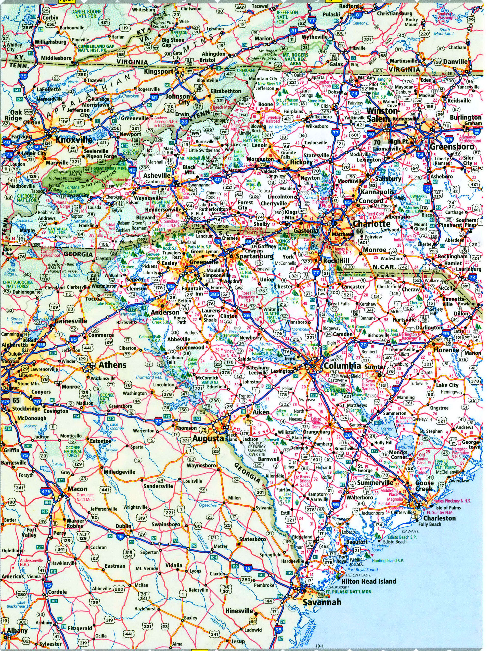
- North Carolina: This is the most technically demanding section of the highway. Between Knoxville, TN, and Asheville, NC, the road winds through the Pigeon River Gorge. This stretch features sharp curves, steep grades, and frequent rockslides. The highway finally terminates at the Atlantic Ocean in Wilmington.
Technical Specifications and Map Reading for I-40
To navigate Highway 40 like a professional, you must understand the technical data points provided on modern maps and DOT (Department of Transportation) resources.
Mile Markers and Exit Numbering
I-40 uses a distance-based exit numbering system in almost every state it traverses. This means the exit number corresponds to the mile marker. If you are at Exit 150 and need to reach Exit 200, you have exactly 50 miles to go. This is invaluable for calculating fuel range and arrival times without needing to consult a digital map constantly.
The Pigeon River Gorge Constraints
For those traveling the eastern end of the map, the section between mile markers 0 and 15 in North Carolina (near the Tennessee border) is restricted for certain oversized loads. As of 2026, enhanced sensor arrays monitor vehicle weight and width in real-time to prevent accidents in the narrow, winding gorge.
EV Infrastructure in 2026
The I-40 corridor is now a fully designated "Alternative Fuel Corridor." Maps now highlight "High-Power Charging Hubs" every 50 miles in most states. However, in the rural stretches of New Mexico and the Mojave Desert in California, these gaps can still be closer to 70 miles. Always verify that your specific charging network (e.g., Tesla Supercharger, Electrify America) has active stalls at your intended stop.
| State | Highest Point on I-40 | Key Junction | Primary Terrain |
|---|---|---|---|
| California | ~4,700 ft (Mountain Pass) | I-15 | High Desert |
| Arizona | 7,335 ft (Arizona Divide) | I-17 | Alpine/High Plateau |
| New Mexico | 7,275 ft (Continental Divide) | I-25 | High Plains/Mesas |
| Texas | ~3,800 ft (Near NM Border) | I-27 | Flat Plains |
| Oklahoma | ~1,900 ft (Western Border) | I-35 / I-44 | Rolling Prairie |
| Arkansas | ~1,000 ft (Ozark Foothills) | I-30 | River Valley/Forest |
| Tennessee | ~2,600 ft (Near NC Border) | I-65 / I-75 | Appalachian Foothills |
| North Carolina | ~2,800 ft (Swannanoa Gap) | I-77 / I-85 | Mountains to Coastal Plain |
Critical Safety and Planning Considerations
Weather Hazards by Region
A single trip across Highway 40 can encounter four distinct climates.
- High Wind (AZ, NM, TX): Semi-trucks and high-profile vehicles (RVs) are frequently grounded in Amarillo or Gallup due to 60+ mph gusts.
- Flash Flooding (AZ, NM): During the monsoon season (July–September), dry washes can become raging rivers that overflow onto the interstate.
- Ice and Snow (Flagstaff, AZ & Asheville, NC): These two mountain points are the most likely to see full highway closures during winter storms.
- Humidity and Fog (TN, NC): The Great Smoky Mountains section is prone to "mountain hole" fog, where visibility drops to near zero instantly.
Heavy Freight and Traffic Density
I-40 is a primary logistics lane for the United States. In 2026, the density of autonomous and platooning freight trucks is highest between Oklahoma City and Nashville. Travelers should maintain consistent speeds and avoid "lingering" in the blind spots of large vehicles, particularly in the middle lanes of three-lane segments.
Communication Dead Zones
Despite 5G expansion, there are still notable "dead zones" on the I-40 map. These are most common in:
- The Mojave Desert (California)
- The Zuni Mountains (New Mexico)
- The Pigeon River Gorge (TN/NC Border)
It is highly recommended to download offline maps via Google Maps or Apple Maps before entering these segments. For emergency use, 2026-era satellite messaging integrated into most modern smartphones is the most reliable backup.
Understanding the "End to End" Significance
The I-40 termini are iconic. In Barstow, CA, the highway peters out into the Mojave. In Wilmington, NC, a famous sign once listed the distance to Barstow as 2,554 miles. While the sign has been stolen and replaced multiple times over the decades, it serves as a reminder of the sheer scale of this route.
For those attempting the full cross-country drive, the transition from the Pacific time zone to the Eastern time zone involves crossing three time zone boundaries.
- Pacific to Mountain: California/Arizona border (Note: Arizona does not observe Daylight Saving Time).
- Mountain to Central: New Mexico/Texas border.
- Central to Eastern: Middle Tennessee (near Cookeville).
Frequently Asked Questions
Is Highway 40 the same as Route 66?
No, but they share much of the same geography in the West. Interstate 40 was built to replace Route 66. In many parts of Arizona and New Mexico, I-40 runs directly over the old path of Route 66, though you can still exit to find "Historic Route 66" frontage roads in towns like Seligman, AZ, and Tucumcari, NM.
What is the most dangerous part of Highway 40?
Statistically, the Pigeon River Gorge on the Tennessee/North Carolina border is considered the most challenging due to its narrow lanes, steep drop-offs, and sharp curves. Another high-risk area is the "crossroads" in Oklahoma City, which sees high volumes of high-speed merging traffic from multiple interstates.
Are there tolls on I-40?
As of 2026, I-40 remains largely a toll-free highway across the country. However, some "Express Lanes" in major metropolitan areas like Nashville or Oklahoma City may require a transponder for bypass access during peak hours. Additionally, bridges in major cities may occasionally implement congestion pricing.
How long does it take to drive the entire length of I-40?
The 2,556-mile trip takes approximately 38 to 42 hours of actual driving time. For a safe trip with rest stops, most travelers should plan for a 5-to-6-day journey, averaging 450 to 500 miles per day.
Can I drive I-40 in a standard electric vehicle?
Yes. By 2026, the National Electric Vehicle Infrastructure (NEVI) formula program has ensured that fast-charging stations are available at regular intervals. However, travelers should still use a dedicated EV trip planner to account for the significant range reduction caused by the high-elevation climbs in Arizona and North Carolina.
Final Recommendations for Your Journey
To successfully navigate and understand Highway 40, your preparation should be tiered. Start with a high-level map to identify your major state-line crossings and overnight stops. Second, consult state-specific DOT websites (such as DriveNC.gov or AZ511.gov) for real-time construction data, as the I-40 corridor undergoes constant maintenance to support its heavy freight load. Finally, always carry a physical road atlas as a fail-safe for the cellular dead zones in the desert and mountain regions. By combining digital tools with geographic knowledge, you can ensure a predictable and efficient passage across this American backbone.