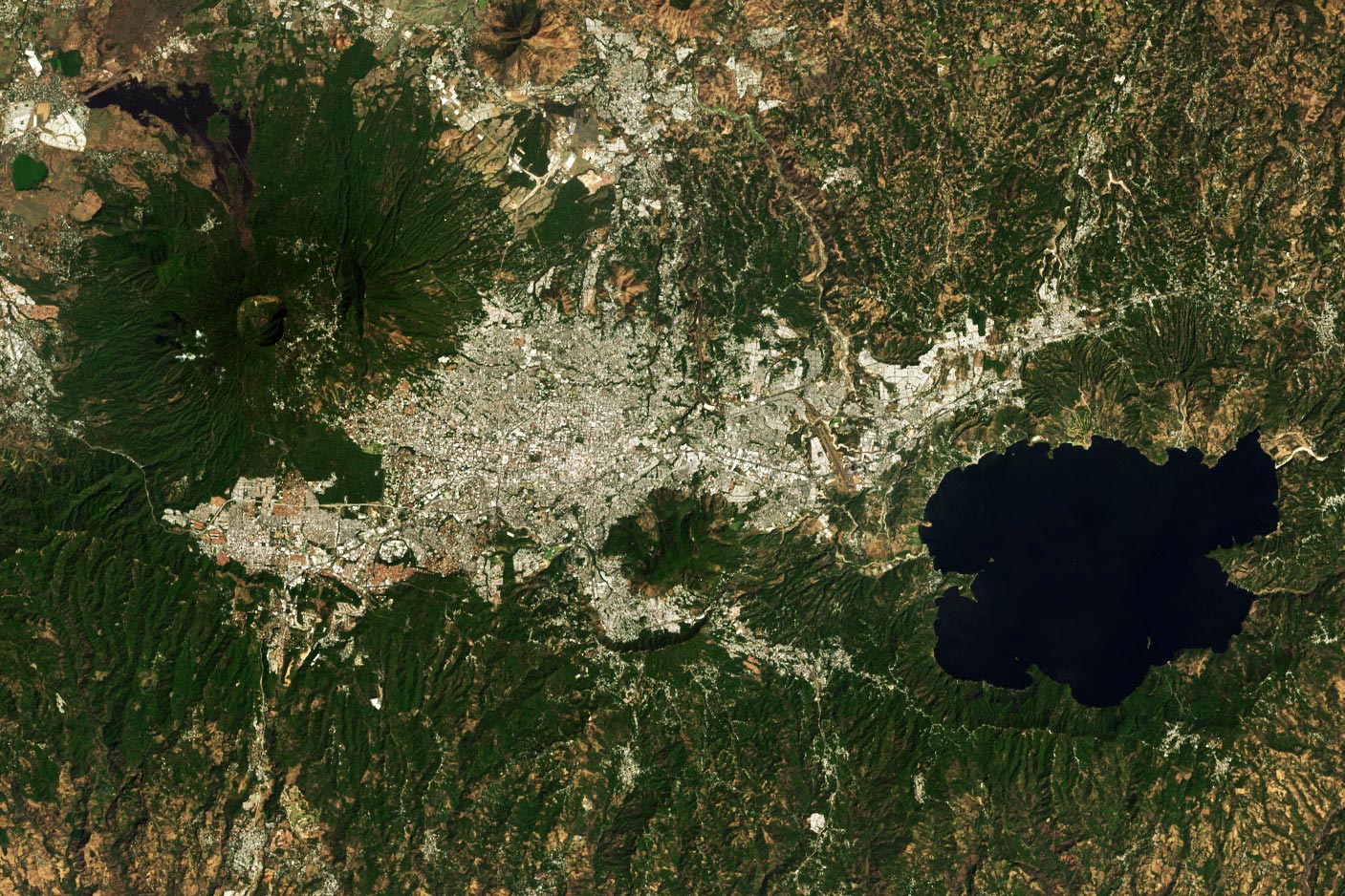
The 1986 San Salvador earthquake was a devastating magnitude 5.7 (Mw) seismic event that struck the capital of El Salvador on October 10, 1986, at 11:49 AM local time. Despite its moderate magnitude, the earthquake caused over 1,000 deaths and widespread destruction due to its shallow focal depth and proximity to the city's densely populated center.
Seismological Profile: Why a Moderate Event Caused Catastrophic Damage
To understand the 1986 San Salvador earthquake, one must distinguish between magnitude and intensity. While a 5.7 magnitude event is often considered "moderate" in global seismology, the specific parameters of this earthquake created a "perfect storm" for urban destruction.
Focal Depth and Proximity
The earthquake’s hypocenter was remarkably shallow, estimated at only 7 to 10 kilometers beneath the earth's surface. In seismology, the shallower the earthquake, the less distance the seismic waves have to travel and attenuate before reaching the surface. Because the epicenter was located directly within the metropolitan area—specifically near the southern outskirts of the city—the energy release occurred almost immediately beneath the foundations of thousands of buildings.
The San Salvador Fault System
Unlike the massive subduction zone earthquakes that occur off the coast of Central America (where the Cocos Plate dives beneath the Caribbean Plate), the 1986 event was an upper-crustal earthquake. It was triggered by the San Salvador Fault System, a local network of faults associated with the Central American Volcanic Arc. These crustal earthquakes are characterized by high-frequency ground motion, which is particularly destructive to low-to-medium-rise masonry and concrete structures—the exact building types that dominated San Salvador in the mid-1980s.
Ground Motion and Acceleration
Recorded peak ground acceleration (PGA) during the event reached levels that exceeded the design thresholds of many contemporary buildings. In some areas of the city, the vertical acceleration was significantly high, which effectively "unweighted" structures, causing columns to lose their load-bearing capacity and leading to catastrophic structural "pancaking."
The Immediate Impact: Urban Destruction and the Human Toll
At 11:49 AM on a Friday, the city was at its peak activity. Schools were in session, offices were full, and the downtown commercial district was crowded with shoppers. This timing contributed significantly to the high casualty rate.
The Collapse of the Rubén Darío Building
The most haunting symbol of the 1986 earthquake was the collapse of the Edificio Rubén Darío. This five-story reinforced concrete building had already been weakened by a previous earthquake in 1965. Despite recommendations to demolish or extensively retro-fit the structure, it remained in use. When the 1986 tremors hit, the building suffered a total structural failure, trapping hundreds of people inside. The rescue efforts at the Rubén Darío lasted for days and highlighted the lack of heavy search-and-rescue equipment in the country at the time.
Healthcare Infrastructure Failure
The earthquake severely crippled the city’s ability to respond to the injured. Several major hospitals, including the San Rafael Hospital and parts of the Bloom Children’s Hospital, suffered structural damage that forced evacuations. When a disaster strikes, the immediate availability of surgical suites and emergency bays is critical; the loss of these facilities meant that many survivable injuries became fatal during the first 48 hours.
Socio-Economic Context: The Shadow of Civil War
In 1986, El Salvador was in the midst of a brutal civil war. The conflict had already strained the national budget and weakened infrastructure. The earthquake forced a temporary de facto truce in some areas as the nation grappled with the disaster, but the war complicated international aid delivery and internal logistics. Furthermore, the city had been flooded with displaced persons (IDPs) fleeing the conflict in the countryside. These populations lived in "mesones" (overcrowded tenement houses) and "tugurios" (shanty towns) constructed of precarious materials, which were obliterated by the shaking.
Technical Analysis of Structural Failures
The destruction of San Salvador provided structural engineers with a grim but vital laboratory for studying building performance. Several factors were identified as primary causes of the widespread structural collapse.
Soil Conditions and "Tierra Blanca"
Much of San Salvador is built on volcanic ash deposits known locally as tierra blanca. While this soil can be stable under dry conditions, its response to seismic waves is problematic. In 1986, the soil contributed to site amplification, where the local geology actually increased the amplitude of the seismic waves. In some neighborhoods, this led to localized landslides and the failure of retaining walls, particularly in the ravines (barrancos) where many informal settlements were located.
Lack of Ductility in Reinforced Concrete
Many of the buildings that collapsed were designed with "non-ductile" reinforced concrete frames. In seismic engineering, ductility is the ability of a structure to undergo large deformations without collapsing. In 1986, many columns lacked sufficient lateral reinforcement (hoops or ties). When the intense shaking began, the concrete inside the columns crushed, the vertical rebar buckled, and the buildings lost their ability to support their own weight.
Soft Story Irregularities
A common architectural trend in San Salvador involved buildings with open ground floors for parking or retail (soft stories) and heavy masonry walls on the upper floors. This creates a "stiffness discontinuity." During the 1986 earthquake, the flexible ground floors were unable to resist the lateral forces, causing the upper floors to shift and crash down onto the street level.
Historical Comparison of Seismic Events in El Salvador
To understand the scale of the 1986 disaster, it is helpful to compare it with other significant earthquakes in the region's history.
| Feature | 1917 Earthquake | 1986 Earthquake | 2001 Earthquake (Jan) |
|---|---|---|---|
| Magnitude (Mw) | ~6.7 | 5.7 | 7.7 |
| Source Type | Volcanic/Crustal | Upper Crustal | Subduction Zone |
| Primary Impact Area | San Salvador / Volcano | San Salvador Metro | Nationwide / Landslides |
| Fatalities | ~1,000+ | 1,000 - 1,500 | 944 |
| Homes Destroyed | High (Adobe) | ~200,000 displaced | ~100,000+ |
| Key Damage Factor | Volcanic Eruption | Building Collapse (Urban) | Massive Landslides (Las Colinas) |
Recovery, Reconstruction, and the Evolution of Building Codes
The 1986 earthquake served as a turning point for Salvadoran engineering and urban planning. The sheer scale of the losses prompted a re-evaluation of how the capital should be built and managed.
The Shift to the West
Following the disaster, there was a notable shift in the city's development. Much of the "old" downtown (Centro Histórico) remained in ruins for years due to insurance complications and the ongoing war. This accelerated the migration of commercial centers and high-end residential areas toward the west, specifically to areas like Escalón, Santa Elena, and Antiguo Cuscatlán, where developers sought more stable ground and modern construction standards.
Modernization of Seismic Codes
In the years following the disaster, Salvadoran engineers worked with international experts to modernize the Reglamento para la Seguridad Estructural de las Construcciones (Regulations for the Structural Safety of Constructions). The code was updated to mandate:
- Increased lateral reinforcement in concrete columns.
- Strict limits on "soft story" designs.
- Mandatory soil studies for any medium-to-high-rise construction.
- Implementation of the "Capacity Design" philosophy, ensuring that if a building fails, it does so in a way that allows occupants to escape.
International Aid and the Role of NGOs
The 1986 earthquake saw a massive influx of international assistance from the United States, Mexico, and Europe. This aid was not only in the form of immediate food and medicine but also in the provision of temporary housing (proviles). However, the long-term reconstruction was hampered by the economic exhaustion of the 1980s. It wasn't until after the 1992 Peace Accords that the "seismic scars" of the 1986 event began to be fully erased from the city's skyline.
Current Status in 2026: Lessons Forty Years Later
As of 2026, San Salvador has transformed significantly, but the ghost of the 1986 earthquake remains a foundational element of its disaster risk management strategies. The city now employs a sophisticated seismic monitoring network managed by the Ministry of Environment and Natural Resources (MARN).
Retrofitting and Preservation
In 2026, many of the historic buildings in the city center have finally been restored or replaced. Modern engineering techniques, such as carbon fiber wrapping for column strengthening and the use of seismic isolators in new government buildings, are now common. However, the challenge of "informal construction" remains. Many homes in the periphery are still built without engineering oversight, representing a persistent vulnerability.
Community Preparedness
The anniversary of the October 10 earthquake is used annually as a day for national earthquake drills. The culture of "mochilismo" (keeping an emergency backpack) and clear evacuation routing in public malls and offices is a direct legacy of the 1986 trauma.
Frequently Asked Questions
Why was the 1986 earthquake more lethal than larger magnitude events?
The 1986 earthquake was more lethal because of its location and depth. While a magnitude 7.7 earthquake (like the one in January 2001) releases more energy, that energy was centered off the coast. The 1986 event occurred directly under the city at a very shallow depth. This resulted in extremely violent ground shaking in a concentrated area where building quality was poor.
How many people were left homeless after the event?
Estimates suggest that approximately 200,000 people were left homeless. This created a massive housing crisis that lasted for over a decade. The government and NGOs had to establish large camps, many of which eventually evolved into permanent neighborhoods that lack proper urban planning.
Was the 1986 earthquake related to volcanic activity?
While the earthquake occurred along the volcanic arc fault system, it was not a volcanic eruption. It was a tectonic event—a release of pressure along a crustal fault. However, San Salvador is situated next to a large volcano (El Boquerón), and the complex interplay between tectonic plates and volcanic pressure makes the region highly seismically active.
Can buildings in San Salvador now withstand a similar earthquake?
Modern buildings constructed under the post-1986 and post-2001 codes are designed to withstand such events without collapsing. Engineers now use advanced computer modeling to simulate ground motion. However, older structures that have not been retrofitted and informal housing in "high-risk zones" (near cliffs or ravines) remain at significant risk.
What should I do if I am in San Salvador during an earthquake?
The standard advice remains "Drop, Cover, and Hold On." In an urban environment like San Salvador, it is often more dangerous to try to run out of a building during the shaking due to falling glass and facade debris. Once the shaking stops, evacuate to a clear area away from power lines and damaged structures.
Practical Recommendations for Residents and Investors
For those living in or looking to invest in San Salvador in 2026, seismic safety must be a primary consideration.
- Verify Structural Certifications: Before purchasing or leasing property, especially in the Centro Histórico or older parts of Escalón, request a structural safety assessment or proof that the building complies with the latest seismic codes.
- Soil Analysis: Ensure that any new construction project includes a comprehensive geotechnical study. The tierra blanca soil requires specific foundation designs (such as deep piles or mat foundations) to mitigate the risk of differential settlement during a quake.
- Emergency Resilience: Maintain an emergency kit that includes at least 72 hours of water and non-perishable food. Given that the 1986 earthquake destroyed the water main system, having independent water storage (cisterns) is a standard and necessary feature for Salvadoran homes.
- Insurance: High-quality seismic insurance is a standard requirement for mortgages in El Salvador, but owners should ensure their policy covers "replacement value" rather than just the loan balance.
The 1986 San Salvador earthquake was a tragic milestone, but it catalyzed the modernization of the country’s engineering standards and disaster response capabilities. By studying the failures of the past, the city continues to build a more resilient future.