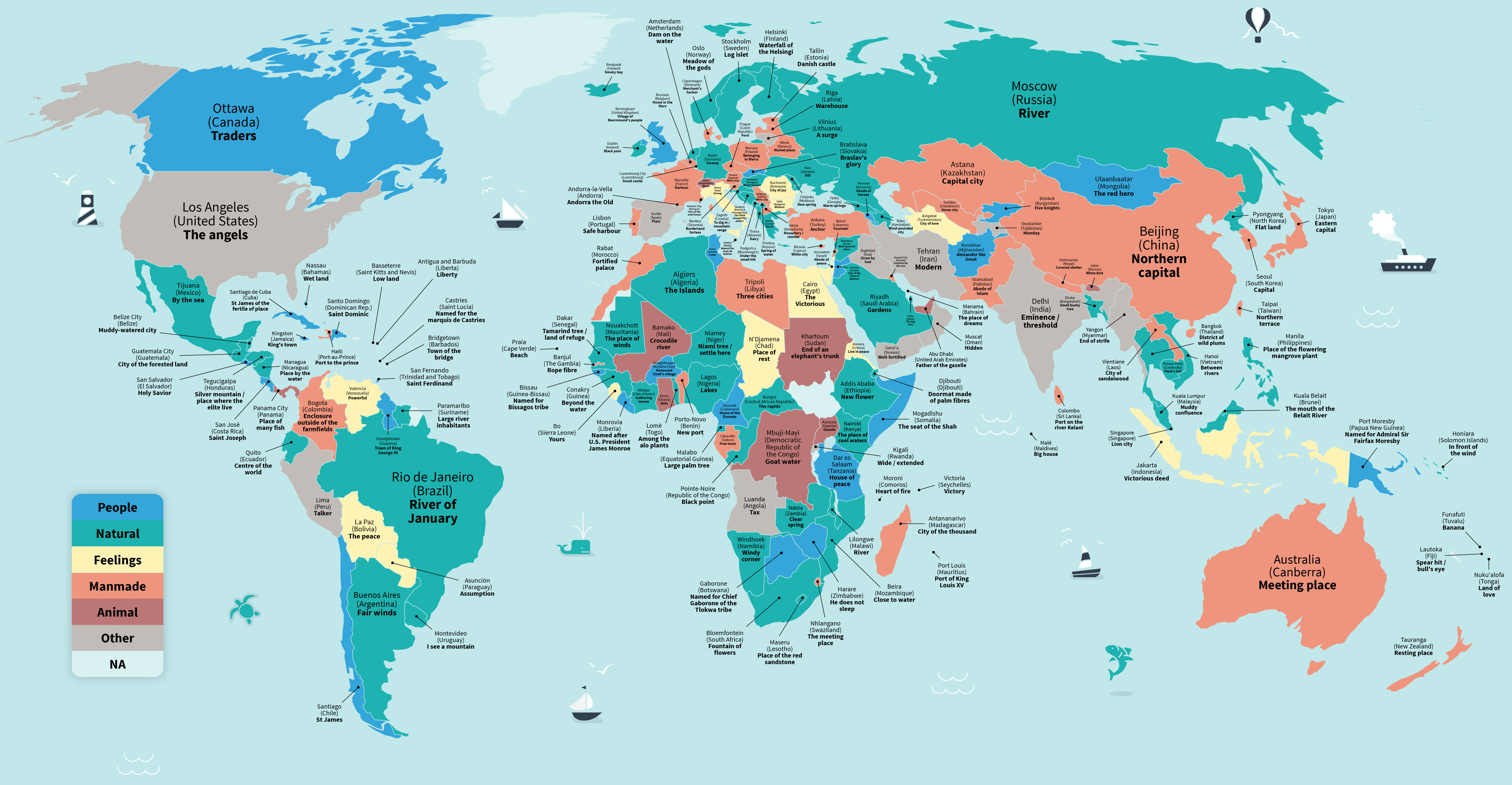
Accessing a comprehensive "all cities in the world list" requires navigating various global databases, as no single official register exists. As of 2026, researchers and developers typically rely on the GeoNames database, which contains over 12 million geographical names, or the UN World Urbanization Prospects, which tracks approximately 1,900 major urban centers.
Determining an exact count of every city globally is a complex task because the definition of a "city" varies significantly between nations. While a settlement of 200 people might be classified as a city in Denmark, other nations require a minimum population of 50,000 or specific administrative designations. For those seeking a complete dataset, the choice depends heavily on whether the goal is demographic research, software development, or logistics planning.
The Challenge of Defining "City" in a Global Context
To understand any list of all cities in the world, one must first address the lack of a universal definition. What qualifies as a city in one jurisdiction may be considered a village or a town in another. In 2026, the international community continues to use three primary lenses to categorize urban settlements:
City Proper
The "city proper" refers to the administrative boundary defined by legal or political limits. This often includes a city council and a mayor. While this is the most common way to list cities, it frequently fails to capture the true size of an urban area. For example, the city proper of Paris has a much smaller population than the functional urban area that surrounds it.
Urban Agglomeration
This definition focuses on the contiguous built-up area. It ignores administrative boundaries and looks at how buildings and infrastructure connect. When searching for a list of "all cities" based on population density, urban agglomerations provide a more accurate picture of human settlement patterns, particularly in massive corridors like the Pearl River Delta in China.
Metropolitan Area
Metropolitan areas include the city proper and the surrounding "commuter belts"—regions that are socially and economically integrated with the urban core. For business and economic lists, metropolitan data is often the most valuable because it represents the full scale of a local economy.
Primary Sources for a Global City Database
When looking for a downloadable or queryable list of all cities in the world, several authoritative sources provide the necessary data. These platforms vary in their technical depth, update frequency, and the specific metadata they offer.
1. GeoNames (The Gold Standard for Developers)
GeoNames is the most comprehensive open-source geographical database available in 2026. It integrates data from national statistical agencies and crowd-sourced edits. It is highly favored by software engineers because it offers a creative commons license and structured data in various formats.
- Total Records: Over 12 million features.
- Use Case: Building drop-down menus for addresses, weather applications, and mapping software.
- Accessibility: Offers a daily export of "cities15000.txt" (cities with a population over 15,000) and "cities500.txt" (settlements over 500 people).
2. UN World Urbanization Prospects
The United Nations Department of Economic and Social Affairs (UN DESA) produces the World Urbanization Prospects, which is the definitive source for demographic analysis.
- Focus: It tracks the growth of urban centers with 300,000 inhabitants or more.
- Data Depth: Provides historical data and projections out to 2050, making it essential for urban planners and climate researchers.
3. SimpleMaps World Cities Database
SimpleMaps provides a curated, high-quality database that is often preferred by those who need "clean" data. Unlike raw GeoNames data, which may contain duplicates or obscure administrative points, SimpleMaps focuses on the most relevant cities for commercial use.
- Features: Includes latitude/longitude, country, ISO codes, and population.
- 2026 Accuracy: Updated regularly to reflect name changes and administrative shifts in emerging economies.
Comparing Global City Data Providers
The following table compares the most frequently used lists of cities based on scope and technical application.
| Database Source | Approximate Count | Primary Format | Update Frequency | Best For |
|---|---|---|---|---|
| GeoNames | 12,000,000+ | Tab-separated text | Daily | Technical development / GIS |
| UN DESA | 1,900+ (Major) | Excel / PDF | Every 2 years | Academic & Demographic research |
| Natural Earth | 7,000+ | Shapefile / SQLite | Annual | Cartography and Visual Maps |
| SimpleMaps | 40,000+ (Basic) | CSV / JSON | Monthly | Business & Logistics |
| OpenStreetMap | Millions | XML / PBF | Real-time | Detailed local navigation |
Regional Distribution and Urbanization Trends in 2026
The global list of cities is not static. In 2026, we are witnessing a significant shift in where the world’s most populous cities are located. While European and North American cities are seeing stabilized or slightly declining populations, the "Global South" is experiencing an unprecedented urban explosion.
Asia: The Urban Powerhouse
Asia currently hosts the majority of the world's "megacities" (cities with over 10 million residents). Tokyo remains the world's largest urban area, though its population is plateauing. Meanwhile, cities in India and China continue to dominate any list by volume. For those compiling a list of cities by economic importance, secondary Chinese cities—often unheard of in the West—now boast populations exceeding 5 million.
Africa: The Fastest Growing Frontier
By 2026, African cities like Lagos (Nigeria), Kinshasa (DR Congo), and Cairo (Egypt) have climbed to the top of the global population rankings. If your search for a "list of all cities" is focused on growth potential, the African continent is where the most new city designations are occurring. This presents a challenge for data accuracy, as rapid urbanization often outpaces official government census updates.
Europe and North America: Administrative Stability
In these regions, the list of cities is relatively stable. Most changes involve the reclassification of "towns" to "cities" based on local governance reforms rather than massive population shifts. Data for these regions is typically the most granular, often including neighborhood-level data (sub-districts).
How to Access and Filter City Lists for Specific Projects
Depending on your objective, you may not actually need "every" city. Downloading a list of 12 million locations can crash a standard spreadsheet application. Here is how to filter the data effectively:
For Web Developers
If you are creating a "Select City" dropdown for a website, you should filter your list by population. Most developers use a threshold of 15,000 or 50,000 residents. This ensures the list remains manageable for the user while covering 90% of likely visitor locations. JSON is the preferred format for these applications due to its compatibility with JavaScript frameworks.
For Data Scientists and Analysts
Researchers often require "Parent-Child" relationships in their city lists. This means knowing which city belongs to which state/province, and which country. When using datasets like Natural Earth, ensure you are pulling the "Admin-0" (Country) and "Admin-1" (State/Province) identifiers to maintain data integrity.
For Logistics and Supply Chain
For shipping and logistics, "all cities" isn't enough; you need postal codes and geocoordinates. Commercial providers like Google Maps Platform or Mapbox are often better than static lists because they resolve "ambiguous" city names (e.g., there are dozens of cities named "Springfield" in the United States).
Challenges in Maintaining a Global City List
Even in 2026, keeping a list of all cities in the world accurate involves overcoming several technical and political hurdles:
- Toponymy (Name Changes): Cities frequently change names for political or cultural reasons. Examples include the shift from "Bombay" to "Mumbai" or "Astana" to "Nur-Sultan" and back to "Astana." A high-quality list must track these "alternate names."
- Disputed Territories: Deciding which country a city like Taipei or Sevastopol belongs to is a geopolitical challenge that data providers must navigate. Most open-source databases use ISO standards to remain neutral.
- Transliteration: Converting names from non-Latin scripts (Cyrillic, Arabic, Mandarin) into the Latin alphabet often results in multiple spellings for the same city, leading to duplicates in uncleaned datasets.
Practical Expert Guidance for Using City Lists
When utilizing a global city dataset, always verify the character encoding. Most global lists use UTF-8 to correctly display accented characters and non-Latin scripts. If you import a list and see symbols like "," it is likely an encoding error.
Furthermore, always check the datum used for coordinates. Most modern lists use WGS84, which is the standard for GPS. Using a different coordinate system can result in location errors of several hundred meters, which is critical for mapping applications.
Frequently Asked Questions
What is the most accurate list of all cities in the world?
There is no single "perfect" list, but GeoNames is widely considered the most accurate open-source database due to its frequent updates and comprehensive coverage of smaller settlements. For demographic accuracy of major cities, the UN World Urbanization Prospects is the industry standard.
How many cities are there in the world in 2026?
If defining a city as an urban area with more than 50,000 people, there are approximately 4,000 to 5,000 cities. If including all settlements with administrative "city" status regardless of population, the number exceeds 200,000.
Where can I download a CSV list of all cities?
The most accessible CSV lists are provided by SimpleMaps (for a clean, commercial-ready version) or the GeoNames export site (for a more technical, raw version). Most of these sites offer a free "Basic" tier and a paid "Premium" tier for more detailed metadata.
Why do some lists show different populations for the same city?
This is usually due to the difference between "City Proper" and "Metropolitan Area" definitions. One list may count only those living within the legal city limits, while another includes the entire suburban sprawl.
Are there any APIs for global city lists?
Yes, the Google Places API, Mapbox Search API, and GeoNames API are the most common tools for developers to query city data dynamically without hosting a massive local database.
Final Recommendation for 2026
If you are a developer or business owner looking for a reliable "all cities in the world list," start by defining your population threshold. For most practical applications, a list of cities with a population of 15,000 or more strikes the best balance between comprehensiveness and system performance. Use the GeoNames "cities15000" dataset as your foundation, but ensure you have a process in place to handle toponymic changes and transliteration variations that occur as global urban boundaries continue to evolve.