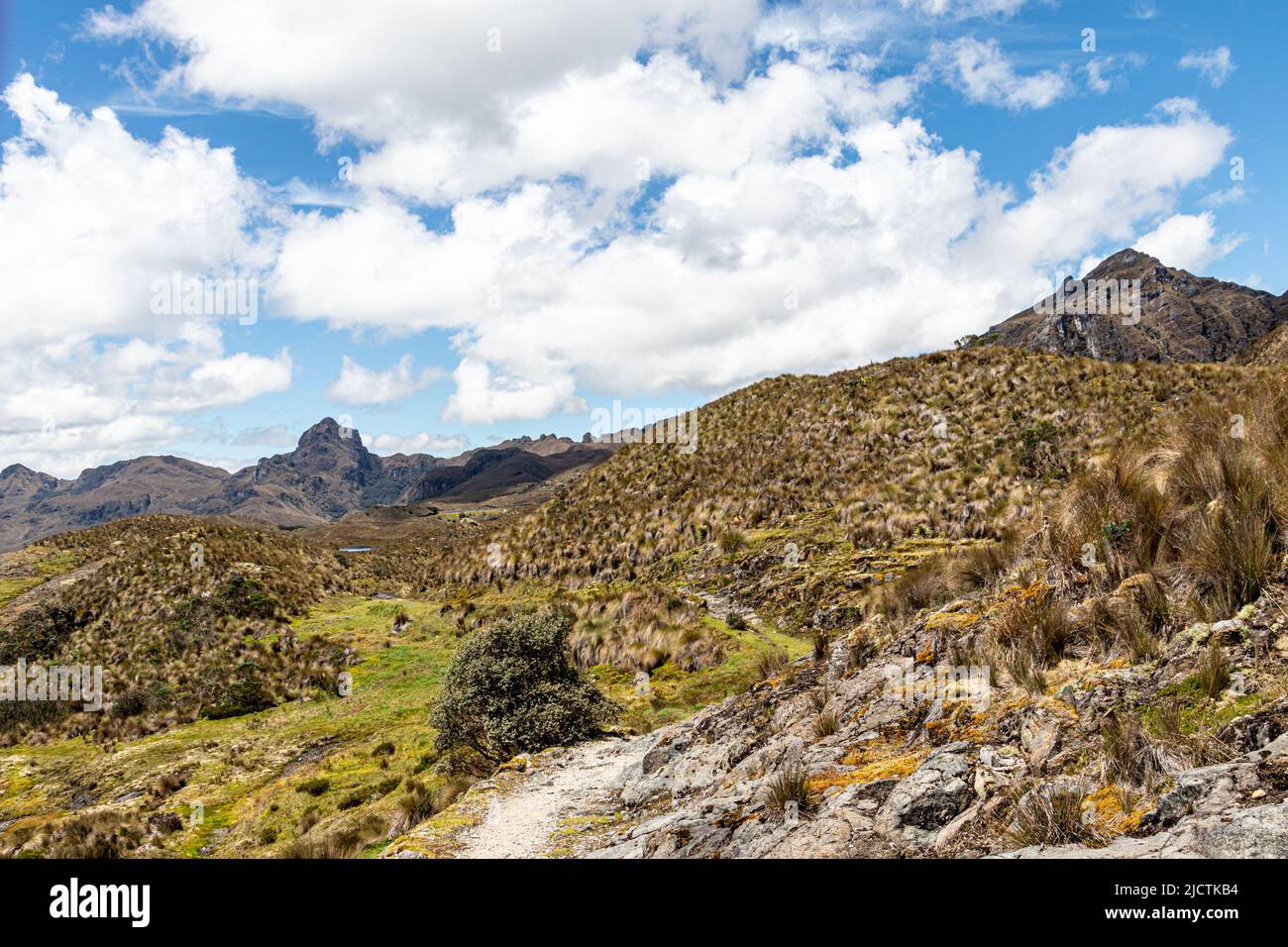
A journey through Cajas National Park is a high-altitude expedition into a unique paramo ecosystem, characterized by over 700 glacial lagoons and rare Polylepis forests. Located just 30 kilometers from Cuenca, Ecuador, this protected area offers diverse hiking trails ranging from easy lakeside walks to demanding trans-continental divide treks at elevations exceeding 4,000 meters.
Understanding the Landscape: The Paramo Ecosystem
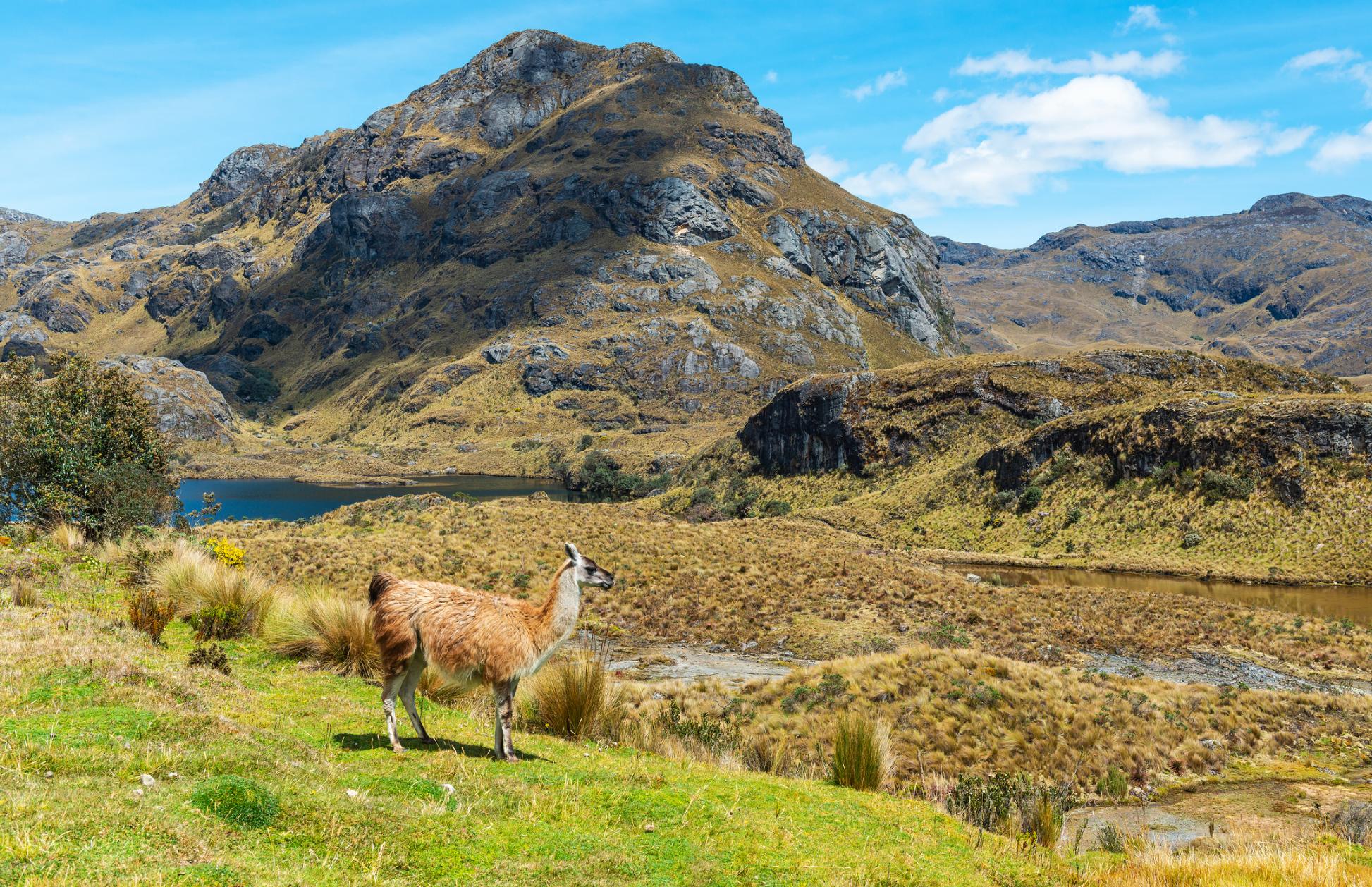
The primary allure of Cajas National Park lies in its "paramo" ecosystem. This high-altitude tundra, found mainly in the Northern Andes, acts as a massive sponge. The soil and vegetation—primarily various species of Stipa (ichu grass) and dense mosses—capture moisture from the frequent mist and rain. In 2026, the park remains the primary water source for the city of Cuenca, highlighting the critical ecological link between these highlands and urban centers.
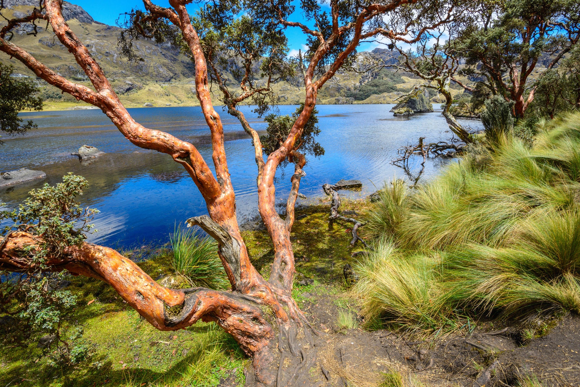
Visually, the park often reminds visitors of the Scottish Highlands, yet its biological composition is entirely distinct. The landscape is dotted with "quinoa" or Polylepis trees, often referred to as "paper trees" due to their thin, exfoliating bark. These are some of the highest-growing trees in the world. Walking through a Polylepis forest feels like stepping into a prehistoric or fantasy setting; the twisted, reddish trunks and dark green foliage create a dense canopy that shelters unique bird species found nowhere else.
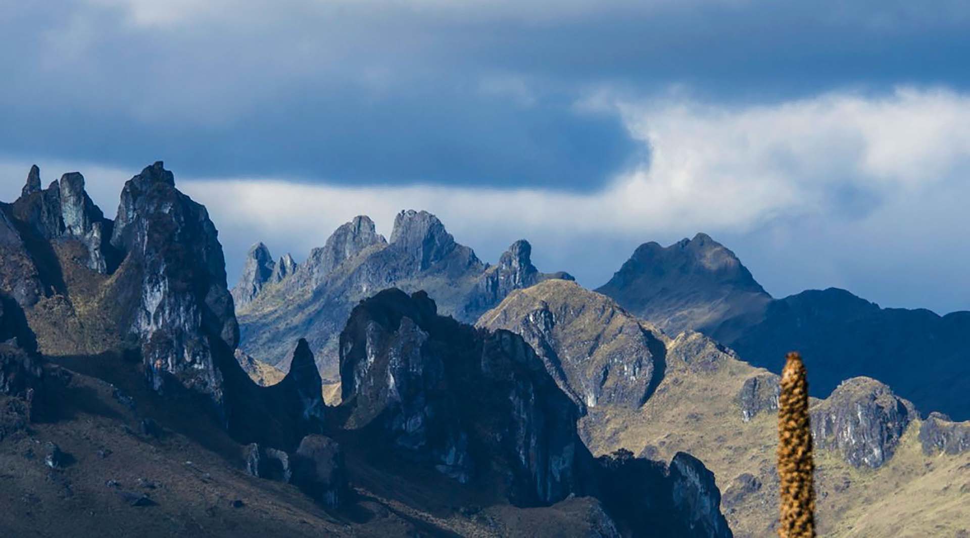
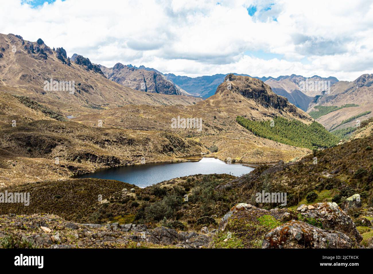
The geological history of Cajas is defined by glaciation. The U-shaped valleys and the sheer number of lakes (more than 700, though many are seasonal) are the result of retreating glaciers from the last ice age. This history created a rugged, "boxed" topography, which gives the park its name—"Cajas" is derived from the Quichua word cassa, meaning "gateway to the snowy mountains," or the Spanish word for "boxes."
Preparing for the Journey: Altitude and Climate Requirements
A journey through Cajas is not a casual stroll; it requires significant physical and logistical preparation. The elevation starts at approximately 3,100 meters (10,170 feet) and peaks at over 4,450 meters (14,600 feet). For most travelers, this necessitates at least two to three days of acclimatization in Cuenca before attempting any serious hiking.
Managing Altitude Sickness
Altitude sickness, or soroche, is a genuine risk. Symptoms include headaches, nausea, dizziness, and shortness of breath. To mitigate these risks, visitors should hydrate aggressively with water and electrolyte-rich fluids. Traditional remedies, such as coca tea or sunfo (a local Andean mint tea), are widely available in the region and are frequently used by locals and tourists alike to alleviate mild symptoms.
Dealing with Volatile Weather
The weather in Cajas is notoriously unpredictable. It is entirely possible to experience bright sunshine, heavy rain, thick fog, and biting wind within a single hour. In 2026, climate patterns continue to show high variability, making "layering" the absolute rule for clothing. A base layer of moisture-wicking synthetic or merino wool is essential, followed by an insulating fleece or down jacket, and topped with a high-quality waterproof and windproof shell. Cotton should be avoided entirely, as it retains moisture and leads to rapid body temperature drops in the cold Andean wind.
Logistics and Access: Navigating to the Park
Accessing the park from Cuenca is relatively straightforward, but requires choosing between public transit, private tours, or rental vehicles. The main highway (Cuenca-Molleturo-Puerto Inca) bisects the park, providing easy access to the primary visitor centers.
- Public Bus: From the Terminal Terrestre in Cuenca, buses heading toward Guayaquil via the Molleturo route can drop passengers at the Toreadora Visitor Center. It is important to confirm with the driver that they are taking the "Cajas" route, as some buses take an alternative southern road.
- Private Transportation: Many travelers opt for a private taxi or hired driver for the day. This allows for a stop at the lower Llaviuco section before proceeding to the higher Toreadora section, which is difficult to do using public buses.
- Registration and Fees: As of 2026, entry to Cajas National Park remains free for both domestic and international tourists, though visitors must register their names and passport numbers at the ranger stations (Toreadora or Llaviuco). This registration is a safety requirement, allowing rangers to track who is currently on the trails.
Primary Routes and Trail Selection
Cajas offers a variety of trails that cater to different fitness levels. Selecting the right trail is essential for a safe and enjoyable journey.
The Llaviuco Section (Lower Altitude)
Located at around 3,100 meters, Llaviuco is the most accessible part of the park. The trail circles a large lake and is mostly flat. It is an excellent choice for birdwatchers, as the lower elevation and dense forest cover attract mountain toucans, hummingbirds, and the occasional Andean guan. This area serves as a good "test" for how your body handles the altitude before moving higher.
The Toreadora Circuit
The most popular trail begins at the Toreadora Visitor Center (approx. 3,900 meters). The standard circuit takes about 2 to 3 hours and passes through Polylepis forests and around several major lakes, including Laguna Toreadora and Laguna Unidas. The trail is well-marked with color-coded stakes, which is vital because the Cajas mist can reduce visibility to a few meters in seconds.
The Inca Trail (Qhapaq Ñan)
For those seeking historical depth, a portion of the Qhapaq Ñan (the Great Inca Road) passes through the park. This trail was once a vital link between the highlands and the coast. Hiking this section allows you to walk on original Inca stone paving while crossing the continental divide. This is a more strenuous, full-day trek that typically requires a guide due to the risk of losing the trail in the marshy paramo.
Comparing Key Hiking Routes
| Trail Name | Avg. Elevation | Difficulty | Duration | Primary Highlight |
|---|---|---|---|---|
| Llaviuco | 3,160 m | Easy | 1 - 1.5 Hours | Birdwatching and Primary Forest |
| Toreadora | 3,950 m | Moderate | 2 - 3 Hours | Glacial Lakes and Polylepis |
| Ilincocha | 3,920 m | Very Easy | 30 Minutes | Quick access to High Paramo |
| Cerro Arquitectos | 4,200 m | High | 5 - 6 Hours | Panoramic views of the "Boxed" valleys |
| Burines | 3,800 m | Moderate | 4 Hours | Traditional paramo and fishing lagoons |
Biodiversity: What to Look For
Despite the harsh conditions, Cajas is a biodiversity hotspot. The park is home to several endangered or endemic species.
- The Andean Condor: While rare, the world's largest flying bird can sometimes be seen soaring over the jagged peaks. Look for a massive silhouette with a white collar.
- Carunculated Caracara: Often seen on the ground or perched on rocks, these birds of prey are quite bold and frequently move near the trails.
- Giant Hummingbird: The largest member of the hummingbird family can be found here, hovering near the red flowers of the Chuquiragua plant.
- Andean Tapir and Spectacled Bear: These mammals are extremely elusive and inhabit the more remote, densely forested areas of the park. It is highly unlikely to see them on the main tourist trails, but their presence is a testament to the park's health.
The flora is equally fascinating. Beyond the Polylepis, keep an eye out for the Chuquiragua, known as the "flower of the Andes." Its hardy, orange, thistle-like blooms are a primary food source for high-altitude hummingbirds. The ground is often covered in "cushion plants"—compact, dense mounds of vegetation that can support the weight of a person and act as mini-reservoirs.
Essential Safety and Ethics
The remote and rugged nature of Cajas National Park necessitates a strict adherence to safety protocols and environmental ethics.
The Danger of Disorientation
Fog is the greatest danger in Cajas. It can roll in without warning, obscuring landmarks and trail markers. If you lose the trail in the fog, the standard advice is to stay put rather than wander, as the terrain is full of cliffs and deep bogs. For this reason, solo hiking is discouraged for those unfamiliar with high-altitude navigation. Utilizing a GPS-enabled map or hiring a certified guide through the Ministerio de Turismo is highly recommended for any route longer than the Toreadora circuit.
Leave No Trace Principles
Cajas is a fragile environment. The slow growth rates at this altitude mean that damage to plants can take decades to heal.
- Stay on Marked Trails: Stepping off-trail compresses the mosses that are vital for water retention.
- Pack It In, Pack It Out: There are no trash cans on the trails. All waste must be carried back to the visitor center.
- No Fire: The paramo is surprisingly flammable during the short dry seasons. Campfires are strictly prohibited.
- Water Protection: Do not use soaps or detergents in the lagoons, as these are the source of Cuenca’s drinking water.
Planning Your 2026 Visit: Best Times to Go
While Cajas is a year-round destination, certain months offer better conditions for a journey.
- Dry Season (June to September): These months typically offer the clearest skies and best visibility, though they are also the windiest. This is the best time for photography and long-distance trekking.
- Transition Months (October to January): These months can be unpredictable but often feature beautiful "atmospheric" conditions where clouds sit low in the valleys.
- Wet Season (February to May): Expect daily rain and heavy mist. While the landscape is at its greenest, hiking can be slippery and cold.
Regardless of the month, plan to arrive at the park as early as possible—ideally by 8:30 AM. The weather in the Andes is generally clearest in the morning, with clouds and rain moving in by the early afternoon.
Frequently Asked Questions
Do I need a guide for Cajas National Park?
For the short, well-marked trails like Llaviuco and the Toreadora loop, a guide is not strictly necessary but can greatly enhance the experience by explaining the ecology. However, for any off-path trekking or long-distance routes like the Inca Trail, a certified guide is highly recommended due to the high risk of disorientation in the fog.
Is there food or water available inside the park?
There is a small restaurant and cafe at the Toreadora Visitor Center that serves hot meals (like trout, a local specialty) and warm drinks. However, there are no facilities once you are on the trails. You must bring your own water and high-energy snacks for the duration of your hike.
Can I camp in Cajas National Park?
Camping is permitted in designated areas, but you must obtain a permit at the visitor center first. Be prepared for sub-freezing temperatures at night. High-quality, four-season gear is mandatory for anyone planning to stay overnight in the park in 2026.
Is Cajas National Park suitable for children?
Yes, but with caveats. The Llaviuco and Ilincocha trails are suitable for children who are accustomed to walking. However, the high altitude can affect children more quickly than adults. Parents should monitor their children closely for signs of fatigue or headache and ensure they stay hydrated.
How much does it cost to visit Cajas in 2026?
Entrance to the park remains free under current Ecuadorian environmental policy. However, you should budget for transportation ($2 for a bus or $40-$60 for a private taxi for the day) and food. Professional guided day tours from Cuenca typically cost between $50 and $90 per person, depending on the group size and itinerary.
Final Recommendations for Your Journey
To make the most of your journey through Cajas National Park, prioritize flexibility. If you arrive and the mist is too thick for the high-altitude trails, consider descending to the Llaviuco section where the forest provides better visibility and shelter. Always check in with the park rangers upon arrival; they have the most current information on trail conditions and weather warnings. Finally, remember that at 4,000 meters, your pace will be significantly slower than at sea level—embrace the slower speed, as it allows you to notice the intricate details of the mosses, wildflowers, and unique geological formations that make this park a crown jewel of the Ecuadorian Andes.