The Alder Creek Road Trail system in Truckee, California, serves as a premier multi-use recreational corridor connecting the Tahoe Donner community with the expansive Tahoe National Forest. As of 2026, it remains a critical access point for hikers, mountain bikers, and cross-country skiers seeking entry into the Euer Valley and the historic Emigrant Trail network.
Understanding the Alder Creek Road Trail Network
Before embarking on a journey through this region, it is essential to distinguish between the various segments that enthusiasts often group under the name "Alder Creek Road Trail." While several locations in the United States share similar names—most notably in the Angeles National Forest and near Boise, Idaho—the most prominent and technically diverse system is located in the northern Sierra Nevada mountains of California.
In the Truckee area, Alder Creek Road exists as both a paved municipal thoroughfare and a springboard for a massive network of unpaved forest service roads and single-track trails. The primary search intent for this location generally revolves around the Alder Creek Adventure Center and the trails that radiate from the end of the paved road into the Euer Valley.
Geographic Disambiguation
To ensure safety and proper planning, travelers should verify their destination based on the following regional markers:
- Truckee/Tahoe (Primary Focus): Located north of Interstate 80, this system provides access to the Euer Valley, Prosser Creek Reservoir, and the Tahoe Donner trail system.
- Angeles National Forest (Southern California): Often referred to as the Alder Creek Trail, this route leads to Alder Creek Falls and is characterized by chaparral and steep canyon terrain, vastly different from the alpine meadows of Truckee.
- Boise National Forest (Idaho): A rugged, remote trail utilized primarily by OHV (Off-Highway Vehicle) users and seasoned backpackers.
The remainder of this guide focuses on the Truckee-based Alder Creek Road trail system, given its high density of recreational infrastructure and its status as a hub for High Sierra outdoor activities in 2026.
Access and Trailhead Logistics
Accessing the Alder Creek Road trails requires an understanding of the transition from residential zones to protected forest lands. As of 2026, the primary staging area is the Alder Creek Adventure Center, managed by the Tahoe Donner Association.
Primary Access Points
- The Adventure Center Trailhead: Located at 15275 Alder Creek Rd, this facility offers paved parking, restrooms, and seasonal amenities. During the summer, it serves as a mountain biking and equestrian hub. In the winter, it transforms into one of the nation’s premier cross-country ski centers.
- The "End of the Pavement" Pullouts: For those seeking direct access to the Tahoe National Forest (USFS) lands without utilizing Tahoe Donner’s private amenities, several dirt pullouts exist where the paved road terminates and transitions into Forest Service Road 01.
- Prosser OHV Staging: Located further east, this area provides access for motorized users who wish to connect with the Alder Creek network via wider forest roads.
Parking and Permits
In 2026, parking at the Adventure Center may require a daily fee for non-members of the Tahoe Donner Association, especially during peak weekend hours. Conversely, parking on US Forest Service land is generally free, though users must ensure they are not blocking gate access or parking on sensitive vegetation. Always check for current fire restrictions, as these frequently dictate where vehicles can be safely idled or parked during the dry summer months.
Technical Specifications and Trail Segments
The Alder Creek Road trail system is not a single linear path but a web of interconnected routes varying in technical difficulty and elevation profile.
The Euer Valley Loop
The Euer Valley is the crown jewel of the Alder Creek system. This 6.5-mile loop is relatively flat compared to other Sierra trails, making it a favorite for family excursions and endurance training.
- Surface: Packed dirt, occasional gravel, and meadow single-track.
- Elevation Change: Approximately 400 feet of total gain.
- Highlights: Historic ranching sites, creek crossings, and expansive wildflower displays in early July.
The Emigrant Trail Connection
Alder Creek Road serves as a southern terminus for a significant portion of the Emigrant Trail. This historic route follows the path taken by 19th-century pioneers.
- Distance: Variable (can be ridden/hiked for 15+ miles toward Stampede Reservoir).
- Difficulty: Moderate. While not steep, the distance and occasional technical "rock gardens" require a baseline of physical fitness.
- User Base: Heavily utilized by mountain bikers due to its "flowy" nature and high-speed sections.
Forest Service Road 01 (Alder Creek Road Extension)
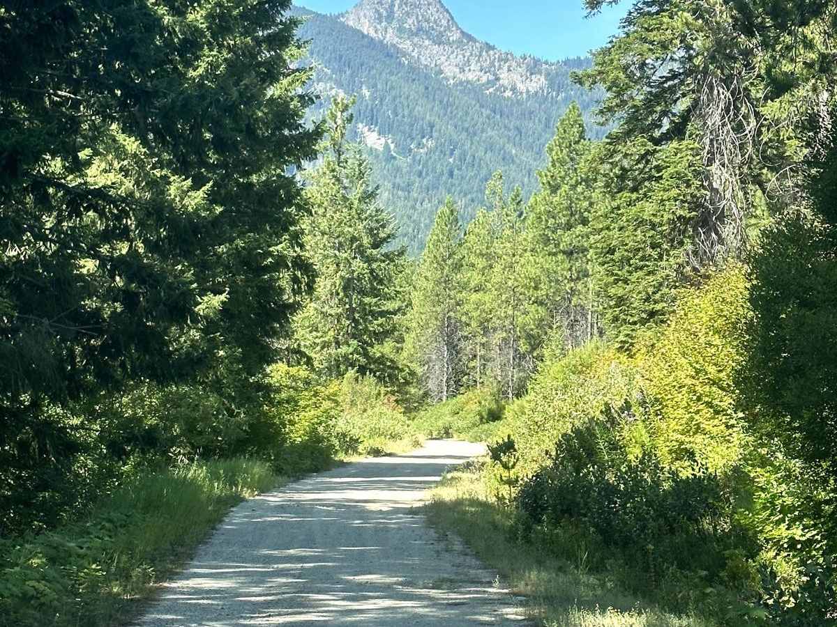
Once the pavement ends, the road becomes a wide, graded dirt path known as FS 01.
- Utility: This is the primary artery for gravel bikers and those looking for a non-technical climb out of the basin.
- Connectivity: It connects Alder Creek to Carpenter Valley and eventually links up with Highway 89 North.
| Trail Segment | Distance (Approx.) | Difficulty | Primary Use | Surface Type |
|---|---|---|---|---|
| Euer Valley Loop | 6.5 Miles | Easy/Moderate | Hiking/Biking | Dirt/Meadow |
| Emigrant Trail | 15+ Miles | Moderate | MTB/Trail Running | Single-track |
| Coyote Crossing | 2.2 Miles | Easy | Hiking/Equestrian | Paved/Gravel |
| Hawk’s Peak Link | 3.5 Miles | Strenuous | Hiking/MTB | Rocky/Steep |
| FS Road 01 | 12.0 Miles | Easy | Gravel Bike/OHV | Graded Dirt |
Seasonal Transitions: Summer vs. Winter
The utility of the Alder Creek Road trail system shifts dramatically with the seasons. In 2026, the area remains a year-round destination, but the rules and required equipment change based on the snowpack.
Summer and Fall (June – October)
During the dry months, the focus is on "dirt" sports. The soil in this region is primarily decomposed granite, which drains well but can become "moon dust" during prolonged droughts. Mountain bikers favor the area for its expansive network that caters to both cross-country (XC) riders and those seeking more technical descents from the surrounding ridges.
Winter and Spring (November – May)
When snow covers the Sierra, the Alder Creek Adventure Center manages a massive network of groomed cross-country ski and snowshoe trails.
- Grooming: The trails are professionally groomed for both classic and skate skiing.
- Restrictions: During the winter season, walking or biking on the groomed tracks without a valid trail pass is prohibited. Fat biking is allowed on specific designated trails depending on snow firmness.
- Backcountry Access: Skilled skiers often use the Alder Creek Road corridor to access the backcountry slopes of Hawk's Peak and the Castle Peak wilderness areas, though this requires significant avalanche knowledge and proper safety gear.
Historical Significance: The Donner Party and Beyond
The Alder Creek Road area is steeped in American history. Specifically, the Alder Creek Donner Camp is located nearby. This is the site where the George and Jacob Donner families were trapped during the winter of 1846-1847.
While the main trail system focuses on recreation, several interpretive paths provide historical context. The Donner Camp Trail is a short, 0.5-mile accessible loop featuring placards that detail the survival struggles of the pioneer party. Respecting these sites is paramount; visitors are reminded to stay on marked paths to preserve the archaeological integrity of the region.
Environmental Stewardship and Safety
Operating in a high-alpine environment like Truckee requires preparation and a commitment to "Leave No Trace" principles. In 2026, environmental pressures from increased tourism have led to stricter enforcement of local regulations.
Wildlife Awareness
The Alder Creek drainage is a corridor for various wildlife species.
- Black Bears: Common in the Euer Valley. While generally non-aggressive, they are attracted to food. Use bear-resistant containers if packing a lunch.
- Coyotes: Frequently heard and seen in the meadows. Keep small dogs on a leash.
- Mountain Lions: Rare but present. Avoid hiking or riding alone at dusk or dawn.
Altitude and Weather
The trailheads begin at approximately 6,300 feet above sea level. For visitors arriving from sea level, altitude sickness is a genuine concern. It is recommended to spend at least 24 hours acclimating before attempting the more strenuous climbs like Hawk’s Peak. Furthermore, Sierra weather is notoriously volatile. Afternoon thunderstorms are common in July and August; these can bring rapid temperature drops and dangerous lightning.
Fire Safety
In 2026, fire risk remains the highest priority for the Tahoe National Forest.
- Smoking: Generally prohibited on trails during the summer.
- Campfires: Strictly forbidden outside of designated, developed campgrounds with active host supervision.
- Equipment: Mountain bikers should ensure their pedals or frames do not strike rocks in dry grass, which can spark a fire.
Essential Gear Checklist
To maximize enjoyment and safety on the Alder Creek Road trails, consider the following equipment:
- Navigation: While the main trails are well-marked, the intersection of USFS roads can be confusing. Carry a physical map or a GPS device with offline capabilities (cell service is spotty once you enter the Euer Valley).
- Hydration: There is no potable water available on the trails. Carry at least 2 liters of water for a three-hour excursion.
- Sun Protection: The high altitude increases UV exposure. Apply high-SPF sunscreen even on cloudy days.
- Repair Kit: For cyclists, a multi-tool, spare tube, and CO2 inflator are mandatory, as the walk back from the far end of Euer Valley can be grueling in cycling shoes.
Frequently Asked Questions
Are dogs allowed on the Alder Creek Road trails?
Yes, dogs are generally permitted on the trails within the Tahoe National Forest and the Tahoe Donner summer trail system. However, they must be under voice control or on a leash. During the winter cross-country ski season, dogs are restricted to specific "dog-friendly" groomed trails and require a separate k9 trail pass. Always check the current Tahoe Donner Association guidelines for seasonal updates.
Is the trail system suitable for E-bikes?
As of 2026, Class 1 (pedal-assist) E-bikes are permitted on most Tahoe Donner managed trails and specific USFS motorized roads. However, they may be restricted on certain non-motorized single-track sections of the Tahoe National Forest. Always look for signage at the trailhead or consult the Tahoe National Forest motor vehicle use map (MVUM).
What is the best time of year to see wildflowers in Euer Valley?
The peak bloom typically occurs from late June through mid-July, depending on the previous winter's snowpack. During heavy snow years, the meadows may remain marshy and the flowers may not peak until late July.
Can I camp along Alder Creek Road?
Dispersed camping is generally allowed on US Forest Service land, but it is prohibited within the Tahoe Donner residential association boundaries and the Euer Valley proper (which is private land with a conservation easement). For those seeking traditional camping, the nearby Prosser Family Campground provides developed sites.
Is the Alder Creek Road Trail paved?
The first several miles of Alder Creek Road are paved and include a dedicated pedestrian/bike lane. However, once the road reaches the Adventure Center and enters the Euer Valley or the National Forest, it transitions to unpaved dirt and gravel.
Final Recommendation for Visitors
For those visiting the Alder Creek Road trail system for the first time in 2026, the best approach is to start at the Alder Creek Adventure Center. The staff provides updated trail conditions and maps that distinguish between easy meadow loops and challenging ridge climbs. If you are a mountain biker, the Emigrant Trail offers the best balance of scenery and flow. If you are a hiker, a sunset walk through the Euer Valley provides unparalleled views of the Sierra Crest without the need for extreme physical exertion. Always check the weather forecast via the National Weather Service before heading out, as conditions at 6,000+ feet can change in minutes.